The Narrows

Sea, Estuary, Creek in Durham

England

The Narrows

Crusoe's Cafe, Long Sands, Tynemouth
Crusoe's Cafe, Long Sands, Tynemouth Credit: habiloid

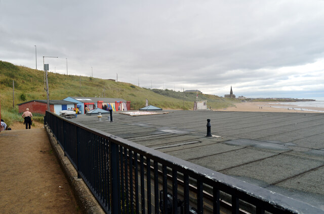
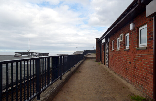
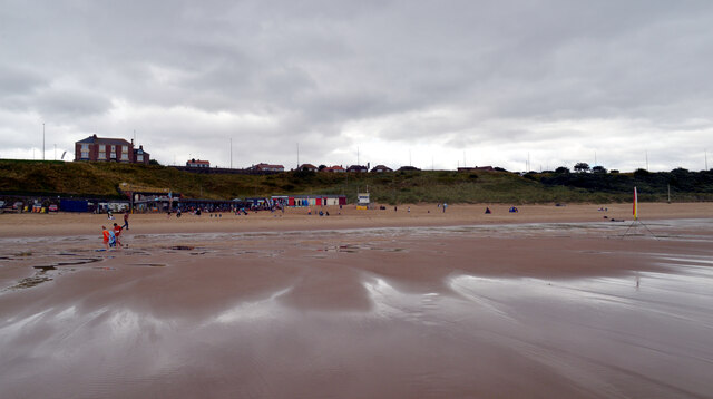
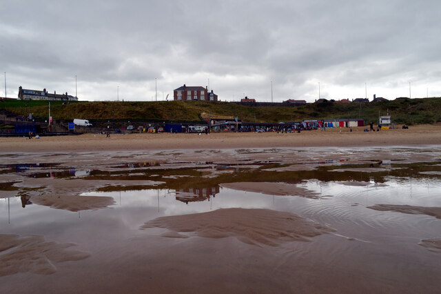
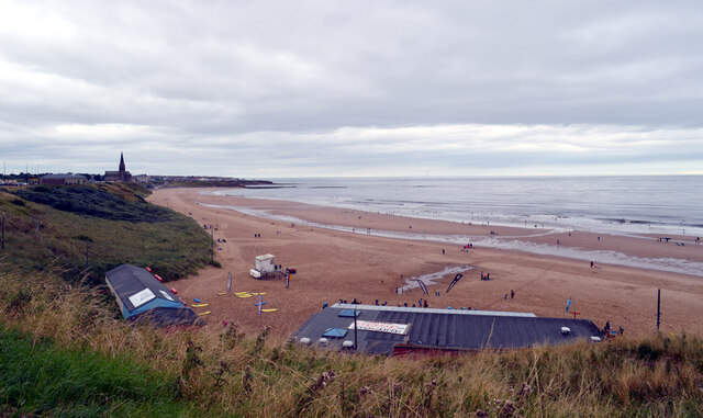
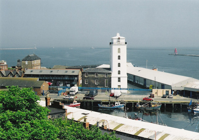
The Narrows, located in Durham, is an enchanting natural formation that encompasses a sea, an estuary, and a creek. Situated along the northeastern coast of England, this beautiful area offers visitors a diverse and captivating landscape to explore.

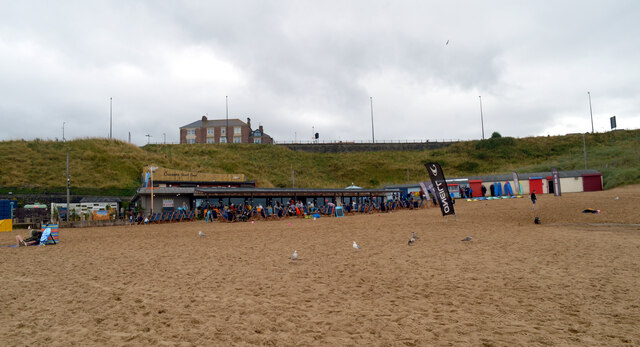
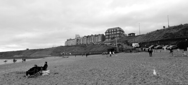
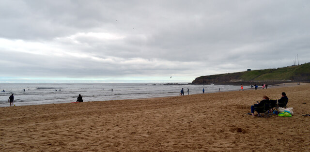
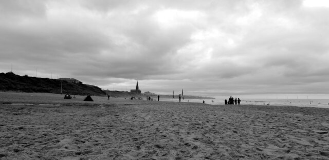
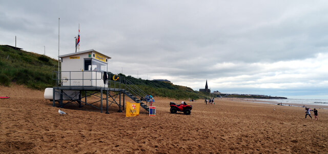
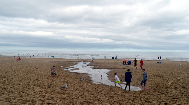
The Narrows is primarily characterized by its stunning sea, which stretches out before visitors, showcasing its vastness and splendor. With its crystal-clear waters and rhythmic waves crashing against the shore, the sea provides a tranquil and serene atmosphere for those seeking relaxation or simply a scenic view.

Adjacent to the sea is the estuary, an area where freshwater from rivers mixes with the seawater. This creates a unique ecosystem that supports a variety of marine life, including fish, shellfish, and birds. The estuary is a popular spot for birdwatching and fishing enthusiasts, as it offers an abundance of opportunities to observe and interact with nature.

Flowing inland from the estuary is the creek, a narrow and winding waterway that meanders through the surrounding landscape. This creek provides a peaceful setting for canoeing and kayaking, allowing visitors to explore the area from a different perspective and immerse themselves in the natural beauty of The Narrows.

The Narrows in Durham is not only a picturesque destination but also an important ecological site. Its sea, estuary, and creek all contribute to the diverse and delicate ecosystem that supports a myriad of plant and animal species. Whether one is interested in outdoor activities, wildlife observation, or simply enjoying the tranquility of nature, The Narrows offers a breathtaking and unforgettable experience for all who visit.

If you have any feedback on the listing, please let us know in the comments section below.

The Narrows Images

Images are sourced within 2km of 55.00736/-1.433914 or Grid Reference NZ3668. Thanks to Geograph Open Source API. All images are credited.

Crusoe's Cafe, Long Sands, Tynemouth
Long Sands, Tynemouth
Long Sands, Tynemouth St. George's Church, Cullercoats can be seen in the distance.
Long Sands, Tynemouth
St. George's Church, Cullercoats can be seen in the distance.
Behind Crusoe's Cafe, Long Sands, Tynemouth
Public Toilets, Long Sands, Tynemouth
Lifeguard Station, Long Sands, Tynemouth
Long Sands, Tynemouth
Steps from Long Sands to Grand Parade, Tynemouth
Long Sands, Tynemouth
'Big Boys Toys', Boating Lake, Tynemouth Park These two men (a number of others were off-camera) are members of the Tynemouth Model Boat Club, a club which exits to build, sail and encourage new members to join the hobby. The club was founded in 1893. In the background is an example of the real thing heading towards the mouth of the River Tyne.
'Big Boys Toys', Boating Lake, Tynemouth Park
These two men (a number of others were off-camera) are members of the Tynemouth Model Boat Club, a club which exits to build, sail and encourage new members to join the hobby. The club was founded in 1893. In the background is an example of the real thing heading towards the mouth of the River Tyne.
Rocks below Sharpness Point There is nothing else in this square other than the rocks exposed at low tide!
Rocks below Sharpness Point
There is nothing else in this square other than the rocks exposed at low tide!
Rock pool below Sharpness Point
Rock pools below Sharpness Point The North Pier, Tynemouth can be seen on the distant horizon.
Rock pools below Sharpness Point
The North Pier, Tynemouth can be seen on the distant horizon.
Long Sand
Long Sand
Tynemouth Toy Museum <span class="nowrap"><a title="http://www.tynemouthtoymuseum.co.uk/" rel="nofollow ugc noopener" href="http://www.tynemouthtoymuseum.co.uk/">Link</a><img style="margin-left:2px;" alt="External link" title="External link - shift click to open in new window" src="https://s1.geograph.org.uk/img/external.png" width="10" height="10"/></span>
Tynemouth Toy Museum
Show me another place!

The Narrows is located at Grid Ref: NZ3668 (Lat: 55.00736, Lng: -1.433914)

Unitary Authority: South Tyneside

Police Authority: Northumbria

What 3 Words

///pinch.dunes.goes. Near South Shields, Tyne & Wear

Related Wikis

North Shields Fish Quay

North Shields Fish Quay is a fishing port located close to the mouth of the River Tyne, in North Shields, Tyne and Wear, North East England, 8 miles (13...
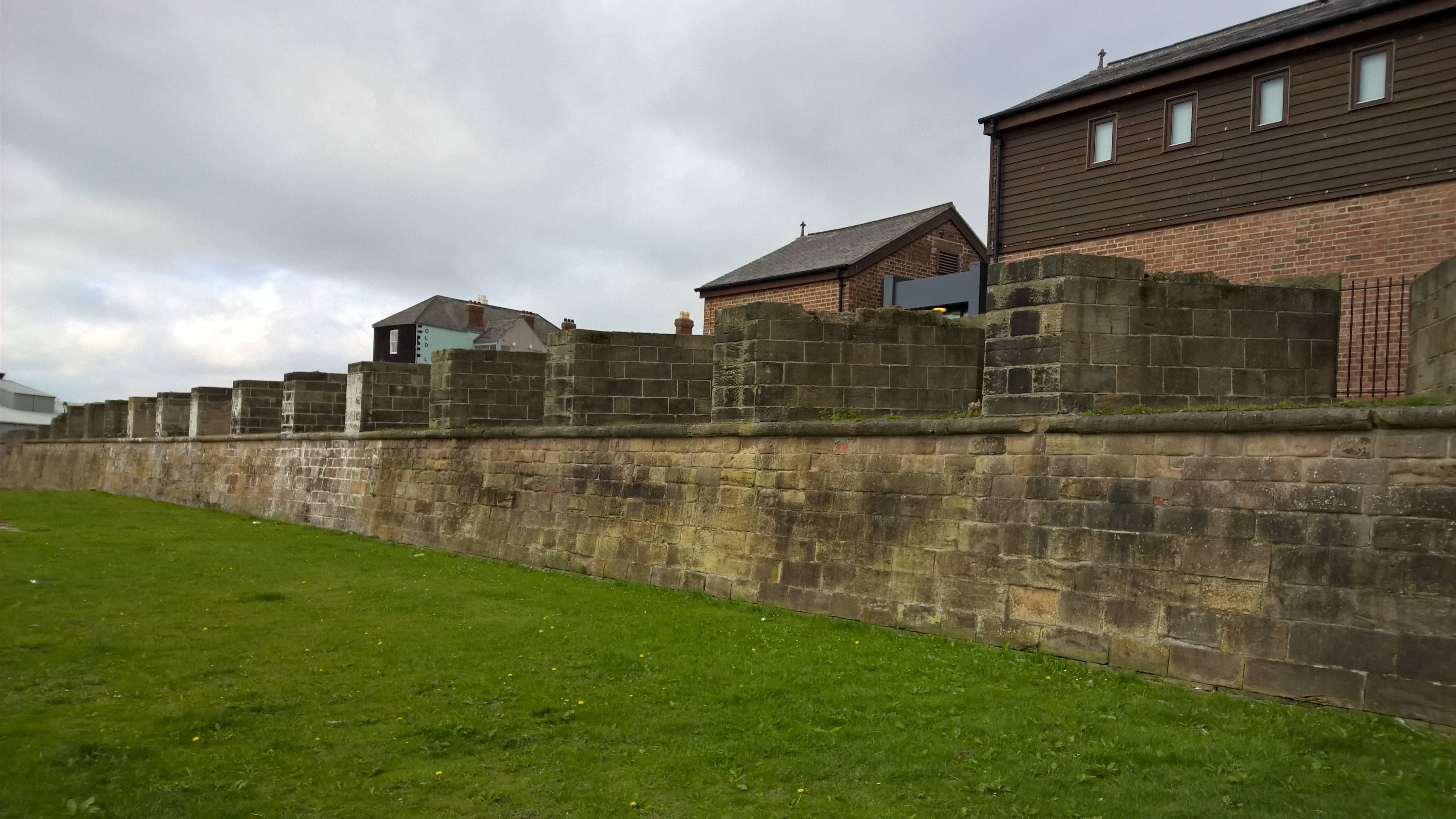
Clifford's Fort

Clifford's Fort was a defensive gun battery established near the mouth of the Tyne during the Anglo-Dutch Wars in the 17th century. It subsequently served...

Arbeia

Arbeia was a large Roman fort in South Shields, Tyne & Wear, England, now ruined, and which has been partially reconstructed. It was first excavated in...

Tynemouth Town Hall

Tynemouth Town Hall, also known as North Shields Town Hall, is a municipal building in Howard Street, North Shields, Tyne and Wear, England. The town hall...

Nearby Amenities

Located within 500m of 55.00736,-1.433914
Source: PGS
Lat/Long: 55.0069901/-1.4408485
Created By: almien_coastlines
Source: PGS
Lat/Long: 55.0073337/-1.4400307
Source: PGS
Lat/Long: 55.0074422/-1.4396822
Source: PGS
Lat/Long: 55.0075659/-1.4393192
Created By: almien_coastlines
Source: PGS
Lat/Long: 55.0076577/-1.4390799
Source: PGS
Lat/Long: 55.0077805/-1.4387775
Source: PGS
Lat/Long: 55.0080699/-1.4375981
Source: PGS
Lat/Long: 55.0083433/-1.4367709
Source: PGS
Lat/Long: 55.0085723/-1.4363634
Source: PGS
Lat/Long: 55.0093737/-1.4350447
Source: PGS
Lat/Long: 55.009314/-1.4348556
Source: PGS
Lat/Long: 55.0082659/-1.4360608
Source: PGS
Lat/Long: 55.0081909/-1.4359702
Source: PGS
Lat/Long: 55.0089241/-1.4336184
Source: PGS
Lat/Long: 55.0091079/-1.4330699
Source: PGS
Lat/Long: 55.0091788/-1.4328609
Source: PGS
Lat/Long: 55.0076203/-1.4264928
Source: PGS
Lat/Long: 55.00745/-1.4267714
Source: PGS
Lat/Long: 55.0069083/-1.4272638
Source: PGS
Lat/Long: 55.0068021/-1.428164
Source: AND
Lat/Long: 55.0063885/-1.4387337
Crossing
Crossing Island: yes
Lat/Long: 55.0062142/-1.4287387
Lawe Beacon (East)
Man Made: beacon
Wikidata: Q26525702
Lat/Long: 55.005987/-1.4297011
Bus: yes
Public Transport: stop_position
Lat/Long: 55.0085289/-1.4369662
Bus Stop
Bird Street
Bench: no
Bus: yes
Local Ref: E
Naptan AtcoCode: 410000041074
Naptan Bearing: NE
Naptan Indicator: NE-Bound
Naptan Landmark: Opposite The Corvette Public House
Naptan NaptanCode: twrgjwpj
Naptan Street: Bird Street
Naptan Verified: no
Public Transport: platform
Shelter: no
Source: naptan_import
Lat/Long: 55.0103346/-1.4381785
Bus Stop
North Shields Fish Quay
Bench: yes
Bus: yes
Departures Board: timetable
Local Ref: E
Naptan AtcoCode: 410000041075
Naptan Bearing: E
Naptan CommonName: NORTH SHIELDS FISH QUAY
Naptan Indicator: E
Naptan Landmark: 35M WEST OF UNION ROAD
Naptan NaptanCode: twrgjwpm
Naptan Street: CLIFFORDS FORT MOAT
Naptan Verified: no
Public Transport: platform
Shelter: yes
Source: naptan_import
Lat/Long: 55.0108606/-1.4328468
Bus Stop
North Shields Fish Quay
Bench: no
Bus: yes
Departures Board: timetable
Local Ref: E
Naptan AtcoCode: 410000041077
Naptan Bearing: E
Naptan Indicator: E-Bound
Naptan Landmark: Outside Mission To Deep Sea Fisherman
Naptan NaptanCode: twrgjwpt
Naptan Street: Bell Street
Naptan Verified: no
Public Transport: platform
Shelter: no
Source: naptan_import
Lat/Long: 55.0085639/-1.4370199
Bus Stop
Bird Street
Bench: no
Bus: yes
Local Ref: SW
Naptan AtcoCode: 410000041078
Naptan Bearing: SW
Naptan Indicator: SW-Bound
Naptan Landmark: Outside The Corvette Public House
Naptan NaptanCode: twrgjwpw
Naptan Street: BIRD STREET
Naptan Verified: no
Public Transport: platform
Shelter: no
Source: naptan_import
Lat/Long: 55.0102801/-1.4380542
Bus Stop
Charlotte Street-Pearson Place
Bus: yes
Local Ref: W
Naptan AtcoCode: 410000041079
Naptan Bearing: SW
Naptan Indicator: SW-Bound
Naptan Landmark: Opposite Ashleigh School
Naptan NaptanCode: twrgjwta
Naptan Street: Charlotte Street
Naptan Verified: no
Public Transport: platform
Source: naptan_import
Lat/Long: 55.0096137/-1.4406355
Bus Stop
CROMPTON PARKINSON
Local Ref: E
Naptan AtcoCode: 410000060010
Naptan Bearing: E
Naptan CommonName: CROMPTON PARKINSON
Naptan Indicator: E
Naptan Landmark: OPPOSITE BARING STREET
Naptan NaptanCode: twrgpjtw
Naptan Street: RIVER DRIVE
Naptan Verified: no
Source: naptan_import
Lat/Long: 55.0054273/-1.4336271
Bus Stop
Liddell Street (E/B)
Bench: no
Bus: yes
Local Ref: NE
Naptan AtcoCode: 410000041983
Naptan Bearing: NE
Naptan CommonName: LIDDEL STREET-E/B
Naptan Indicator: NE
Naptan Landmark: OPPOSITE LIFEBOAT STATION
Naptan NaptanCode: twrgtgtw
Naptan Street: LIDDEL STREET
Naptan Verified: no
Public Transport: platform
Shelter: no
Source: naptan_import
Lat/Long: 55.0074912/-1.4407435
Bus Stop
Liddell Street (W/B)
Bench: no
Bus: yes
Local Ref: SW
Naptan AtcoCode: 410000041984
Naptan Bearing: SW
Naptan CommonName: LIDDELL STREET-W/B
Naptan Indicator: SW
Naptan Landmark: OUTSIDE LIFEBOAT STATION
Naptan NaptanCode: twrgtgtp
Naptan Street: LIDDELL STREET
Naptan Verified: no
Public Transport: platform
Shelter: no
Source: naptan_import
Lat/Long: 55.0073037/-1.4409963
Bus Stop
The Lawe
Local Ref: S
Naptan AtcoCode: 410000042085
Naptan Bearing: S
Naptan CommonName: THE LAWE
Naptan Indicator: S
Naptan Landmark: OUTSIDE THE PILOTS' LOOKOUT HOUSE
Naptan NaptanCode: twrgmdpw
Naptan Street: LAWE ROAD
Naptan Verified: no
Source: naptan_import
Lat/Long: 55.0059752/-1.4298877
Bus Stop
Mile End Road
Bench: no
Bin: yes
Bus: yes
Departures Board: timetable
Local Ref: S
Naptan AtcoCode: 410000042202
Naptan Bearing: S
Naptan Indicator: S-Bound
Naptan Landmark: Outside St Stephen's Church
Naptan NaptanCode: twrgmjgj
Naptan Street: Mile End Road
Naptan Verified: no
Official Name: Mile End Road-St Stephens Church
Passenger Information Display: no
Public Transport: platform
Shelter: yes
Source: naptan_import
Lat/Long: 55.0037702/-1.4365064
Bus Stop
River Drive-Number 3
Bench: no
Bin: no
Bus: yes
Local Ref: N
Naptan AtcoCode: 410000042203
Naptan Bearing: N
Naptan Indicator: N-Bound
Naptan Landmark: Opposite No.3/4 River Drive
Naptan NaptanCode: twrgmjgm
Naptan Street: River Drive
Naptan Verified: no
Public Transport: platform
Shelter: no
Source: naptan_import
Lat/Long: 55.0037446/-1.4383155
Bicycle: yes
Information: guidepost
Ncn Milepost: mills
Sustrans Ref: MP30
Tourism: information
Lat/Long: 55.0113928/-1.4316953
Barrier: bollard
Lat/Long: 55.0047985/-1.4348444
Fish Quay Old Light
Disused: yes
Man Made: lighthouse
Wikidata: Q28465916
Lat/Long: 55.0092381/-1.4368502
Seamark Light Character: Fl
Seamark Light Colour: green
Seamark Light Height: 6
Seamark Light Period: 5
Seamark Light Range: 9
Seamark Light Reference: A 2708
Seamark Radar Reflector: yes
Seamark Type: light_minor
Source: US NGA Pub. 114. 2011-04-02
Lat/Long: 55.0090445/-1.4307166
Entrance: main
Lat/Long: 55.0064625/-1.4281904
Bus: yes
Public Transport: stop_position
Lat/Long: 55.0108179/-1.432801
Source: PGS
Lat/Long: 55.0091904/-1.4328875
Stan Laurel Statue
Historic: memorial
Memorial: statue
Lat/Long: 55.009198/-1.4385639
Pub
Harbour Lights
Lat/Long: 55.0055727/-1.430168
Bus: yes
Public Transport: stop_position
Lat/Long: 55.0102869/-1.4381538
Post Box
Ref: NE33 117
Lat/Long: 55.0066503/-1.4299536
Post Box
Ref: NE33 5
Lat/Long: 55.0033537/-1.4310857
Bench
Backrest: yes
Lat/Long: 55.0078563/-1.4394373
Bench
Backrest: yes
Lat/Long: 55.0078284/-1.4394638
Bench
Backrest: yes
Lat/Long: 55.0077876/-1.4394841
Bench
Backrest: yes
Lat/Long: 55.0077584/-1.4394638
Bench
Backrest: yes
Lat/Long: 55.0077351/-1.4393947
Bench
Backrest: yes
Lat/Long: 55.007854/-1.4393194
Bench
Backrest: yes
Lat/Long: 55.007875/-1.439232
Bench
Backrest: yes
Lat/Long: 55.0079018/-1.4391365
Bench
Backrest: yes
Lat/Long: 55.0079228/-1.4390349
Waste Basket
Lat/Long: 55.0078422/-1.439393
Waste Basket
Lat/Long: 55.0079325/-1.4389719
Waste Basket
Lat/Long: 55.0081408/-1.4380527
Bench
Backrest: yes
Lat/Long: 55.0081716/-1.4379266
Bench
Backrest: yes
Lat/Long: 55.0082011/-1.4378006
Bench
Backrest: yes
Lat/Long: 55.0082386/-1.4376815
Bench
Backrest: yes
Lat/Long: 55.0082747/-1.437539
Waste Basket
Lat/Long: 55.0085019/-1.4368391
Restaurant
Dodgin’s Yard
Addr City: North Shields
Addr Housenumber: 50B
Addr Postcode: NE30 1HF
Addr Street: Bell Street
Email: hello@dodginsyard.co.uk
Fhrs Id: 1073850
Phone: +44 191 259 1992
Takeaway: yes
Website: http://www.dodginsyard.co.uk
Lat/Long: 55.0084728/-1.4374886
Cafe
The Quay Tap House
Addr City: North Shields
Addr Country: GB
Addr Housenumber: 50
Addr Postcode: NE30 1HF
Addr Street: Bell Street
Fhrs Id: 1658534
Phone: +44 191 259 2023
Wheelchair: limited
Lat/Long: 55.0084983/-1.4374069
Cafe
River Cafe On The Tyne
Addr City: North Shields
Addr Street: Bell Street
Fixme: resurvey, suspect closed
Phone: +44 191 296 6168
Website: www.rivercafeonthetyne.co.uk
Lat/Long: 55.0085518/-1.4372621
Fast Food
Chips Skins & Ice Cream
Addr City: North Shields
Addr Street: Bell Street
Fixme: resurvey, suspect closed
Lat/Long: 55.0085866/-1.4371173
Restaurant
Cassia Sambuca
Addr City: North Shields
Addr Country: GB
Addr Housenumber: 52
Addr Postcode: NE30 1HH
Addr Street: Bell Street
Cuisine: italian
Fhrs Id: 34945
Not Addr Postcode: NE30 1HF
Opening Hours: Mo-Su 12:00-21:00; Fr,Sa 12:00-22:00
Phone: +44 191 259 0999
Website: https://sambucarestaurants.co.uk/restaurants/north-shields-cassia/
Wheelchair: no
Lat/Long: 55.0086857/-1.4368348
Waste Basket
Lat/Long: 55.0086911/-1.43669
Post Box
Brand: Royal Mail
Brand Wikidata: Q638098
Collection Times: Mo-Fr 09:00; Sa 07:00
Drive Through: no
Operator: Royal Mail
Operator Wikidata: Q638098
Post Box Type: pillar
Ref: NE30 60
Royal Cypher: EIIR
Royal Cypher Wikidata: Q33102113
Lat/Long: 55.0087368/-1.436647
Bench
Backrest: yes
Lat/Long: 55.0088621/-1.4375355
Bench
Backrest: yes
Lat/Long: 55.008833/-1.4376392
Bench
Backrest: yes
Lat/Long: 55.0089099/-1.4373485
Bench
Backrest: yes
Lat/Long: 55.0089647/-1.437194
Bench
Backrest: yes
Lat/Long: 55.0090008/-1.4371087
Bench
Backrest: yes
Lat/Long: 55.0090463/-1.4369847
Waste Basket
Lat/Long: 55.0088131/-1.437749
Waste Basket
Lat/Long: 55.0090952/-1.436883
Bar
Allards On The Quay
Addr City: North Shields
Addr Housenumber: 1
Addr Postcode: NE30 1HJ
Addr Street: Union Quay
Breakfast: yes
Check Date: 2023-11-04
Diet Vegan: yes
Diet Vegetarian: yes
Dog: yes
Fhrs Id: 1227760
Food: yes
Payment Credit Cards: yes
Payment Debit Cards: yes
Phone: +44 191 296 3973
Website: https://www.allardslounge.co.uk/
Lat/Long: 55.0088423/-1.4365761
Restaurant
The Plaice
Addr City: North Shields
Addr Street: Union Quay
Lat/Long: 55.0089985/-1.4363545
Fast Food
The Plaice Takeaway
Addr City: North Shields
Addr Street: Union Quay
Lat/Long: 55.0091151/-1.4361716
Restaurant
Sambuca 1
Addr City: North Shields
Addr County: Tyne And Wear
Addr Housenumber: 9-11
Addr Postcode: NE30 1HJ
Addr Street: Union Quay
Fhrs Id: 188453
Phone: +44 191 261 7767
Website: https://sambucarestaurants.co.uk/restaurants/north-shields/
Wheelchair: limited
Lat/Long: 55.0092305/-1.4359988
Seaview Fisheries
Addr City: North Shields
Addr Street: Union Quay
Phone: +44 191 296 0642
Shop: seafood
Lat/Long: 55.0093517/-1.4357772
Restaurant
Martino's
Addr City: North Shields
Addr Housenumber: 16
Addr Street: Union Quay
Cuisine: italian
Fixme: resurvey, suspect closed
Phone: +44 191 258 5929
Lat/Long: 55.0094682/-1.4355557
Restaurant
1225
Addr City: North Shields
Addr Country: GB
Addr Housenumber: 22A
Addr Postcode: NE30 1HJ
Addr Street: Union Quay
Fhrs Id: 1383515
Lat/Long: 55.0096528/-1.435158
Restaurant
Waterfront
Addr City: North Shields
Addr Housenumber: 22-26
Addr Postcode: NE30 1HJ
Addr Street: Union Quay
Cuisine: fish_and_chips
Delivery: yes
Fhrs Id: 114550
Phone: +44 191 296 1721
Takeaway: yes
Wheelchair: yes
Lat/Long: 55.0098509/-1.434918
J R Fisheries Smokehouse
Addr City: North Shields
Addr Country: GB
Addr Housenumber: 29-31
Addr Postcode: NE30 1HJ
Addr Street: Union Quay
Fhrs Id: 114551
Shop: seafood
Lat/Long: 55.0100334/-1.4348158
Bar
Lobo Rojo
Addr City: North Shields
Addr Country: GB
Addr Housename: Irvin Building
Addr Postcode: NE30 1HB
Addr Street: Union Quay
Fhrs Id: 1182597
Lat/Long: 55.0101531/-1.4347203
Clinic
Ewan Bramley Skin Clinic
Addr City: North Shields
Addr Street: Union Road
Lat/Long: 55.0102688/-1.4346424
Buoy
Tourism: artwork
Lat/Long: 55.0104585/-1.4325756
Buoys
Image: https://www.geograph.org.uk/photo/7191948
Tourism: artwork
Lat/Long: 55.0107114/-1.4325115
Phils Plaice
Addr City: North Shields
Addr Housenumber: 3
Addr Postcode: NE30 1JE
Addr Street: Cliffords Fort
Fhrs Id: 1213292
Phone: +44 191 257 1555
Shop: seafood
Website: https://philsplaice.com/
Lat/Long: 55.0102646/-1.4336264
Lindisfarne Seafoods
Addr City: North Shields
Addr Housenumber: 2
Addr Postcode: NE30 1JE
Addr Street: Cliffords Fort
Fhrs Id: 49644
Phone: +44 191 259 2909
Shop: seafood
Lat/Long: 55.0101652/-1.4337008
Old Lowlight Heritage Centre
Addr City: North Shields
Addr Postcode: NE30 1JA
Addr Street: Fish Quay
Phone: +44 191 257 4506
Tourism: museum
Website: https://oldlowlight.co.uk/
Lat/Long: 55.0095989/-1.4338154
Waste Basket
Lat/Long: 55.0102161/-1.4341453
Dolphin Mooring Post
Image: https://www.geograph.org.uk/photo/3589339
Tourism: artwork
Lat/Long: 55.0102176/-1.434274
Waste Basket
Lat/Long: 55.0104273/-1.4340702
Waste Basket
Lat/Long: 55.0108668/-1.4325403
Noexit: yes
Lat/Long: 55.0069027/-1.4410708
Armtec Engineering
Addr City: North Shields
Addr Street: Hudson Street
Man Made: works
Phone: +44 191 500 9619
Lat/Long: 55.0113418/-1.4372942
78 Rylands
Man Made: works
Phone: +44 191 252 6500
Lat/Long: 55.0112238/-1.4371033
Arbeia House
Building: yes
Lat/Long: 55.0046152/-1.435233
Fiddlers Green
Artist Name: Ray Lonsdale
Artwork Type: sculpture
Image: https://www.geograph.org.uk/photo/7191955
Tourism: artwork
Lat/Long: 55.0101225/-1.4323986
Arbeia Roman Fort Museum
Check Date Opening Hours: 2024-02-17
Fee: no
Opening Hours: Mar 25-Sep 29 Mo-Fr 10:00-17:00; Mar 25-Sep 29 Sa 11:00-16:00; Mar 25-Sep 29 Su 13:00-16:00
Seasonal: yes
Tourism: museum
Website: https://arbeiaromanfort.org.uk/
Wheelchair: yes
Lat/Long: 55.0041192/-1.4319694
Commanding Officer's house (Reconstruction)
Access: yes
Archaeological Site: fortification
Historic: archaeological_site
Historic Civilization: roman
Tourism: attraction
Wheelchair: yes
Lat/Long: 55.0040916/-1.4299921
Roman Gatehouse (Reconstruction)
Access: yes
Archaeological Site: fortification
Historic: archaeological_site
Historic Civilization: roman
Tourism: attraction
Wheelchair: no
Lat/Long: 55.0045114/-1.4319763
Barracks (Reconstruction)
Historic: archaeological_site
Lat/Long: 55.0042033/-1.4300689
Entrance: main
Lat/Long: 55.003575/-1.4316314
Drinking Water: no
Man Made: water_well
Lat/Long: 55.004122/-1.4305368
Seamark Name: North Shields
Seamark Radio Station Mmsi: 992351286
Seamark Type: virtual_aton
Seamark Virtual Aton Category: special_purpose
Lat/Long: 55.0089/-1.4326
Collingwood Seafoods
Addr City: North Shields
Addr Housenumber: 1
Addr Postcode: NE30 1JE
Addr Street: Cliffords Fort
Fhrs Id: 1213293
Shop: seafood
Lat/Long: 55.0100437/-1.433753
Life Ring
Emergency: life_ring
Lat/Long: 55.0083012/-1.4373587
Life Ring
Emergency: life_ring
Lat/Long: 55.0080876/-1.4383524
Defibrillator
Emergency: defibrillator
Indoor: no
Lat/Long: 55.0109093/-1.4325481
Generator Method: photovoltaic
Generator Output Electricity: yes
Generator Source: solar
Generator Type: solar_photovoltaic_panel
Location: roof
Power: generator
Lat/Long: 55.0104056/-1.4382239
Generator Method: photovoltaic
Generator Output Electricity: yes
Generator Source: solar
Generator Type: solar_photovoltaic_panel
Location: roof
Power: generator
Lat/Long: 55.0103303/-1.4384989
Generator Method: photovoltaic
Generator Output Electricity: yes
Generator Source: solar
Generator Type: solar_photovoltaic_panel
Location: roof
Power: generator
Lat/Long: 55.0103518/-1.4384036
Generator Method: photovoltaic
Generator Output Electricity: yes
Generator Source: solar
Generator Type: solar_photovoltaic_panel
Location: roof
Power: generator
Lat/Long: 55.0106243/-1.4368736
Generator Method: photovoltaic
Generator Output Electricity: yes
Generator Source: solar
Generator Type: solar_photovoltaic_panel
Location: roof
Power: generator
Lat/Long: 55.0084649/-1.4409558
Generator Method: photovoltaic
Generator Output Electricity: yes
Generator Source: solar
Generator Type: solar_photovoltaic_panel
Location: roof
Power: generator
Lat/Long: 55.0082418/-1.4407037
Generator Method: photovoltaic
Generator Output Electricity: yes
Generator Source: solar
Generator Type: solar_photovoltaic_panel
Location: roof
Power: generator
Lat/Long: 55.0082526/-1.4406554
Vending Machine
Operator: North Tyneside Council
Payment Coins: yes
Payment Credit Cards: no
Payment Cryptocurrencies: no
Payment Debit Cards: no
Payment Electronic Purses: no
Payment Notes: no
Vending: parking_tickets
Lat/Long: 55.008514/-1.4368051
Dentist
Ewan Bramley Dental Care Ltd
Addr City: North Shields
Addr Country: GB
Addr Housename: Richard Irvin Building
Addr Postcode: NE30 1HR
Addr Street: Union Road
Healthcare: dentist
Phone: +44 191 259 6506
Website: https://www.ewanbramley.com/
Lat/Long: 55.0103053/-1.4346023
Bar
Salty Sea Dog
Addr City: North Shields
Addr Country: GB
Addr Housenumber: 17
Addr Postcode: NE30 1HJ
Addr Street: Union Quay
Fhrs Id: 1006144
Phone: +44 191 257 8354
Lat/Long: 55.0095716/-1.4353646
Entrance: yes
Lat/Long: 55.006793/-1.4265117
Bicycle Parking
Bicycle Parking: ground_slots
Capacity: 5
Note: Totally insecure
Lat/Long: 55.0066978/-1.426945
Bench
Backrest: yes
Lat/Long: 55.0052128/-1.4313873
Bench
Lat/Long: 55.0053299/-1.4317874
Waste Basket
Lat/Long: 55.0054992/-1.4280391
Bench
Lat/Long: 55.0055374/-1.4281494
Bench
Lat/Long: 55.0058003/-1.4301001
Information: board
Tourism: information
Lat/Long: 55.0060216/-1.4299379
Lawe Beacon (West)
Man Made: beacon
Wikidata: Q26525701
Lat/Long: 55.0057032/-1.4303832
Bench
Lat/Long: 55.0058066/-1.4299996
Bench
Lat/Long: 55.0058532/-1.4301217
Historic: cannon
Tourism: attraction
Lat/Long: 55.0058124/-1.4300412
Historic: cannon
Tourism: attraction
Lat/Long: 55.0058312/-1.4300969
Bus: yes
Public Transport: stop_position
Lat/Long: 55.0074806/-1.4406668
Spirit of Northumberland
Water Rescue
Emergency: water_rescue
Lifeboat: offshore
Lifeboat Class: RNLI Severn
Operator: Royal National Lifeboat Institution
Operator Short: RNLI
Ref: 17-20
Seamark Name: Spirit of Northumberland
Seamark Radio Station Category: ais
Seamark Radio Station Mmsi: 232003140
Seamark Rescue Station Category: lifeboat_on_mooring
Seamark Source: Bing; https://rnli.org/find-my-nearest
Seamark Type: rescue_station
Website: https://rnli.org/find-my-nearest/lifeboat-stations/tynemouth-lifeboat-station/our-lifeboats-tynemouth
Lat/Long: 55.0088734/-1.4328843
Seamark Mooring Category: post
Seamark Type: mooring
Lat/Long: 55.0088649/-1.4326248
Seamark Mooring Category: post
Seamark Type: mooring
Lat/Long: 55.0089395/-1.4327006
Seamark Mooring Category: post
Seamark Type: mooring
Lat/Long: 55.0088487/-1.4325652
Seamark Mooring Category: post
Seamark Type: mooring
Lat/Long: 55.0088264/-1.4330399
Source: PGS
Lat/Long: 55.0087024/-1.4346039
Bench
Backrest: yes
Lat/Long: 55.0078345/-1.4411707
Bench
Backrest: yes
Lat/Long: 55.0079213/-1.4409493
Bench
Lat/Long: 55.0080214/-1.4406968
Bench
Lat/Long: 55.0081099/-1.4404629
Bench
Lat/Long: 55.0081931/-1.4402306
Pub
Flash House Brewing Co
Addr City: North Shields
Addr County: Tyne And Wear
Addr Postcode: NE30 1DS
Addr Street: Northumberland Street
Addr Unit: 1A
Fhrs Id: 972774
Microbrewery: yes
Lat/Long: 55.0114775/-1.4365101
Pub
6 Barrels
Air Conditioning: no
Real Fire: no
Lat/Long: 55.011356/-1.4363716
Generator Method: photovoltaic
Generator Output Electricity: yes
Generator Source: solar
Generator Type: solar_photovoltaic_panel
Power: generator
Lat/Long: 55.0046804/-1.4376572
Barrier: entrance
Lat/Long: 55.0100638/-1.4323405
Bench
Backrest: yes
Lat/Long: 55.0100054/-1.4324471
Bench
Backrest: yes
Lat/Long: 55.0099562/-1.4325182
Bench
Backrest: yes
Lat/Long: 55.0098583/-1.4326449
Swansty
Shop: gift
Lat/Long: 55.0093632/-1.4342724
The Fishermen's Mission
Shop: charity
Lat/Long: 55.0093102/-1.4342818
The Gut
Board Type: history
Information: board
Network: North East Heritage Trail
Ref: 8
Tourism: information
Lat/Long: 55.0095755/-1.4349248
Black Middens
Board Type: history
Information: board
Network: North East Heritage Trail
Ref: 11
Tourism: information
Lat/Long: 55.0098227/-1.4353835
Cafe
Fish Quay Hub
Addr City: North Shields
Addr County: Tyne And Wear
Addr Housenumber: 3
Addr Postcode: NE30 1DS
Addr Street: Northumberland Street
Addr Unit: Unit A3
Fhrs Id: 1293011
Takeaway: yes
Website: https://northeasthomeless.org.uk/
Lat/Long: 55.0115288/-1.4366877
Addr Housenumber: 21
Addr Street: Renaissance Point
Survey Date: 2021-12-11
Lat/Long: 55.0100923/-1.4357599
Addr Housenumber: 22
Addr Street: Renaissance Point
Note: House number assumed, none displayed.
Survey Date: 2021-12-11
Lat/Long: 55.0101111/-1.4358016
Addr Housenumber: 23
Addr Street: Renaissance Point
Note: House number assumed, none displayed.
Survey Date: 2021-12-11
Lat/Long: 55.0101491/-1.4358501
Addr Housenumber: 24
Addr Street: Renaissance Point
Note: House number assumed, none displayed.
Survey Date: 2021-12-11
Lat/Long: 55.0101807/-1.4359036
Addr Housenumber: 25
Addr Street: Hudson Street
Survey Date: 2021-12-11
Lat/Long: 55.0102179/-1.435954
Addr Housenumber: 38
Addr Street: Renaissance Point
Survey Date: 2023-08-20
Lat/Long: 55.0104247/-1.4357633
Addr Housenumber: 39
Addr Street: Renaissance Point
Survey Date: 2023-08-20
Lat/Long: 55.0104635/-1.4358187
Addr Housenumber: 40
Addr Street: Renaissance Point
Survey Date: 2023-08-20
Lat/Long: 55.0104968/-1.4358751
Addr Housenumber: 26-31
Addr Street: Renaissance Point
Survey Date: 2021-12-11
Lat/Long: 55.0103442/-1.4361561
Addr Housenumber: 41
Addr Street: Renaissance Point
Survey Date: 2023-08-20
Lat/Long: 55.0105235/-1.4359163
Addr Housenumber: 42
Addr Street: Renaissance Point
Survey Date: 2023-08-20
Lat/Long: 55.0105493/-1.435974
Addr Housenumber: 43
Addr Street: Renaissance Point
Survey Date: 2023-08-20
Lat/Long: 55.0105705/-1.436017
Addr Housenumber: 44
Addr Street: Renaissance Point
Survey Date: 2023-08-20
Lat/Long: 55.0106101/-1.4360896
Addr Housenumber: 17
Addr Street: Hudson Street
Survey Date: 2021-12-11
Lat/Long: 55.0104825/-1.4363932
Addr Housenumber: 45
Addr Street: Renaissance Point
Survey Date: 2023-08-20
Lat/Long: 55.0106366/-1.4361367
Addr Housenumber: 46
Addr Street: Renaissance Point
Survey Date: 2023-08-20
Lat/Long: 55.0106699/-1.4362004
Addr Housenumber: 19
Addr Street: Hudson Street
Survey Date: 2021-12-11
Lat/Long: 55.0105302/-1.4364842
Addr Housenumber: 47
Addr Street: Renaissance Point
Survey Date: 2023-08-20
Lat/Long: 55.0107082/-1.4362456
Addr Housenumber: 48
Addr Street: Renaissance Point
Survey Date: 2023-08-20
Lat/Long: 55.0107415/-1.4362865
Addr Housenumber: 21
Addr Street: Hudson Street
Survey Date: 2021-12-11
Lat/Long: 55.0105983/-1.4365544
Addr Housenumber: 49
Addr Street: Renaissance Point
Survey Date: 2023-08-20
Lat/Long: 55.0107649/-1.4363337
Addr Housenumber: 50
Addr Street: Renaissance Point
Survey Date: 2023-08-20
Lat/Long: 55.0107834/-1.4363733
Addr Housenumber: 23
Addr Street: Hudson Street
Survey Date: 2021-12-11
Lat/Long: 55.010645/-1.4366291
Addr Housenumber: 51
Addr Street: Renaissance Point
Survey Date: 2023-08-20
Lat/Long: 55.0108208/-1.4364345
Addr Housenumber: 52
Addr Postcode: NE30 1LA
Addr Street: Renaissance Point
Survey Date: 2023-08-20
Lat/Long: 55.0108546/-1.4364942
Crossing
Crossing: zebra
Crossing Island: no
Kerb: flush
Tactile Paving: yes
Lat/Long: 55.0036205/-1.4318872
Generator Method: photovoltaic
Generator Output Electricity: yes
Generator Source: solar
Generator Type: solar_photovoltaic_panel
Power: generator
Lat/Long: 55.0049441/-1.4370263
Description: Wooden dolly
Tourism: artwork
Lat/Long: 55.0071826/-1.4413324
Defibrillator
Emergency: defibrillator
Indoor: no
Lat/Long: 55.0095846/-1.4352145
Bench
Backrest: yes
Lat/Long: 55.0091567/-1.4367434
Edwards Architecture
Addr Housenumber: 5
Addr Postcode: NE30 1LL
Addr Street: Brewhouse Bank
Office: architect
Website: https://www.edwardsarchitecture.co.uk/
Lat/Long: 55.011037/-1.4349597
Power: substation
Lat/Long: 55.0103745/-1.4345728
Artwork Type: mural
Tourism: artwork
Lat/Long: 55.0113282/-1.4329071
Tourism: artwork
Lat/Long: 55.0099673/-1.4353452
Crossing
Crossing: unmarked
Crossing Island: no
Crossing Markings: no
Kerb: lowered
Tactile Paving: yes
Lat/Long: 55.0097119/-1.4348114
Defibrillator
Emergency: defibrillator
Indoor: no
Lat/Long: 55.0033731/-1.4317336
The data included in this document is from www.openstreetmap.org. The data is made available under ODbL.

Have you been to The Narrows?

Leave your review of The Narrows below (or comments, questions and feedback).