Black Hole

Sea, Estuary, Creek in Northumberland

England

Black Hole

Craster Harbour The ruin on the horizon is Dunstanburgh Castle.
Craster Harbour Credit: Michael Parry

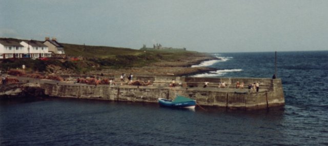
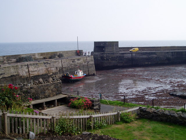
Black Hole is a small coastal feature located in Northumberland, England. It is a sea inlet that leads into a narrow creek, forming an estuary. The area is known for its picturesque landscape and is a popular destination for nature enthusiasts and birdwatchers.

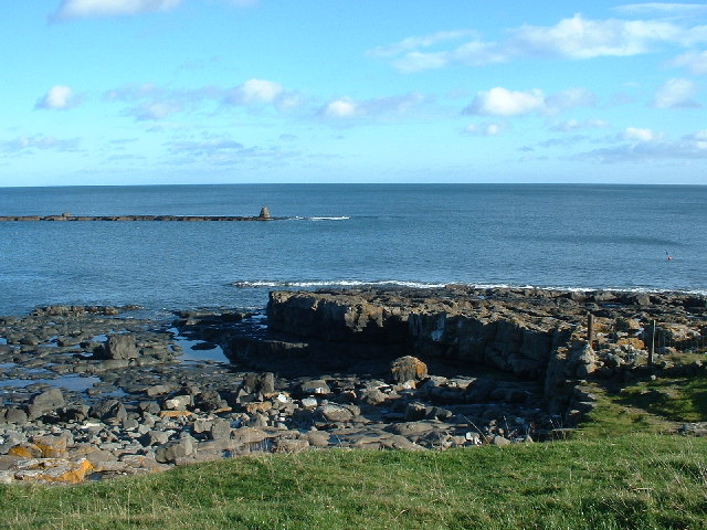
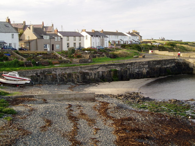
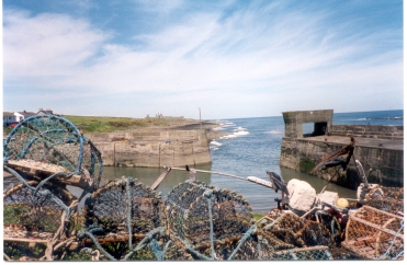
The Black Hole estuary is surrounded by rugged cliffs and sandy beaches, creating a stunning backdrop for visitors. The creek itself is relatively shallow and has a slow-moving current, making it an ideal habitat for a variety of marine life. The estuary is also home to a diverse range of bird species, such as herons, cormorants, and oystercatchers, which can often be seen wading through the shallow waters.

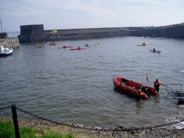
The Black Hole area offers excellent opportunities for walking and hiking, with several scenic trails that wind along the coastline. Visitors can explore the cliffs and enjoy panoramic views of the Northumberland coast. The beaches are also a popular spot for beachcombing and picnicking, providing a peaceful and tranquil setting.

It is worth noting that the Black Hole is subject to tidal changes, and visitors should exercise caution when exploring the area. The tides can create strong currents, particularly during high tide, making it important to check local tide times and be aware of any warnings or restrictions.

Overall, Black Hole in Northumberland is a beautiful coastal feature, offering a unique blend of natural beauty and wildlife. It is a must-visit destination for those seeking a peaceful and scenic experience by the sea.

If you have any feedback on the listing, please let us know in the comments section below.

Black Hole Images

Images are sourced within 2km of 55.465124/-1.5898068 or Grid Reference NU2619. Thanks to Geograph Open Source API. All images are credited.

Craster Harbour The ruin on the horizon is Dunstanburgh Castle.
Craster Harbour
The ruin on the horizon is Dunstanburgh Castle.
Craster WWII Chain Home Low radar station
Craster View from the shore from the sleepy village of Craster made famous for its kippers
Craster
View from the shore from the sleepy village of Craster made famous for its kippers
Ridge and furrow field pattern, Dunstan. The concrete buildings that housed a radar station during the Second World can be seen on the skyline above Craster Heugh
Ridge and furrow field pattern, Dunstan.
The concrete buildings that housed a radar station during the Second World can be seen on the skyline above Craster Heugh
Dunstan Hall This is reputed to be the oldest continuously inhabited building in Northumberland.
Dunstan Hall
This is reputed to be the oldest continuously inhabited building in Northumberland.
Dunstan Square The ruins of Dunstanburgh Castle can be seen on the skyline above Dunstan Square farm.
Dunstan Square
The ruins of Dunstanburgh Castle can be seen on the skyline above Dunstan Square farm.
A Geo or Inlet Is this a natural feature or man made?
A Geo or Inlet
Is this a natural feature or man made?
The Heugh, looking from Dunstanburgh Castle south to Craster This covers pretty much the whole grid square.
The Heugh, looking from Dunstanburgh Castle south to Craster
This covers pretty much the whole grid square.
Little Carr An outcrop of Whin Sill off Craster Harbour
Little Carr
An outcrop of Whin Sill off Craster Harbour
Dunstan Square & field
Gorse on The Heugh An outcrop of Whin Sill
Gorse on The Heugh
An outcrop of Whin Sill
Road to Dunstan Road to Dunstan coming from Caster where the footpath starts to Dunstan Square.
Road to Dunstan
Road to Dunstan coming from Caster where the footpath starts to Dunstan Square.
Craster Harbour. Robsons Fish Restaurant on right
Craster Harbour.
Robsons Fish Restaurant on right
Craster Harbour. View from Craster Harbour to Dunstanburgh Castle.
Craster Harbour.
View from Craster Harbour to Dunstanburgh Castle.
Craster Harbour. High Tide.
Craster Harbour.
High Tide.
Craster Harbour. Low Tide.
Craster Harbour.
Low Tide.
Craster Harbour. View from Craster Harbour to Dunstanburgh Castle.
Craster Harbour.
View from Craster Harbour to Dunstanburgh Castle.
Craster Harbour. Activity and Lifeboat in Craster Harbour
Craster Harbour.
Activity and Lifeboat in Craster Harbour
Show me another place!

Black Hole is located at Grid Ref: NU2619 (Lat: 55.465124, Lng: -1.5898068)

Unitary Authority: Northumberland

Police Authority: Northumbria

What 3 Words

///lightens.highly.backs. Near Longhoughton, Northumberland

Nearby Locations

Muckle Carr Black Hole

Related Wikis

Craster Tower

Craster Tower is an 18th-century Georgian mansion incorporating a 14th-century pele tower situated near the fishing village of Craster, Northumberland...

Craster

Craster is a small fishing village on the Northumberland coast of England, eight miles (13 km) from Alnwick. The next village to the north is Embleton...

Howick house

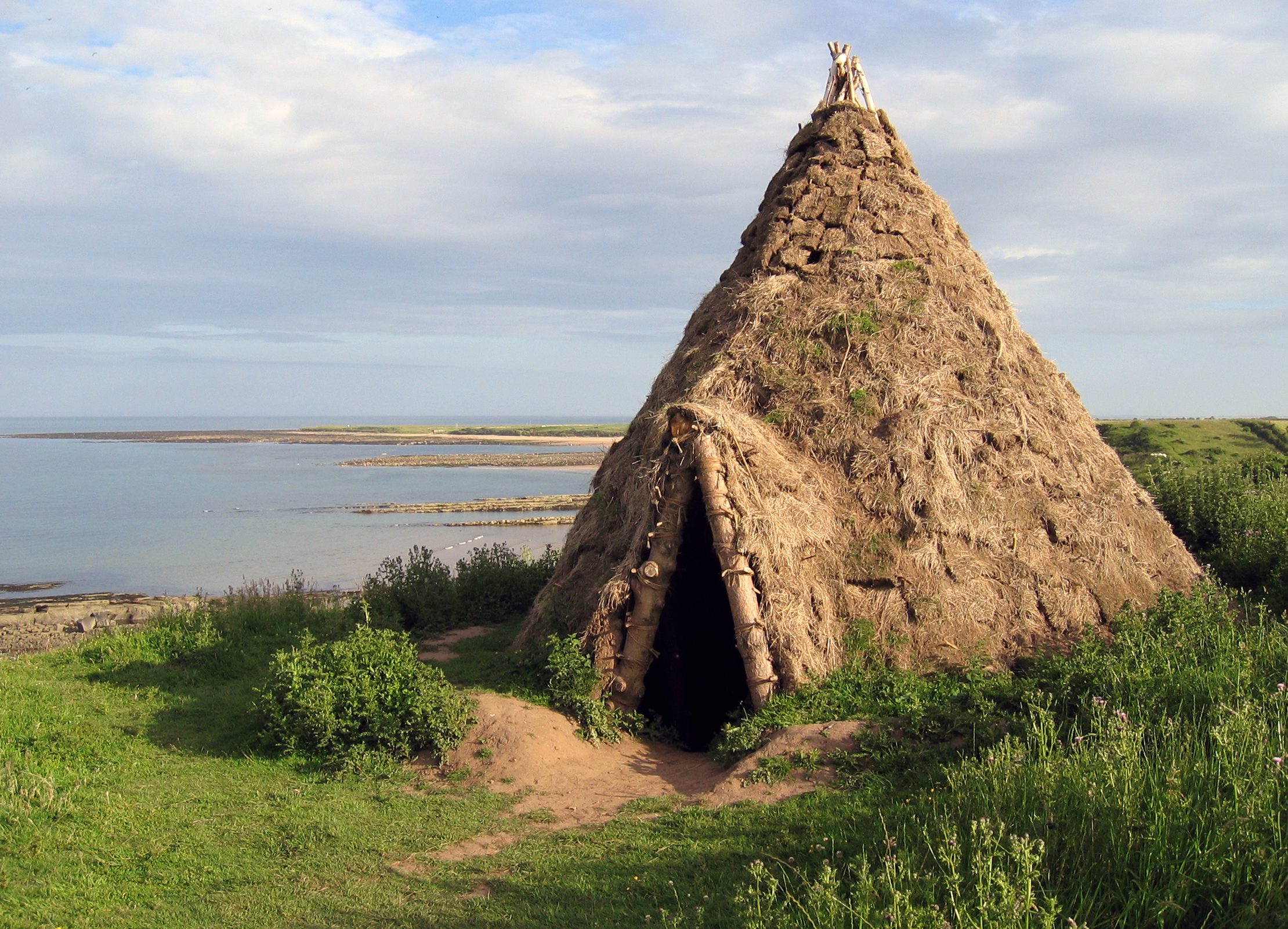
The Howick house is a Mesolithic site located in Northumberland, England. It was found when an amateur archaeologist noticed flint tools eroding out of...

Craster radar station

Craster radar station (also known as RAF Craster), was a Chain Home Low (later a Chain Home Extra Low) Second World War radar site at Craster in Northumberland...

Nearby Amenities

Located within 500m of 55.465124,-1.5898068
Barrier: kissing_gate
Foot: yes
Lat/Long: 55.4649085/-1.590749
Cullernose Point
Place: locality
Lat/Long: 55.4618391/-1.5869006
Black Hole
Place: locality
Lat/Long: 55.4652316/-1.5888577
Hole o' the Dike
Place: locality
Lat/Long: 55.468005/-1.589673
Barrier: kissing_gate
Source: GPS survey
Lat/Long: 55.4681124/-1.5920374
Barrier: kissing_gate
Foot: yes
Lat/Long: 55.4609662/-1.5918911
Hiking: yes
Information: guidepost
Source: GPS survey
Tourism: information
Lat/Long: 55.4693407/-1.5922706
The data included in this document is from www.openstreetmap.org. The data is made available under ODbL.

Have you been to Black Hole?

Leave your review of Black Hole below (or comments, questions and feedback).