Braidstone Hole

Sea, Estuary, Creek in Northumberland

England

Braidstone Hole

Looking seaward over Annstead Rocks
Looking seaward over Annstead Rocks Credit: Richard Law

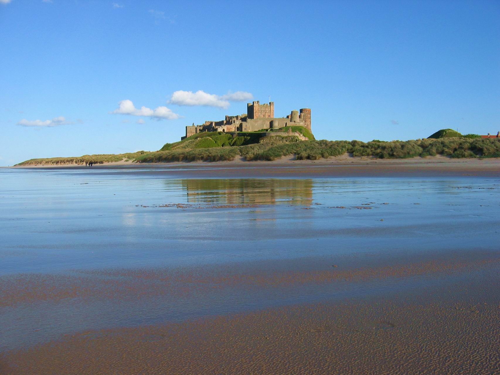
Braidstone Hole is a picturesque coastal feature located in Northumberland, England. Situated along the North Sea, it is an estuary and creek that offers stunning views and a tranquil atmosphere. The hole is formed by the convergence of the Braidstone Burn with the sea, creating a small inlet surrounded by rocky cliffs and sandy beaches.

The hole is known for its diverse wildlife and natural beauty. The surrounding area is home to a variety of bird species, including herons, cormorants, and oystercatchers. Bird watchers often flock to Braidstone Hole to catch a glimpse of these majestic creatures in their natural habitat.

The beach at Braidstone Hole is a popular spot for nature enthusiasts and visitors looking to relax. The sandy shoreline stretches for miles, providing ample space for beachcombing, sandcastle building, and picnicking. The clear waters of the hole are also perfect for swimming during the summer months.

For those who enjoy outdoor activities, Braidstone Hole offers opportunities for hiking and exploring the nearby cliffs. The area is known for its coastal trails and panoramic vistas, making it a favorite destination for walkers and photographers.

Braidstone Hole is easily accessible by car, with a small parking area available for visitors. It is also a short distance from nearby towns and villages, making it a convenient day trip for tourists and locals alike.

Overall, Braidstone Hole is a hidden gem on the Northumberland coastline, offering a peaceful retreat for nature lovers and a chance to immerse oneself in the beauty of the sea, estuary, and creek.

If you have any feedback on the listing, please let us know in the comments section below.

Braidstone Hole Images

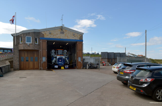
Images are sourced within 2km of 55.580462/-1.6417282 or Grid Reference NU2231. Thanks to Geograph Open Source API. All images are credited.

Looking seaward over Annstead Rocks
Along the beach towards Seahouses
Northwards from the edge of Annstead Rocks Shortly after the turn of tide on a bright September afternoon
Northwards from the edge of Annstead Rocks
Shortly after the turn of tide on a bright September afternoon
Northern tip of Annstead Rocks Much of the seaward part of the beach to the south of here consists of a low platform of limestone and sandstone outcrops. From this point north, that gives way to open sand until the low cliffs just below the golf course.
Northern tip of Annstead Rocks
Much of the seaward part of the beach to the south of here consists of a low platform of limestone and sandstone outcrops. From this point north, that gives way to open sand until the low cliffs just below the golf course.
Main Street, Seahouses
The Olde Ship at the junction of Main Street and Crumstone, Seahouses
Roundabout at the junction of King Street and Main Street (B1340), Seahouses
Main Street (B1340), Seahouses
North Sunderland Harbour, Seahouses
Boat trip kiosks, North Sunderland Harbour, Seahouses
Lifeboat Station, Seahouses
The Tumblers at high tide, Seahouses
Harbour Wall, Seahouses
North Sunderland Harbour, Seahouses
Breakwater, North Sunderland Harbour, Seahouses
Boat, North Sunderland Harbour, Seahouses
Show me another place!

Braidstone Hole is located at Grid Ref: NU2231 (Lat: 55.580462, Lng: -1.6417282)

Unitary Authority: Northumberland

Police Authority: Northumbria

What 3 Words

///begins.illogical.grows. Near Seahouses, Northumberland

Related Wikis

Seahouses railway station

Seahouses railway station was the brick and wood built eastern terminus of the single track branch of the North Sunderland Railway, in north east England...

Seahouses

Seahouses is a large village on the North Northumberland coast in England. It is about 20 kilometres (12 mi) north of Alnwick, within the Northumberland...

North Sunderland

North Sunderland is a fishing village on the coast of Northumberland, England, and adjacent to Seahouses. The population of the civil parish was 1,803...

Northumberland Coast

The Northumberland Coast is a designated Area of Outstanding Natural Beauty (AONB) covering 40 miles (64 km) of coastline from Berwick-Upon-Tweed to the...

Nearby Amenities

Located within 500m of 55.580462,-1.6417282
Smokehouse
Created By: Potlatch 0.10
Lat/Long: 55.5811957/-1.6494035
Noexit: yes
Lat/Long: 55.5789202/-1.6473829
Southend Rock
Place: locality
Lat/Long: 55.5835583/-1.6421518
Lowgos Bay
Natural: bay
Lat/Long: 55.5843005/-1.6440678
Brandy Lake
Place: locality
Lat/Long: 55.5784657/-1.6373255
The Brigses
Place: locality
Lat/Long: 55.5828141/-1.6482981
Braidstone Hole
Place: locality
Lat/Long: 55.5805422/-1.6412406
Fluke Hole
Place: locality
Lat/Long: 55.5825911/-1.6460771
Seahouses Point
Place: locality
Lat/Long: 55.5818834/-1.6460685
Braidcarr Rocks
Place: locality
Lat/Long: 55.5791127/-1.6402525
Swallows
Addr City: Seahouses
Addr Housenumber: 2
Addr Postcode: NE68 7RB
Addr Street: South Street
Phone: +44 1665 721052
Shop: seafood
Website: https://www.swallowfish.co.uk
Lat/Long: 55.5811331/-1.6494771
Seamark Type: anchorage
Lat/Long: 55.5823056/-1.6469444
Gunpowder Hut
Name En: Gunpowder Hut
Tourism: viewpoint
Lat/Long: 55.5820696/-1.6454071
Noexit: yes
Lat/Long: 55.5781458/-1.6479935
Direction: 140
Generator Method: photovoltaic
Generator Output Electricity: yes
Generator Solar Modules: 8
Generator Source: solar
Generator Type: solar_photovoltaic_panel
Location: roof
Power: generator
Lat/Long: 55.5815403/-1.6484273
Direction: 145
Generator Method: photovoltaic
Generator Output Electricity: yes
Generator Solar Modules: 8
Generator Source: solar
Generator Type: solar_photovoltaic_panel
Location: roof
Power: generator
Lat/Long: 55.5783128/-1.6484545
Direction: 145
Generator Method: photovoltaic
Generator Output Electricity: yes
Generator Solar Modules: 8
Generator Source: solar
Generator Type: solar_photovoltaic_panel
Location: roof
Power: generator
Lat/Long: 55.5792498/-1.6486922
Direction: 140
Generator Method: photovoltaic
Generator Output Electricity: yes
Generator Solar Modules: 14
Generator Source: solar
Generator Type: solar_photovoltaic_panel
Location: roof
Power: generator
Lat/Long: 55.581687/-1.6483274
Bench
Backrest: yes
Material: wood
Lat/Long: 55.5816738/-1.6465304
The data included in this document is from www.openstreetmap.org. The data is made available under ODbL.

Have you been to Braidstone Hole?

Leave your review of Braidstone Hole below (or comments, questions and feedback).