Akers Geo
Sea, Estuary, Creek in Shetland
Scotland
Akers Geo
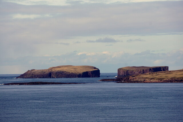
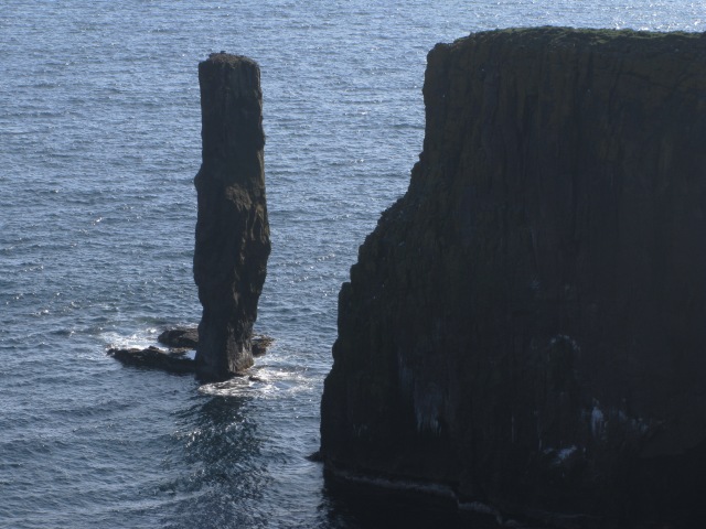
Akers Geo is a picturesque and captivating natural feature located in Shetland, Scotland. It is a unique combination of sea, estuary, and creek, which adds to its charm and appeal. The geo is situated on the eastern coast of the Mainland, the largest island in the Shetland archipelago.
The sea aspect of Akers Geo is evident in its open and expansive waters. The sea surrounding the geo is known for its crystal-clear and azure blue hues, creating a striking contrast against the rugged cliffs and green hills that encompass it. These tranquil waters are a haven for various marine species, including seals, seabirds, and occasional sightings of dolphins.
Moving towards the estuary, the landscape transforms into a more secluded and sheltered environment. The estuary is characterized by its calm and peaceful waters, which meander through the surrounding grassy marshes and sandy banks. This area is rich in biodiversity and provides a habitat for numerous wading birds, such as oystercatchers, curlews, and herons.
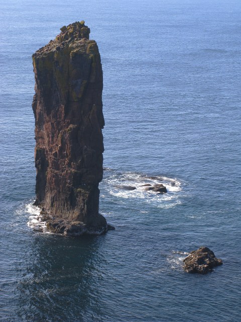
Finally, the creek section of Akers Geo offers a narrower and more intimate setting. It is a small watercourse that winds its way through steep cliffs and rocky outcrops. During high tides, the creek becomes a small, navigable channel, allowing small boats and kayakers to explore its hidden corners.
Akers Geo is not only a natural wonder but also a place of historical significance. Its unique geology and landscape have attracted humans for centuries, and archaeological remains, including Iron Age settlements and Viking artifacts, have been discovered in the vicinity.
Overall, Akers Geo is a place of exceptional natural beauty, where sea, estuary, and creek converge, offering visitors a captivating and diverse coastal experience.
If you have any feedback on the listing, please let us know in the comments section below.
Akers Geo Images
Images are sourced within 2km of 60.340691/-1.7315688 or Grid Reference HU1461. Thanks to Geograph Open Source API. All images are credited.


Akers Geo is located at Grid Ref: HU1461 (Lat: 60.340691, Lng: -1.7315688)
Unitary Authority: Shetland Islands
Police Authority: Highlands and Islands
What 3 Words
///notifying.either.saved. Near Walls, Shetland Islands
Nearby Locations
Related Wikis

Papa Stour
Papa Stour (Scots: Papa Stour) is one of the Shetland Islands in Scotland, with a population of under fifteen people, some of whom immigrated after an...

Papa Stour Airstrip
Papa Stour Airstrip is a small airstrip in the village of Biggings on the island of Papa Stour. Shetland, Scotland. == History == Papa Stour Airstrip opened...

Biggings
Biggings is a village on the island of Papa Stour, in Shetland, Scotland. Papa Stour's church is situated at the south of Biggings. A homestead of Duke...
Maiden Stack
The Maiden Stack or Frau Stack is a tiny stack in the western Shetland Islands to the north of Brei Holm and east of Housa Voe in Papa Stour. It is so...
Brei Holm
Brei Holm is a tiny tidal islet in the western Shetland Islands. It is due east of Papa Stour, to which it is connected at low tide, just outside Housa...
Forewick Holm
Forewick Holm is a 1-hectare (2.5-acre) island in the Sound of Papa in the Shetland islands, Scotland. Located between Papa Stour and the Sandness peninsula...

Ve Skerries
The Ve Skerries or Vee Skerries (Old Norse: Vestan sker, West Skerries) are a group of low skerries (rocky islands) three miles (4.8 km) north west of...

MV Coelleira
MV Coelleira was a Spanish-owned fishing vessel which was built in 1970 in the Netherlands. It was wrecked on 4 August 2019 on the Ve Skerries, Shetland...
Have you been to Akers Geo?
Leave your review of Akers Geo below (or comments, questions and feedback).