Hund Geo
Coastal Feature, Headland, Point in Shetland
Scotland
Hund Geo
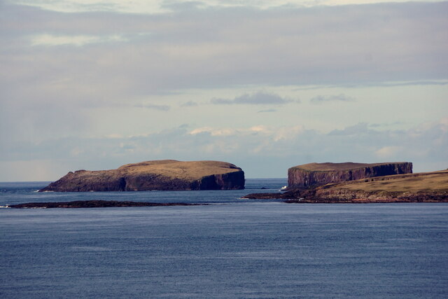
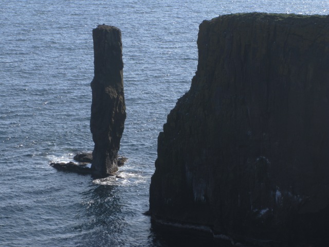
Hund Geo is a prominent coastal feature located on the Shetland Islands, an archipelago in Scotland. It is a headland that extends into the North Sea, forming a distinct point along the rugged coastline. The name "Hund Geo" is derived from Old Norse and translates to "dog inlet," possibly referring to the shape of the feature or its historical association with dogs.
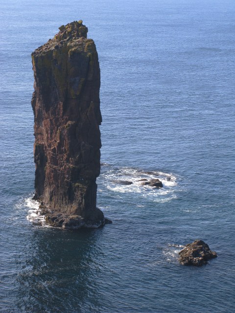
This headland is characterized by its dramatic cliffs and steep slopes, which provide stunning panoramic views of the surrounding landscape. The cliffs are composed of layers of sedimentary rocks, showcasing different geological formations and colors, adding to the visual appeal of the area. The exposed rocks also offer opportunities for geologists and enthusiasts to study the region's geological history.
Hund Geo is known for its rich biodiversity, with various seabird species nesting on its cliffs, including puffins, guillemots, and razorbills. These birds create a vibrant and lively atmosphere, filling the air with their calls and displaying their impressive aerial acrobatics.
The headland is a popular spot for outdoor activities such as hiking, birdwatching, and photography. Visitors can explore the surrounding coastal paths, taking in the breathtaking scenery and observing the diverse wildlife. It is advisable to exercise caution near the cliff edges due to their steepness and potential hazards.
Overall, Hund Geo stands as a remarkable and picturesque coastal feature, offering visitors a chance to immerse themselves in the natural beauty of the Shetland Islands while appreciating its geological and ecological wonders.
If you have any feedback on the listing, please let us know in the comments section below.
Hund Geo Images
Images are sourced within 2km of 60.338642/-1.7353169 or Grid Reference HU1461. Thanks to Geograph Open Source API. All images are credited.


Hund Geo is located at Grid Ref: HU1461 (Lat: 60.338642, Lng: -1.7353169)
Unitary Authority: Shetland Islands
Police Authority: Highlands and Islands
What 3 Words
///rugs.drooling.rolled. Near Walls, Shetland Islands
Nearby Locations
Related Wikis

Papa Stour
Papa Stour (Scots: Papa Stour) is one of the Shetland Islands in Scotland, with a population of under fifteen people, some of whom immigrated after an...

Papa Stour Airstrip
Papa Stour Airstrip is a small airstrip in the village of Biggings on the island of Papa Stour. Shetland, Scotland. == History == Papa Stour Airstrip opened...

Biggings
Biggings is a village on the island of Papa Stour, in Shetland, Scotland. Papa Stour's church is situated at the south of Biggings. A homestead of Duke...
Maiden Stack
The Maiden Stack or Frau Stack is a tiny stack in the western Shetland Islands to the north of Brei Holm and east of Housa Voe in Papa Stour. It is so...
Brei Holm
Brei Holm is a tiny tidal islet in the western Shetland Islands. It is due east of Papa Stour, to which it is connected at low tide, just outside Housa...
Forewick Holm
Forewick Holm is a 1-hectare (2.5-acre) island in the Sound of Papa in the Shetland islands, Scotland. Located between Papa Stour and the Sandness peninsula...

Ve Skerries
The Ve Skerries or Vee Skerries (Old Norse: Vestan sker, West Skerries) are a group of low skerries (rocky islands) three miles (4.8 km) north west of...

MV Coelleira
MV Coelleira was a Spanish-owned fishing vessel which was built in 1970 in the Netherlands. It was wrecked on 4 August 2019 on the Ve Skerries, Shetland...
Have you been to Hund Geo?
Leave your review of Hund Geo below (or comments, questions and feedback).