Coves of Mullcleave

Sea, Estuary, Creek in Banffshire

Scotland

Coves of Mullcleave

Mouse-ear Hawkweed Hawkweeds, Hawksbeards and Hawkbits all have dandelion-like flowers and are notoriously difficult to tell apart. This is the exception, instantly recognisable because its flowers are lemon-yellow, while all the others are more canary-yellow.
Mouse-ear Hawkweed Credit: Anne Burgess

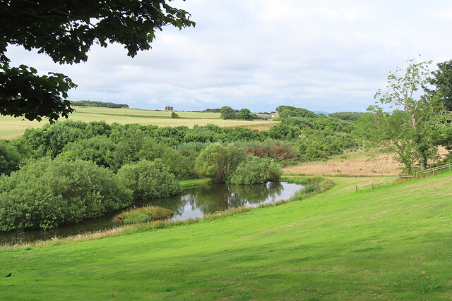
The Coves of Mullcleave is a picturesque coastal area located in Banffshire, Scotland. Nestled between rugged cliffs and rolling hills, it offers breathtaking views of the sea, estuary, and creek.

The sea, with its deep blue waters, stretches as far as the eye can see, creating a stunning backdrop for the surrounding landscape. The crashing waves and salty breeze create a serene atmosphere that is perfect for relaxation and contemplation.

The estuary, formed by the convergence of a river and the sea, is a unique feature of the Coves of Mullcleave. Here, the calm, brackish water meets the powerful force of the ocean, creating a diverse ecosystem that is home to a wide variety of marine life. Visitors can witness the ebb and flow of the tides, bringing with them an ever-changing environment.

A meandering creek adds to the charm of this coastal area. With its shallow and winding course, it invites exploration and provides a habitat for numerous species of plants and animals. The gentle babbling of the water as it flows over rocks and pebbles creates a soothing soundtrack to accompany the natural beauty of the surroundings.

The Coves of Mullcleave is a haven for nature enthusiasts and outdoor adventurers alike. The rugged cliffs offer opportunities for hiking and cliff-top walks, providing breathtaking views of the coastline. The area is also a birdwatcher's paradise, with a diverse range of species calling it home throughout the year.

Whether you are drawn to the crashing waves of the sea, the tranquil waters of the estuary, or the winding creek, the Coves of Mullcleave is a must-visit destination that showcases the natural beauty of Banffshire's coastal landscape.

If you have any feedback on the listing, please let us know in the comments section below.

Coves of Mullcleave Images

Images are sourced within 2km of 57.67145/-2.4402461 or Grid Reference NJ7364. Thanks to Geograph Open Source API. All images are credited.

Mouse-ear Hawkweed Hawkweeds, Hawksbeards and Hawkbits all have dandelion-like flowers and are notoriously difficult to tell apart. This is the exception, instantly recognisable because its flowers are lemon-yellow, while all the others are more canary-yellow.
Mouse-ear Hawkweed
Hawkweeds, Hawksbeards and Hawkbits all have dandelion-like flowers and are notoriously difficult to tell apart. This is the exception, instantly recognisable because its flowers are lemon-yellow, while all the others are more canary-yellow.
Loch Craig In the foreground is the sea wall of the Tarlair open-air swimming pool. Loch craig is the sea inlet offshore. The ship is Petronordic, port of registry Nassau, which is a shuttle tanker, gross tonnage 54865.
Loch Craig
In the foreground is the sea wall of the Tarlair open-air swimming pool. Loch craig is the sea inlet offshore. The ship is Petronordic, port of registry Nassau, which is a shuttle tanker, gross tonnage 54865.
House Martin (Delichon urbica) There are half a dozen nests under the roof of the pavilion at the Tarlair swimming pool. Note the bird sitting in this nest, presumably incubating eggs.
House Martin (Delichon urbica)
There are half a dozen nests under the roof of the pavilion at the Tarlair swimming pool. Note the bird sitting in this nest, presumably incubating eggs.
Tarlair Lido, 2022 The monochrome emphasises the current state of disrepair of the pavilion, but that is set to change, as funding has been secured and listed building consent given for its refurbishment starting in 2022.
The Friends of Tarlair <span class="nowrap"><a title="http://friendsoftarlair.co.uk/" rel="nofollow ugc noopener" href="http://friendsoftarlair.co.uk/">Link</a><img style="margin-left:2px;" alt="External link" title="External link - shift click to open in new window" src="https://s1.geograph.org.uk/img/external.png" width="10" height="10"/></span> are working towards making this a vibrant leisure destination once again. The Category A Listed facility deserves nothing less.
Tarlair Lido, 2022
The monochrome emphasises the current state of disrepair of the pavilion, but that is set to change, as funding has been secured and listed building consent given for its refurbishment starting in 2022. The Friends of Tarlair LinkExternal link are working towards making this a vibrant leisure destination once again. The Category A Listed facility deserves nothing less.
Natural sloping slabs at Tarlair At the entrance to the lido.
Natural sloping slabs at Tarlair
At the entrance to the lido.
Threading the needle View through the natural arch known locally as the Needle's Eye
Threading the needle
View through the natural arch known locally as the Needle's Eye
Tarlair Lido - the swimming pool The lowest of the three pools. The terraces were restored in 2014, and restoration of the pavilion is due to commence in 2022.
Tarlair Lido - the swimming pool
The lowest of the three pools. The terraces were restored in 2014, and restoration of the pavilion is due to commence in 2022.
Tarlair Lido, the three pools Nearest, surrounded by the narrow wall was a paddling pool, the next area being a boating pool with the main swimming pool furthest away. The surrounds of the pools were restored in 2014. The complex Listed Category A.
Tarlair Lido, the three pools
Nearest, surrounded by the narrow wall was a paddling pool, the next area being a boating pool with the main swimming pool furthest away. The surrounds of the pools were restored in 2014. The complex Listed Category A.
Tarlair Lido, view from the east Compare with this view of the lido in its heyday <span class="nowrap"><a title="http://friendsoftarlair.co.uk/welcome-to-friends-of-tarlair/about-us/" rel="nofollow ugc noopener" href="http://friendsoftarlair.co.uk/welcome-to-friends-of-tarlair/about-us/">Link</a><img style="margin-left:2px;" alt="External link" title="External link - shift click to open in new window" src="https://s1.geograph.org.uk/img/external.png" width="10" height="10"/></span>

Restoration of the pavilion is due to start in 2022. Listed Category A.
Tarlair Lido, view from the east
Compare with this view of the lido in its heyday LinkExternal link Restoration of the pavilion is due to start in 2022. Listed Category A.
Pond at Mains of Melrose An artificial pond beside the Burn of Melrose.
Pond at Mains of Melrose
An artificial pond beside the Burn of Melrose.
Mains of Melrose Fields of ripening barley on the undulating fields at the top of the cliffs at Melrose.
Mains of Melrose
Fields of ripening barley on the undulating fields at the top of the cliffs at Melrose.
Kamered Bank The modern maps don't name the headland in the middle of the bay, but the older large-scale maps call it Kamered Bank. This is presumably from the word kame, meaning a ridge. Stocked Head, behind me, is an igneous dyke, so perhaps there is also a dyke making this headland more resistant than the psammites and pelites of the Macduff Formation that make up the cliffs here.
Kamered Bank
The modern maps don't name the headland in the middle of the bay, but the older large-scale maps call it Kamered Bank. This is presumably from the word kame, meaning a ridge. Stocked Head, behind me, is an igneous dyke, so perhaps there is also a dyke making this headland more resistant than the psammites and pelites of the Macduff Formation that make up the cliffs here.
Wild Angelica (Angelica sylvestris) A fat flower-head, reminiscent of cauliflower. Angelica is very common on the banks below the cliffs here.
Wild Angelica (Angelica sylvestris)
A fat flower-head, reminiscent of cauliflower. Angelica is very common on the banks below the cliffs here.
Goldenrod (Solidago virgaurea) The bright yellow flowers of Goldenrod are common on the grassy banks along this stretch of coast.
Goldenrod (Solidago virgaurea)
The bright yellow flowers of Goldenrod are common on the grassy banks along this stretch of coast.
Lady's Bedstraw (Galium verum) In olden days the flowers of this common plant were strewn on floors to give a pleasant scent.
Lady's Bedstraw (Galium verum)
In olden days the flowers of this common plant were strewn on floors to give a pleasant scent.
White Bluebells (Campanula rotundifolia) In England these are called Harebells, but C rotundifolia is the true Bluebell of Scotland. I'd never seen a pure white one before.
White Bluebells (Campanula rotundifolia)
In England these are called Harebells, but C rotundifolia is the true Bluebell of Scotland. I'd never seen a pure white one before.
White Bluebell (Campanula rotundifolia) In England this would be called a Harebell, but C rotundifolia is the true Bluebell of Scotland. I'd never seen a pure white one before.
White Bluebell (Campanula rotundifolia)
In England this would be called a Harebell, but C rotundifolia is the true Bluebell of Scotland. I'd never seen a pure white one before.
Lady's Bedstraw (Galium verum) In olden days the flowers of this common plant were strewn on floors to give a pleasant scent.
Lady's Bedstraw (Galium verum)
In olden days the flowers of this common plant were strewn on floors to give a pleasant scent.
Show me another place!

Coves of Mullcleave is located at Grid Ref: NJ7364 (Lat: 57.67145, Lng: -2.4402461)

Unitary Authority: Aberdeenshire

Police Authority: North East

What 3 Words

///tanked.dustbin.trucks. Near Macduff, Aberdeenshire

Related Wikis

Tarlair Swimming Pool

Tarlair Swimming Pool is a disused lido at the base of a sea cliff just outside Macduff in Aberdeenshire in Scotland. This outdoor swimming complex was...

A98 road

The A98 road is a major coastal road of northeast Scotland passing through Moray and Aberdeenshire. The A98 is no longer a primary route, with this status...

Cairn Lee

Cairn Lee is a prehistoric monument in Aberdeenshire, Scotland. Cairn Lee and proximate Longman Hill are the oldest prehistoric features in the local area...
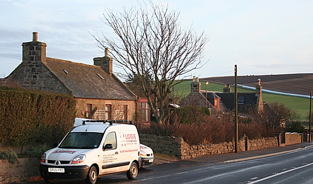
Longmanhill

Longmanhill is a settlement in the Aberdeenshire parish of Gamrie; it is located along the A98 road connecting Fraserburgh to Macduff. This hamlet was...

Have you been to Coves of Mullcleave?

Leave your review of Coves of Mullcleave below (or comments, questions and feedback).