Cove of the Head
Sea, Estuary, Creek in Angus
Scotland
Cove of the Head

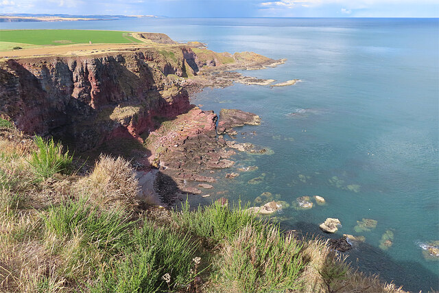
Cove of the Head is a picturesque coastal feature located in Angus, Scotland. Nestled between Arbroath and Montrose, this stunning area is known for its natural beauty and diverse ecosystems. It is a combination of a sea inlet, an estuary, and a creek, making it a unique and multifaceted destination.
The cove is surrounded by rugged cliffs, providing a dramatic backdrop to the crystal-clear waters that gently lap against the shore. The rocky coastline is home to a variety of marine life, and the area is popular among anglers who come to fish for a wide range of species.
The estuary, formed by the convergence of several rivers, adds another dimension to the cove. It is a haven for many bird species, including herons, oystercatchers, and gulls. Birdwatchers flock to Cove of the Head to observe these beautiful creatures in their natural habitat.
A small creek meanders through the landscape, adding to the charm of the area. The creek provides a sheltered spot for wildlife, and its tranquil waters are often used by kayakers and paddleboarders who enjoy exploring its hidden corners.
Cove of the Head is also a popular destination for walkers and hikers, with numerous trails that offer breathtaking views of the surrounding scenery. The coastal path allows visitors to appreciate the rugged cliffs and the ever-changing sea, while inland trails lead through lush vegetation and offer glimpses of wildlife.
Overall, Cove of the Head is a natural wonder that showcases the beauty and diversity of Angus' coastal landscape. Whether it's exploring the sea, estuary, or creek, visitors will find themselves immersed in a stunning environment that showcases the best of Scotland's natural beauty.
If you have any feedback on the listing, please let us know in the comments section below.
Cove of the Head Images
Images are sourced within 2km of 56.617029/-2.4860803 or Grid Reference NO7047. Thanks to Geograph Open Source API. All images are credited.


Cove of the Head is located at Grid Ref: NO7047 (Lat: 56.617029, Lng: -2.4860803)
Unitary Authority: Angus
Police Authority: Tayside
What 3 Words
///tweeted.important.shoelaces. Near Arbroath, Angus
Nearby Locations
Related Wikis
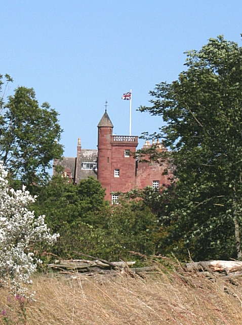
Ethie Castle
Ethie Castle is a 15,091 square feet (1,402.0 m2) 14th-century castle, situated around 3 miles north of the fishing town of Arbroath in Angus, Scotland...
Lunan Water
The Lunan Water is an easterly flowing river in Angus, Scotland, that discharges to the North Sea 11 kilometres (6.8 mi) north of the town of Arbroath...

Auchmithie
Auchmithie is a small fishing village in Angus, Scotland, three miles north east of the town of Arbroath. It sits atop a cliff of red sandstone conglomerate...

Inverkeilor railway station
Inverkeilor railway station served the village of Inverkeilor, Angus, Scotland from 1883 to 1930 on the North British, Arbroath and Montrose Railway....
Nearby Amenities
Located within 500m of 56.617029,-2.4860803Have you been to Cove of the Head?
Leave your review of Cove of the Head below (or comments, questions and feedback).