Bridge Watermans Reach
Sea, Estuary, Creek in Monmouthshire
Wales
Bridge Watermans Reach

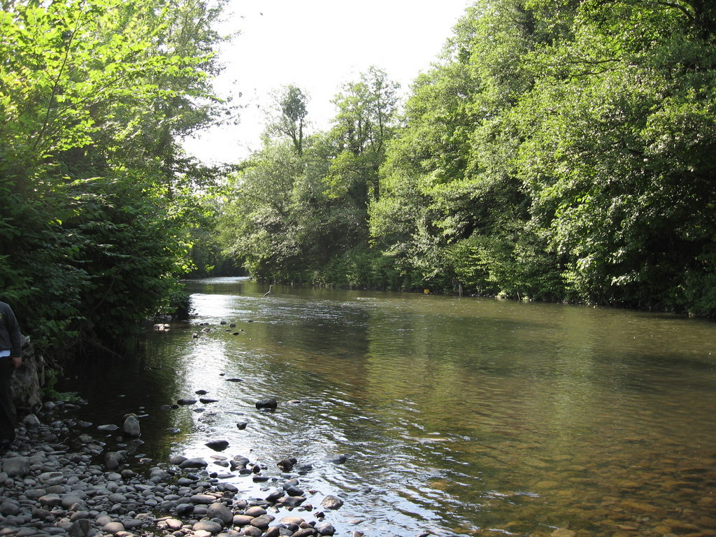
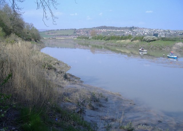
Bridge Watermans Reach is a picturesque location situated in Monmouthshire, Wales. It is a unique area where the sea, estuary, and creek converge, creating a stunning natural landscape.
The area is known for its diverse wildlife and exceptional beauty. The sea, with its crystal-clear waters, provides a stunning backdrop to the surrounding landscape. The estuary, formed by the River Usk, opens up to the sea, creating a calm and serene environment.
The creek, which flows into the estuary, adds to the charm of Bridge Watermans Reach. It is a narrow waterway that winds its way through the landscape, offering opportunities for boating and fishing. The creek is teeming with various species of fish and is a popular spot for anglers.
The surrounding area is abundant in flora and fauna. The shores are lined with lush greenery, and the area is home to a wide variety of bird species, including herons, gulls, and wading birds. It is a haven for birdwatchers and nature enthusiasts.
Bridge Watermans Reach is also a popular destination for outdoor activities. Visitors can explore the area by foot, taking in the stunning views and enjoying the tranquility of the surroundings. There are walking trails that lead to secluded beaches and hidden coves, perfect for a peaceful day out.
Overall, Bridge Watermans Reach is a hidden gem in Monmouthshire, offering a unique blend of sea, estuary, and creek. Its natural beauty, diverse wildlife, and range of outdoor activities make it a must-visit destination for nature lovers and those seeking a tranquil getaway.
If you have any feedback on the listing, please let us know in the comments section below.
Bridge Watermans Reach Images
Images are sourced within 2km of 51.548276/-2.9850449 or Grid Reference ST3183. Thanks to Geograph Open Source API. All images are credited.


Bridge Watermans Reach is located at Grid Ref: ST3183 (Lat: 51.548276, Lng: -2.9850449)
Unitary Authority: Newport
Police Authority: Gwent
What 3 Words
///longer.couches.couple. Near Nash, Newport
Nearby Locations
Related Wikis
Ebbw River
The Ebbw River (; Welsh: Afon Ebwy) is a river in South Wales which gives its name to the town of Ebbw Vale. The Ebbw River is joined by the Ebbw Fach...
River Usk
The River Usk (; Welsh: Afon Wysg) rises on the northern slopes of the Black Mountain (y Mynydd Du), Wales, in the westernmost part of the Brecon Beacons...

Uskmouth power stations
The Uskmouth power stations (also known as the Fifoots Point power stations) refers to a series of two coal-fired power stations at the mouth of the River...
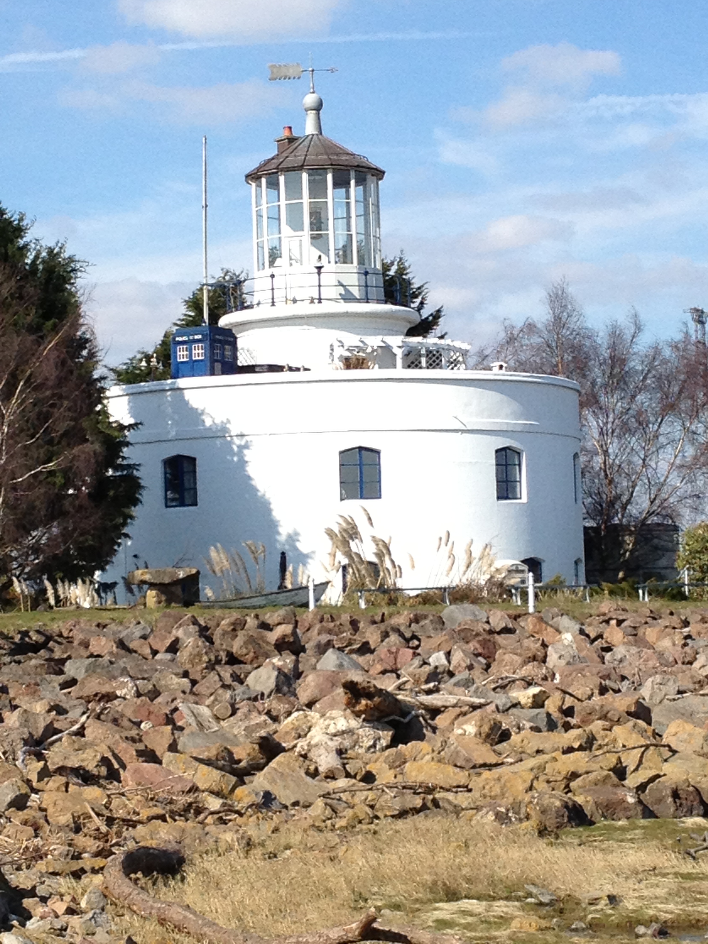
West Usk Lighthouse
West Usk Lighthouse is a Grade II-listed building on the Severn Estuary at the mouth of the River Usk south of the city of Newport, South Wales. ��2�...

Newport Docks
Newport Docks is the collective name for a group of docks in the city of Newport, south-east Wales. By the eighteenth century there were a number of wharves...
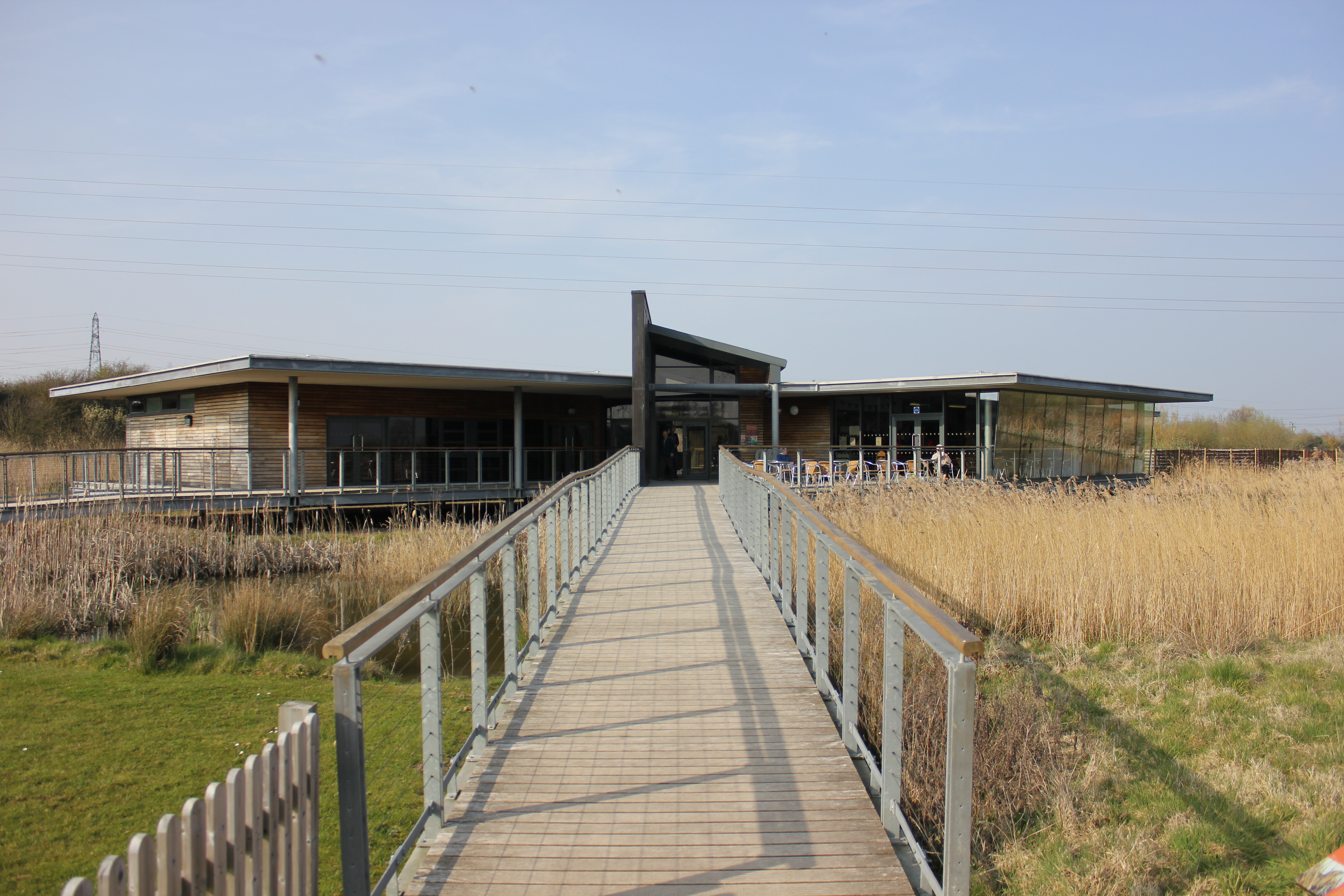
Newport Wetlands
Newport Wetlands is a wildlife reserve covering parts of Uskmouth, Nash and Goldcliff, in the south-east of the city of Newport, South Wales. == History... ==
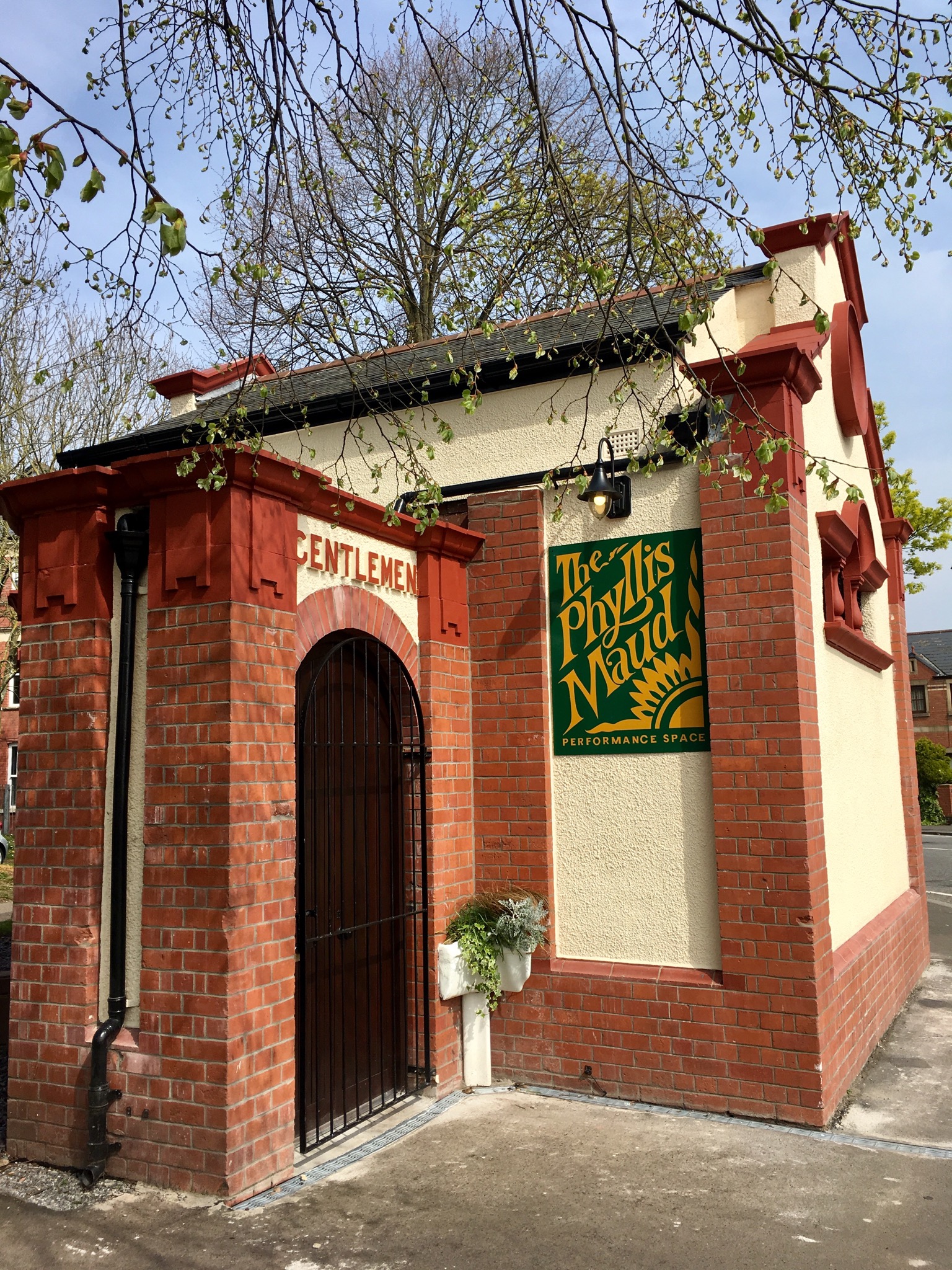
Phyllis Maud Performance Space
The Phyllis Maud Performance Space is a Grade II listed former public toilet in Newport, South Wales. == History == The building ceased to operate as a...
Uskmouth
Uskmouth (Welsh: Aberwysg) is an area to the south of the city of Newport, South Wales. == Location == Uskmouth is effectively in the west of the village...
Nearby Amenities
Located within 500m of 51.548276,-2.9850449Have you been to Bridge Watermans Reach?
Leave your review of Bridge Watermans Reach below (or comments, questions and feedback).