Cove Garbh

Sea, Estuary, Creek in Caithness

Scotland

Cove Garbh

Entrance to an old ice-house, Swiney
Entrance to an old ice-house, Swiney Credit: sylvia duckworth

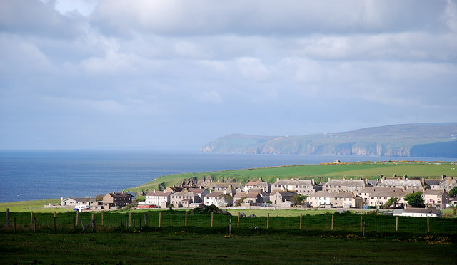
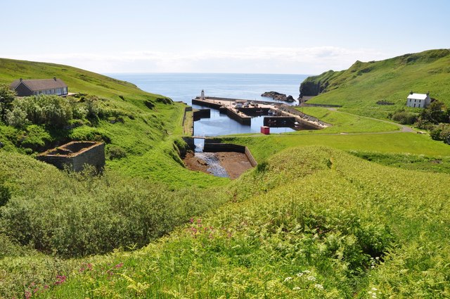
Cove Garbh is a picturesque coastal area located in Caithness, Scotland. Situated on the eastern coast, Cove Garbh features a combination of sea, estuary, and creek landscapes, making it a unique and diverse natural environment.

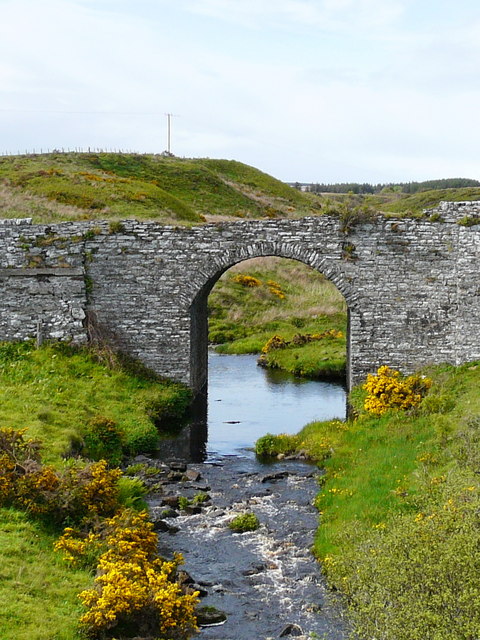
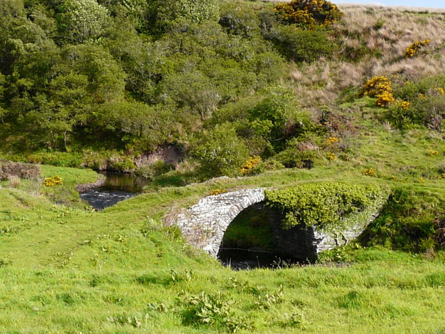
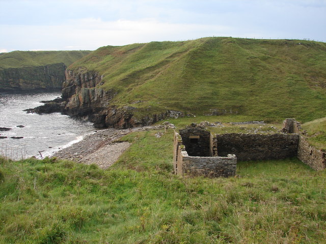
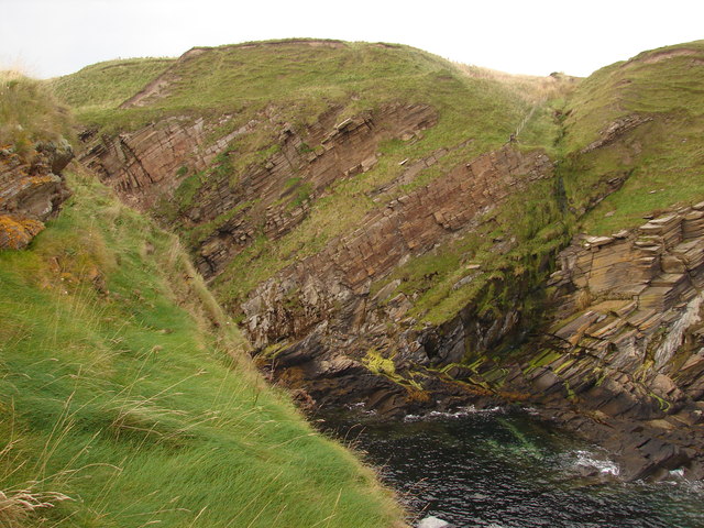
The area is characterized by its rocky shoreline, dotted with small caves and crevices that have been formed over centuries by the relentless pounding of the waves. The rugged cliffs that frame the coast provide a stunning backdrop to the panoramic views of the North Sea. The sea itself is known for its wild and unpredictable nature, with powerful waves crashing against the rocks, creating a mesmerizing spectacle.

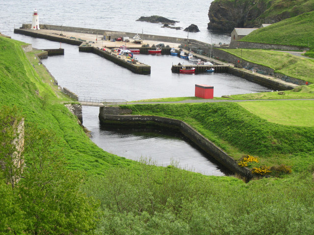
Cove Garbh is also home to an estuary, where a river meets the sea. This estuary provides a habitat for a variety of marine life, including fish, birds, and small mammals. The calm waters of the estuary contrast with the rough sea, creating a tranquil and serene atmosphere.

In addition, a small creek cuts through the landscape, meandering its way towards the sea. This creek is surrounded by lush vegetation, offering a peaceful and secluded spot for visitors to explore and enjoy nature.

Cove Garbh is a popular destination for nature enthusiasts, photographers, and those seeking a peaceful retreat. Its diverse landscapes, rich wildlife, and breathtaking views make it a must-visit location for anyone seeking to experience the raw beauty of the Scottish coastline.

If you have any feedback on the listing, please let us know in the comments section below.
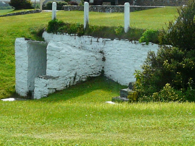
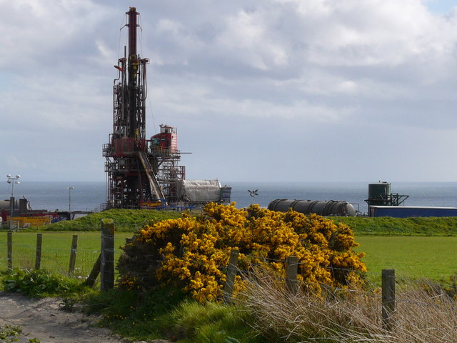
Cove Garbh Images

Images are sourced within 2km of 58.291848/-3.2927051 or Grid Reference ND2434. Thanks to Geograph Open Source API. All images are credited.

Entrance to an old ice-house, Swiney
Old bridge at Reisgill
Oldest bridge at Reisgill
Caithness Oil drilling rig
Quatre Bras From Norland Road Lybster's main road junction with the A99 has a French connection.
Quatre Bras
From Norland Road Lybster's main road junction with the A99 has a French connection.
Lybster Village The Commercial Hotel, a disused church and a bank looking north.
Lybster Village
The Commercial Hotel, a disused church and a bank looking north.
Lybster View Over the fields for a morning view of the village.
Lybster View
Over the fields for a morning view of the village.
Harbour View Lybster Harbour from the picnic spot on Shore Road, Lybster.
Harbour View
Lybster Harbour from the picnic spot on Shore Road, Lybster.
Lybster Station Now the clubhouse for Lybster Golf Course, this was originally the end of the line of the short lived Lybster and Wick Light Railway, opened 1903 and closed 1944. Within are photos of the old station.
Lybster Station
Now the clubhouse for Lybster Golf Course, this was originally the end of the line of the short lived Lybster and Wick Light Railway, opened 1903 and closed 1944. Within are photos of the old station.
Lybster Harbour The inner harbour was completed as recently as 1950. The harbour is still used mainly for fishing, but the number of working boats is down to twenty or so.
Lybster Harbour
The inner harbour was completed as recently as 1950. The harbour is still used mainly for fishing, but the number of working boats is down to twenty or so.
Peak of the cliff Facing westwards back towards land with the sheer cliff behind and on either side, I was definitely not tempted to take a step back to get a better view!
This is the northernmost of the two fingers pointing from Achastle-shore.
Peak of the cliff
Facing westwards back towards land with the sheer cliff behind and on either side, I was definitely not tempted to take a step back to get a better view! This is the northernmost of the two fingers pointing from Achastle-shore.
Ruins at Achastle-shore Not sure what the history of this property is.  There is a track leading to the main road although it is quite overgrown.
Ruins at Achastle-shore
Not sure what the history of this property is. There is a track leading to the main road although it is quite overgrown.
Remains of Swiney Castle This may appear to be a few mounds in the grass, but it is probably the remains of Swiney Castle <span class="nowrap"><a title="http://canmore.rcahms.gov.uk/en/site/8651/details/swiney+castle/" rel="nofollow ugc noopener" href="http://canmore.rcahms.gov.uk/en/site/8651/details/swiney+castle/">Link</a><img style="margin-left:2px;" alt="External link" title="External link - shift click to open in new window" src="https://s1.geograph.org.uk/img/external.png" width="10" height="10"/></span>.  To my back, left and right are some precipituous cliffs leading down to the sea.  An ideal location for a defensive position.
Remains of Swiney Castle
This may appear to be a few mounds in the grass, but it is probably the remains of Swiney Castle LinkExternal link. To my back, left and right are some precipituous cliffs leading down to the sea. An ideal location for a defensive position.
North of Swiney Castle Strata and cliffs marking the northern edge of the ruins of Swiney Castle. <span class="nowrap"><a title="http://canmore.rcahms.gov.uk/en/site/8651/details/swiney+castle/" rel="nofollow ugc noopener" href="http://canmore.rcahms.gov.uk/en/site/8651/details/swiney+castle/">Link</a><img style="margin-left:2px;" alt="External link" title="External link - shift click to open in new window" src="https://s1.geograph.org.uk/img/external.png" width="10" height="10"/></span>
North of Swiney Castle
Strata and cliffs marking the northern edge of the ruins of Swiney Castle. LinkExternal link
South of Swiney Castle Inlet and promontory to the south of the ancient monument known as Swiney Castle <span class="nowrap"><a title="http://canmore.rcahms.gov.uk/en/site/8651/details/swiney+castle/" rel="nofollow ugc noopener" href="http://canmore.rcahms.gov.uk/en/site/8651/details/swiney+castle/">Link</a><img style="margin-left:2px;" alt="External link" title="External link - shift click to open in new window" src="https://s1.geograph.org.uk/img/external.png" width="10" height="10"/></span>.
South of Swiney Castle
Inlet and promontory to the south of the ancient monument known as Swiney Castle LinkExternal link.
East of Swiney Castle Nowhere else to go apart from down  The grounds of Swiney Castle <span class="nowrap"><a title="http://canmore.rcahms.gov.uk/en/site/8651/details/swiney+castle/" rel="nofollow ugc noopener" href="http://canmore.rcahms.gov.uk/en/site/8651/details/swiney+castle/">Link</a><img style="margin-left:2px;" alt="External link" title="External link - shift click to open in new window" src="https://s1.geograph.org.uk/img/external.png" width="10" height="10"/></span> come to an abrupt end at Creag an Eich.
East of Swiney Castle
Nowhere else to go apart from down The grounds of Swiney Castle LinkExternal link come to an abrupt end at Creag an Eich.
Remains of an old herring fishing station at Achastle-shore
Headland of Creag an Eich
Show me another place!

Cove Garbh is located at Grid Ref: ND2434 (Lat: 58.291848, Lng: -3.2927051)

Unitary Authority: Highland

Police Authority: Highlands and Islands

What 3 Words

///generally.camera.fingernails. Near Dunbeath, Highland

Related Wikis

Swiney

Swiney is a small village on the east coast of Scotland, 1 mile west of Lybster along the A99 road, in Caithness, Scottish Highlands and is in the Scottish...
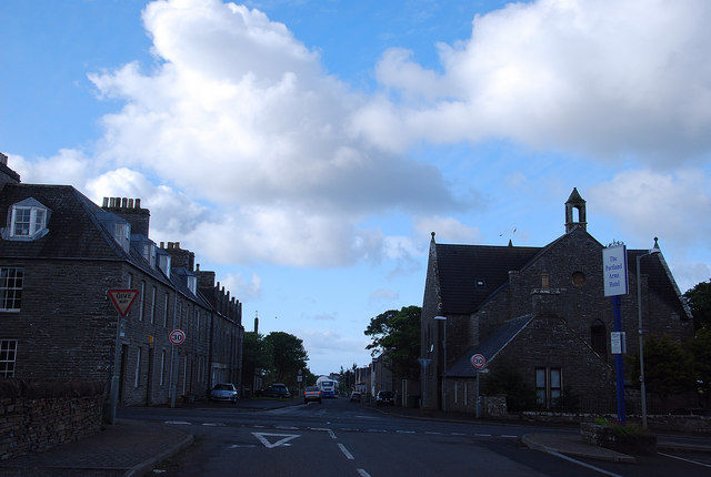
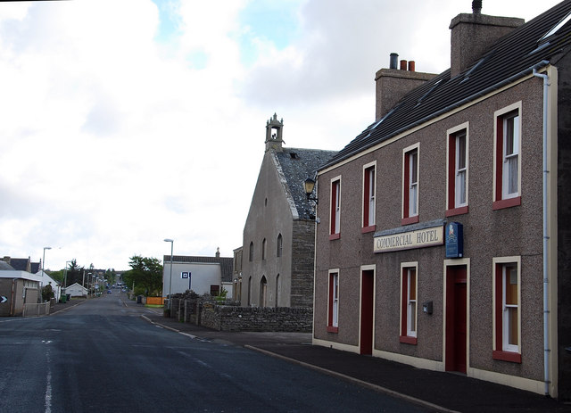
Lybster

Lybster (, Scottish Gaelic: Liabost) is a village on the east coast of Caithness in northern Scotland. It was once a big herring fishing port. The Waterlines...

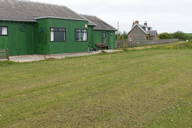
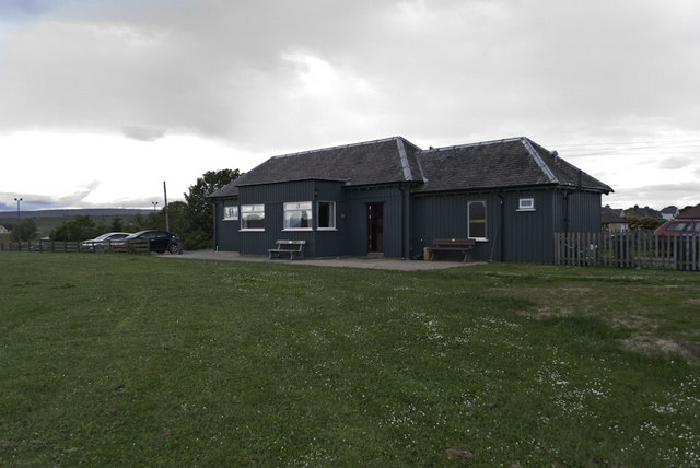
Lybster railway station

Lybster was a railway station located on the Wick and Lybster Railway in the Highland area of Scotland. The station building now serves as the clubhouse...
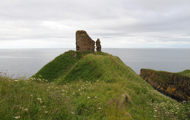
Forse Castle

Forse Castle is a ruined building dating from 1200 in the hamlet of Forse in the Caithness region in the Scottish council area of Highland. It is protected...

Nearby Amenities

Located within 500m of 58.291848,-3.2927051
Lybster
Man Made: beacon
Lat/Long: 58.2954003/-3.2899297
Hunting Stand
Lat/Long: 58.2917462/-3.2940702
Tourism: information
Lat/Long: 58.2963022/-3.2918386
Lybster Harbour Lighthouse
Man Made: lighthouse
Seamark Light Character: Oc
Seamark Light Colour: red
Seamark Light Height: 10
Seamark Light Period: 6
Seamark Light Range: 3
Seamark Light Reference: A 3522
Seamark Status: occasional
Seamark Type: light_minor
Source: US NGA Pub. 114. 2011-05-26.
Wikidata: Q17827352
Lat/Long: 58.2952019/-3.2895287
Man Made: mast
Lat/Long: 58.2935682/-3.3001212
Power: pole
Lat/Long: 58.2918629/-3.3008927
Power: pole
Lat/Long: 58.291562/-3.3000988
Power: pole
Lat/Long: 58.2912802/-3.299376
Power: pole
Lat/Long: 58.2920961/-3.2990014
Power: pole
Lat/Long: 58.2929701/-3.2991811
Power: pole
Lat/Long: 58.2938334/-3.2992329
Power: pole
Lat/Long: 58.2947137/-3.2992654
Power: pole
Lat/Long: 58.294495/-3.2981547
Power: pole
Lat/Long: 58.2943669/-3.2970807
Bench
Description: In memory of David Gunn
Lat/Long: 58.295373/-3.2932549
Bench
Lat/Long: 58.2958048/-3.2934945
The data included in this document is from www.openstreetmap.org. The data is made available under ODbL.

Have you been to Cove Garbh?

Leave your review of Cove Garbh below (or comments, questions and feedback).