Hatter Dub

Sea, Estuary, Creek in Lancashire Copeland

England

Hatter Dub

A595 at Buckman Brow
A595 at Buckman Brow Credit: Colin Pyle

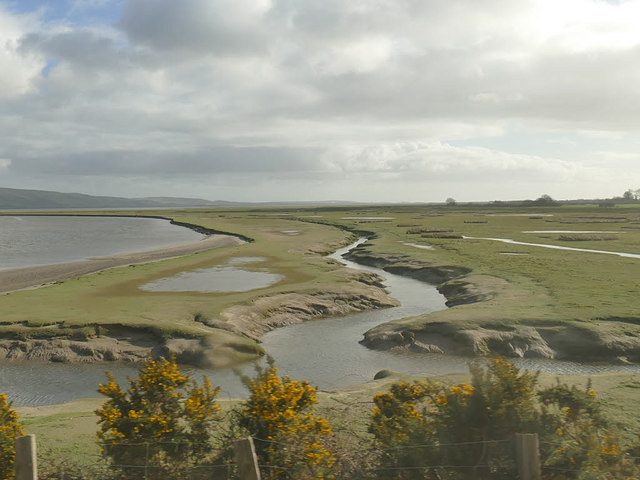
Hatter Dub is a small coastal settlement located in Lancashire, England. Situated at the mouth of a creek, it is bordered by the Irish Sea to the west and the estuary of the River Hatter to the east. The name "Hatter Dub" is derived from the local dialect, with "Hatter" referring to the nearby village of Hatterall and "Dub" meaning a small body of water.

The area is known for its picturesque natural beauty, with stunning views of the sea and surrounding countryside. The coastline is characterized by rocky cliffs and sandy beaches, attracting both tourists and locals alike. The beach is particularly popular during the summer months, with families enjoying picnics, sunbathing, and swimming in the refreshing waters.

Hatter Dub is also home to a small fishing community, where local fishermen can be seen setting sail early in the morning to catch a variety of fish, including cod, mackerel, and haddock. The local seafood is highly regarded for its freshness and quality, and several seafood restaurants in the area offer delicious dishes made from the daily catch.

Nature enthusiasts will find plenty to explore in Hatter Dub, as it is surrounded by a diverse ecosystem. The creek and estuary provide habitats for a variety of bird species, including herons, oystercatchers, and curlews. There are also several nature trails and walking paths that wind through the nearby marshlands and woodlands, offering opportunities for birdwatching and enjoying the tranquility of nature.

Overall, Hatter Dub in Lancashire is a charming coastal settlement, offering breathtaking views, a thriving fishing community, and abundant opportunities for outdoor activities and nature appreciation.

If you have any feedback on the listing, please let us know in the comments section below.

Hatter Dub Images

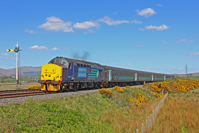
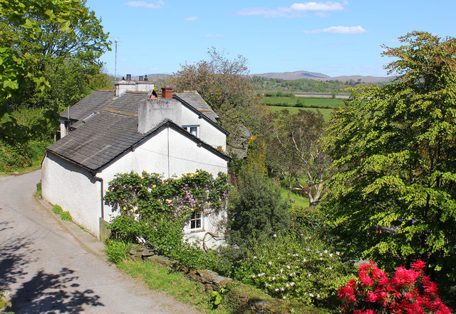
Images are sourced within 2km of 54.274531/-3.2248524 or Grid Reference SD2087. Thanks to Geograph Open Source API. All images are credited.

A595 at Buckman Brow
Recent felling on Coops Wood has opened up a view of the bridge over the Duddon
Bluebells, Furnace Wood In deepest Duddon
Bluebells, Furnace Wood
In deepest Duddon
Ascending Barrow Looking towards the Duddon estuary
Ascending Barrow
Looking towards the Duddon estuary
Duddon iron furnace (disused) A charcoal burning blast furnace dating from 1736. Isaac Wilkinson's cylinder bellows powered by water were first applied here. It is a Scheduled Ancient Monument but is temporarily closed to the public while structural issues are considered. There is a good view from the bridleway that goes past the site.
Duddon iron furnace (disused)
A charcoal burning blast furnace dating from 1736. Isaac Wilkinson's cylinder bellows powered by water were first applied here. It is a Scheduled Ancient Monument but is temporarily closed to the public while structural issues are considered. There is a good view from the bridleway that goes past the site.
Pivot type mark This Pivot style mark can be found on the SE parapet of the bridge.
Pivot type mark
This Pivot style mark can be found on the SE parapet of the bridge.
SRPS Cumbrian Coast Railtour 2018 : Signal Post Before Duddon Viaduct
SRPS Cumbrian Coast Railtour 2018 : Approaching Duddon Viaduct
Ordnance Survey Flush Bracket (G3075) This OS Flush Bracket can be found on a roadside building at Duddon Bridge Farm. It marks a point 10.398m above mean sea level.
Ordnance Survey Flush Bracket (G3075)
This OS Flush Bracket can be found on a roadside building at Duddon Bridge Farm. It marks a point 10.398m above mean sea level.
Ordnance Survey Cut Mark This OS cut mark can be found on a rock face west side of the road. It marks a point 31.425m above mean sea level.
Ordnance Survey Cut Mark
This OS cut mark can be found on a rock face west side of the road. It marks a point 31.425m above mean sea level.
Ordnance Survey Cut Mark This OS cut mark can be found on the large boulder in the wall SE side of the road. It marks a point 99.048m above mean sea level.
Ordnance Survey Cut Mark
This OS cut mark can be found on the large boulder in the wall SE side of the road. It marks a point 99.048m above mean sea level.
Railway near Lady Hall Lancaster to Barrow line near Green Road.
Railway near Lady Hall
Lancaster to Barrow line near Green Road.
Lady Hall Cottages in Lady Hall, Cumbria.
Lady Hall
Cottages in Lady Hall, Cumbria.
The Duddon estuary  It was just after high tide when we crossed the estuary by train.
The Duddon estuary
It was just after high tide when we crossed the estuary by train.
A595 towards Broughton in Furness
Bracken covered bank towards Mount Wood
Track (bridleway) towards Ash House
Buckman Hall House on Buckman Brow (A595).
Buckman Hall
House on Buckman Brow (A595).
Show me another place!

Hatter Dub is located at Grid Ref: SD2087 (Lat: 54.274531, Lng: -3.2248524)

Administrative County: Cumbria

District: Copeland

Police Authority: Cumbria

What 3 Words

///finest.merit.graph. Near Millom, Cumbria

Nearby Locations

Hatter Dub Little Island

Related Wikis

St Mary Magdalene's Church, Broughton-in-Furness

St Mary Magdalene's Church is in Broughton-in-Furness, Cumbria, England. It is an active Anglican parish church in the deanery of Furness, the archdeaconry...

Broughton-in-Furness

Broughton in Furness is a market town in the civil parish of Broughton West in the Westmorland and Furness district of Cumbria, England. It had a population...

Broughton-in-Furness railway station

Broughton-in-Furness railway station served the market town of Broughton-in-Furness, in Lancashire, England (now in Cumbria). It was on the branch line...

Duddon Bridge

Duddon Bridge is a hamlet in Cumbria, England. == References ==

Nearby Amenities

Located within 500m of 54.274531,-3.2248524
Source: PGS
Lat/Long: 54.2748652/-3.2246271
Source: PGS
Lat/Long: 54.2748107/-3.2243423
Source: PGS
Lat/Long: 54.2740567/-3.2246196
Source: PGS
Lat/Long: 54.2736482/-3.2246434
Source: PGS
Lat/Long: 54.2733628/-3.2250516
Source: PGS
Lat/Long: 54.2714884/-3.2261031
Source: PGS
Lat/Long: 54.2729657/-3.22504
Source: PGS
Lat/Long: 54.272495/-3.225135
Source: PGS
Lat/Long: 54.2708077/-3.2251664
Power: pole
Lat/Long: 54.2782241/-3.2286657
Power: pole
Lat/Long: 54.2781677/-3.2274802
Power: pole
Lat/Long: 54.2781019/-3.2260049
Power: pole
Lat/Long: 54.278033/-3.2245726
Power: pole
Lat/Long: 54.2779672/-3.2231886
Material: wood
Power: pole
Lat/Long: 54.2778545/-3.2211984
Material: wood
Power: pole
Lat/Long: 54.2776634/-3.2206942
Material: wood
Power: pole
Lat/Long: 54.2713672/-3.223925
Greety Gate
Place: hamlet
Lat/Long: 54.2709654/-3.2231169
Material: wood
Power: pole
Lat/Long: 54.2715412/-3.2224945
Material: wood
Power: pole
Lat/Long: 54.2710516/-3.222506
Material: wood
Power: pole
Lat/Long: 54.2711297/-3.2208826
Line Management: termination
Material: wood
Power: pole
Lat/Long: 54.2703954/-3.2219949
Line Management: termination
Material: wood
Power: pole
Lat/Long: 54.2703888/-3.2219716
Power: pole
Lat/Long: 54.2731369/-3.2176329
Power: pole
Lat/Long: 54.2733953/-3.2189749
Power: pole
Lat/Long: 54.2736023/-3.2196743
Power: pole
Lat/Long: 54.2731977/-3.2184239
The data included in this document is from www.openstreetmap.org. The data is made available under ODbL.

Have you been to Hatter Dub?

Leave your review of Hatter Dub below (or comments, questions and feedback).