Leonard's Cove

Sea, Estuary, Creek in Devon South Hams

England

Leonard's Cove

Trees by young wood, Weeke Looking right from <a href="https://www.geograph.org.uk/photo/6926894">SX8749 : Fields near Lower Weeke</a>. The wood also appears in <a href="https://www.geograph.org.uk/photo/6608416">SX8749 : Valley, Week</a>.
Trees by young wood, Weeke Credit: Derek Harper

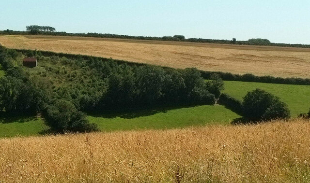
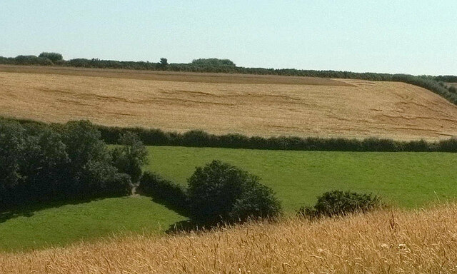
Leonard's Cove is a picturesque coastal area located in Devon, England. Situated between the towns of Dartmouth and Kingswear, this stunning cove is known for its beautiful sea views, estuary, and creek.

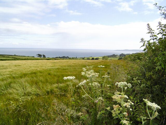
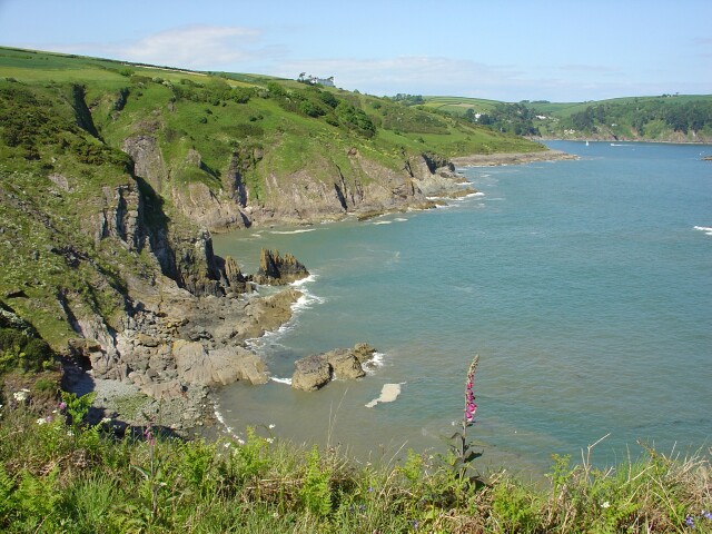
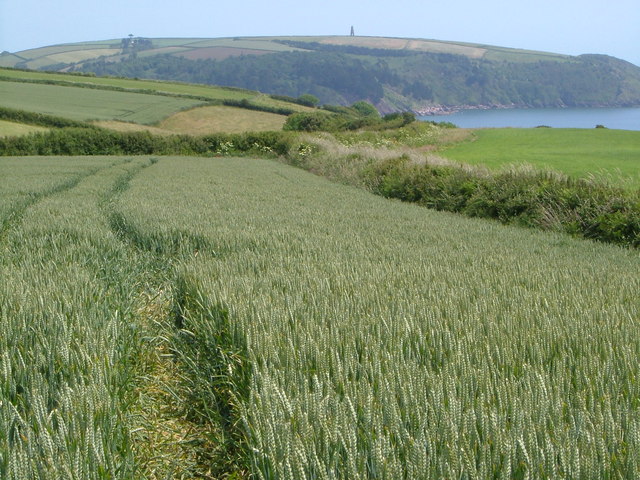
The cove is nestled within the South Devon Area of Outstanding Natural Beauty, offering visitors a natural paradise with its serene surroundings. The sea at Leonard's Cove is known for its crystal-clear waters and is a popular spot for swimming, snorkeling, and other water activities. The coastline is also ideal for leisurely walks, providing breathtaking panoramic views of the surrounding cliffs and the English Channel.

One of the iconic features of Leonard's Cove is its estuary, which is formed by the convergence of the River Dart and the sea. This estuary is a haven for wildlife, attracting a wide range of bird species and marine life. Visitors can often spot seabirds, seals, and even dolphins in the area.

Additionally, Leonard's Cove boasts a charming creek, which meanders through the landscape. This creek is perfect for exploring by kayak or small boat, allowing visitors to navigate through the tranquil waters while enjoying the scenic beauty and peaceful atmosphere.

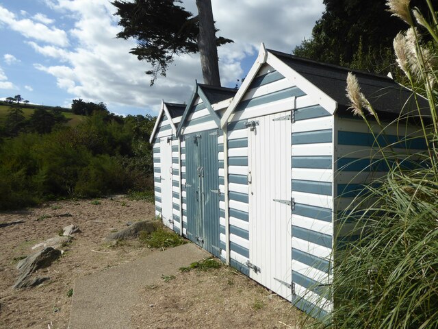
The area around Leonard's Cove is also home to various amenities, including campsites, holiday cottages, and a small café. This makes it an ideal destination for those seeking a relaxing coastal getaway with access to modern conveniences.

In conclusion, Leonard's Cove in Devon is a stunning coastal area that offers visitors a unique combination of a beautiful sea, estuary, and creek. With its natural beauty and abundance of wildlife, it is a must-visit destination for nature enthusiasts and those seeking a tranquil coastal experience.

If you have any feedback on the listing, please let us know in the comments section below.

Leonard's Cove Images

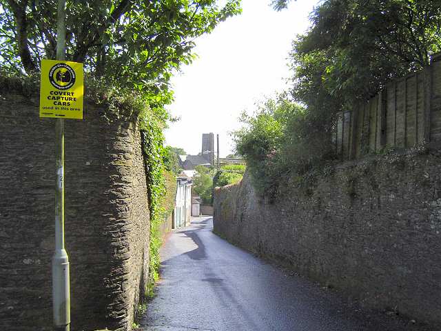
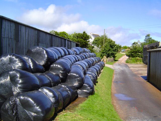
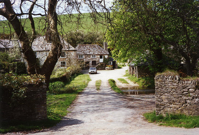
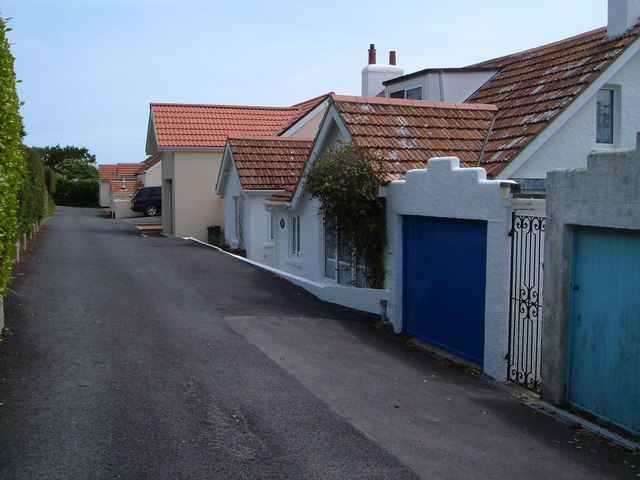
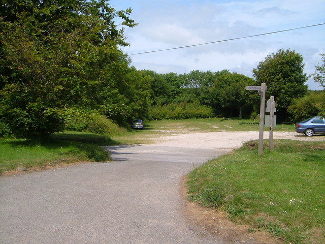
Images are sourced within 2km of 50.322829/-3.5937191 or Grid Reference SX8648. Thanks to Geograph Open Source API. All images are credited.

Trees by young wood, Weeke Looking right from <a href="https://www.geograph.org.uk/photo/6926894">SX8749 : Fields near Lower Weeke</a>. The wood also appears in <a href="https://www.geograph.org.uk/photo/6608416">SX8749 : Valley, Week</a>.
Trees by young wood, Weeke
Looking right from SX8749 : Fields near Lower Weeke. The wood also appears in SX8749 : Valley, Week.
Farmland, Weeke Looking right from <a href="https://www.geograph.org.uk/photo/6927011">SX8749 : Trees by young wood, Weeke</a>, with overlap.
Farmland, Weeke
Looking right from SX8749 : Trees by young wood, Weeke, with overlap.
Valley, Weeke A view towards Weeke Cottage from Swannaton. Beyond it, Dartmouth footpath 6 climbs beside a hedge.
Valley, Weeke
A view towards Weeke Cottage from Swannaton. Beyond it, Dartmouth footpath 6 climbs beside a hedge.
Beach huts on Blackpool Sands
A sunny September day on Blackpool Sands
Old Well Site, Stoke Fleming In Shady Lane, restored 2000 - 2001
Old Well Site, Stoke Fleming
In Shady Lane, restored 2000 - 2001
Stoke Fleming This is the A379 from Dartmouth to Kingsbridge. It gets a bit narrow within this village and is the cause of some summer traffic slow downs.
Stoke Fleming
This is the A379 from Dartmouth to Kingsbridge. It gets a bit narrow within this village and is the cause of some summer traffic slow downs.
Little Dartmouth The mid summer hay is in.
Little Dartmouth
The mid summer hay is in.
South of Dartmouth The roadside view just outside of Dartmouth. Far in the distance is Start Point.
South of Dartmouth
The roadside view just outside of Dartmouth. Far in the distance is Start Point.
Blackpool Sands Source of many a tourist brochure about Devon.
Blackpool Sands
Source of many a tourist brochure about Devon.
Combe Point Looking north across Shinglehill, Willow and Compass Coves to Blackstone Point
Combe Point
Looking north across Shinglehill, Willow and Compass Coves to Blackstone Point
Stoke Fleming: Blackpool Farm In 1882 this was a dairy farm of 35 acres with a watermill, known as ‘Lower Blackpool’. The mill was the lowest of four in the little Em valley, above Blackpool Sands, and it still stands, to the right of the pink-washed farmhouse
Stoke Fleming: Blackpool Farm
In 1882 this was a dairy farm of 35 acres with a watermill, known as ‘Lower Blackpool’. The mill was the lowest of four in the little Em valley, above Blackpool Sands, and it still stands, to the right of the pink-washed farmhouse
Stoke Fleming: Riversbridge Once a farm and now, it appears, a private residence. A bridlepath runs through the property to Worden. Ponds here provided water to the four mills in the Em valley, which leads to Blackpool Sands
Stoke Fleming: Riversbridge
Once a farm and now, it appears, a private residence. A bridlepath runs through the property to Worden. Ponds here provided water to the four mills in the Em valley, which leads to Blackpool Sands
Coast west of Warren Point A short diversion from the SW Coast Path leads to the gorsy headland of Warren Point. This view is west towards Stoke Fleming on the further headland, past several coves.
Coast west of Warren Point
A short diversion from the SW Coast Path leads to the gorsy headland of Warren Point. This view is west towards Stoke Fleming on the further headland, past several coves.
Overseas Estate, Stoke Fleming The view from the front of these modern houses on this rather exclusive estate is probably more impressive, perched as they are above Start Bay.
Overseas Estate, Stoke Fleming
The view from the front of these modern houses on this rather exclusive estate is probably more impressive, perched as they are above Start Bay.
Southwood Farm, Strete Uniformly built in local slate, this farm is at the top of a steep hill above Blackpool Sands, the cliff behind which can just be seen on the left.
Southwood Farm, Strete
Uniformly built in local slate, this farm is at the top of a steep hill above Blackpool Sands, the cliff behind which can just be seen on the left.
National Trust car park, Little Dartmouth Typically sylvan and grassy, this NT car park near Redlap is right on the South West Coast Path.
National Trust car park, Little Dartmouth
Typically sylvan and grassy, this NT car park near Redlap is right on the South West Coast Path.
View near Little Dartmouth A view ENE as the coast path, which for some 3 miles west of here is not especially coastal in nature, re-approaches the sea at Warren Point. Across the fields is the mouth of the Dart, with the daymark <a href="https://www.geograph.org.uk/photo/46172">SX9050 : Day Mark Tower, near Froward Point Kingswear S. Devon</a> beyond. This is roughly the same view as <a href="https://www.geograph.org.uk/photo/6747552">SX8748 : Farmland above Warren Cove</a>, taken in autumn over 14 years later.
View near Little Dartmouth
A view ENE as the coast path, which for some 3 miles west of here is not especially coastal in nature, re-approaches the sea at Warren Point. Across the fields is the mouth of the Dart, with the daymark SX9050 : Day Mark Tower, near Froward Point Kingswear S. Devon beyond. This is roughly the same view as SX8748 : Farmland above Warren Cove, taken in autumn over 14 years later.
Show me another place!

Leonard's Cove is located at Grid Ref: SX8648 (Lat: 50.322829, Lng: -3.5937191)

Administrative County: Devon

District: South Hams

Police Authority: Devon and Cornwall

What 3 Words

///estuaries.happy.petition. Near Dartmouth, Devon

Related Wikis

Stoke Fleming

Stoke Fleming is a village and civil parish in the South Hams district of Devon, England. It lies on the A379 road about one and a half miles south of...

Blackpool Sands, Dartmouth

Blackpool Sands is a gravel beach near Dartmouth, Devon, England named after the nearby village of Blackpool. It has been increasingly encroached on each...

Battle of Blackpool Sands

The Battle of Blackpool Sands was the result of an attempted French raid on the port of Dartmouth, South Devon, England, in April or May 1404. Local forces...

A379 road

The A379 is a road in the English county of Devon. It links points on the edges of that county's two principal cities, Exeter and Plymouth, by an indirect...

Nearby Amenities

Located within 500m of 50.322829,-3.5937191
Source: PGS
Lat/Long: 50.3200233/-3.5962743
Stoke Fleming
Is In: Devon, England, UK
Place: village
Website: http://www.stokefleming.org.uk/
Lat/Long: 50.3251062/-3.5982017
Turning Circle
Source: Bing
Lat/Long: 50.3254453/-3.5971586
Turning Circle
Source: Bing
Lat/Long: 50.3256701/-3.5979754
Post Office
Stoke Fleming Post Office
Addr City: Dartmouth
Addr Housename: Albany House
Addr Postcode: TQ6 0NR
Addr Street: New Road
Addr Village: Stoke Fleming
Brand: Post Office
Brand Wikidata: Q1783168
Check Date Opening Hours: 2023-07-25
Opening Hours: Mo,Tu,Fr 08:30-17:00; We 09:00-13:00; Th 08:00-17:00; Sa 08:30-13:30
Ref Pol Id: 5720
Source: OS OpenData StreetView;pol_branch_list_2020‑11‑13
Website: https://www.postoffice.co.uk/branch-finder/1855522/stoke-fleming
Wheelchair: limited
Lat/Long: 50.3243566/-3.5993774
Village Shop
Shop: convenience
Lat/Long: 50.3243247/-3.5994804
Generator Method: photovoltaic
Generator Output Electricity: yes
Generator Source: solar
Generator Type: solar_photovoltaic_panel
Location: roof
Power: generator
Lat/Long: 50.3262539/-3.5967646
Generator Method: photovoltaic
Generator Output Electricity: yes
Generator Source: solar
Generator Type: solar_photovoltaic_panel
Location: roof
Power: generator
Lat/Long: 50.3222651/-3.5975022
Generator Method: photovoltaic
Generator Output Electricity: yes
Generator Source: solar
Generator Type: solar_photovoltaic_panel
Location: roof
Power: generator
Lat/Long: 50.3210732/-3.5981432
Generator Method: photovoltaic
Generator Output Electricity: yes
Generator Source: solar
Generator Type: solar_photovoltaic_panel
Location: roof
Power: generator
Lat/Long: 50.3203166/-3.5994441
Post Box
Brand: Royal Mail
Brand Wikidata: Q638098
Brand Wikipedia: en:Royal Mail
Collection Times: Mo-Fr 16:15; Sa 11:15; Su off
Operator: Royal Mail
Operator Wikidata: Q638098
Post Box Design: type_a
Post Box Type: pillar
Ref: TQ6 170
Royal Cypher: EIIR
Royal Cypher Wikidata: Q33102113
Source: survey;streetlevel imagery;aerial imagery
Lat/Long: 50.3243799/-3.5995178
Bus Stop
Endsleigh Hotel
Bench: no
Bin: no
Bus: yes
Lit: no
Public Transport: platform
Shelter: no
Survey Date: 2022-03-26
Tactile Paving: no
Lat/Long: 50.3238484/-3.5985343
Bench
Backrest: yes
Survey Date: 2022-03-26
Lat/Long: 50.3243945/-3.5991697
Waste Basket
Survey Date: 2022-03-26
Lat/Long: 50.3244172/-3.5991939
Fire Hydrant
Emergency: fire_hydrant
Fire Hydrant Type: underground
Survey Date: 2022-03-26
Lat/Long: 50.3255483/-3.5987936
Telephone
Booth: K6
Covered: booth
Survey Date: 2022-03-26
Lat/Long: 50.3255343/-3.5986213
Bench
Backrest: yes
Survey Date: 2022-03-26
Lat/Long: 50.326454/-3.5977535
Grit Bin
Seasonal: no
Survey Date: 2022-03-26
Lat/Long: 50.3240742/-3.6003699
Fire Hydrant
Emergency: fire_hydrant
Fire Hydrant Diameter Signed: no
Fire Hydrant Position: lane
Fire Hydrant Type: underground
Survey Date: 2022-03-26
Lat/Long: 50.3211736/-3.5986611
Bus Stop
Endsleigh Hotel
Bench: yes
Bin: yes
Bus: yes
Lit: no
Naptan AtcoCode: 1100DEA10213
Naptan NaptanCode: dvndgtgw
Public Transport: platform
Shelter: yes
Survey Date: 2022-03-26
Tactile Paving: no
Lat/Long: 50.3237398/-3.5986153
Waste Basket
Survey Date: 2022-03-26
Lat/Long: 50.3237711/-3.5986163
Fire Hydrant
Emergency: fire_hydrant
Fire Hydrant Diameter: 3"
Fire Hydrant Position: lane
Fire Hydrant Type: underground
Survey Date: 2022-03-26
Lat/Long: 50.3248235/-3.5988212
Bus Stop
Bidders Close
Bench: yes
Bin: no
Lit: no
Shelter: yes
Survey Date: 2022-03-26
Tactile Paving: no
Lat/Long: 50.3256515/-3.5984773
Fire Hydrant
Emergency: fire_hydrant
Fire Hydrant Type: underground
Survey Date: 2022-03-26
Lat/Long: 50.3256959/-3.5984096
Waste Basket
Survey Date: 2022-03-26
Lat/Long: 50.3236982/-3.6004661
Entrance: main
Lat/Long: 50.3237509/-3.5987364
Telephone
Booth: K6
Covered: booth
Lat/Long: 50.3235923/-3.5977859
The data included in this document is from www.openstreetmap.org. The data is made available under ODbL.

Have you been to Leonard's Cove?

Leave your review of Leonard's Cove below (or comments, questions and feedback).