Copstone Cove

Sea, Estuary, Creek in Devon South Hams

England

Copstone Cove

Thatched Cottage in East Prawle
Thatched Cottage in East Prawle Credit: Sandy Gerrard

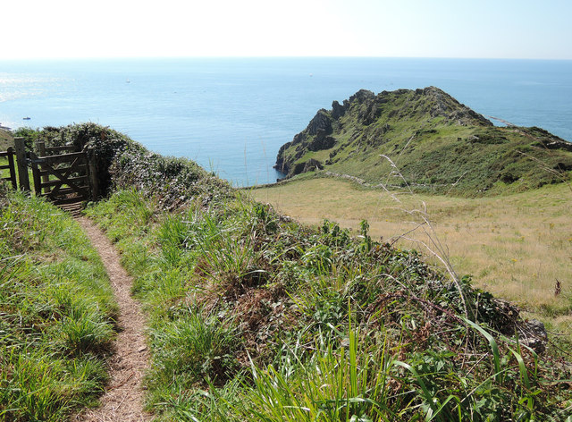
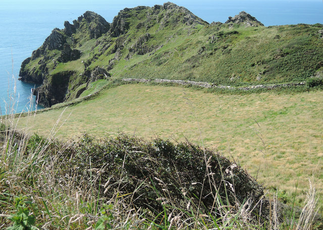
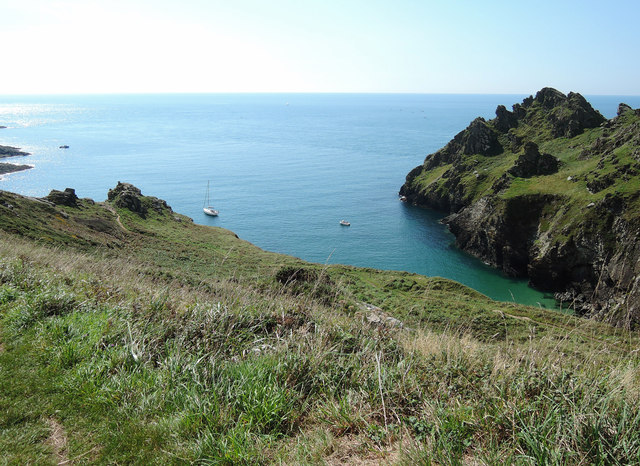
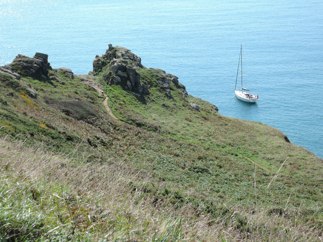
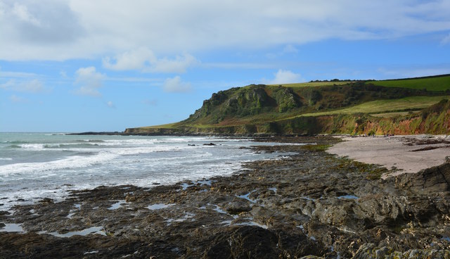
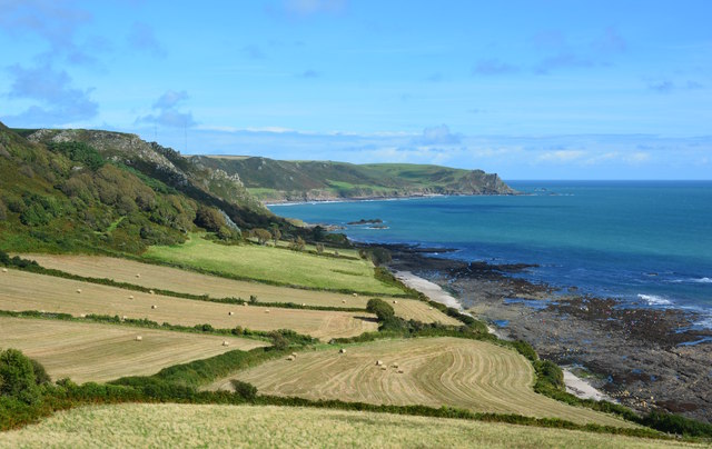
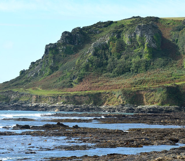
Copstone Cove is a picturesque coastal area located in Devon, England. Situated on the southern coast of the county, it is known for its stunning sea views, estuary, and creek. The cove is nestled between rolling hills and cliffs, providing visitors with a breathtaking natural setting.

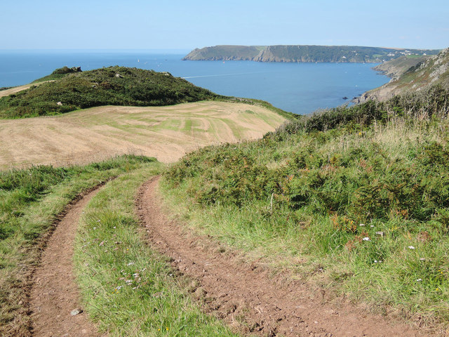
The main highlight of Copstone Cove is, of course, its pristine sea. The crystal-clear waters offer a refreshing escape for swimmers and water sports enthusiasts. The beach, with its soft golden sand, is perfect for sunbathing, picnicking, and leisurely walks along the shore.

Adjacent to the sea is an estuary, formed by the confluence of a river with the sea. This estuary provides a unique and diverse ecosystem, attracting a wide range of bird species and marine life. Birdwatchers will delight in observing the various species that inhabit the estuary, including herons, gulls, and ducks.

In addition to the estuary, Copstone Cove boasts a charming creek. The creek is a small waterway that winds its way through the landscape, creating a tranquil and peaceful atmosphere. Visitors can explore the creek by boat or kayak, immersing themselves in the serenity of nature.

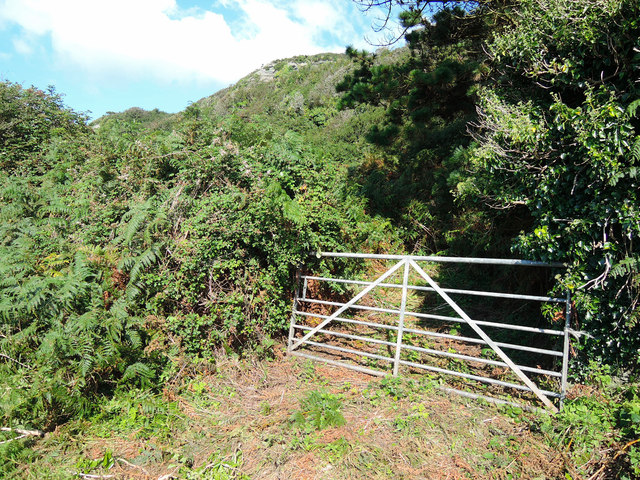
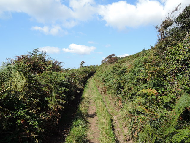
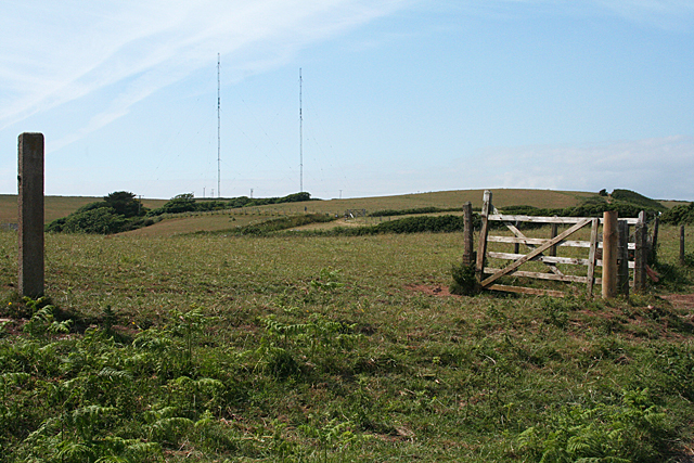
The surrounding area of Copstone Cove is also worth exploring. There are numerous walking trails that lead to stunning viewpoints, where visitors can soak in panoramic vistas of the sea and coastline. The nearby countryside offers opportunities for hiking and discovering the local flora and fauna.

In summary, Copstone Cove is a hidden gem in Devon, offering a combination of stunning sea views, an estuary teeming with wildlife, and a peaceful creek. Whether you seek relaxation, adventure, or nature observation, this coastal haven has something to offer for everyone.

If you have any feedback on the listing, please let us know in the comments section below.

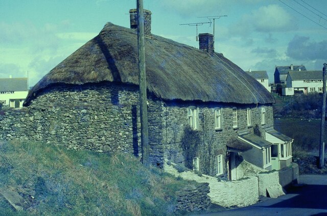
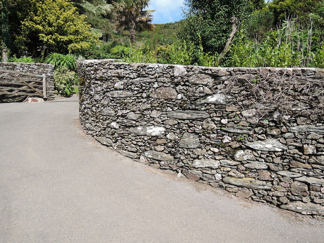
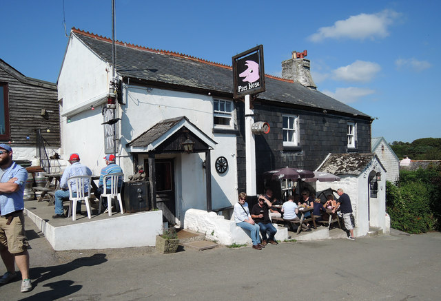
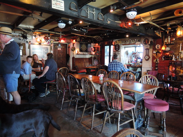
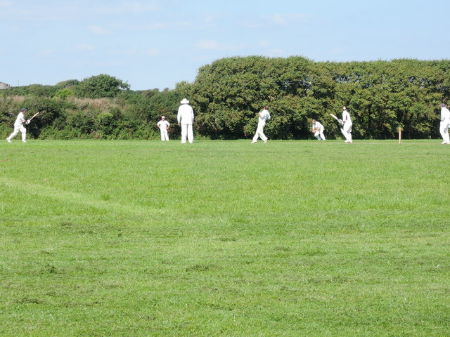
Copstone Cove Images

Images are sourced within 2km of 50.203372/-3.7184621 or Grid Reference SX7735. Thanks to Geograph Open Source API. All images are credited.

Thatched Cottage in East Prawle
East Prawle With the public conveniences the first building on the left
East Prawle
With the public conveniences the first building on the left
Towards a rock outcrop Seen from a public footpath near East Prawle
Towards a rock outcrop
Seen from a public footpath near East Prawle
Public footpath from East Prawle The path looking westwards. To the south, way out of shot, is Prawle Point
Public footpath from East Prawle
The path looking westwards. To the south, way out of shot, is Prawle Point
A field of Oats Looking towards Prawle Point from a public footpath from East Prawle
A field of Oats
Looking towards Prawle Point from a public footpath from East Prawle
Farmland above the Pig's Nose Looking towards Bolt Head and the entrance to Salcombe Harbour in the distance
Farmland above the Pig's Nose
Looking towards Bolt Head and the entrance to Salcombe Harbour in the distance
Towards Gammon Head On a footpath leading to the South West Coast Path above Elender Cove
Towards Gammon Head
On a footpath leading to the South West Coast Path above Elender Cove
Gammon Head
Gammon Head
By Gammon Head
By Gammon Head
Towards the South West Coast Path Just east from Elender Cove, with moored yacht
Towards the South West Coast Path
Just east from Elender Cove, with moored yacht
Entrance to Ash Park, East Prawle Attractive random stone wall on the edge of the village
Entrance to Ash Park, East Prawle
Attractive random stone wall on the edge of the village
The Pigs Nose, East Prawle Village inn. The individuals with the red caps are part of a touring cricket side from near Reading. They play South Hams clubs every summer
The Pigs Nose, East Prawle
Village inn. The individuals with the red caps are part of a touring cricket side from near Reading. They play South Hams clubs every summer
The bar at the Pigs Nose Pub interior
The bar at the Pigs Nose
Pub interior
Cricket match at East Prawle A local team - batting - play a touring side from Reading way. An annual fixture, apparently
Cricket match at East Prawle
A local team - batting - play a touring side from Reading way. An annual fixture, apparently
View towards Langerstone Point, Devon The headland in the background is Langerstone Point.

The beach has an interesting array of rock pools, lichens and flora such as Rock Samphire <a href="https://www.geograph.org.uk/photo/4680605">SX7936 : Rock samphire and lichen, East Prawle, Devon</a>.

The rocks from the foreground to the headland are a wave-cut platform comprising hornblendic and chloritic schists, and quartz-mica schists that are sedimentary rocks that have been metamorphosed and intensely folded, resulting (in my opinion) in some beautiful rock forms.
View towards Langerstone Point, Devon
The headland in the background is Langerstone Point. The beach has an interesting array of rock pools, lichens and flora such as Rock Samphire SX7936 : Rock samphire and lichen, East Prawle, Devon. The rocks from the foreground to the headland are a wave-cut platform comprising hornblendic and chloritic schists, and quartz-mica schists that are sedimentary rocks that have been metamorphosed and intensely folded, resulting (in my opinion) in some beautiful rock forms.
Coastal farmland by Hine Hill, Devon A September view, with straw bales rolled up on the fields. The headland in the background is Sleaden Rocks, across Lannacombe Bay, and hidden behind it is Start Point and the lighthouse there.

The coast path runs along the right hand edge of the fields.
Coastal farmland by Hine Hill, Devon
A September view, with straw bales rolled up on the fields. The headland in the background is Sleaden Rocks, across Lannacombe Bay, and hidden behind it is Start Point and the lighthouse there. The coast path runs along the right hand edge of the fields.
Sharpers Head, East Prawle, Devon Schist. Originally the rocks here were sedimentary layers, but under intense pressure and heat the rocks are metamorphosed into the strange and imposing gnarled schists that make up the coast here.
Sharpers Head, East Prawle, Devon
Schist. Originally the rocks here were sedimentary layers, but under intense pressure and heat the rocks are metamorphosed into the strange and imposing gnarled schists that make up the coast here.
Raised beach at Prawle Point, Devon The raised beach (or wave-cut platform) here - the flat land above the small cliff running along the shoreline - was formed around 10,000 years ago, towards the end of the last ice age, when sea levels were high due to the melting of ice sheets. It has been farmed for around 5,000 years.

There is an excellent and readable description of this area's history and geology at 
<span class="nowrap"><a title="http://www.southwestcoastpath.org.uk/walksdb/96/" rel="nofollow ugc noopener" href="http://www.southwestcoastpath.org.uk/walksdb/96/">Link</a><img style="margin-left:2px;" alt="External link" title="External link - shift click to open in new window" src="https://s1.geograph.org.uk/img/external.png" width="10" height="10"/></span>
Raised beach at Prawle Point, Devon
The raised beach (or wave-cut platform) here - the flat land above the small cliff running along the shoreline - was formed around 10,000 years ago, towards the end of the last ice age, when sea levels were high due to the melting of ice sheets. It has been farmed for around 5,000 years. There is an excellent and readable description of this area's history and geology at LinkExternal link
Show me another place!

Copstone Cove is located at Grid Ref: SX7735 (Lat: 50.203372, Lng: -3.7184621)

Administrative County: Devon

District: South Hams

Police Authority: Devon and Cornwall

What 3 Words

///deflate.covers.sunblock. Near Salcombe, Devon

Related Wikis

Prawle Point

Prawle Point (Old English: Prǣwhyll, "lookout hill") is a coastal headland in south Devon, England. It is the southernmost point of Devon. Just to the...

East Prawle

East Prawle is a village in Chivelstone parish in the South Hams district of Devon, England. It is situated on the coast south east of Salcombe, near the...

RNAS Prawle Point

The RNAS Naval Air Station Prawle Point was a British First World War airfield outside the village of East Prawle in Devon, England and 2.6 miles (4.2...

Moor Sand site

The remains of a wreck carrying cargo of Middle Bronze Age weapons was found in 1977 off Moor Sand, Gammon Head, South Hams, Devon, England. The site was...

Salcombe Cannon Wreck

The Salcombe Cannon wrecksite is close to two other designated wrecksites in the Erme Estuary which the South West Maritime Archaeological Group (SWMAG...

Chivelstone

Chivelstone is a village and civil parish in Devon, England. The parish contains the villages of East Prawle and South Allington as well as the hamlets...

East Portlemouth

East Portlemouth is a small Devon village situated at the southern end of the Kingsbridge Estuary, on the south Devon Coast. The population of this parish...

Start Point transmitting station

The Start Point transmitting station is a broadcasting facility at Start Point, Devon, owned by Arqiva. The site is just north-west of the Start Point...

Nearby Amenities

Located within 500m of 50.203372,-3.7184621
Prawle Point
Alt Name Cs: mys Prawle
Name Cs: Prawle
Natural: cape
Place: locality
Source: PGS
Wikidata: Q7238910
Wikipedia: en:Prawle Point
Lat/Long: 50.2025/-3.7212
Source: PGS
Lat/Long: 50.2021625/-3.7220658
Barrier: kissing_gate
Lat/Long: 50.2045251/-3.7205277
Barrier: stile
Stile: squeezer
Lat/Long: 50.2048512/-3.7243117
Tourism: viewpoint
Lat/Long: 50.2047897/-3.7245819
Barrier: kissing_gate
Lat/Long: 50.2059102/-3.7166769
Power: pole
Lat/Long: 50.2052289/-3.7201626
Power: pole
Lat/Long: 50.2061099/-3.7205889
Demetrios
Access: yes
Historic: wreck
Seamark Type: wreck
Wreck Visible At High Tide: yes
Wreck Visible At Low Tide: yes
Lat/Long: 50.2039422/-3.7238868
Building: bunker
Military: bunker
Lat/Long: 50.2054722/-3.7173893
Barrier: kissing_gate
Lat/Long: 50.2059102/-3.7166769
The data included in this document is from www.openstreetmap.org. The data is made available under ODbL.

Have you been to Copstone Cove?

Leave your review of Copstone Cove below (or comments, questions and feedback).