Off Cove
Sea, Estuary, Creek in Devon
England
Off Cove

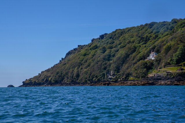
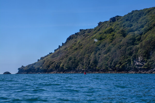
Off Cove is a picturesque coastal area located in Devon, a county in southwestern England. Nestled between rolling hills and stunning cliffs, this hidden gem offers visitors a unique blend of sea, estuary, and creek landscapes.
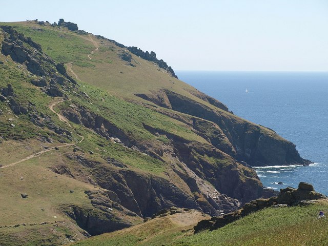
The main attraction of Off Cove is its pristine beach, which stretches for approximately 2 miles along the coastline. With its soft golden sand and crystal-clear waters, the beach is a paradise for sunbathers and swimmers alike. The gentle waves make it a popular spot for families and water sports enthusiasts, including kayakers and paddleboarders.
Adjacent to the beach is the estuary, where the river meets the sea. This area is known for its rich biodiversity, attracting birdwatchers and nature lovers. The estuary is a haven for various species of birds, including herons, oystercatchers, and curlews, making it a perfect spot for birdwatching and photography.
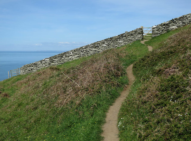
Further inland, visitors can explore the tranquil creek that winds its way through lush marshlands. The creek provides a peaceful setting for leisurely walks and offers opportunities for fishing and boating.
Off Cove is also home to a charming coastal village, with traditional cottages and a handful of local shops and restaurants. The village offers visitors a chance to experience the local culture and indulge in fresh seafood delicacies.
Overall, Off Cove, Devon is a natural paradise that combines the beauty of the sea, estuary, and creek, providing a diverse range of activities and breathtaking views for visitors to enjoy.
If you have any feedback on the listing, please let us know in the comments section below.
Off Cove Images
Images are sourced within 2km of 50.214002/-3.8004902 or Grid Reference SX7136. Thanks to Geograph Open Source API. All images are credited.


![A coastal walk around Bolt Head and The Warren [1] This car park is at the intersection of the two runways of the former RAF Bolt Head.
Beginning at Bolt Head Airfield car park, the route takes the road eastwards to East Soar Farm and then across fields to Sharp Tor and Starehole Bottom. Turning south onto the South West Coast Path, an ascent of Bolt Head follows before heading west up to and along the plateau known as The Warren. Turning inland and north, the route goes via Lower and Higher Soar before a minor road heads southeast back to the starting point. About 4¾ miles.](https://s1.geograph.org.uk/geophotos/07/58/46/7584689_46db395a.jpg)
![A coastal walk around Bolt Head and The Warren [2] In the car park is this information board about RAF Bolt Head and RAF Hope Cove.
Beginning at Bolt Head Airfield car park, the route takes the road eastwards to East Soar Farm and then across fields to Sharp Tor and Starehole Bottom. Turning south onto the South West Coast Path, an ascent of Bolt Head follows before heading west up to and along the plateau known as The Warren. Turning inland and north, the route goes via Lower and Higher Soar before a minor road heads southeast back to the starting point. About 4¾ miles.](https://s2.geograph.org.uk/geophotos/07/58/46/7584690_5275cc47.jpg)
![A coastal walk around Bolt Head and The Warren [3] In the car park is this information board about RAF Bolt Head and RAF Hope Cove.
Beginning at Bolt Head Airfield car park, the route takes the road eastwards to East Soar Farm and then across fields to Sharp Tor and Starehole Bottom. Turning south onto the South West Coast Path, an ascent of Bolt Head follows before heading west up to and along the plateau known as The Warren. Turning inland and north, the route goes via Lower and Higher Soar before a minor road heads southeast back to the starting point. About 4¾ miles.](https://s3.geograph.org.uk/geophotos/07/58/46/7584691_0690b056.jpg)
![A coastal walk around Bolt Head and The Warren [4] Hope Cove Rotor Radar Station was built in 1952-54, and it was converted into a Regional Seat of Government in the late 1950s. Constructed of reinforced concrete with walls 3 feet (900mm) thick. Seen from the road, a public footpath, alongside. The station is listed, grade II, with much history and detail at: <span class="nowrap"><a title="https://historicengland.org.uk/listing/the-list/list-entry/1427493" rel="nofollow ugc noopener" href="https://historicengland.org.uk/listing/the-list/list-entry/1427493">Link</a><img style="margin-left:2px;" alt="External link" title="External link - shift click to open in new window" src="https://s1.geograph.org.uk/img/external.png" width="10" height="10"/></span>
Beginning at Bolt Head Airfield car park, the route takes the road eastwards to East Soar Farm and then across fields to Sharp Tor and Starehole Bottom. Turning south onto the South West Coast Path, an ascent of Bolt Head follows before heading west up to and along the plateau known as The Warren. Turning inland and north, the route goes via Lower and Higher Soar before a minor road heads southeast back to the starting point. About 4¾ miles.](https://s0.geograph.org.uk/geophotos/07/58/46/7584692_88a57c01.jpg)
![A coastal walk around Bolt Head and The Warren [5] This structure alongside the road is shown on the OS map as a tank.
Beginning at Bolt Head Airfield car park, the route takes the road eastwards to East Soar Farm and then across fields to Sharp Tor and Starehole Bottom. Turning south onto the South West Coast Path, an ascent of Bolt Head follows before heading west up to and along the plateau known as The Warren. Turning inland and north, the route goes via Lower and Higher Soar before a minor road heads southeast back to the starting point. About 4¾ miles.](https://s1.geograph.org.uk/geophotos/07/58/46/7584693_869dd970.jpg)
![A coastal walk around Bolt Head and The Warren [6] Hope Cove Rotor Radar Station was built in 1952-54, and it was converted into a Regional Seat of Government in the late 1950s. Constructed of reinforced concrete with walls 3 feet (900mm) thick. Seen from the road, a public footpath, alongside. The station is listed, grade II, with much history and detail at: <span class="nowrap"><a title="https://historicengland.org.uk/listing/the-list/list-entry/1427493" rel="nofollow ugc noopener" href="https://historicengland.org.uk/listing/the-list/list-entry/1427493">Link</a><img style="margin-left:2px;" alt="External link" title="External link - shift click to open in new window" src="https://s1.geograph.org.uk/img/external.png" width="10" height="10"/></span>
Beginning at Bolt Head Airfield car park, the route takes the road eastwards to East Soar Farm and then across fields to Sharp Tor and Starehole Bottom. Turning south onto the South West Coast Path, an ascent of Bolt Head follows before heading west up to and along the plateau known as The Warren. Turning inland and north, the route goes via Lower and Higher Soar before a minor road heads southeast back to the starting point. About 4¾ miles.](https://s2.geograph.org.uk/geophotos/07/58/46/7584694_cecf9682.jpg)
Off Cove is located at Grid Ref: SX7136 (Lat: 50.214002, Lng: -3.8004902)
Administrative County: Devon
Police Authority: Devon and Cornwall
What 3 Words
///animator.crowns.museum. Near Salcombe, Devon
Nearby Locations
Related Wikis

Bolt Head
Bolt Head is a National Trust headland on the South Coast of Devon, England, United Kingdom, situated west of the Kingsbridge Estuary. It is a popular...

RAF Bolt Head
Royal Air Force Bolt Head or more simply RAF Bolt Head is a former Royal Air Force satellite airfield 1 mile (1.6 km) south west of Salcombe on the south...
RAF Hope Cove
Royal Air Force Hope Cove or more simply RAF Hope Cove is a former Royal Air Force radar station. It is located about 1 mile (1.6 km) south west of Salcombe...

Overbeck's
Overbeck's Museum and Garden is an Edwardian house and 2.75 hectare (7 acre) garden at Sharpitor, Salcombe, Devon, England. It is named after its last...

Salcombe Castle
Salcombe Castle or Fort Charles is a ruined fortification just off the beach of North Sands in Salcombe, Devon, England, within the South Devon Area of...
Bolberry
Bolberry is a hamlet on the south coast of Devon, England. The village is mentioned in Domesday Book in 1066 and 1086, which shows the land was of little...

Salcombe
Salcombe is a resort town in the South Hams district of Devon, south west England. The town is close to the mouth of the Kingsbridge Estuary, mostly built...

Malborough
Malborough is a village located in the South Hams region of Devon. The village is located on the A381 between Kingsbridge and Salcombe, and is a popular...
Nearby Amenities
Located within 500m of 50.214002,-3.8004902Have you been to Off Cove?
Leave your review of Off Cove below (or comments, questions and feedback).