Gull Cove

Sea, Estuary, Creek in Devon South Hams

England

Gull Cove

Path to Wadham Beach
Path to Wadham Beach Credit: Hugh Venables

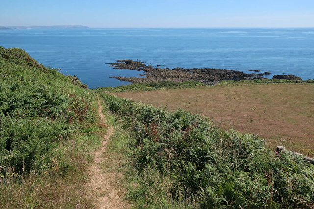
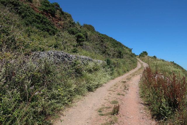
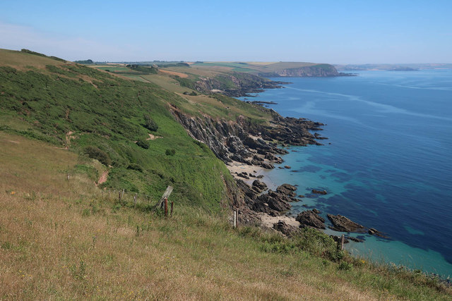
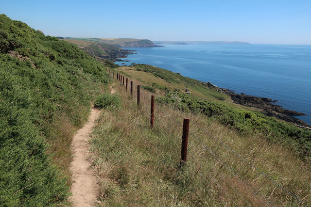
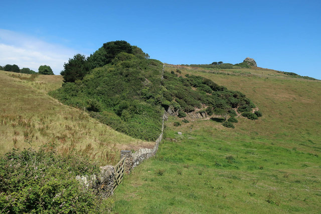
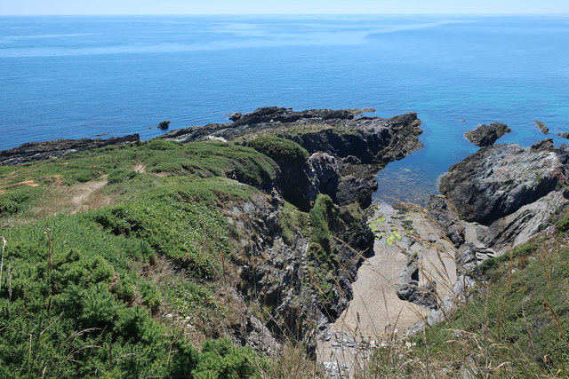
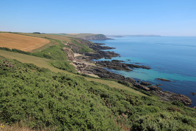
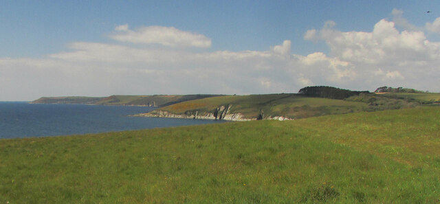
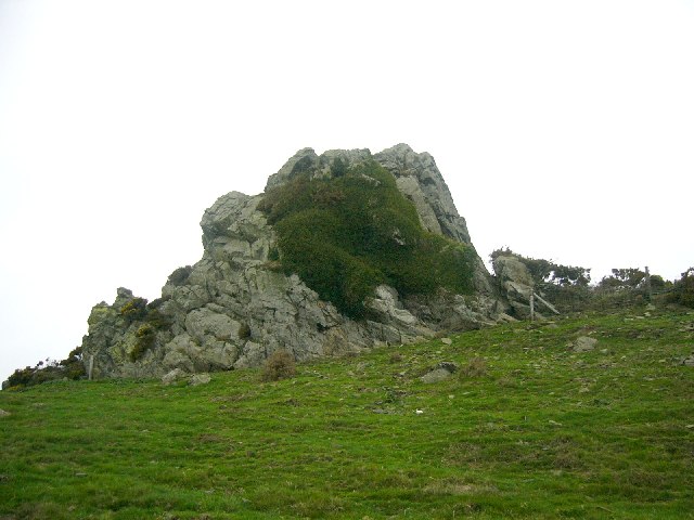
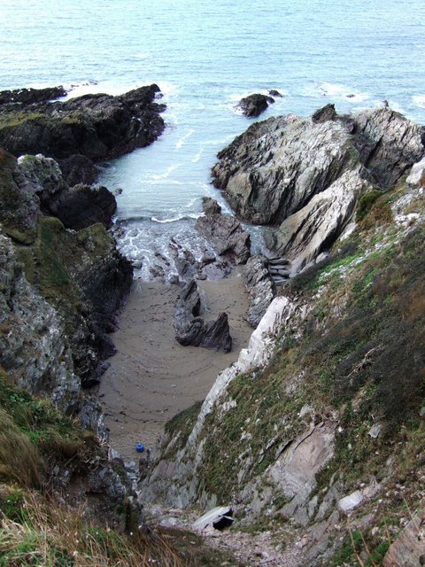
Gull Cove is a picturesque coastal area located in Devon, England. Situated on the southeastern coast, it is known for its stunning natural beauty and diverse ecosystem. The cove is nestled between towering cliffs and boasts a breathtaking view of the sea, estuary, and creek.

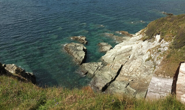
The sea at Gull Cove is renowned for its azure blue waters and rolling waves. It provides a mesmerizing backdrop, perfect for swimming, sunbathing, or simply enjoying a leisurely walk along the sandy beach. The sea is also a popular spot for water sports enthusiasts, with opportunities for surfing, kayaking, and paddleboarding.

Adjacent to the sea is the estuary, a unique feature of Gull Cove. The estuary is formed where a river meets the sea, creating a brackish, sheltered area rich in marine life. It serves as a haven for a variety of bird species, making it a popular destination for birdwatching enthusiasts. The estuary is also home to an abundance of fish and other aquatic creatures, making it a prime location for fishing and crabbing.

Further inland, the creek meanders through the cove, providing a tranquil setting for boating and sailing. The creek is flanked by lush greenery and offers opportunities for exploration and discovery. Visitors can navigate the waters, discovering hidden coves and secret beaches along the way.

Gull Cove, Devon, is a haven for nature lovers and outdoor enthusiasts, offering a unique combination of sea, estuary, and creek. Its breathtaking scenery and diverse ecosystem make it a must-visit destination for those seeking a peaceful and picturesque coastal experience.

If you have any feedback on the listing, please let us know in the comments section below.

Gull Cove Images

Images are sourced within 2km of 50.305939/-3.9702381 or Grid Reference SX5946. Thanks to Geograph Open Source API. All images are credited.

Path to Wadham Beach
Gabions by South West Coast Path
Carswell Cove
Carswell Cove
South West Coast Path
Scrub below St Anchorite's Rock
Butcher's Cove
Butcher's Cove
Keaton Cove
Keaton Cove
Headland at Wonwell Beach Cliffs at the southwestern end of the cove adjoining the beach, with Owen's Hill and Point across the Erme estuary.
Headland at Wonwell Beach
Cliffs at the southwestern end of the cove adjoining the beach, with Owen's Hill and Point across the Erme estuary.
Muxham Point The clifftop on the south side of the headland, with Owen's Hill and Point across the Erme estuary. A brighter moment than shown at <a href="https://www.geograph.org.uk/photo/6288574">SX6146 : Coast path at Muxham Point</a>.
Muxham Point
The clifftop on the south side of the headland, with Owen's Hill and Point across the Erme estuary. A brighter moment than shown at SX6146 : Coast path at Muxham Point.
Fernycombe Point Also shown at <a title="https://www.geograph.org.uk/gridref/SX6146?centi=SX615464&nl=1" href="https://www.geograph.org.uk/gridref/SX6146?centi=SX615464&nl=1">Link</a> from a different angle - see also <a href="https://www.geograph.org.uk/photo/6830347">SX6146 : Rocks, Fernycombe Beach</a>.
Fernycombe Point
Also shown at Link from a different angle - see also SX6146 : Rocks, Fernycombe Beach.
Clifftop above Fernycombe Beach Looking right from <a href="https://www.geograph.org.uk/photo/6997000">SX6146 : Fernycombe Point</a>, with a footpath signpost at the junction of the coast path with a permissive path inland to Kingston.
Clifftop above Fernycombe Beach
Looking right from SX6146 : Fernycombe Point, with a footpath signpost at the junction of the coast path with a permissive path inland to Kingston.
Cliffs, Fernycombe Beach <a href="https://www.geograph.org.uk/photo/6830338">SX6146 : Cliff erosion above Fernycombe Beach</a> is a detail of this, taken a few metres away. The beach is also shown at <a href="https://www.geograph.org.uk/photo/6288617">SX6146 : Fernycombe Beach</a>.
Cliffs, Fernycombe Beach
SX6146 : Cliff erosion above Fernycombe Beach is a detail of this, taken a few metres away. The beach is also shown at SX6146 : Fernycombe Beach.
South Devon coastline From Erme Mouth to Stoke Point (left), seen from above Fernycombe Point. The foreground field, and Stoke Point itself, are owned by the National Trust.
South Devon coastline
From Erme Mouth to Stoke Point (left), seen from above Fernycombe Point. The foreground field, and Stoke Point itself, are owned by the National Trust.
Coast path above Fernycombe Beach Crossing a hanging combe above the cliffs shown in <a href="https://www.geograph.org.uk/photo/6997038">SX6146 : Cliffs, Fernycombe Beach</a>.
Coast path above Fernycombe Beach
Crossing a hanging combe above the cliffs shown in SX6146 : Cliffs, Fernycombe Beach.
St Anchorites Rock On the coastal footpath this feature dominates for miles to the east or west, disappoints close to.
St Anchorites Rock
On the coastal footpath this feature dominates for miles to the east or west, disappoints close to.
Poole Farm - South Devon These hay bags scattered around the fields look more like something out of the cult TV series - "The Prisoner".
Poole Farm - South Devon
These hay bags scattered around the fields look more like something out of the cult TV series - "The Prisoner".
Butcher's Cove A steep and narrow inlet just west of <a href="https://www.geograph.org.uk/photo/326298">SX6046 : Battisborough Cove and Bugle Hole</a>, seen from the coast path at the top of the cliff.
Butcher's Cove
A steep and narrow inlet just west of SX6046 : Battisborough Cove and Bugle Hole, seen from the coast path at the top of the cliff.
Blackaterry Point Blackaterry Point consists of these dark rocks sprawling into the sea between Wadham Beach and Ryder's Hole. Seen from SX5747, up on the cliff somewhere near the line of Newton and Noss Footpath 39, of which there is no real evidence. At this point a thicket of thorn bushes - blackthorn, I think - bars access to the coast.
Blackaterry Point
Blackaterry Point consists of these dark rocks sprawling into the sea between Wadham Beach and Ryder's Hole. Seen from SX5747, up on the cliff somewhere near the line of Newton and Noss Footpath 39, of which there is no real evidence. At this point a thicket of thorn bushes - blackthorn, I think - bars access to the coast.
Show me another place!

Gull Cove is located at Grid Ref: SX5946 (Lat: 50.305939, Lng: -3.9702381)

Administrative County: Devon

District: South Hams

Police Authority: Devon and Cornwall

What 3 Words

///instilled.compiler.disposing. Near Newton Ferrers, Devon

Nearby Locations

Butcher's Cove Gull Cove

Related Wikis

Battisborough Cross

Battisborough Cross is a village in the parish of Holbeton near Plymouth on the south coast of Devon, England . It is within the South Devon Area of Outstanding...

River Erme

The Erme is a river in south Devon, England. From its source on Dartmoor it flows in a generally southerly direction past some of the best-preserved archaeological...

SS Persier (1918)

Persier was a 5,382 GRT cargo ship which was built in 1918 as War Buffalo for the British Shipping Controller. In 1919, she was sold to Belgium and renamed...

Church of St Peter the Poor Fisherman, Revelstoke

The Church of St Peter the Poor Fisherman in the village of Noss Mayo, in Devon, England, was built in 1226. It is located in the former civil parish of...

Nearby Amenities

Located within 500m of 50.305939,-3.9702381
Source: PGS
Lat/Long: 50.3060129/-3.9710458
Source: PGS
Lat/Long: 50.3060696/-3.9708237
Source: PGS
Lat/Long: 50.3059084/-3.9703751
Source: PGS
Lat/Long: 50.3057686/-3.9700886
Source: PGS
Lat/Long: 50.3056508/-3.9698162
Source: PGS
Lat/Long: 50.3058341/-3.9662415
Barrier: kissing_gate
Lat/Long: 50.3087372/-3.9756495
Barrier: stile
Lat/Long: 50.3078962/-3.9730581
The data included in this document is from www.openstreetmap.org. The data is made available under ODbL.

Have you been to Gull Cove?

Leave your review of Gull Cove below (or comments, questions and feedback).