Keaton Cove

Sea, Estuary, Creek in Devon South Hams

England

Keaton Cove

South West Coast Path down Beacon Hill
South West Coast Path down Beacon Hill Credit: Hugh Venables

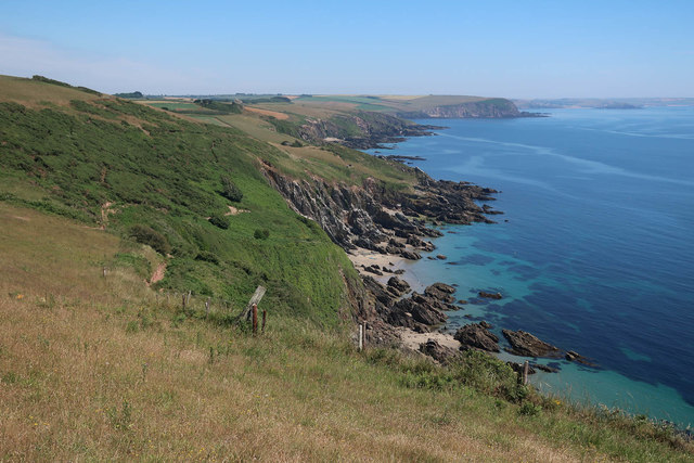
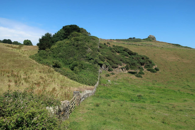
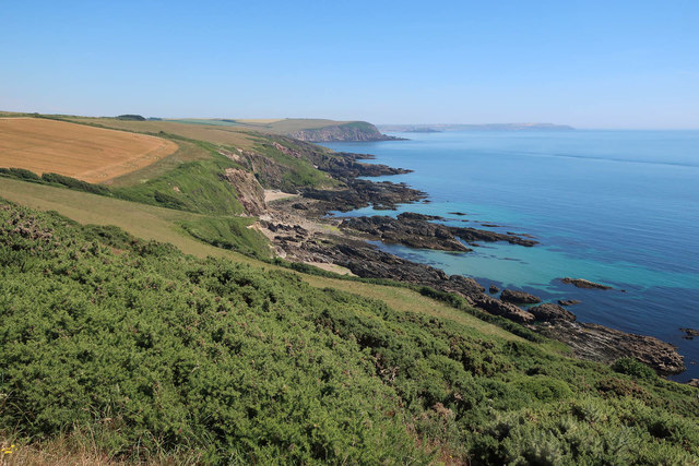
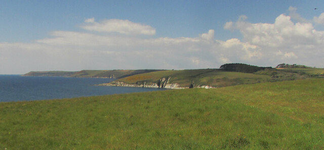
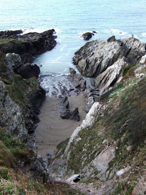
Keaton Cove is a picturesque coastal area located in the county of Devon, England. Situated along the southern coast of the country, it is renowned for its stunning sea views, tranquil estuary, and meandering creek.

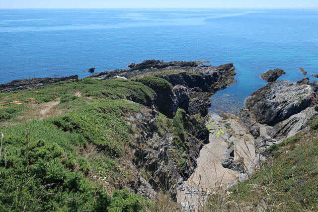
The cove is nestled between towering cliffs, providing a dramatic backdrop to the crystal-clear waters of the sea. The beach, with its golden sand, stretches for about half a mile, offering visitors a perfect spot for relaxation and leisurely strolls. The sea at Keaton Cove is known for its gentle waves, making it a popular destination for swimming and other water activities such as kayaking and paddleboarding.

One of the highlights of Keaton Cove is its estuary, which is formed where a river meets the sea. This estuary is characterized by its calm and shallow waters, making it an ideal spot for families and children to enjoy paddling and exploring the diverse marine life that thrives in the area. The estuary also provides a haven for various bird species, attracting birdwatchers and nature enthusiasts.

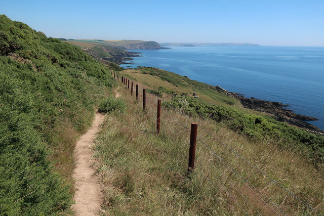
In addition to the sea and estuary, Keaton Cove boasts a charming creek that winds its way through the landscape. The creek is flanked by lush vegetation, creating a peaceful and idyllic setting. Visitors can take leisurely walks along the creek, admiring the natural beauty of the surroundings and perhaps spotting some wildlife along the way.

Overall, Keaton Cove in Devon is a haven for nature lovers and those seeking a tranquil coastal escape. Its combination of a stunning sea, serene estuary, and meandering creek make it a must-visit destination for anyone looking to immerse themselves in the beauty of the natural world.

If you have any feedback on the listing, please let us know in the comments section below.
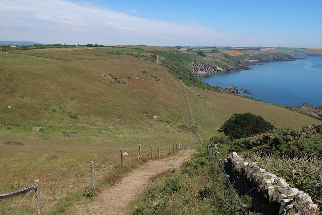
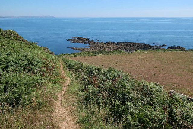
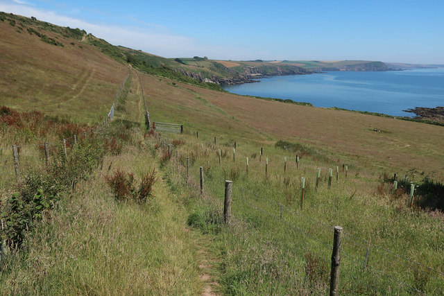
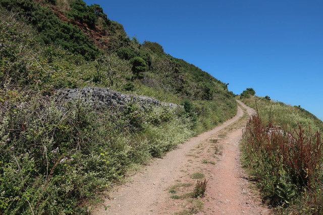
Keaton Cove Images

Images are sourced within 2km of 50.306417/-3.9738672 or Grid Reference SX5947. Thanks to Geograph Open Source API. All images are credited.

South West Coast Path down Beacon Hill
Path to Wadham Beach
Tree planting at bottom of Beacon Hill
Gabions by South West Coast Path
Carswell Cove
Carswell Cove
South West Coast Path
Scrub below St Anchorite's Rock
Butcher's Cove
Butcher's Cove
Keaton Cove
Keaton Cove
Muxham Point The clifftop on the south side of the headland, with Owen's Hill and Point across the Erme estuary. A brighter moment than shown at <a href="https://www.geograph.org.uk/photo/6288574">SX6146 : Coast path at Muxham Point</a>.
Muxham Point
The clifftop on the south side of the headland, with Owen's Hill and Point across the Erme estuary. A brighter moment than shown at SX6146 : Coast path at Muxham Point.
South Devon coastline From Erme Mouth to Stoke Point (left), seen from above Fernycombe Point. The foreground field, and Stoke Point itself, are owned by the National Trust.
South Devon coastline
From Erme Mouth to Stoke Point (left), seen from above Fernycombe Point. The foreground field, and Stoke Point itself, are owned by the National Trust.
St Anchorites Rock On the coastal footpath this feature dominates for miles to the east or west, disappoints close to.
St Anchorites Rock
On the coastal footpath this feature dominates for miles to the east or west, disappoints close to.
Poole Farm - South Devon These hay bags scattered around the fields look more like something out of the cult TV series - "The Prisoner".
Poole Farm - South Devon
These hay bags scattered around the fields look more like something out of the cult TV series - "The Prisoner".
Henna Mill The bridleway from Borough Farm emerges onto a lane here. The name is probably more to do with domestic fowl than dyes. The building is some 50 metres from the Newton Stream, but doubtless there was a leat.
Henna Mill
The bridleway from Borough Farm emerges onto a lane here. The name is probably more to do with domestic fowl than dyes. The building is some 50 metres from the Newton Stream, but doubtless there was a leat.
Newton Stream valley near Coldharbour Wood Looking up the valley towards Brownstone from the point where <a href="https://www.geograph.org.uk/photo/291653">SX5949 : Newton Stream</a> was taken - same tree in foreground. Some small ponds occupy the rough area in the centre of the photo.
Newton Stream valley near Coldharbour Wood
Looking up the valley towards Brownstone from the point where SX5949 : Newton Stream was taken - same tree in foreground. Some small ponds occupy the rough area in the centre of the photo.
Coldharbour Wood Some overlap with <a href="https://www.geograph.org.uk/photo/292994">SX5949 : Newton Stream valley near Coldharbour Wood</a>. Looking along the line of the bridleway up the Newton Stream valley towards Borough Farm, past the wood on the right.
Coldharbour Wood
Some overlap with SX5949 : Newton Stream valley near Coldharbour Wood. Looking along the line of the bridleway up the Newton Stream valley towards Borough Farm, past the wood on the right.
Butcher's Cove A steep and narrow inlet just west of <a href="https://www.geograph.org.uk/photo/326298">SX6046 : Battisborough Cove and Bugle Hole</a>, seen from the coast path at the top of the cliff.
Butcher's Cove
A steep and narrow inlet just west of SX6046 : Battisborough Cove and Bugle Hole, seen from the coast path at the top of the cliff.
Blackaterry Point Blackaterry Point consists of these dark rocks sprawling into the sea between Wadham Beach and Ryder's Hole. Seen from SX5747, up on the cliff somewhere near the line of Newton and Noss Footpath 39, of which there is no real evidence. At this point a thicket of thorn bushes - blackthorn, I think - bars access to the coast.
Blackaterry Point
Blackaterry Point consists of these dark rocks sprawling into the sea between Wadham Beach and Ryder's Hole. Seen from SX5747, up on the cliff somewhere near the line of Newton and Noss Footpath 39, of which there is no real evidence. At this point a thicket of thorn bushes - blackthorn, I think - bars access to the coast.
Show me another place!

Keaton Cove is located at Grid Ref: SX5947 (Lat: 50.306417, Lng: -3.9738672)

Administrative County: Devon

District: South Hams

Police Authority: Devon and Cornwall

What 3 Words

///magically.smaller.losing. Near Newton Ferrers, Devon

Related Wikis

Battisborough Cross

Battisborough Cross is a village in the parish of Holbeton near Plymouth on the south coast of Devon, England . It is within the South Devon Area of Outstanding...

River Erme

The Erme is a river in south Devon, England. From its source on Dartmoor it flows in a generally southerly direction past some of the best-preserved archaeological...

SS Persier (1918)

Persier was a 5,382 GRT cargo ship which was built in 1918 as War Buffalo for the British Shipping Controller. In 1919, she was sold to Belgium and renamed...

Church of St Peter the Poor Fisherman, Revelstoke

The Church of St Peter the Poor Fisherman in the village of Noss Mayo, in Devon, England, was built in 1226. It is located in the former civil parish of...

Nearby Amenities

Located within 500m of 50.306417,-3.9738672
Source: PGS
Lat/Long: 50.306908/-3.980623
Source: PGS
Lat/Long: 50.306745/-3.9805582
Source: PGS
Lat/Long: 50.3060129/-3.9710458
Source: PGS
Lat/Long: 50.3060696/-3.9708237
Source: PGS
Lat/Long: 50.3059084/-3.9703751
Source: PGS
Lat/Long: 50.3057686/-3.9700886
Source: PGS
Lat/Long: 50.3056508/-3.9698162
Barrier: kissing_gate
Lat/Long: 50.3087372/-3.9756495
Barrier: stile
Lat/Long: 50.3078962/-3.9730581
St Anchorite's Rock
Man Made: survey_point
Lat/Long: 50.3082781/-3.9799509
The data included in this document is from www.openstreetmap.org. The data is made available under ODbL.

Have you been to Keaton Cove?

Leave your review of Keaton Cove below (or comments, questions and feedback).