Bideford Bar

Sea, Estuary, Creek in Devon

England

Bideford Bar

Saunton sands On the edge of the extensive Braunton Burrows. Looking towards the Saunton Sands hotel.
Saunton sands Credit: Fiona Avis

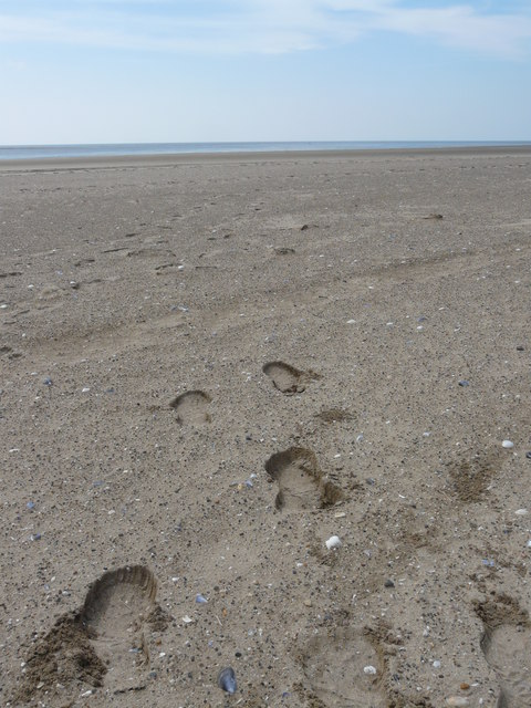
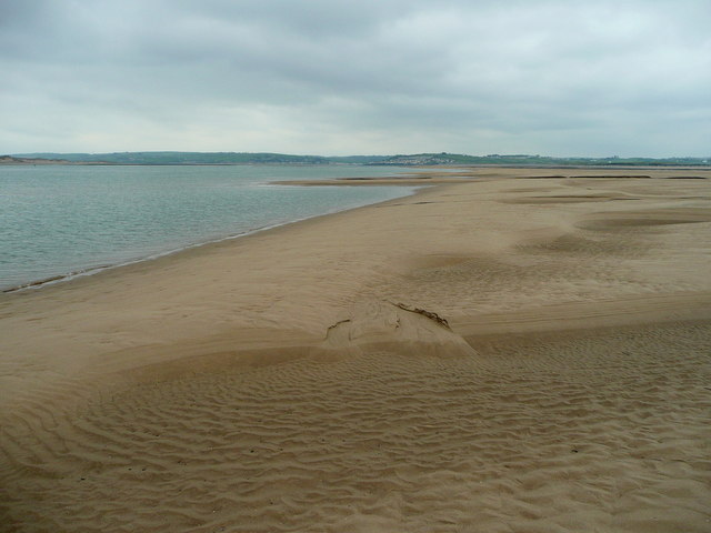
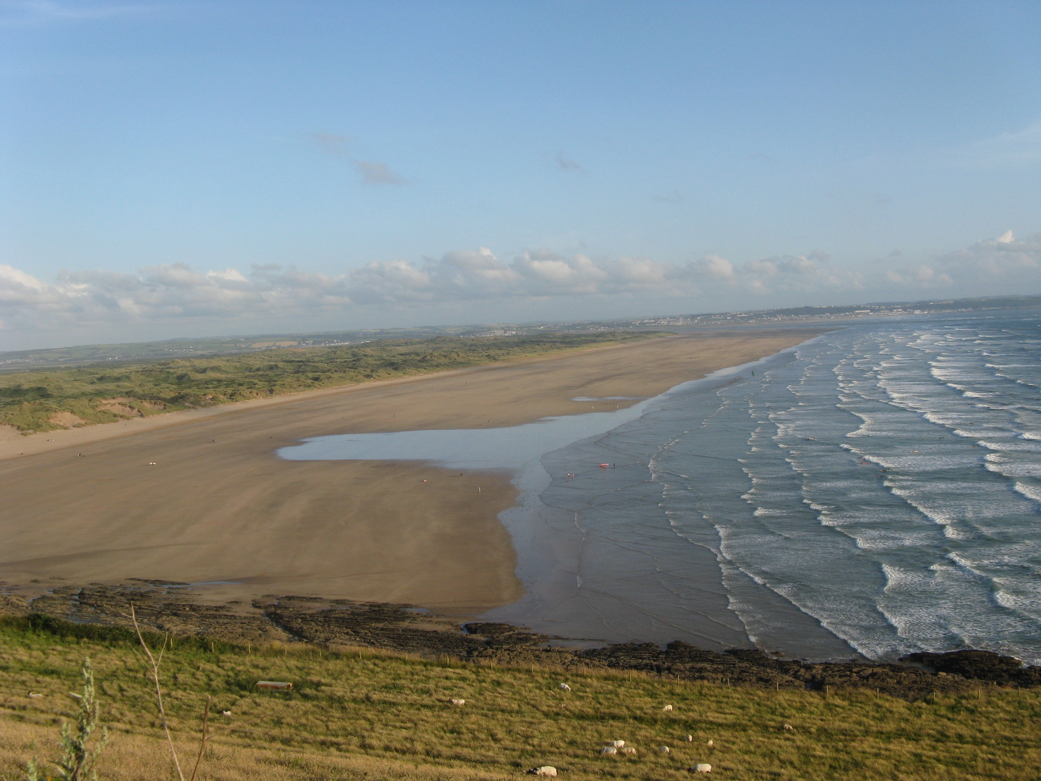
Bideford Bar is a natural sandbank located at the entrance of the River Torridge in North Devon, England. It serves as a barrier between the river and the open sea, creating a unique ecosystem that is home to a variety of marine life. The bar is primarily made up of sand and shingle, with shallow waters covering it at high tide.

The area is popular among fishermen, sailors, and wildlife enthusiasts, as it provides a habitat for a diverse range of seabirds, fish, and other marine creatures. The strong currents and shifting sandbanks can make navigation tricky for boats, adding an element of challenge for those venturing into the area.

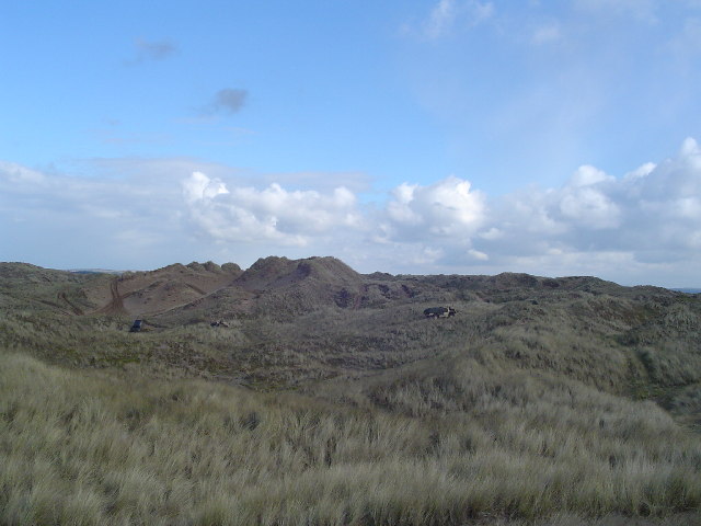
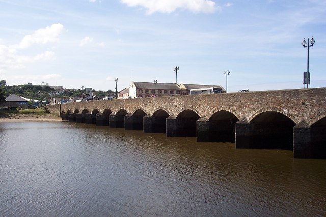
Bideford Bar is also a popular spot for water sports such as kayaking, paddleboarding, and windsurfing, with its calm waters and scenic views attracting visitors from near and far. The surrounding landscape is characterized by rolling hills, sandy beaches, and picturesque villages, making it a popular destination for tourists looking to explore the natural beauty of the Devon coastline.

If you have any feedback on the listing, please let us know in the comments section below.
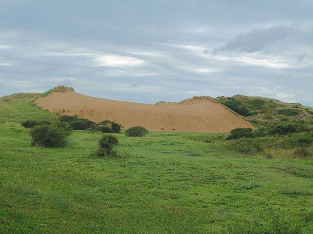
Bideford Bar Images

Images are sourced within 2km of 51.081737/-4.2366687 or Grid Reference SS4333. Thanks to Geograph Open Source API. All images are credited.

Saunton sands On the edge of the extensive Braunton Burrows. Looking towards the Saunton Sands hotel.
Saunton sands
On the edge of the extensive Braunton Burrows. Looking towards the Saunton Sands hotel.
Dunes and Army trucks looking due east watching Army manoeuvres.
Dunes and Army trucks
looking due east watching Army manoeuvres.
Footprints in the sand near Braunton Burrows. This grid square is totally under water during high tides and therefore is constantly changing. There is nothing to distinguish it from any other part of the beach. I have located it using a GPS device which has proven to be accurate for known locations.
Footprints in the sand near Braunton Burrows.
This grid square is totally under water during high tides and therefore is constantly changing. There is nothing to distinguish it from any other part of the beach. I have located it using a GPS device which has proven to be accurate for known locations.
The Crumbles A slight elevation of the sand gives a lighter colour.
Looking south-east parallel to the Taw/Torridge estuary.
The Crumbles
A slight elevation of the sand gives a lighter colour. Looking south-east parallel to the Taw/Torridge estuary.
Tide closing in! Not much of this corner of the square with an incoming tide one hour on the turn.
Looking out to the mouth of the Taw/Torridge estuary.
Tide closing in!
Not much of this corner of the square with an incoming tide one hour on the turn. Looking out to the mouth of the Taw/Torridge estuary.
Looking across the Taw/Torridge estuary Standing on a rapidly diminishing sliver of sand on the south side of the river.
Looking across the Taw/Torridge estuary
Standing on a rapidly diminishing sliver of sand on the south side of the river.
Middle Ridge, South Tail Looking towards the end of the sand spit on the south side of the Taw/Torridge estuary.
The mouth of the estuary is known as Bideford Bar.
The tide is on the turn so I didn't hang around to admire the view!
Middle Ridge, South Tail
Looking towards the end of the sand spit on the south side of the Taw/Torridge estuary. The mouth of the estuary is known as Bideford Bar. The tide is on the turn so I didn't hang around to admire the view!
South Tail This is the sand spit on the south side of the Taw/Torridge estuary.
In the distance are the breakers of the Atlantic revving themselves up to inundate this entire scene within one hour - time to depart to higher ground!
South Tail
This is the sand spit on the south side of the Taw/Torridge estuary. In the distance are the breakers of the Atlantic revving themselves up to inundate this entire scene within one hour - time to depart to higher ground!
South Gut This area of sand spit is also known as Zulu Bank according to the 1:50,000 mapping.
South Gut
This area of sand spit is also known as Zulu Bank according to the 1:50,000 mapping.
South Gut/South Tail An area of sand forming the spit to the south of the Taw/Torridge estuary mouth.
South Gut/South Tail
An area of sand forming the spit to the south of the Taw/Torridge estuary mouth.
Tide on the turn Within minutes these small inlets become one large one!
Tide on the turn
Within minutes these small inlets become one large one!
Expanse of sand Northam Burrows are over 1km away, and the tide was coming in!
Expanse of sand
Northam Burrows are over 1km away, and the tide was coming in!
The inlets enlarge rapidly The sea quickly starts to dissect the intertidal sand spit.
The inlets enlarge rapidly
The sea quickly starts to dissect the intertidal sand spit.
View back to the intertidal spit The enlargement of inlets is almost completely cutting off the South Tail.
Wading was necessary, but the sand was firm.
View back to the intertidal spit
The enlargement of inlets is almost completely cutting off the South Tail. Wading was necessary, but the sand was firm.
Pebbles near Zulu Bank Low tide of the coast to the north-west of Appledore in the Taw estuary exposes these large pebbles on the southern edge of Zulu Bank. Baggy Point can be seen in to background to the extreme left.
Pebbles near Zulu Bank
Low tide of the coast to the north-west of Appledore in the Taw estuary exposes these large pebbles on the southern edge of Zulu Bank. Baggy Point can be seen in to background to the extreme left.
Low tide on Zulu Bank Low tide on Zulu Bank at the mouth of the River Taw. Braunton Burrows can be seen in the distance.
Low tide on Zulu Bank
Low tide on Zulu Bank at the mouth of the River Taw. Braunton Burrows can be seen in the distance.
Sands in the Taw/Torridge estuary Low tide in the Taw/Torridge estuary. The river can be seen in the background and beyond is Braunton Burrows.
Sands in the Taw/Torridge estuary
Low tide in the Taw/Torridge estuary. The river can be seen in the background and beyond is Braunton Burrows.
Beach to the north of Westward Ho! View towards Westward Ho! from the north across the beach at low tide.
Beach to the north of Westward Ho!
View towards Westward Ho! from the north across the beach at low tide.
Show me another place!

Bideford Bar is located at Grid Ref: SS4333 (Lat: 51.081737, Lng: -4.2366687)

Administrative County: Devon

Police Authority: Devon and Cornwall

What 3 Words

///alienated.advancing.cement. Near Appledore, Devon

Nearby Locations

Bideford Bar Middle Ridge

Related Wikis

River Taw

The River Taw () rises at Taw Head, a spring on the central northern flanks of Dartmoor, crosses North Devon and at the town of Barnstaple, formerly a...

Saunton Sands

Saunton Sands is a beach near the English village of Saunton on the North Devon coast near Braunton, popular for longboard surfing. Beyond its southern...

Braunton Burrows

Braunton Burrows is a sand dune system on the North Devon coast. It is privately owned and forms part of the Christie Devon Estates Trust (see Tapeley...

River Torridge

The River Torridge is a river in Devon in England; it rises near Meddon. The river describes a long loop through Devon farming country where its tributaries...

Nearby Amenities

Located within 500m of 51.081737,-4.2366687
Bideford Bar
Place: locality
Lat/Long: 51.0809219/-4.2365156
Note: Bideford Bar
Seamark Buoy Lateral Category: starboard
Seamark Buoy Lateral Colour: green
Seamark Buoy Lateral Shape: conical
Seamark Light Character: Q
Seamark Light Colour: green
Seamark Name: Bideford Bar
Seamark Type: buoy_lateral
Lat/Long: 51.0815/-4.24367
The data included in this document is from www.openstreetmap.org. The data is made available under ODbL.

Have you been to Bideford Bar?

Leave your review of Bideford Bar below (or comments, questions and feedback).