Hen Borth

Sea, Estuary, Creek in Anglesey

Wales

Hen Borth

The approach to Bryn Aber Bryn Aber, the former home of Vivian Hewitt, was put up for sale a few years ago and the particulars <span class="nowrap"><a title="https://media.onthemarket.com/properties/3258764/doc_0_4.pdf" rel="nofollow ugc noopener" href="https://media.onthemarket.com/properties/3258764/doc_0_4.pdf">Link</a><img style="margin-left:2px;" alt="External link" title="External link - shift click to open in new window" src="https://s1.geograph.org.uk/img/external.png" width="10" height="10"/></span> describe what was on offer inside those forbidding walls: 'immense enclosed rear gardens' (a long and very high wall can be seen surrounding them), 'ample off road parking' (in those immense gardens), 'advantage of no onward chain' (the house had been unoccupied for some time) but 'in need of a great deal of internal and external attention'.  It is in the process of being converted to a holiday let.

Across the bay can be seen the former Wylfa nuclear power station.
The approach to Bryn Aber Credit: HelenK

Hen Borth, located on the picturesque island of Anglesey in Wales, is a captivating coastal area encompassing a sea, estuary, and creek. Situated on the western side of the island, Hen Borth is a haven for nature enthusiasts and those seeking tranquility amidst stunning natural beauty.

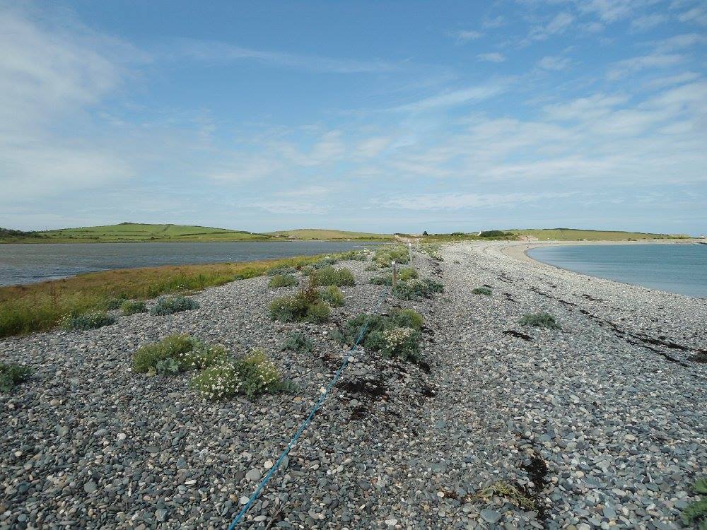
The sea at Hen Borth offers breathtaking panoramic views of the Irish Sea, with its crystal-clear waters and expansive sandy beaches. The crashing waves and the salty breeze create an invigorating atmosphere, making it an ideal spot for beachcombing, sunbathing, and swimming during the warmer months.

Moving inland, the estuary at Hen Borth is a haven for a diverse range of bird species, making it a paradise for birdwatchers. The estuary provides a vital habitat for migratory birds, including curlews, oystercatchers, and herons. It is a sight to behold when the birds gracefully take flight or settle on the estuary's mudflats during low tide.

The creek at Hen Borth, known locally as "Afon Rhyd-Hir," meanders through lush green meadows and offers a tranquil setting for leisurely walks and picnics. The gently flowing waters of the creek are home to an assortment of wildlife, including otters, fish, and waterfowl. The surrounding woodland adds to the idyllic charm of the area, providing a peaceful retreat for visitors.

Whether you choose to explore the sea, estuary, or creek, Hen Borth offers a unique and enchanting experience for nature lovers and those seeking solace in the beauty of the natural world.

If you have any feedback on the listing, please let us know in the comments section below.

Hen Borth Images

Images are sourced within 2km of 53.407595/-4.5303352 or Grid Reference SH3193. Thanks to Geograph Open Source API. All images are credited.

The approach to Bryn Aber Bryn Aber, the former home of Vivian Hewitt, was put up for sale a few years ago and the particulars <span class="nowrap"><a title="https://media.onthemarket.com/properties/3258764/doc_0_4.pdf" rel="nofollow ugc noopener" href="https://media.onthemarket.com/properties/3258764/doc_0_4.pdf">Link</a><img style="margin-left:2px;" alt="External link" title="External link - shift click to open in new window" src="https://s1.geograph.org.uk/img/external.png" width="10" height="10"/></span> describe what was on offer inside those forbidding walls: 'immense enclosed rear gardens' (a long and very high wall can be seen surrounding them), 'ample off road parking' (in those immense gardens), 'advantage of no onward chain' (the house had been unoccupied for some time) but 'in need of a great deal of internal and external attention'.  It is in the process of being converted to a holiday let.

Across the bay can be seen the former Wylfa nuclear power station.
The approach to Bryn Aber
Bryn Aber, the former home of Vivian Hewitt, was put up for sale a few years ago and the particulars LinkExternal link describe what was on offer inside those forbidding walls: 'immense enclosed rear gardens' (a long and very high wall can be seen surrounding them), 'ample off road parking' (in those immense gardens), 'advantage of no onward chain' (the house had been unoccupied for some time) but 'in need of a great deal of internal and external attention'. It is in the process of being converted to a holiday let. Across the bay can be seen the former Wylfa nuclear power station.
The path turns inland A path diverges from the Isle of Anglesey Coastal Path and heads south-west inland across fields. On this clear day the islet of West Mouse is visible offshore.
The path turns inland
A path diverges from the Isle of Anglesey Coastal Path and heads south-west inland across fields. On this clear day the islet of West Mouse is visible offshore.
National Cycle Route 566 National Cycle Route 566 <span class="nowrap"><a title="https://www.sustrans.org.uk/find-a-route-on-the-national-cycle-network/route-566" rel="nofollow ugc noopener" href="https://www.sustrans.org.uk/find-a-route-on-the-national-cycle-network/route-566">Link</a><img style="margin-left:2px;" alt="External link" title="External link - shift click to open in new window" src="https://s1.geograph.org.uk/img/external.png" width="10" height="10"/></span> extends to the north coast of Anglesey. Here it passes the lagoon and nature reserve at Cemlyn Bay.  The turning on the left goes to the National Trust car park north of the lagoon.  

Wylfa former nuclear power station is also visible across the bay.
National Cycle Route 566
National Cycle Route 566 LinkExternal link extends to the north coast of Anglesey. Here it passes the lagoon and nature reserve at Cemlyn Bay. The turning on the left goes to the National Trust car park north of the lagoon. Wylfa former nuclear power station is also visible across the bay.
Bryn Aber, Bae Cemlyn The house of Bryn Aber was encased in its huge walls in 1939 by its owner, Captain Vivian Hewitt. He stated that they were to shelter nesting birds on this exposed corner of Anglesey, though his urge for extreme privacy surely played its part. He was though a famous birder; he created the lagoon at Cemlyn by damming the neck of the saltmarsh.
Bryn Aber, Bae Cemlyn
The house of Bryn Aber was encased in its huge walls in 1939 by its owner, Captain Vivian Hewitt. He stated that they were to shelter nesting birds on this exposed corner of Anglesey, though his urge for extreme privacy surely played its part. He was though a famous birder; he created the lagoon at Cemlyn by damming the neck of the saltmarsh.
Gwartheg a gorsaf pŵer Wylfa Looking across the fields of Trwyn Cemlyn towards the Wylfa power station on the next headland.
Gwartheg a gorsaf pŵer Wylfa
Looking across the fields of Trwyn Cemlyn towards the Wylfa power station on the next headland.
Eglwys Llanrhwydrus The little coastal church, sat quietly in the fields, from a footpath. Rhwydrus was believed to be the son of a sixth century king of Connaught (Ireland), who landed here and founded a llan.
Eglwys Llanrhwydrus
The little coastal church, sat quietly in the fields, from a footpath. Rhwydrus was believed to be the son of a sixth century king of Connaught (Ireland), who landed here and founded a llan.
Bryn Aber, Bae Cemlyn The house of Bryn Aber was encased in its huge walls in 1939 by its owner, Captain Vivian Hewitt. He stated that they were to shelter nesting birds on this exposed corner of Anglesey, though his urge for extreme privacy surely played its part. He was though a famous birder; he created the lagoon at Cemlyn by damming the neck of the saltmarsh.
Bryn Aber, Bae Cemlyn
The house of Bryn Aber was encased in its huge walls in 1939 by its owner, Captain Vivian Hewitt. He stated that they were to shelter nesting birds on this exposed corner of Anglesey, though his urge for extreme privacy surely played its part. He was though a famous birder; he created the lagoon at Cemlyn by damming the neck of the saltmarsh.
Cemlyn Bay & shingle spit
Bridge at NW end of spit at Cemlyn Bay
Coastal path & foreshore W of Cemlyn
Beach at Hen Borth, W of Cemlyn
West Mouse & Navigation Beacon off Carmel Head
Edge of the Nature Reserve
Rocky inlet near Carmel Head Rocky inlet on the Anglesey Coastal Path between Carmel Head and Hen Borth
Rocky inlet near Carmel Head
Rocky inlet on the Anglesey Coastal Path between Carmel Head and Hen Borth
Capel Siloam Looks like its now been converted
Capel Siloam
Looks like its now been converted
Road north from Capel Siloam
Road junction near Tyddyn Sydney
Causeway near Tyn Llan
Show me another place!

Hen Borth is located at Grid Ref: SH3193 (Lat: 53.407595, Lng: -4.5303352)

Unitary Authority: Isle of Anglesey

Police Authority: North Wales

What 3 Words

///snooping.snail.whisk. Near Cemaes Bay, Isle of Anglesey

Nearby Locations

Hen Borth

Related Wikis

Henborth

Henborth is a Site of Special Scientific Interest (or SSSI) in Anglesey, North Wales. It has been designated as a Site of Special Scientific Interest since...

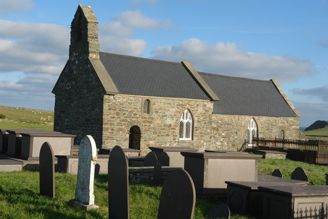
St Rhwydrus's Church, Llanrhwydrus

St Rhwydrus's Church is a medieval church in the village of Cemlyn on the Isle of Anglesey, Wales. The building dates from the mid-12th century and underwent...

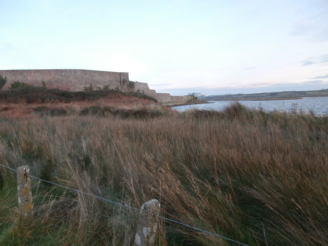
Cemlyn Bay and lagoon

Cemlyn Bay is a bay on the northwest coast of Anglesey, North Wales, approximately 2.5 km west of Wylfa nuclear power station, within the community of...

Cemlyn

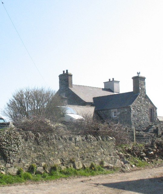
Cemlyn is a village in Anglesey, in north-west Wales. It lies near Cemlyn Bay. It is in the community of Cylch-y-Garn. == References ==

Nearby Amenities

Located within 500m of 53.407595,-4.5303352
Source: PGS
Lat/Long: 53.4111129/-4.5283447
Source: PGS
Lat/Long: 53.4099893/-4.5284062
Source: PGS
Lat/Long: 53.4091849/-4.5288873
Source: PGS
Lat/Long: 53.4090953/-4.5286338
Source: PGS
Lat/Long: 53.407358/-4.527814
Source: PGS
Lat/Long: 53.4063494/-4.5290527
Source: PGS
Lat/Long: 53.4060458/-4.5298826
Source: PGS
Lat/Long: 53.4068346/-4.5310342
Source: PGS
Lat/Long: 53.4068439/-4.5317019
Source: PGS
Lat/Long: 53.4074089/-4.532636
Source: PGS
Lat/Long: 53.4073471/-4.5329098
Source: PGS
Lat/Long: 53.4069601/-4.5328245
Source: PGS
Lat/Long: 53.4065365/-4.5338256
Source: PGS
Lat/Long: 53.4065287/-4.5350697
Source: PGS
Lat/Long: 53.4063286/-4.5353107
Source: PGS
Lat/Long: 53.4061258/-4.5363975
Hen Borth
Created By: Potlatch 0.8b
Place: locality
Source: npe
Lat/Long: 53.4069953/-4.5297466
Llanrhwydrys
Place: village
Wikidata: Q20594263
Lat/Long: 53.4083767/-4.5233952
Barrier: kissing_gate
Lat/Long: 53.4060533/-4.5352613
Barrier: kissing_gate
Lat/Long: 53.4098628/-4.5279148
Entrance: yes
Lat/Long: 53.4090759/-4.525824
The data included in this document is from www.openstreetmap.org. The data is made available under ODbL.

Have you been to Hen Borth?

Leave your review of Hen Borth below (or comments, questions and feedback).