Sheffield Hole

Sea, Estuary, Creek in Wigtownshire

Scotland

Sheffield Hole

Fields above Knockencule Farm On the west coast of the Rhins.
Fields above Knockencule Farm Credit: David Purchase

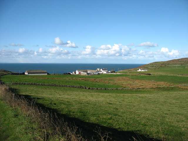
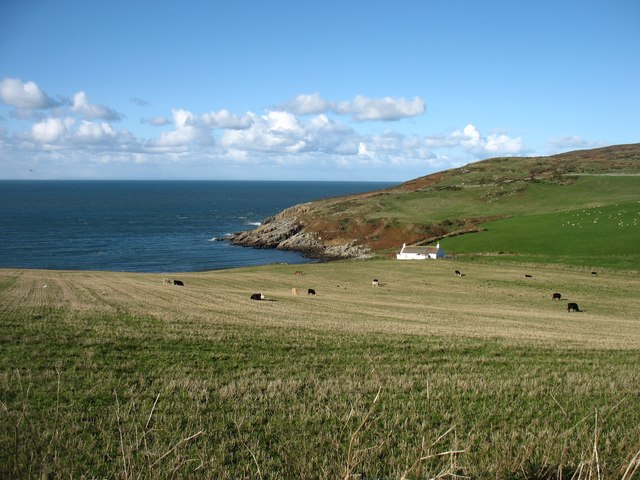
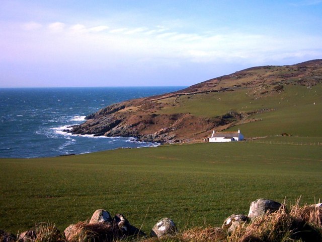
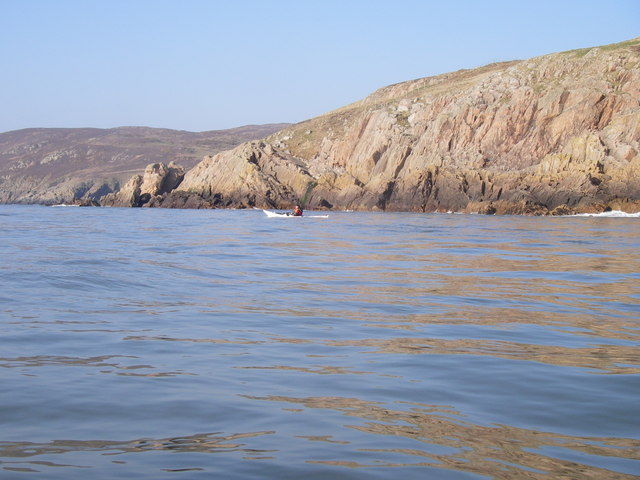
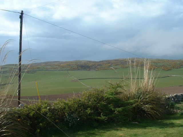
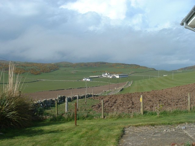
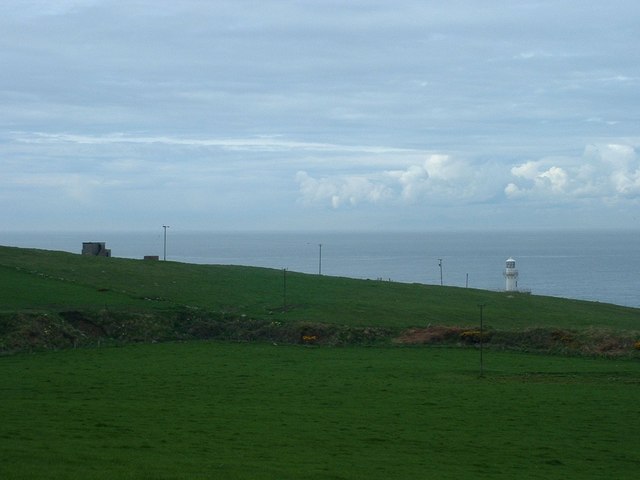
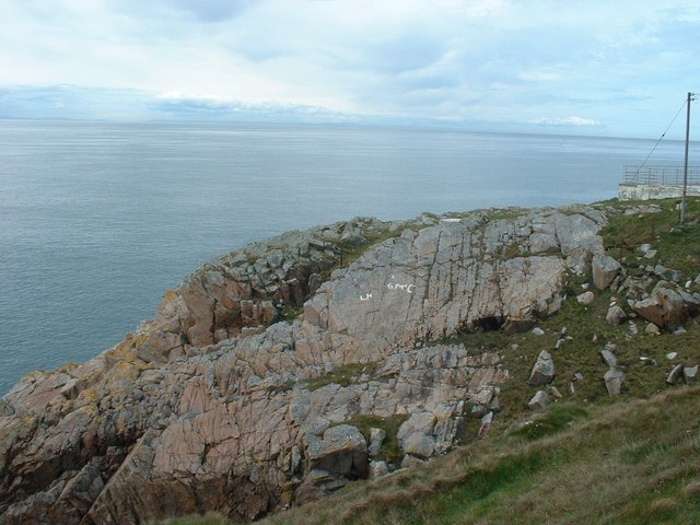
Sheffield Hole is a picturesque coastal area located in Wigtownshire, Scotland. Situated on the western coast, it is renowned for its stunning views of the sea, estuary, and creek. The rugged coastline, with its rocky cliffs and sandy beaches, attracts numerous visitors year-round.

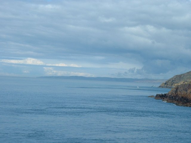
The main feature of Sheffield Hole is its expansive sea, which stretches out into the horizon, offering a mesmerizing sight for nature enthusiasts. The sparkling blue waters are often dotted with fishing boats, adding to the charm and authenticity of the area. The sea also provides opportunities for various water activities such as swimming, sailing, and fishing.

Adjacent to the sea is an estuary, where the river meets the sea. This unique ecosystem is home to a diverse range of marine life, including fish, birds, and plant species. Birdwatchers flock to Sheffield Hole to observe the numerous species that inhabit the estuary, including herons, oystercatchers, and curlews.

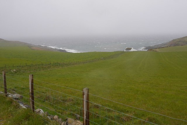
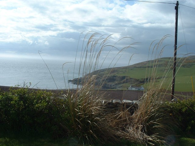
A creek meanders through Sheffield Hole, offering a tranquil spot for leisurely walks and picnics. The creek is flanked by lush greenery and tall grasses, creating a serene atmosphere for visitors to unwind and connect with nature.

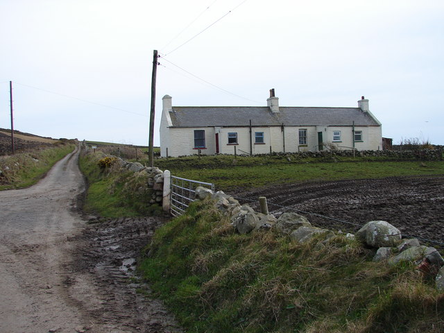
Sheffield Hole is also known for its rich history, with evidence of ancient settlements and archaeological artifacts found in the area. The nearby town of Wigtown offers a range of amenities, including accommodation, restaurants, and shops, making it a convenient base for exploring Sheffield Hole and its surrounding areas.

Overall, Sheffield Hole is a hidden gem on the Scottish coast, providing a perfect blend of natural beauty, diverse wildlife, and historical significance.

If you have any feedback on the listing, please let us know in the comments section below.

Sheffield Hole Images

Images are sourced within 2km of 54.678894/-4.9690671 or Grid Reference NX0835. Thanks to Geograph Open Source API. All images are credited.

Fields above Knockencule Farm On the west coast of the Rhins.
Fields above Knockencule Farm
On the west coast of the Rhins.
The west shore of The Rhins Bay House in view, just right of centre.
The west shore of The Rhins
Bay House in view, just right of centre.
Bay House The bay is Portencorkrie. The west side of the Rhins is wild and there is a gale blowing out to sea.
Bay House
The bay is Portencorkrie. The west side of the Rhins is wild and there is a gale blowing out to sea.
Road to Slockmill Serving scattered dwellings on the exposed west coast of the Rhins of Galloway.
Road to Slockmill
Serving scattered dwellings on the exposed west coast of the Rhins of Galloway.
Bay House, Portencorkrie An idyllic traditional Galloway cottage above Portencorkrie Bay.
Bay House, Portencorkrie
An idyllic traditional Galloway cottage above Portencorkrie Bay.
North of Crammag Head
Knockencule Cottages Farm cottages at Knockencule in the remote south-west corner of South Rhins.
Knockencule Cottages
Farm cottages at Knockencule in the remote south-west corner of South Rhins.
North End Portencorkrie Bay The beach side house is now boarded up and abandoned.
North End Portencorkrie Bay
The beach side house is now boarded up and abandoned.
Towards Barncorkrie Moor The gorse on the hillside glows brightly against the new spring grass in the sheep pasture.
Towards Barncorkrie Moor
The gorse on the hillside glows brightly against the new spring grass in the sheep pasture.
Barncorkrie Farm With Barncorkrie Moor behind and the minor road to Inshanks Fell in front.
Barncorkrie Farm
With Barncorkrie Moor behind and the minor road to Inshanks Fell in front.
Fields towards Cairn Fell With Barncorkrie Moor to left.
Fields towards Cairn Fell
With Barncorkrie Moor to left.
Fields by Knockencule With outbuildings of Knockencule Farm to right.
Fields by Knockencule
With outbuildings of Knockencule Farm to right.
Buildings on Crammag Head To left, abandoned coastguard lookout.  To right, newly erected glass fibre lighthouse.
Buildings on Crammag Head
To left, abandoned coastguard lookout. To right, newly erected glass fibre lighthouse.
View north from Crammag Head From north side of new lighthouse, with Laggantalluch Head middle right and Black Head, beyond Portpatrick in left far distance.
View north from Crammag Head
From north side of new lighthouse, with Laggantalluch Head middle right and Black Head, beyond Portpatrick in left far distance.
New lighthouse at Crammag Head Erected over the winter of 2009/2010 by specialist builders from the Orkney's, this glass fibre lighthouse replaced previous structure whose square base is visible to left. Coast of Northern Ireland near Belfast just visible on far horizon.
New lighthouse at Crammag Head
Erected over the winter of 2009/2010 by specialist builders from the Orkney's, this glass fibre lighthouse replaced previous structure whose square base is visible to left. Coast of Northern Ireland near Belfast just visible on far horizon.
Towards Mull of Galloway From south side of newly erected lighthouse at Crammag Head along western coast line of South Rhinns with Isle of Mann visible on far horizon.
Towards Mull of Galloway
From south side of newly erected lighthouse at Crammag Head along western coast line of South Rhinns with Isle of Mann visible on far horizon.
Old coastguard lookout Derelict but still identifiable.
Old coastguard lookout
Derelict but still identifiable.
Lighthouse constructors graffiti South side of newly erected lighthouse at Crammag Head, platform to right, where the very fresh and white coloured initials were probably left by the constructors in February 2010.
Lighthouse constructors graffiti
South side of newly erected lighthouse at Crammag Head, platform to right, where the very fresh and white coloured initials were probably left by the constructors in February 2010.
Show me another place!

Sheffield Hole is located at Grid Ref: NX0835 (Lat: 54.678894, Lng: -4.9690671)

Unitary Authority: Dumfries and Galloway

Police Authority: Dumfries and Galloway

What 3 Words

///given.gravitate.dribble. Near Drummore, Dumfries & Galloway

Related Wikis

Kirkmaiden (village)

Kirkmaiden (sometimes Maidenkirk; Scottish Gaelic: Cill M'Eudan) is a small settlement in Galloway, Scotland, located approximately 17 miles (27 km) south...

Kirkmaiden

Kirkmaiden is a parish in the Rhins of Galloway, the most southerly in Scotland; the present Church of Scotland parish has the same name as and is approximately...

Port Logan

Port Logan, formerly Port Nessock, is a small village in the parish of Kirkmaiden in the Rhins of Galloway in Wigtownshire. The Gaelic name is Port Neasaig...

Drummore

Drummore (drum-ORE; (from Gaelic An Druim Mòr meaning "the great ridge") is the southernmost village in Scotland, located at the southern end of the Rhins...

Cairngaan

Cairngaan, Wigtownshire, is the southmost settlement in Scotland. The hamlet of Cairngaan lies just north of the Mull of Galloway (which contains Scotland...

Logan Botanic Garden

Logan Botanic Garden is a botanical garden near Port Logan on the Rhins of Galloway, at the south-western tip of Scotland. The Botanic Garden was established...

Mull of Galloway

The Mull of Galloway (Scottish Gaelic: Maol nan Gall, pronounced [mɯːlˠ̪ nəŋ ˈkaulˠ̪]; grid reference NX158303) is the southernmost point of Scotland....

Doon Castle Broch

Doon Castle Broch is an iron-age broch located in Dumfries and Galloway, Scotland (grid reference NX 06702 44683). == Location == The Broch is located...

Nearby Amenities

Located within 500m of 54.678894,-4.9690671
Source: PGS
Lat/Long: 54.6827403/-4.9729859
Source: PGS
Lat/Long: 54.6825395/-4.9728901
Source: PGS
Lat/Long: 54.6821851/-4.9724103
Source: PGS
Lat/Long: 54.6818579/-4.9718229
Source: PGS
Lat/Long: 54.6818238/-4.9715133
Source: PGS
Lat/Long: 54.6813708/-4.9711057
Source: PGS
Lat/Long: 54.6804921/-4.9707763
Source: PGS
Lat/Long: 54.6799261/-4.9701806
Source: PGS
Lat/Long: 54.6791129/-4.9694727
Source: PGS
Lat/Long: 54.6789113/-4.9693112
Source: PGS
Lat/Long: 54.6790388/-4.968697
Source: PGS
Lat/Long: 54.6785214/-4.9693949
Source: PGS
Lat/Long: 54.6781595/-4.9692965
Source: PGS
Lat/Long: 54.6777831/-4.9689044
Source: PGS
Lat/Long: 54.6777591/-4.9683446
Source: PGS
Lat/Long: 54.6780754/-4.9672505
Source: PGS
Lat/Long: 54.6776316/-4.9674024
Source: PGS
Lat/Long: 54.6776199/-4.9667546
Source: PGS
Lat/Long: 54.6773587/-4.9671188
Source: PGS
Lat/Long: 54.6773279/-4.9668099
Source: PGS
Lat/Long: 54.6771506/-4.9667246
Source: PGS
Lat/Long: 54.6771083/-4.9657964
Source: PGS
Lat/Long: 54.6769998/-4.9653739
Source: PGS
Lat/Long: 54.6772002/-4.964512
Source: PGS
Lat/Long: 54.676962/-4.9637636
Source: PGS
Lat/Long: 54.6766667/-4.963431
Source: PGS
Lat/Long: 54.6764082/-4.9633685
Source: PGS
Lat/Long: 54.6758906/-4.9633795
The data included in this document is from www.openstreetmap.org. The data is made available under ODbL.

Have you been to Sheffield Hole?

Leave your review of Sheffield Hole below (or comments, questions and feedback).