Bonny Well Bay

Sea, Estuary, Creek in Wigtownshire

Scotland

Bonny Well Bay

Path from Cairnywellan Head An unofficial footpath that comes to an abrupt halt a little further south <a href="https://www.geograph.org.uk/photo/838279">NX0939 : End of Clifftop Walk from Port Logan</a> .
Path from Cairnywellan Head Credit: Rose and Trev Clough

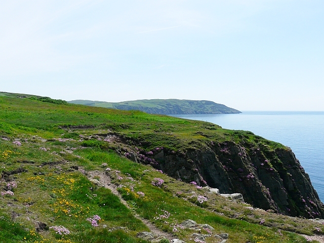
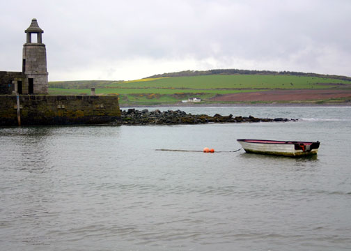
Bonny Well Bay is a picturesque coastal area located in Wigtownshire, Scotland. Nestled along the banks of the Irish Sea, it offers a combination of stunning sea views, a tranquil estuary, and a charming creek, making it a popular destination for nature lovers and outdoor enthusiasts.

The bay itself is characterized by its sandy beaches and rocky outcrops, providing a diverse landscape that attracts a wide range of wildlife. It is an important habitat for various bird species, including oystercatchers, curlews, and herons, which can often be seen wading along the shoreline or perched on the rocks.

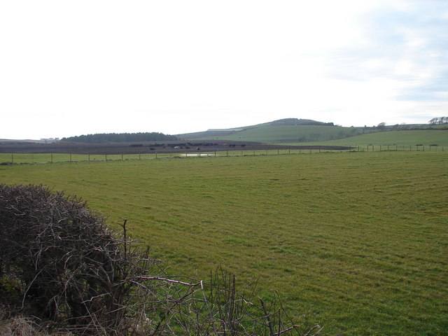
The estuary, which is formed by the convergence of several rivers, is a haven for marine life. It is home to a variety of fish species, such as salmon and trout, making it a popular spot for anglers. The estuary's calm waters also offer opportunities for kayaking and boating, providing a peaceful and scenic experience for visitors.

Within the bay, a charming creek meanders through the landscape, adding to its natural beauty. The creek is lined with lush vegetation, including reeds and marsh grasses, creating a rich ecosystem that supports a range of plant and animal species.

Bonny Well Bay is not only a haven for nature enthusiasts but also offers recreational activities for visitors. The sandy beaches provide an ideal setting for picnics, sunbathing, and leisurely walks, while the rocky areas offer opportunities for rock pooling and exploration.

Overall, Bonny Well Bay is a captivating coastal area that offers a blend of stunning sea views, a serene estuary, and a charming creek, making it a must-visit destination for those seeking a tranquil and scenic experience.

If you have any feedback on the listing, please let us know in the comments section below.

Bonny Well Bay Images

Images are sourced within 2km of 54.732969/-4.9768918 or Grid Reference NX0841. Thanks to Geograph Open Source API. All images are credited.

Path from Cairnywellan Head An unofficial footpath that comes to an abrupt halt a little further south <a href="https://www.geograph.org.uk/photo/838279">NX0939 : End of Clifftop Walk from Port Logan</a> .
Path from Cairnywellan Head
An unofficial footpath that comes to an abrupt halt a little further south NX0939 : End of Clifftop Walk from Port Logan .
Logan Botanic Gardens Entrance of the B7065
Logan Botanic Gardens
Entrance of the B7065
Auchabreck, South Rhins View from West Myroch northwest across the cattle crazing fields of Auchabreck.
Auchabreck, South Rhins
View from West Myroch northwest across the cattle crazing fields of Auchabreck.
Road into Logan Botanic Garden Viewed in late March  (27th).
Road into Logan Botanic Garden
Viewed in late March (27th).
Exit Road from Logan Botanic Garden Onto the B7065. Viewed in late March  (27th).
Exit Road from Logan Botanic Garden
Onto the B7065. Viewed in late March (27th).
Port Logan Pier The harbour wall on Port Logan Pier is a feast of texture and colour.

The harbour is a natural feature, and forms a small sandy bay. 

The pier runs SW to NE, about dead centre of this grid square.

Port Logan achieved some fame through being featured in some TV programme or other, but remains a quiet and unspoiled place. Picnic tables are available here by the sands, offering a great view of the ancient harbour wall.

Nearby feature: Logan Fish Pond
In 1800 Colonel Andrew MacDouall created the Logan Fishpond,  on the north side of the bay. This is a circular pool, into which the sea washes at every tide through a narrow crevice, and then washed out again refreshing the water left behind. It was used to keep cod for the table at Logan House but today it is a marine centre.
Port Logan Pier
The harbour wall on Port Logan Pier is a feast of texture and colour. The harbour is a natural feature, and forms a small sandy bay. The pier runs SW to NE, about dead centre of this grid square. Port Logan achieved some fame through being featured in some TV programme or other, but remains a quiet and unspoiled place. Picnic tables are available here by the sands, offering a great view of the ancient harbour wall. Nearby feature: Logan Fish Pond In 1800 Colonel Andrew MacDouall created the Logan Fishpond, on the north side of the bay. This is a circular pool, into which the sea washes at every tide through a narrow crevice, and then washed out again refreshing the water left behind. It was used to keep cod for the table at Logan House but today it is a marine centre.
Boat in Port Logan Harbour A boat tied up in the natural harbour at Port Logan, Dumfries & Galloway.
Boat in Port Logan Harbour
A boat tied up in the natural harbour at Port Logan, Dumfries & Galloway.
Logan botanic gardens, Gunnera grove Logan is one of the National Botanic Gardens of Scotland. Warmed by the Gulf Stream and sheltered by trees, it grows many plants from the southern hemisphere. In the photo is a grove of Gunnera, from Andean cloud forests, and a cabbage tree from New Zealand.
Logan botanic gardens, Gunnera grove
Logan is one of the National Botanic Gardens of Scotland. Warmed by the Gulf Stream and sheltered by trees, it grows many plants from the southern hemisphere. In the photo is a grove of Gunnera, from Andean cloud forests, and a cabbage tree from New Zealand.
Port Logan fish pond These are the Buildings associated with the Victorian fish pond at Port Logan. To the left can be seen the small changing room for the bathers, although it was a bit too chilly for me on this bright February day.
Port Logan fish pond
These are the Buildings associated with the Victorian fish pond at Port Logan. To the left can be seen the small changing room for the bathers, although it was a bit too chilly for me on this bright February day.
Portlogan Cottages Setting for Two Thousand Acres of Sky
Portlogan Cottages
Setting for Two Thousand Acres of Sky
The Port Logan Inn, Port Logan The Port Logan Inn, Port Logan.
The Port Logan Inn, Port Logan
The Port Logan Inn, Port Logan.
Ornamental pond at Logan Gardens One of a series taken on an exquisite day during a visit by myself and other old car enthusiasts during a private 'run' - vehicles including Talbot, Chenard-Walcker and Bugatti present.
Ornamental pond at Logan Gardens
One of a series taken on an exquisite day during a visit by myself and other old car enthusiasts during a private 'run' - vehicles including Talbot, Chenard-Walcker and Bugatti present.
Port Logan Picture taken from the Butterchurn Tea Room on a dull day.
Port Logan
Picture taken from the Butterchurn Tea Room on a dull day.
Tree Ferns at Logan Botanic Garden, Mull of Galloway Tree ferns can grow in this part of Scotland, which has a mild climate due to the Gulf Stream
Tree Ferns at Logan Botanic Garden, Mull of Galloway
Tree ferns can grow in this part of Scotland, which has a mild climate due to the Gulf Stream
Wollemi Pine OK, so it's less than a foot tall and it might not merit a geograph, but if you're up on plants you'll know that this one can be pinpointed to a few square inches of soil in the Logan Botanic Gardens. This Wollemi Pine cutting is the only one in Britain growing in outdoor conditions. The plant is a 'living fossil', thought to be extinct in its native Australia until it was discovered by accident in the 1990s.
Wollemi Pine
OK, so it's less than a foot tall and it might not merit a geograph, but if you're up on plants you'll know that this one can be pinpointed to a few square inches of soil in the Logan Botanic Gardens. This Wollemi Pine cutting is the only one in Britain growing in outdoor conditions. The plant is a 'living fossil', thought to be extinct in its native Australia until it was discovered by accident in the 1990s.
The bay at Port Logan Looking north, from the car park near the Inn.
The bay at Port Logan
Looking north, from the car park near the Inn.
The pier at Port Logan Looking west from the car park near Port Logan Inn.
The pier at Port Logan
Looking west from the car park near Port Logan Inn.
The waterfront at Port Logan Looking south west.
The waterfront at Port Logan
Looking south west.
Show me another place!

Bonny Well Bay is located at Grid Ref: NX0841 (Lat: 54.732969, Lng: -4.9768918)

Unitary Authority: Dumfries and Galloway

Police Authority: Dumfries and Galloway

What 3 Words

///donates.pursuing.shorthand. Near Drummore, Dumfries & Galloway

Related Wikis

Port Logan

Port Logan, formerly Port Nessock, is a small village in the parish of Kirkmaiden in the Rhins of Galloway in Wigtownshire. The Gaelic name is Port Neasaig...

Logan Botanic Garden

Logan Botanic Garden is a botanical garden near Port Logan on the Rhins of Galloway, at the south-western tip of Scotland. The Botanic Garden was established...

Doon Castle Broch

Doon Castle Broch is an iron-age broch located in Dumfries and Galloway, Scotland (grid reference NX 06702 44683). == Location == The Broch is located...

Ardwell

Ardwell (from Gaelic Àrd Bhaile meaning "high town", pronounced as "Ardwell") is a village in the Scottish unitary council area of Dumfries and Galloway...

Clachanmore

Clachanmore is a village in the South Rhins of Galloway near Ardwell in the south west of Scotland. It has also been known as Low Ardwell.The name of the...

Kirkmaiden

Kirkmaiden is a parish in the Rhins of Galloway, the most southerly in Scotland; the present Church of Scotland parish has the same name as and is approximately...

Kirkmaiden (village)

Kirkmaiden (sometimes Maidenkirk; Scottish Gaelic: Cill M'Eudan) is a small settlement in Galloway, Scotland, located approximately 17 miles (27 km) south...

Drummore

Drummore (drum-ORE; (from Gaelic An Druim Mòr meaning "the great ridge") is the southernmost village in Scotland, located at the southern end of the Rhins...

Nearby Amenities

Located within 500m of 54.732969,-4.9768918
Source: PGS
Lat/Long: 54.7327722/-4.9841498
Source: PGS
Lat/Long: 54.7325347/-4.9840053
Source: PGS
Lat/Long: 54.7329227/-4.9824817
Source: PGS
Lat/Long: 54.7332168/-4.9814738
Source: PGS
Lat/Long: 54.7336168/-4.9807061
Source: PGS
Lat/Long: 54.7334341/-4.9801385
Source: PGS
Lat/Long: 54.7333603/-4.9793409
Source: PGS
Lat/Long: 54.733543/-4.9787341
Source: PGS
Lat/Long: 54.7332025/-4.9776368
Source: PGS
Lat/Long: 54.7333516/-4.9767431
Source: PGS
Lat/Long: 54.7329008/-4.9757181
Source: PGS
Lat/Long: 54.7330197/-4.9751986
Source: PGS
Lat/Long: 54.7329283/-4.9749387
Source: PGS
Lat/Long: 54.732499/-4.9750953
Source: PGS
Lat/Long: 54.7324288/-4.9740966
Source: PGS
Lat/Long: 54.7329407/-4.973326
Source: PGS
Lat/Long: 54.7324157/-4.9716086
Source: PGS
Lat/Long: 54.7315848/-4.9704596
Source: PGS
Lat/Long: 54.7312785/-4.9707431
Source: PGS
Lat/Long: 54.7309622/-4.9700241
The data included in this document is from www.openstreetmap.org. The data is made available under ODbL.

Have you been to Bonny Well Bay?

Leave your review of Bonny Well Bay below (or comments, questions and feedback).