Backways Cove

Sea, Estuary, Creek in Cornwall

England

Backways Cove

Cut Benchmark Trebarwith Farm Outbuilding CUT BENCHMARK OUTBLDG TREBARWITH FM 0.1M N ANG NW FACE SE SIDE RD Over Datum Newlyn: 105.998m - Above ground Level 0.8m - Last verified 1974
<span class="nowrap"><a title="https://www.bench-marks.org.uk/bm157313" rel="nofollow ugc noopener" href="https://www.bench-marks.org.uk/bm157313">Link</a><img style="margin-left:2px;" alt="External link" title="External link - shift click to open in new window" src="https://s1.geograph.org.uk/img/external.png" width="10" height="10"/></span>
Cut Benchmark Trebarwith Farm Outbuilding Credit: Tony Houlihan

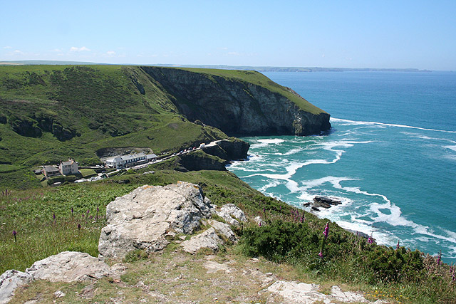
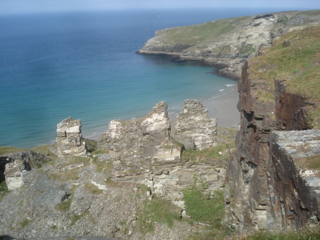
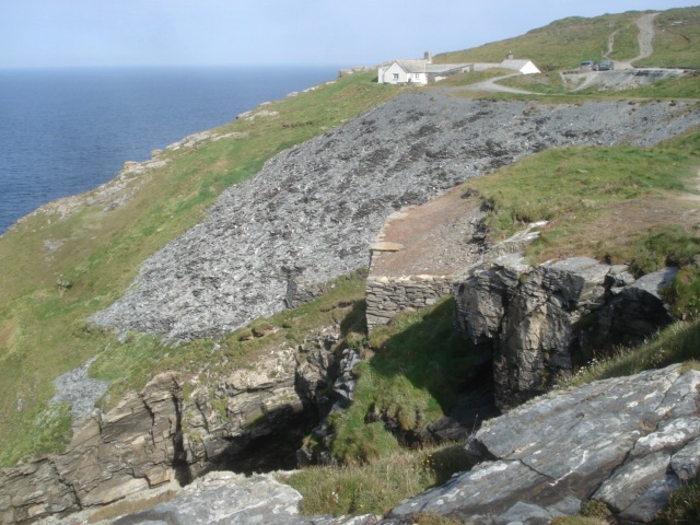
Backways Cove is a picturesque coastal area located in Cornwall, England. Nestled between towering cliffs and verdant hillsides, it is renowned for its stunning natural beauty and tranquil atmosphere. The cove is situated on the southern coast of Cornwall, providing visitors with breathtaking views of the vast Atlantic Ocean.

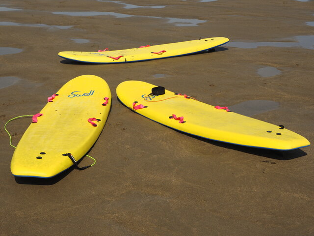
One of the defining features of Backways Cove is its pristine sea. The azure waters are clear and inviting, making it a popular spot for swimming and water sports enthusiasts. The cove is also a haven for wildlife, with various species of fish, seals, and seabirds calling it home.

An estuary can be found at the mouth of the cove, offering a unique blend of freshwater and saltwater. This brackish environment provides an ideal habitat for a diverse range of flora and fauna, including marine plants and wading birds. The estuary is a peaceful spot for nature lovers to observe the delicate balance of coastal ecosystems.

A meandering creek cuts through the cove, adding to its charm and allure. This narrow waterway is flanked by lush greenery, creating a serene and idyllic setting. Exploring the creek by kayak or paddleboard is a popular activity, allowing visitors to immerse themselves in the tranquility of the surrounding nature.

Backways Cove is a sanctuary away from the hustle and bustle of city life, offering a peaceful retreat for those seeking solace amidst nature's beauty. Whether it is basking in the sun on the sandy beach, exploring the estuary's unique ecosystem, or simply enjoying a leisurely stroll along the creek, this coastal gem is a must-visit destination for anyone seeking a true Cornish experience.

If you have any feedback on the listing, please let us know in the comments section below.

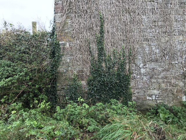
Backways Cove Images

Images are sourced within 2km of 50.641214/-4.7680404 or Grid Reference SX0486. Thanks to Geograph Open Source API. All images are credited.

Cut Benchmark Trebarwith Farm Outbuilding CUT BENCHMARK OUTBLDG TREBARWITH FM 0.1M N ANG NW FACE SE SIDE RD Over Datum Newlyn: 105.998m - Above ground Level 0.8m - Last verified 1974
<span class="nowrap"><a title="https://www.bench-marks.org.uk/bm157313" rel="nofollow ugc noopener" href="https://www.bench-marks.org.uk/bm157313">Link</a><img style="margin-left:2px;" alt="External link" title="External link - shift click to open in new window" src="https://s1.geograph.org.uk/img/external.png" width="10" height="10"/></span>
Cut Benchmark Trebarwith Farm Outbuilding
CUT BENCHMARK OUTBLDG TREBARWITH FM 0.1M N ANG NW FACE SE SIDE RD Over Datum Newlyn: 105.998m - Above ground Level 0.8m - Last verified 1974 LinkExternal link
Benchmark Trebarwith Farm CUT BENCHMARK OUTBLDG TREBARWITH FM 0.1M N ANG NW FACE SE SIDE RD Over Datum Newlyn = 105.998m - Last verified 1974 - Above Ground Level 0.8m
<span class="nowrap"><a title="https://www.bench-marks.org.uk/bm157313" rel="nofollow ugc noopener" href="https://www.bench-marks.org.uk/bm157313">Link</a><img style="margin-left:2px;" alt="External link" title="External link - shift click to open in new window" src="https://s1.geograph.org.uk/img/external.png" width="10" height="10"/></span>
Benchmark Trebarwith Farm
CUT BENCHMARK OUTBLDG TREBARWITH FM 0.1M N ANG NW FACE SE SIDE RD Over Datum Newlyn = 105.998m - Last verified 1974 - Above Ground Level 0.8m LinkExternal link
Mussel Mountains I don't think I've ever seen so many mussels in such a small area before.
Mussel Mountains
I don't think I've ever seen so many mussels in such a small area before.
Surfboards on the Beach There was no sign of their owners... but worthy of a photo though.
Surfboards on the Beach
There was no sign of their owners... but worthy of a photo though.
Tintagel: Surf Shop at Trebarwith Strand By the coast path to Tintagel village
Tintagel: Surf Shop at Trebarwith Strand
By the coast path to Tintagel village
Tintagel: The Strand Cafe at Trebarwith Strand Would appear to be run by the owners of the adjoining Surf Shop, out of shot to the right. In Tintagel parish
Tintagel: The Strand Cafe at Trebarwith Strand
Would appear to be run by the owners of the adjoining Surf Shop, out of shot to the right. In Tintagel parish
Tintagel: above Trebarwith Strand The road to the strand is hidden in the valley. Seen from the coast path to Tintagel village
Tintagel: above Trebarwith Strand
The road to the strand is hidden in the valley. Seen from the coast path to Tintagel village
Tintagel: above Trebarwith Strand Gull Rock can be seen offshore, beyond the square. Dennis Point to the left of it. Tide is out at Trebarwith Strand. In Tintagel parish, seen from the coast path
Tintagel: above Trebarwith Strand
Gull Rock can be seen offshore, beyond the square. Dennis Point to the left of it. Tide is out at Trebarwith Strand. In Tintagel parish, seen from the coast path
Tintagel: towards the Port William Seen from the coast path from Tintagel village. The Port William is the inn in the distance, overlooking Trebarwith Strand. In Tintagel parish
Tintagel: towards the Port William
Seen from the coast path from Tintagel village. The Port William is the inn in the distance, overlooking Trebarwith Strand. In Tintagel parish
Tintagel: South West Coast Path near Trebarwith Strand With Gull Rock in the distance. Low tide at Trebarwith Strand and the beach is deceptively near. In fact there is a significant drop to it from this location. In Tintagel parish
Tintagel: South West Coast Path near Trebarwith Strand
With Gull Rock in the distance. Low tide at Trebarwith Strand and the beach is deceptively near. In fact there is a significant drop to it from this location. In Tintagel parish
North Cornwall : The B3263 The B3263 between Camelford and Tintagel.
North Cornwall : The B3263
The B3263 between Camelford and Tintagel.
Treknow : Trelake Lane Looking up Trelake Lane which heads towards Trewarmett.
Treknow : Trelake Lane
Looking up Trelake Lane which heads towards Trewarmett.
North Cornwall : The Mill House Inn The Mill House is situated on the North coast of Cornwall between the fishing villages of Port Isaac and Boscastle.
North Cornwall : The Mill House Inn
The Mill House is situated on the North coast of Cornwall between the fishing villages of Port Isaac and Boscastle.
Markers Shelter on former bombing/firing range A reinforced concrete shelter used by naval personnel serving at HMS Vulture II for servicing targets and assessing the accuracy of aircraft firing on the air to ground weapons range located on the nearby cliff tops.  The range was in service from 1939 until the mid 1950's and was used by aircraft of the Fleet Air Arm and latterly the RAF.  Aircraft would have fired guns, rockets and dropped practice bombs from the landside in the direction of the sea.  There were three grass landing strips for use in the event of emergency landings
Markers Shelter on former bombing/firing range
A reinforced concrete shelter used by naval personnel serving at HMS Vulture II for servicing targets and assessing the accuracy of aircraft firing on the air to ground weapons range located on the nearby cliff tops. The range was in service from 1939 until the mid 1950's and was used by aircraft of the Fleet Air Arm and latterly the RAF. Aircraft would have fired guns, rockets and dropped practice bombs from the landside in the direction of the sea. There were three grass landing strips for use in the event of emergency landings
Track, Trebarwith Strand I read somewhere this is a man made track.
Track, Trebarwith Strand
I read somewhere this is a man made track.
Out to Sea, Trebarwith Strand
Gull Rock from Trebarwith Strand
Car park for Trebarwith Strand
Show me another place!

Backways Cove is located at Grid Ref: SX0486 (Lat: 50.641214, Lng: -4.7680404)

Unitary Authority: Cornwall

Police Authority: Devon and Cornwall

What 3 Words

///worth.assembles.curl. Near Tintagel, Cornwall

Related Wikis

Trebarwith Strand

Trebarwith Strand (Cornish: Trebervedh Sian; locally sometimes shortened to The Strand) is a section of coastline located near the coastal settlement of...

West Quarry

West Quarry is a disused open cast slate quarry between Tintagel and Trebarwith on the north coast of Cornwall, South West England. The quarry ceased operations...

Lanterdan Quarry

Lanterdan Quarry is a disused open cast slate quarry between Tintagel and Trebarwith on the north coast of Cornwall, South West England. The quarry is...

HMS Vulture II (Treligga Aerodrome)

HMS Vulture II was an aerial bombing and gunnery range at Treligga, 2 km west of Delabole, Cornwall, England, United Kingdom (SX 047 848). The station...

Bagalow Quarry

Bagalow Quarry is a disused slate quarry between Tintagel and Trebarwith at Bagalow Cove on the north coast of Cornwall, South West England. The quarry...

Penhallick Wharf

Penhallick Wharf is a disused coastal loading dock between Tintagel Castle and Trebarwith Strand on the north coast of Cornwall in South West England....

Treknow

Treknow () is a small village in Tintagel civil parish, Cornwall, England, United Kingdom: it is the second largest settlement, and is located between...

Lambshouse and Gull Point Quarry

Lambshouse and Gull Point Quarries are two disused slate quarries between Tintagel and Trebarwith at Lambshouse Cove on the north coast of Cornwall, South...

Nearby Amenities

Located within 500m of 50.641214,-4.7680404
Source: PGS
Lat/Long: 50.6440209/-4.7632508
Source: PGS
Lat/Long: 50.6438042/-4.7635921
Source: PGS
Lat/Long: 50.643312/-4.766479
Source: PGS
Lat/Long: 50.6427766/-4.7673559
Source: PGS
Lat/Long: 50.6425202/-4.7675526
Source: PGS
Lat/Long: 50.6415757/-4.767697
Source: PGS
Lat/Long: 50.6402684/-4.7658756
Source: PGS
Lat/Long: 50.6401204/-4.7672026
Source: PGS
Lat/Long: 50.6395099/-4.7676292
Source: PGS
Lat/Long: 50.6393405/-4.7677893
Source: PGS
Lat/Long: 50.6381254/-4.768079
Source: PGS
Lat/Long: 50.6376357/-4.7679494
Source: PGS
Lat/Long: 50.6372296/-4.7678068
Source: PGS
Lat/Long: 50.6369239/-4.7676008
Backways Cove
Natural: bay
Source: OD Streetview
Lat/Long: 50.6404669/-4.7691948
Natural: cave_entrance
Lat/Long: 50.6427235/-4.764271
The data included in this document is from www.openstreetmap.org. The data is made available under ODbL.

Have you been to Backways Cove?

Leave your review of Backways Cove below (or comments, questions and feedback).