Port an Alltain Duibh

Sea, Estuary, Creek in Cromartyshire

Scotland

Port an Alltain Duibh

Sunset at Old Dornie Old Dornie is a small harbour for pleasure craft to the north of Polbain near the Summer Isles in north west Scotland. Taken on film during the summer of 1977 on a wonderful holiday opposite the Summer Isles.
Sunset at Old Dornie Credit: Malcolm Neal

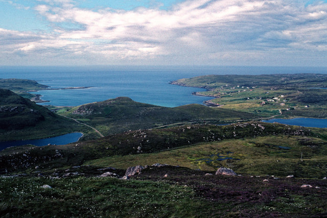
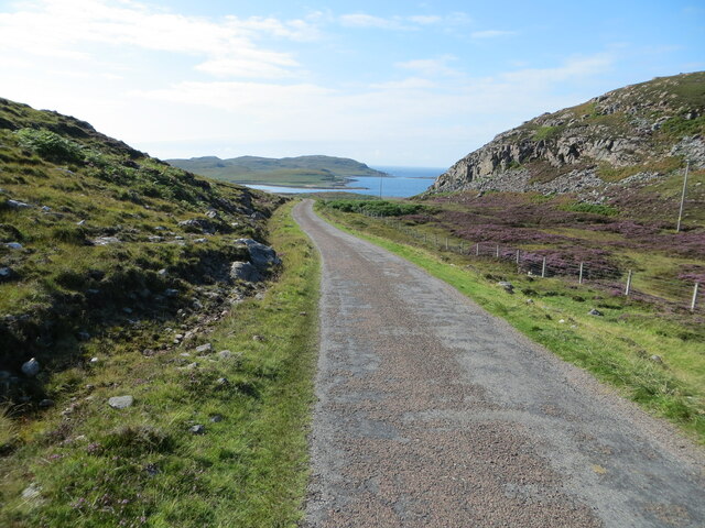
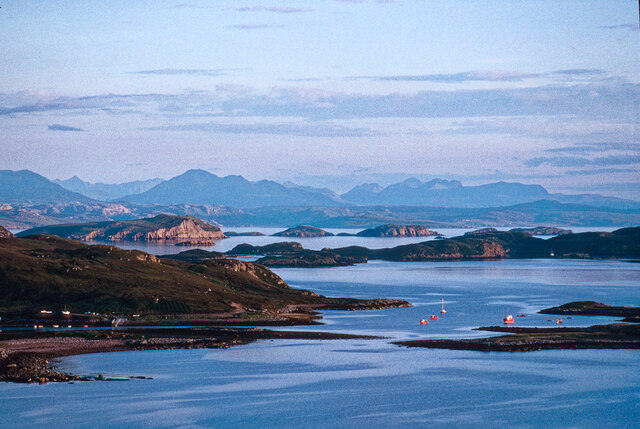
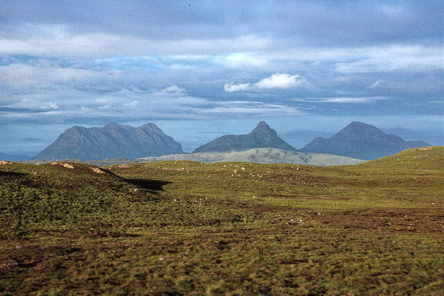
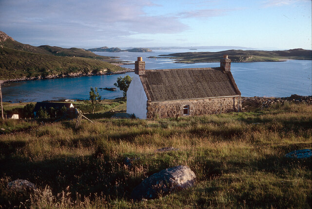
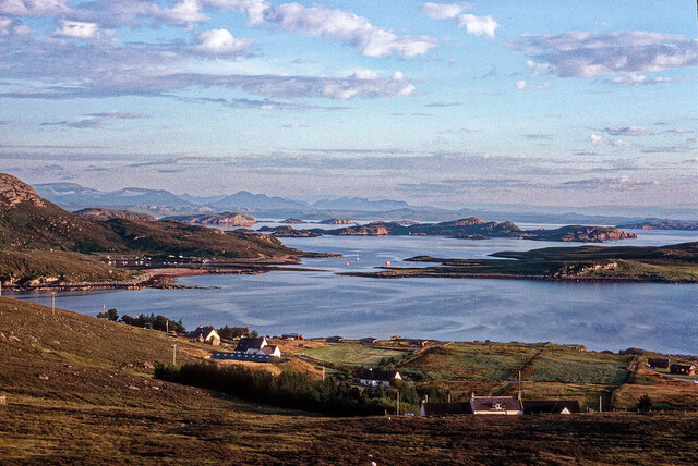
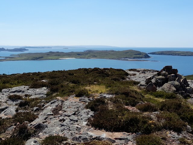
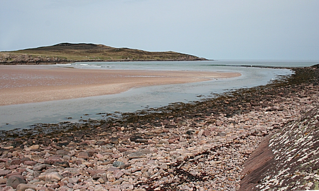
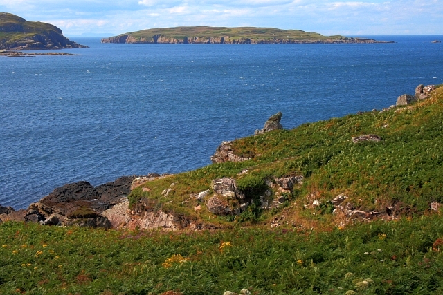
Port an Alltain Duibh, located in Cromartyshire, is a picturesque coastal area encompassing a sea, estuary, and creek. Situated on the eastern coast of Scotland, it is renowned for its stunning natural beauty and abundant marine life.

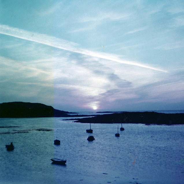
The sea at Port an Alltain Duibh is part of the North Sea, offering breathtaking views of the open waters. The sea is characterized by its deep blue color and its occasional rough waves, making it a popular spot for water sports enthusiasts and sailors seeking a thrilling adventure. The area is also home to a diverse range of marine species, including seals, dolphins, and various types of fish, making it a prime location for wildlife enthusiasts and eco-tourists.

The estuary at Port an Alltain Duibh is formed by the convergence of a river and the sea, creating a unique habitat for both marine and freshwater species. The estuary's calm waters and rich nutrients support a thriving ecosystem, attracting a wide variety of bird species such as herons, gulls, and waders. This makes it a popular destination for birdwatchers who come to observe the avian residents and migratory birds that visit the area.

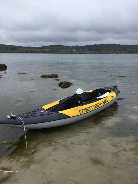
The creek at Port an Alltain Duibh provides a tranquil and sheltered area for smaller boats and fishing vessels. Its calm waters and secluded location make it an ideal spot for recreational fishing, allowing anglers to catch a variety of fish species such as mackerel, cod, and haddock.

Overall, Port an Alltain Duibh in Cromartyshire offers a unique blend of natural beauty, diverse marine life, and recreational opportunities, making it a must-visit destination for nature enthusiasts and those seeking a peaceful coastal experience.

If you have any feedback on the listing, please let us know in the comments section below.

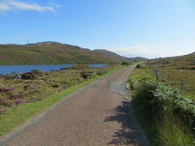
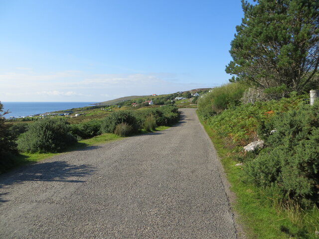
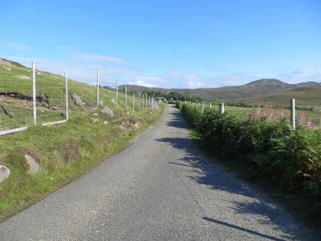
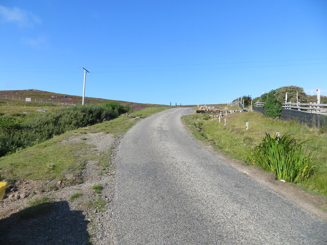
Port an Alltain Duibh Images

Images are sourced within 2km of 58.054621/-5.4179065 or Grid Reference NB9812. Thanks to Geograph Open Source API. All images are credited.

Sunset at Old Dornie Old Dornie is a small harbour for pleasure craft to the north of Polbain near the Summer Isles in north west Scotland. Taken on film during the summer of 1977 on a wonderful holiday opposite the Summer Isles.
Sunset at Old Dornie
Old Dornie is a small harbour for pleasure craft to the north of Polbain near the Summer Isles in north west Scotland. Taken on film during the summer of 1977 on a wonderful holiday opposite the Summer Isles.
View from Meall an Fheadain towards Altandhu A brief walk on a slightly uncertain day for weather.
View from Meall an Fheadain towards Altandhu
A brief walk on a slightly uncertain day for weather.
Polbain Radio Station Mast
Isle Ristol, Summer Isles The view, from the beach on Ristol, looking north towards the mainland settlement of Altandhu. This paddle trip was started at the nearby jetty at Old Dorney Bay.
Isle Ristol, Summer Isles
The view, from the beach on Ristol, looking north towards the mainland settlement of Altandhu. This paddle trip was started at the nearby jetty at Old Dorney Bay.
Minor road near to Old Dornie Looking westward.
Minor road near to Old Dornie
Looking westward.
Minor road beside Loch Camas an Fhèith Looking southward. The distant masted hill is Meall an Fheadain
Minor road beside Loch Camas an Fhèith
Looking southward. The distant masted hill is Meall an Fheadain
Minor road approaching Altandhu Looking north-westward.
Minor road approaching Altandhu
Looking north-westward.
Fence enclosed minor road at Altandhu Looking south-eastward.
Fence enclosed minor road at Altandhu
Looking south-eastward.
Minor road climbing up and away from Altandhu Looking north-eastward.
Minor road climbing up and away from Altandhu
Looking north-eastward.
View to the Summer Isles from Altandhu A telephoto view from the hills above the village.
View to the Summer Isles from Altandhu
A telephoto view from the hills above the village.
Stac Pollaidh, Cùl Mòr and Cùl Beag from Altandhu Inspiring hills behind drab moorland. Stac Pollaidh lies in the middle.
Stac Pollaidh, Cùl Mòr and Cùl Beag from Altandhu
Inspiring hills behind drab moorland. Stac Pollaidh lies in the middle.
Path to Hill House, Altandhu Subsequently a road/track has been bulldozed to the house from the west.  In 2002 only a footpath served the house.
Path to Hill House, Altandhu
Subsequently a road/track has been bulldozed to the house from the west. In 2002 only a footpath served the house.
Hill House, Altandhu The cottage has a great view over the Summer Isles. In 2002 it was available to rent as a holiday home.
Hill House, Altandhu
The cottage has a great view over the Summer Isles. In 2002 it was available to rent as a holiday home.
Hills of the North - from Altandhu This is a stitch of three images and is available to download at full size in "more sizes". Suilven at the left - then Cùl Mòr, then Stac Pollaidh and Cùl Beag.
Hills of the North - from Altandhu
This is a stitch of three images and is available to download at full size in "more sizes". Suilven at the left - then Cùl Mòr, then Stac Pollaidh and Cùl Beag.
View over Altandhu towards the Summer Isles A great viewpoint to scan the Summer Isles over Isle Ristol.
View over Altandhu towards the Summer Isles
A great viewpoint to scan the Summer Isles over Isle Ristol.
On Cnoc Altandhu An easy TumP with excellent views over the Summer Isles.
On Cnoc Altandhu
An easy TumP with excellent views over the Summer Isles.
Postbox at Altandhu IV26 208. Royal Mail list this box as 'Altandhu'.
Postbox at Altandhu
IV26 208. Royal Mail list this box as 'Altandhu'.
Dornie and Meall Dearg Dornie is the hamlet and Meall Dearg the 163m hill behind to the left.
Dornie and Meall Dearg
Dornie is the hamlet and Meall Dearg the 163m hill behind to the left.
Show me another place!

Port an Alltain Duibh is located at Grid Ref: NB9812 (Lat: 58.054621, Lng: -5.4179065)

Unitary Authority: Highland

Police Authority: Highlands and Islands

What 3 Words

///grounded.amuses.whirlwind. Near Clachtoll, Highland

Related Wikis

Altandhu

Altandhu is a small hamlet, overlooking the sea loch, Loch an Alltain Duibh to the west, on the western shore of the Rubha Mor Peninsula, in the Achiltibuie...

Isle Ristol

Isle Ristol, the innermost of the Summer Isles in Scotland, is a Scottish Wildlife Trust Reserve. Lying roughly 12 miles (19 kilometres) north of Ullapool...

Blairbuie

Blairbuie is a hamlet in Coigach, Scotland. It has just 6 houses and a sheep shed. When driving past the junction which connects Blairbuie to the rest...

Reiff, Ross-shire

Reiff is a small remote coastal crofting and fishing village, situated on Reiff Bay on the Ruhba Mòr peninsula, in western Ross-shire, Scottish Highlands...

Achnahaird

Ahnahaird (Scottish Gaelic: Achadh na h-Àirde) is a small settlement on Achnahaird Bay in Ross and Cromarty, in the Scottish council area of Highland....

Eilean Mullagrach

Eilean Mullagrach is an island in the Summer Isles of Scotland. It is located in Highland council area, in the northwestern part of the country, 800 km...

Brae of Achnahaird

Brae of Achnahaird (Achadh na h-Àirde) is a small settlement at the head of Achnahaird Bay in Achiltibuie, Ullapool in Ross-shire, Scottish Highlands and...

Summer Isles

The Summer Isles (Scottish Gaelic: Na h-Eileanan Samhraidh, pronounced [nə ˈhelanən ˈs̪ãũɾɪ] ) are an archipelago lying in the mouth of Loch Broom, in...

Nearby Amenities

Located within 500m of 58.054621,-5.4179065
Source: PGS
Lat/Long: 58.0574031/-5.4243417
Source: PGS
Lat/Long: 58.05709/-5.4243806
Source: PGS
Lat/Long: 58.05675/-5.4241381
Source: PGS
Lat/Long: 58.0563472/-5.4243237
Source: PGS
Lat/Long: 58.0559731/-5.4239371
Source: PGS
Lat/Long: 58.0558752/-5.4232645
Source: PGS
Lat/Long: 58.055645/-5.4231962
Source: PGS
Lat/Long: 58.0556883/-5.4229764
Created By: almien_coastlines
Source: PGS
Lat/Long: 58.055324/-5.417179
Bus Stop
Altandhu
Naptan AtcoCode: 6700712343
Naptan Bearing: SE
Naptan CommonName: Altandhu
Naptan Indicator: o/s Smokehouse
Naptan Landmark: Smokehouse
Naptan NaptanCode: 45327675
Naptan Street: Reiff Road
Naptan Verified: no
Source: naptan_import
Lat/Long: 58.0564565/-5.4184444
Altandhu
Name En: Altandhu
Name Gd: Alltan Dubh
Place: village
Wikidata: Q1891039
Wikipedia: en:Altandhu
Lat/Long: 58.0560856/-5.4151039
Passing Place
Lat/Long: 58.05535/-5.4160274
Passing Place
Lat/Long: 58.0557908/-5.4172124
Turning Circle
Lat/Long: 58.0572545/-5.4222145
Post Box
Post Box Type: wall
Ref: IV26 208
Royal Cypher: GR
Royal Cypher Wikidata: Q33102273
Source: survey
Lat/Long: 58.0565996/-5.4186658
Telephone
Booth: K6
Covered: booth
Source: survey
Lat/Long: 58.0565453/-5.4185945
Barrier: cattle_grid
Source: survey
Lat/Long: 58.0540569/-5.4098934
Place: farm
Lat/Long: 58.0579662/-5.4186561
Power: pole
Lat/Long: 58.0563051/-5.4175311
Power: pole
Lat/Long: 58.0566116/-5.416359
Power: pole
Lat/Long: 58.0585174/-5.4214847
Power: pole
Lat/Long: 58.0585345/-5.4202509
Power: pole
Lat/Long: 58.0585586/-5.4189608
Power: pole
Lat/Long: 58.0585714/-5.4180086
Power: pole
Lat/Long: 58.0580179/-5.4172227
Power: pole
Lat/Long: 58.0574404/-5.4164395
Power: pole
Lat/Long: 58.0568131/-5.4155839
Power: pole
Lat/Long: 58.0563789/-5.4149482
Power: pole
Lat/Long: 58.056176/-5.4139182
Power: pole
Lat/Long: 58.0560596/-5.4132181
Power: pole
Lat/Long: 58.0559319/-5.412443
Power: pole
Lat/Long: 58.0557261/-5.4113406
Power: pole
Lat/Long: 58.0554238/-5.4101443
Port an Alltain Duibh
Natural: bay
Lat/Long: 58.0546412/-5.4187325
Camas an Fhèidh
Natural: bay
Lat/Long: 58.0514962/-5.4152135
Passing Place
Lat/Long: 58.0548065/-5.4129091
The data included in this document is from www.openstreetmap.org. The data is made available under ODbL.

Have you been to Port an Alltain Duibh?

Leave your review of Port an Alltain Duibh below (or comments, questions and feedback).