Burn Foot

Sea, Estuary, Creek in Wigtownshire

Scotland

Burn Foot

Cattle feed lot near Castle Ban At the end of the road from Mains of Aries; 33 metres from the rocky west coast.
Cattle feed lot near Castle Ban Credit: M J Richardson

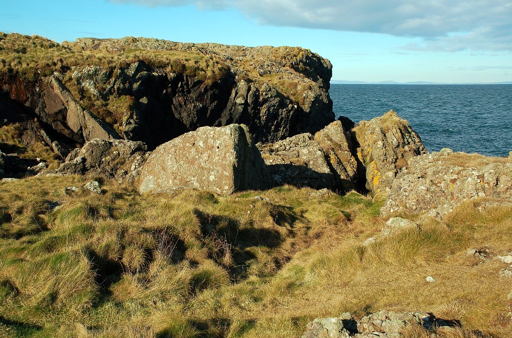
Burn Foot is a small coastal village located in Wigtownshire, in the southwest of Scotland. Situated on the eastern shore of Luce Bay, it is known for its picturesque sea views, estuary, and creek. The village is surrounded by rolling hills and lush greenery, providing a tranquil and idyllic setting for residents and visitors alike.

The main attraction of Burn Foot is its beautiful sandy beach, which stretches for several kilometers along the coast. The beach is a popular spot for sunbathing, picnicking, and leisurely walks, especially during the summer months when the weather is mild. The clear blue waters of the bay also offer opportunities for swimming and other water activities.

The village is blessed with a stunning estuary, where the River Bladnoch meets the sea. This estuary not only adds to the natural beauty of Burn Foot but also provides a habitat for various species of birds, making it a popular spot for birdwatching. The estuary is also a haven for fishing enthusiasts, who can try their luck at catching salmon and sea trout.

In addition to the estuary, Burn Foot boasts a small creek that flows through the village. This creek serves as a natural boundary and adds to the charm of the area. It is a favorite spot for locals and visitors to relax and enjoy the peaceful surroundings.

Overall, Burn Foot is a delightful coastal village that offers visitors the perfect blend of natural beauty, tranquility, and recreational activities. Whether one is seeking a peaceful beach getaway or an opportunity to explore the estuary and creek, Burn Foot has something to offer for everyone.

If you have any feedback on the listing, please let us know in the comments section below.

Burn Foot Images

Images are sourced within 2km of 54.970965/-5.1788407 or Grid Reference NW9668. Thanks to Geograph Open Source API. All images are credited.

Cattle feed lot near Castle Ban At the end of the road from Mains of Aries; 33 metres from the rocky west coast.
Cattle feed lot near Castle Ban
At the end of the road from Mains of Aries; 33 metres from the rocky west coast.
Grassland and Gorse at Mains of Aries The rock over which the sea is breaking is the Ebbstone or Craig Laggan <a href="https://www.geograph.org.uk/photo/7418717">NW9569 : Craig Laggan or the Ebbstone</a>.
Grassland and Gorse at Mains of Aries
The rock over which the sea is breaking is the Ebbstone or Craig Laggan NW9569 : Craig Laggan or the Ebbstone.
Craig Laggan or the Ebbstone An emergent rock, the remains of a sea stack, 1.85 km away from the viewpoint.
Craig Laggan or the Ebbstone
An emergent rock, the remains of a sea stack, 1.85 km away from the viewpoint.
Pillar at Mains of Airies A strange structure by the edge of the track west of the farm. It is not mentioned on Canmore, but there is a Medieval Motte nearby. In the field beyond is a smartly constructed watering place for cattle. Beyond that is Orbain Hill.
Pillar at Mains of Airies
A strange structure by the edge of the track west of the farm. It is not mentioned on Canmore, but there is a Medieval Motte nearby. In the field beyond is a smartly constructed watering place for cattle. Beyond that is Orbain Hill.
Pastures at Mains of Airies Extensive grass fields on the flanks of Lingloskin Hill, with a  brick-built watering trough serving both sides of the fence.
Pastures at Mains of Airies
Extensive grass fields on the flanks of Lingloskin Hill, with a brick-built watering trough serving both sides of the fence.
North Cairn Farm Kirkcolm The view of North Cairn farmhouse, over the hill behind are views of the Northern Ireland coastline.
North Cairn Farm Kirkcolm
The view of North Cairn farmhouse, over the hill behind are views of the Northern Ireland coastline.
North Cairn Farm, The Rhins
Shoreline Grazing at Port Gavillan The cattle had access to the shoreline at the end of the farm track.  Some were grazing on the grass, but others were out among the Genoch Rocks.
Shoreline Grazing at Port Gavillan
The cattle had access to the shoreline at the end of the farm track. Some were grazing on the grass, but others were out among the Genoch Rocks.
Genoch Rocks at Low Tide Viewed on a fine February afternoon with the tide well out. Cattle were grazing on the shoreline grass, with some seen out on the rocks.
Genoch Rocks at Low Tide
Viewed on a fine February afternoon with the tide well out. Cattle were grazing on the shoreline grass, with some seen out on the rocks.
War-Time Radar Station at North Cairn The shoreline here has a number of war-time buildings, belonging to the North Cairn "Chain Home" radar station.  "Chain Home" was the code name for the ring of radar stations which protected Britain during the Second World War.  This photo shows one of the power houses, which is still largely intact.  To see the station at Saligo Bay, on Islay, see <a href="https://www.geograph.org.uk/photo/15341">NR2166 : Former WW2 Bunker</a>.
War-Time Radar Station at North Cairn
The shoreline here has a number of war-time buildings, belonging to the North Cairn "Chain Home" radar station. "Chain Home" was the code name for the ring of radar stations which protected Britain during the Second World War. This photo shows one of the power houses, which is still largely intact. To see the station at Saligo Bay, on Islay, see NR2166 : Former WW2 Bunker.
Sand Ripples Ripples in the sand, left by the receding tide between the land and the Genoch Rocks.
Sand Ripples
Ripples in the sand, left by the receding tide between the land and the Genoch Rocks.
North Cairn The house at North Cairn is adandoned and the outbuildings are becoming derelict.
North Cairn
The house at North Cairn is adandoned and the outbuildings are becoming derelict.
North Cairn farm This farmhouse stands in a fantastic position with views over the North Channel.  Sadly it has been empty for many years and both the house and the buildings are falling into ruins.
North Cairn farm
This farmhouse stands in a fantastic position with views over the North Channel. Sadly it has been empty for many years and both the house and the buildings are falling into ruins.
North Cairn Cottage
North Cairn Cottage
Dounan Bay and Dally Bay This interesting coastline doesn't seem to get many visitors. On the top left sea skyline is the Ebbstone. This rock is just in NW9569 and photographing it should provide quite a challenge.
Dounan Bay and Dally Bay
This interesting coastline doesn't seem to get many visitors. On the top left sea skyline is the Ebbstone. This rock is just in NW9569 and photographing it should provide quite a challenge.
Carrick Fundle This coastal view is heading towards Salt Pan Bay and can be approached via Mains of Airies.
Carrick Fundle
This coastal view is heading towards Salt Pan Bay and can be approached via Mains of Airies.
Craig Laggan Looking over Dounan Bay to Craig Laggan, or the Ebbstone.
Craig Laggan
Looking over Dounan Bay to Craig Laggan, or the Ebbstone.
Ebbstone/Craig Laggan Prominent rock off the North Rhinns of Galloway Coastline. Corsewall lighthouse is in the background.
Ebbstone/Craig Laggan
Prominent rock off the North Rhinns of Galloway Coastline. Corsewall lighthouse is in the background.
Show me another place!

Burn Foot is located at Grid Ref: NW9668 (Lat: 54.970965, Lng: -5.1788407)

Unitary Authority: Dumfries and Galloway

Police Authority: Dumfries and Galloway

What 3 Words

///magically.wriggle.greyhound. Near Cairnryan, Dumfries & Galloway

Related Wikis

Ervie

Ervie is a small village in Dumfries and Galloway, Scotland, in the Rhins of Galloway, just outside Stranraer.

Corsewall Point

Corsewall Point, or Corsill Point, is a headland at the northern end of the Rhins of Galloway in Scotland. A lighthouse, Corsewall Lighthouse, was placed...

Galdenoch Castle

Galdenoch Castle is a tower house near the Scottish village of Leswalt in the Council Area Dumfries and Galloway . The ruin is listed as a Scheduled Monument...

Kirkcolm

Kirkcolm is a village and civil parish on the northern tip of the Rhinns of Galloway peninsula, south-west Scotland. It is in Dumfries and Galloway, and...

Nearby Amenities

Located within 500m of 54.970965,-5.1788407
Created By: dmgroom_coastlines
Source: PGS
Lat/Long: 54.974154/-5.184268
Created By: dmgroom_coastlines
Source: PGS
Lat/Long: 54.974162/-5.183823
Created By: dmgroom_coastlines
Source: PGS
Lat/Long: 54.974039/-5.183595
Created By: dmgroom_coastlines
Source: PGS
Lat/Long: 54.973535/-5.183122
Created By: dmgroom_coastlines
Source: PGS
Lat/Long: 54.973031/-5.182649
Created By: dmgroom_coastlines
Source: PGS
Lat/Long: 54.972907/-5.182419
Created By: dmgroom_coastlines
Source: PGS
Lat/Long: 54.972787/-5.181967
Created By: dmgroom_coastlines
Source: PGS
Lat/Long: 54.973555/-5.182009
Created By: dmgroom_coastlines
Source: PGS
Lat/Long: 54.973442/-5.181112
Created By: dmgroom_coastlines
Source: PGS
Lat/Long: 54.973319/-5.180884
Created By: dmgroom_coastlines
Source: PGS
Lat/Long: 54.972811/-5.180633
Created By: dmgroom_coastlines
Source: PGS
Lat/Long: 54.972851/-5.178408
Created By: dmgroom_coastlines
Source: PGS
Lat/Long: 54.972591/-5.178617
Created By: dmgroom_coastlines
Source: PGS
Lat/Long: 54.972335/-5.178604
Created By: dmgroom_coastlines
Source: PGS
Lat/Long: 54.972211/-5.178373
Created By: dmgroom_coastlines
Source: PGS
Lat/Long: 54.972087/-5.178145
Created By: dmgroom_coastlines
Source: PGS
Lat/Long: 54.971579/-5.177894
Created By: dmgroom_coastlines
Source: PGS
Lat/Long: 54.971563/-5.178784
Created By: dmgroom_coastlines
Source: PGS
Lat/Long: 54.971055/-5.178534
Created By: dmgroom_coastlines
Source: PGS
Lat/Long: 54.970799/-5.17852
Created By: dmgroom_coastlines
Source: PGS
Lat/Long: 54.970536/-5.178952
Created By: dmgroom_coastlines
Source: PGS
Lat/Long: 54.970272/-5.179382
Created By: dmgroom_coastlines
Source: PGS
Lat/Long: 54.970016/-5.179369
Created By: dmgroom_coastlines
Source: PGS
Lat/Long: 54.969/-5.178868
Created By: dmgroom_coastlines
Source: PGS
Lat/Long: 54.968496/-5.178396
Created By: dmgroom_coastlines
Source: PGS
Lat/Long: 54.967988/-5.178145
Created By: dmgroom_coastlines
Source: PGS
Lat/Long: 54.967972/-5.179035
Created By: dmgroom_coastlines
Source: PGS
Lat/Long: 54.96772/-5.178799
Created By: dmgroom_coastlines
Source: PGS
Lat/Long: 54.967208/-5.178771
Created By: dmgroom_coastlines
Source: PGS
Lat/Long: 54.966953/-5.178757
Created By: dmgroom_coastlines
Source: PGS
Lat/Long: 54.966828/-5.178527
Created By: dmgroom_coastlines
Source: PGS
Lat/Long: 54.966705/-5.178299
Place: farm
Lat/Long: 54.9729791/-5.1723721
Power: pole
Lat/Long: 54.9738624/-5.1736587
Power: pole
Lat/Long: 54.9738274/-5.1749617
Power: pole
Lat/Long: 54.9737775/-5.1763608
Power: pole
Lat/Long: 54.9737452/-5.1775769
Power: pole
Lat/Long: 54.9737088/-5.1789503
The data included in this document is from www.openstreetmap.org. The data is made available under ODbL.

Have you been to Burn Foot?

Leave your review of Burn Foot below (or comments, questions and feedback).