Eastern Cove

Sea, Estuary, Creek in Cornwall

England

Eastern Cove

Nare Point, Lizard At centre L there is a building erected by the MoD in 1952 as an observation post for trials of air-launched torpedoes.  
It has recently been adopted by National Coastwatch as part of their voluntary cover of coastal waters.
Nare Point, Lizard Credit: Rabbi WP Thinrod

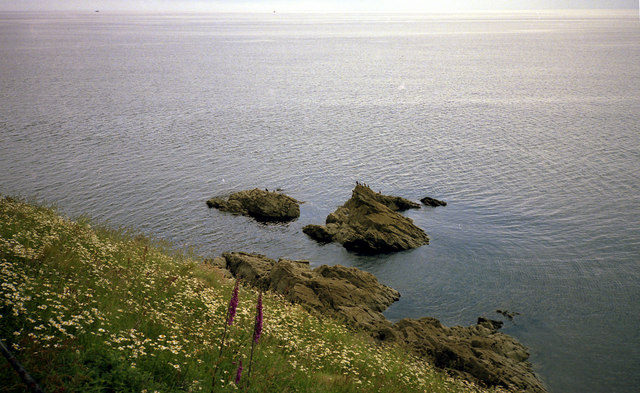
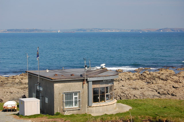
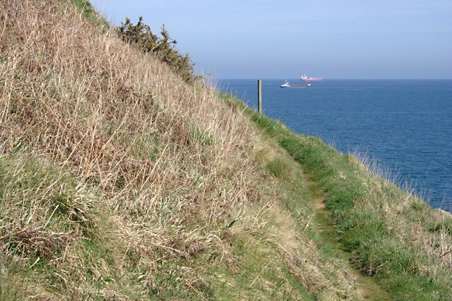
Eastern Cove is a picturesque and tranquil inlet located in Cornwall, England. This cove is surrounded by lush green hills and cliffs on either side, creating a secluded and peaceful atmosphere. The cove opens up to the vast expanse of the sea, offering stunning views of the water stretching out to the horizon.

The calm waters of Eastern Cove are perfect for swimming, kayaking, and paddleboarding. The clear blue waters are teeming with marine life, making it a popular spot for snorkeling and diving. The cove is also home to a variety of bird species, making it a great destination for birdwatching enthusiasts.

At low tide, the estuary and creek that run through Eastern Cove are revealed, providing a unique opportunity to explore the diverse ecosystem of the area. The sandy beaches along the shoreline are ideal for picnicking and sunbathing, while the rocky outcrops offer a perfect spot for fishing.

Overall, Eastern Cove is a hidden gem in Cornwall, offering a peaceful retreat for nature lovers and outdoor enthusiasts alike. Its stunning beauty and diverse wildlife make it a must-visit destination for anyone exploring the southwest coast of England.

If you have any feedback on the listing, please let us know in the comments section below.

Eastern Cove Images

Images are sourced within 2km of 50.086097/-5.0937325 or Grid Reference SW7825. Thanks to Geograph Open Source API. All images are credited.

Nare Point, Lizard At centre L there is a building erected by the MoD in 1952 as an observation post for trials of air-launched torpedoes.  
It has recently been adopted by National Coastwatch as part of their voluntary cover of coastal waters.
Nare Point, Lizard
At centre L there is a building erected by the MoD in 1952 as an observation post for trials of air-launched torpedoes. It has recently been adopted by National Coastwatch as part of their voluntary cover of coastal waters.
Observation Post, Nare Head, Lizard This MoD Observation Post closed on 1993 after 50 years supervising the naval torpedo range and is now used as a reporting station for the National Coastwatch Institution.  <span class="nowrap"><a title="http://www.nci.org.uk" rel="nofollow ugc noopener" href="http://www.nci.org.uk">Link</a><img style="margin-left:2px;" alt="External link" title="External link - shift click to open in new window" src="https://s1.geograph.org.uk/img/external.png" width="10" height="10"/></span>
The National Trust have provided an information display at the gate and NCI observers welcome visitors and invite them to become "Friends of Nare Point".
Observation Post, Nare Head, Lizard
This MoD Observation Post closed on 1993 after 50 years supervising the naval torpedo range and is now used as a reporting station for the National Coastwatch Institution. LinkExternal link The National Trust have provided an information display at the gate and NCI observers welcome visitors and invite them to become "Friends of Nare Point".
Nare Point, Lizard Low tide will expose greater areas of rock which still present a challenge to sailors approaching the Helford River in fog.
Nare Point, Lizard
Low tide will expose greater areas of rock which still present a challenge to sailors approaching the Helford River in fog.
Nare Point  Cliff Above this low cliff, to landward, is the former MOD Observation Post now operated by the National Coastwatch Institute.  <span class="nowrap"><a title="http://nci.org.uk" rel="nofollow ugc noopener" href="http://nci.org.uk">Link</a><img style="margin-left:2px;" alt="External link" title="External link - shift click to open in new window" src="https://s1.geograph.org.uk/img/external.png" width="10" height="10"/></span>
Nare Point Cliff
Above this low cliff, to landward, is the former MOD Observation Post now operated by the National Coastwatch Institute. LinkExternal link
Nare Head The Coastal Path runs across the top left of picture.  The white post marks insulated access, over an electrified fence, to the viewpoint.
Nare Head
The Coastal Path runs across the top left of picture. The white post marks insulated access, over an electrified fence, to the viewpoint.
Nare Head This view from the Coastal Footpath shows the headland and one of two viewpoints (R).
Nare Head
This view from the Coastal Footpath shows the headland and one of two viewpoints (R).
Rocks near Porthoustock
On Nare Head The coast path narrows as it hugs the end of Nare Head.
On Nare Head
The coast path narrows as it hugs the end of Nare Head.
Observation Post, Nare Point Built originally as an MOD observation post connected with torpedo testing (and then unused for some years), this is now manned by coastwatch volunteers.
Observation Post, Nare Point
Built originally as an MOD observation post connected with torpedo testing (and then unused for some years), this is now manned by coastwatch volunteers.
Nare Point
Nare Point
Rocks below Nare Head
Rocky headland on Nare Point There is a commanding view of Falmouth Bay from this headland.  The ship in the centre of the photo is a coaster awaiting high tide to sail into Porthallow and take on board stone bound for Ostend in Belgium.
Rocky headland on Nare Point
There is a commanding view of Falmouth Bay from this headland. The ship in the centre of the photo is a coaster awaiting high tide to sail into Porthallow and take on board stone bound for Ostend in Belgium.
Rocks to the north-east of Nare Head Looking towards Nare Point.
Rocks to the north-east of Nare Head
Looking towards Nare Point.
Rounding Nare Head On the coast path around Nare Head with a view out over Falmouth Bay. This is not the only Nare Head on the south Cornwall coast. There is another bigger and more famous one to the east of Falmouth Bay at <a href="https://www.geograph.org.uk/gridref/SW9136">SW9136</a> and <a href="https://www.geograph.org.uk/gridref/SW9137">SW9137</a>.
Rounding Nare Head
On the coast path around Nare Head with a view out over Falmouth Bay. This is not the only Nare Head on the south Cornwall coast. There is another bigger and more famous one to the east of Falmouth Bay at SW9136 and SW9137.
Coast path on Nare Head Coast path on Nare Head to the north of Porthallow.
Coast path on Nare Head
Coast path on Nare Head to the north of Porthallow.
Nare Point observation point Nare Point National Coastwatch Institution observation point.
Nare Point observation point
Nare Point National Coastwatch Institution observation point.
The coast at Nare Point View south along the coast over Polnare Cove from Nare Point.
The coast at Nare Point
View south along the coast over Polnare Cove from Nare Point.
Nare Point observation point Nare Point National Coastwatch Institution observation point.
Nare Point observation point
Nare Point National Coastwatch Institution observation point.
Show me another place!

Eastern Cove is located at Grid Ref: SW7825 (Lat: 50.086097, Lng: -5.0937325)

Unitary Authority: Cornwall

Police Authority: Devon and Cornwall

What 3 Words

///consults.clinking.develops. Near Falmouth, Cornwall

Related Wikis

Gillan, Cornwall

Gillan is a hamlet in the parish of St Anthony-in-Meneage, Cornwall, England. Gillan Creek is one of the creeks of the Helford River. Gillan lies within...

St Anthony-in-Meneage

St Anthony-in-Meneage (Cornish: Lannentenin) is a coastal civil parish and village in Cornwall, England, United Kingdom. The parish is in the Meneage district...

The Gear Rout

The Gear Rout was a Cornish insurrection of 1648 following the end of the English Civil War. It involved some 500 Cornish rebels who fought on the Royalist...

SS Rock Island Bridge

Rock Island Bridge was a steam cargo ship built in 1919 by Submarine Boat Company of Newark for the United States Shipping Board (USSB) as part of the...

Nearby Amenities

Located within 500m of 50.086097,-5.0937325
Barrier: stile
Lat/Long: 50.0855404/-5.0877401
Dennis Head
Is In: Cornwall, England, UK
Place: locality
Lat/Long: 50.0890338/-5.0931722
Gillan
Is In County: Cornwall
Name Kw: An Gilen
Place: hamlet
Source: OS_OpenData_StreetView
Wikidata: Q5561970
Lat/Long: 50.0847936/-5.0963794
Tourism: viewpoint
Lat/Long: 50.0896688/-5.0936388
Backrest: yes
Check Date: 2021-07-07
Ruins Amenity: bench
Lat/Long: 50.0899648/-5.0968736
Bench
Backrest: yes
Lat/Long: 50.085521/-5.0944873
Barrier: kissing_gate
Lat/Long: 50.0898825/-5.0970824
Crook
Seamark Topmark Shape: 2 cones base together
Seamark Type: buoy_cardinal
Lat/Long: 50.0877764/-5.090231
Post Box
Brand: Royal Mail
Brand Wikidata: Q638098
Collection Times: Mo-Fr 09:00; Sa 07:00; Su off
Drive Through: no
Operator: Royal Mail
Operator Wikidata: Q638098
Post Box Mounting: brick_pillar
Post Box Type: wall
Ref: TR12 70D
Royal Cypher: GR
Royal Cypher Wikidata: Q33102273
Source: survey;streetlevel imagery;aerial imagery
Survey Date: 2023-07-29
Lat/Long: 50.0852312/-5.0991656
Fire Hydrant
Emergency: fire_hydrant
Fire Hydrant Type: underground
Survey Date: 2023-07-29
Lat/Long: 50.0851705/-5.0991599
Waste Basket
Survey Date: 2023-07-29
Lat/Long: 50.0852598/-5.0990892
The data included in this document is from www.openstreetmap.org. The data is made available under ODbL.

Have you been to Eastern Cove?

Leave your review of Eastern Cove below (or comments, questions and feedback).