Port Caol
Sea, Estuary, Creek in Argyllshire
Scotland
Port Caol
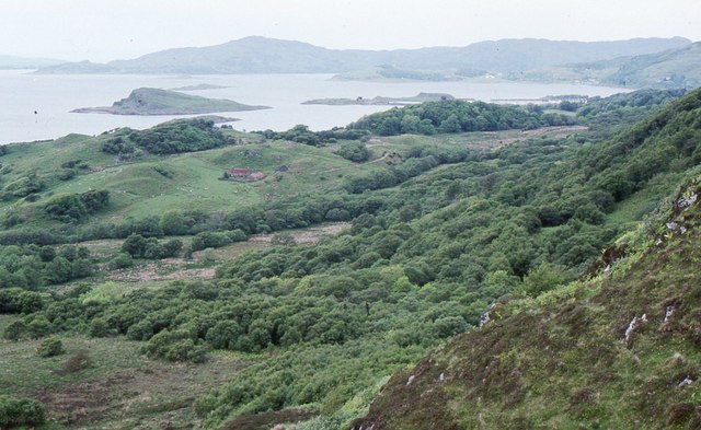
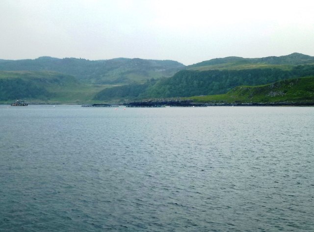
Port Caol is a picturesque coastal village located in Argyllshire, Scotland. Situated on the western coast of the country, it boasts breathtaking views of the sea, estuary, and creek. The village is nestled between rolling hills and offers a serene and peaceful environment for locals and visitors alike.
The main attraction of Port Caol is its beautiful coastline. The sea, with its crystal-clear turquoise waters, is a haven for water sports enthusiasts and nature lovers. The sandy beaches provide a perfect spot for sunbathing, picnicking, and relaxing while enjoying the stunning vistas.
The estuary is a unique feature of Port Caol, where the river meets the sea. It is a thriving ecosystem, home to a diverse range of marine life. Visitors can witness an array of bird species, including herons, oystercatchers, and gulls, as they flock to the estuary for feeding and nesting.
The creek in Port Caol is a tranquil waterway that winds its way through the village. It offers a peaceful setting for walking, fishing, and boating. The creek is lined with quaint cottages and traditional fishing boats, adding to the charm and character of the area.
Port Caol is also known for its friendly community and warm hospitality. The village has a few local shops and cozy cafes where visitors can enjoy a taste of traditional Scottish cuisine. The annual Port Caol Sea Festival is a highlight of the village, featuring live music, seafood stalls, and activities for all ages.
In summary, Port Caol in Argyllshire is a hidden gem on Scotland's western coast. With its stunning sea, estuary, and creek, it offers a tranquil escape for nature lovers, water sports enthusiasts, and those seeking a peaceful retreat by the sea.
If you have any feedback on the listing, please let us know in the comments section below.
Port Caol Images
Images are sourced within 2km of 56.191774/-5.5710524 or Grid Reference NM7805. Thanks to Geograph Open Source API. All images are credited.
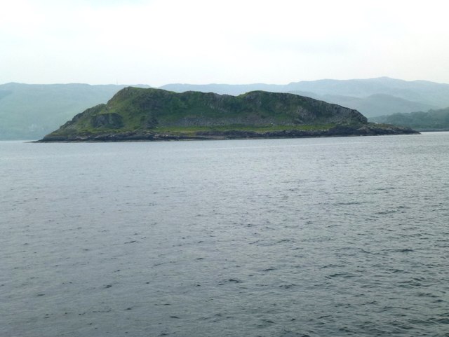
![Port Caol The upstanding rock on the right is Creag nam Muran [<a title="https://www.geograph.org.uk/photo/165706" href="https://www.geograph.org.uk/photo/165706">Link</a>] - part of an igneous dyke. The island of Shuna is on the other side of the water.](https://s1.geograph.org.uk/geophotos/05/64/50/5645077_c396644e.jpg)


Port Caol is located at Grid Ref: NM7805 (Lat: 56.191774, Lng: -5.5710524)
Unitary Authority: Argyll and Bute
Police Authority: Argyll and West Dunbartonshire
What 3 Words
///yoga.enveloped.school. Near Lochgilphead, Argyll & Bute
Nearby Locations
Related Wikis

Craignish
Craignish (Scottish Gaelic, Creiginis) is a peninsula in Argyll, on the west coast of Scotland. It lies around 25 miles (40 km) south of Oban, and 10 miles...

Craobh Haven
Craobh Haven Scottish Gaelic pronunciation: [kɾɯːv] is a small purpose-built village and sailing port on the west coast of Argyll and Bute, Scotland. It...

Ardfern
Ardfern (Scottish Gaelic: Aird Fheàrna, meaning "the head-land of alder-trees") is a village in Argyll and Bute, Scotland. It lies on the south coast of...

Eilean Mhic Chrion
Eilean Mhic Chrion is a tidal island sheltering Ardfern in Loch Craignish, Scotland. Eilean Mhic Chrion is one of 43 tidal islands that can be walked to...

Shuna, Slate Islands
Shuna (Scottish Gaelic: Siuna) is one of the Slate Islands lying east of Luing on the west coast of Scotland. == History == In 1815, James Yates, a Glasgow...
Eilean Rìgh
Eilean Rìgh is an island in the Inner Hebrides of the west coast of Scotland. It lies in Loch Craignish, about 300 metres (1⁄8 mile) off the Argyll coastline...

Craignish Castle
Craignish Castle is located on the Craignish peninsula in Argyll, western Scotland and is a category B listed building. The present castle includes a 16th...

Asknish Bay
Asknish Bay is a small, remote, southwest-facing coastal embayment, located next to the small settlement of Arduaine within Argyll and Bute, Scotland....
Nearby Amenities
Located within 500m of 56.191774,-5.5710524Have you been to Port Caol?
Leave your review of Port Caol below (or comments, questions and feedback).