Llanfair-yn-Neubwll

Settlement in Anglesey

Wales

Llanfair-yn-Neubwll

Traeth Llydan
Traeth Llydan Credit: Chris Andrews

Llanfair-yn-Neubwll is a small village located on the island of Anglesey in North Wales. It lies approximately 3 miles southwest of the town of Holyhead and is situated near the western coastline of the island. The name Llanfair-yn-Neubwll translates to "St. Mary's Church in the Hollow" in English.

The village is known for its picturesque setting, surrounded by rolling hills and farmland. It is a predominantly rural area, with a population of around 1,500 people. Llanfair-yn-Neubwll is well-connected to other parts of Anglesey and mainland Wales, with the A55 road passing nearby, providing easy access to Holyhead and the Menai Bridge.

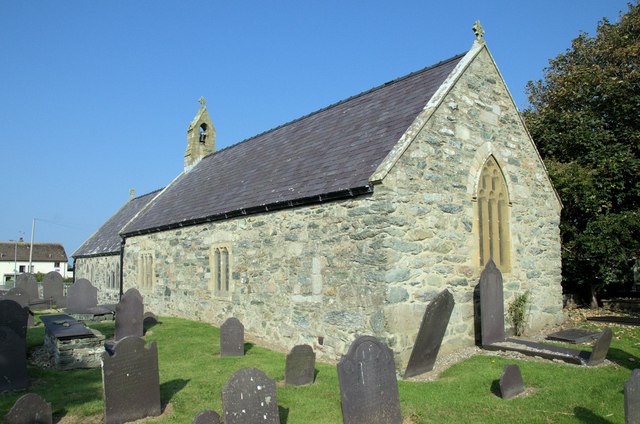
One of the notable features of the village is its historic St. Mary's Church, which dates back to the 14th century. The church is a Grade II listed building and is known for its elegant architecture and beautiful stained glass windows. It serves as a focal point for the community, hosting regular services and events.

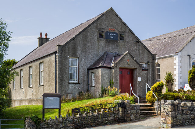
Llanfair-yn-Neubwll is also home to a primary school, a community center, and a few local businesses, including a pub and a convenience store. The village enjoys a peaceful and friendly atmosphere, making it an attractive place to live for those seeking a rural lifestyle.

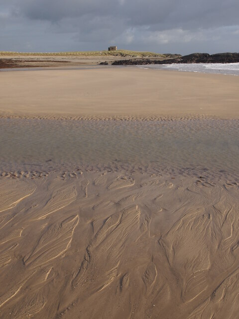
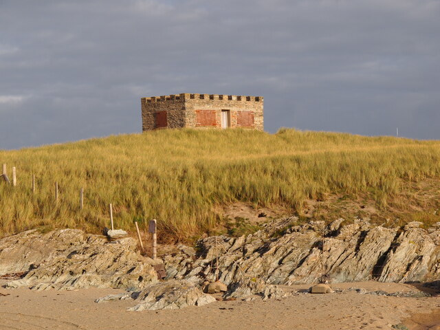
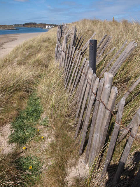
The surrounding area offers plenty of opportunities for outdoor activities, including walking, cycling, and birdwatching. The nearby coastline provides stunning views and is popular among locals and tourists alike.

Overall, Llanfair-yn-Neubwll is a charming village that combines natural beauty with a rich history, making it a delightful place to visit or call home.

If you have any feedback on the listing, please let us know in the comments section below.

Llanfair-yn-Neubwll Images

Images are sourced within 2km of 53.260389/-4.544514 or Grid Reference SH3076. Thanks to Geograph Open Source API. All images are credited.

Traeth Llydan
Traeth Llydan
Bodior Bathing House
WWII Defences of North Wales: RAF Valley - Operations Block  (1) -
Caergeiliog Chapel Hall: temporary wartime Operations Room

During the Second World War RAF Valley operated as a fighter station for No. 9 Group defending England's industrial north-west and shipping in the Irish Sea. Operations against the enemy were planned and directed initially from this temporary Operations Room at the nearby village of Caergeiliog's chapel hall. A purpose-built Operations Block would be built later, the chapel hall having to suffice until such time as it became operational.

<a href="https://www.geograph.org.uk/photo/6944594">SH3277 : WWII Defences of North Wales: RAF Valley - Operations Block  (2)</a>
WWII Defences of North Wales: RAF Valley - Operations Block (1)
- Caergeiliog Chapel Hall: temporary wartime Operations Room During the Second World War RAF Valley operated as a fighter station for No. 9 Group defending England's industrial north-west and shipping in the Irish Sea. Operations against the enemy were planned and directed initially from this temporary Operations Room at the nearby village of Caergeiliog's chapel hall. A purpose-built Operations Block would be built later, the chapel hall having to suffice until such time as it became operational. SH3277 : WWII Defences of North Wales: RAF Valley - Operations Block (2)
Caergeiliog Toll House by the A5 on Anglesey The Caergeiliog Toll House stands at the junction of Holyhead Road with Cymyran Road. The 19th century Toll House is Grade II listed by Cadw: <span class="nowrap"><a title="https://cadwpublic-api.azurewebsites.net/reports/listedbuilding/FullReport?lang=&id=5266" rel="nofollow ugc noopener" href="https://cadwpublic-api.azurewebsites.net/reports/listedbuilding/FullReport?lang=&id=5266">Link</a><img style="margin-left:2px;" alt="External link" title="External link - shift click to open in new window" src="https://s1.geograph.org.uk/img/external.png" width="10" height="10"/></span>

Milestone Society National ID: ANG.LFN
Caergeiliog Toll House by the A5 on Anglesey
The Caergeiliog Toll House stands at the junction of Holyhead Road with Cymyran Road. The 19th century Toll House is Grade II listed by Cadw: LinkExternal link Milestone Society National ID: ANG.LFN
View across RAF Valley
Mobile control tower at RAF Valley
British Aerospace Hawk T1W Two aircraft, XX312 and XX313, taxiing for takeoff at RAF Valley.
British Aerospace Hawk T1W
Two aircraft, XX312 and XX313, taxiing for takeoff at RAF Valley.
Ready for takeoff Two British Aerospace Hawk T1W aircraft, XX312 and XX313, taxiing for takeoff at RAF Valley.
Ready for takeoff
Two British Aerospace Hawk T1W aircraft, XX312 and XX313, taxiing for takeoff at RAF Valley.
Danger very low flying aircraft Sign at the viewing area on the northwest perimeter of RAF Valley.
Danger very low flying aircraft
Sign at the viewing area on the northwest perimeter of RAF Valley.
Landing lights on the RAF Valley perimeter
Shorts Tucano T.1 ZF145 taxiing for takeoff at RAF Valley.
Shorts Tucano T.1
ZF145 taxiing for takeoff at RAF Valley.
Red Arrows at RAF Valley
Eglwys St. Mihangel's Church Eglwys St.Mihangel, the RAF Church - used as the Anglican and Scottish Free Church place of worship.
Eglwys St. Mihangel's Church
Eglwys St.Mihangel, the RAF Church - used as the Anglican and Scottish Free Church place of worship.
Road junction near Llanfairyneubwll Minor road here leads towards Anglesey Airport
Road junction near Llanfairyneubwll
Minor road here leads towards Anglesey Airport
Anglesey Airport terminal building It was opened in 2007 and is situated on land that is leased from RAF Valley.
It handles weekday flights between Anglesey and Cardiff.
Currently (November 2014) the airline is Citywing with the flights operated by Links Air.
Anglesey Airport terminal building
It was opened in 2007 and is situated on land that is leased from RAF Valley. It handles weekday flights between Anglesey and Cardiff. Currently (November 2014) the airline is Citywing with the flights operated by Links Air.
Boundary Fence, Traeth Cymyran Plas Cymyran in the distance.
Boundary Fence, Traeth Cymyran
Plas Cymyran in the distance.
RAF Valley From Tywyn Trewan Common Shooting range and radar tower at the edge of the airfield.
RAF Valley From Tywyn Trewan Common
Shooting range and radar tower at the edge of the airfield.
Show me another place!

Llanfair-yn-Neubwll is located at Grid Ref: SH3076 (Lat: 53.260389, Lng: -4.544514)

Unitary Authority: Isle of Anglesey

Police Authority: North Wales

Also known as: Llanfairyneubwll

What 3 Words

///splint.paler.perplexed. Near Valley, Isle of Anglesey

Related Wikis

Llanfair-yn-Neubwll

Llanfair-yn-Neubwll is a village and community on the Isle of Anglesey in the north west of Wales. The community includes the villages of Llanfihangel...

Llyn Cerrig Bach

Llyn Cerrig Bach is a small lake located between Rhosneigr and Valley in the west of Anglesey, Wales. Whilst it is not one of the largest lakes on the...

St Mary's Church, Llanfair-yn-Neubwll

St Mary's Church was a Church in Wales parish church in Llanfair-yn-Neubwll, Anglesey, Wales. The current building was constructed in the 14th century...
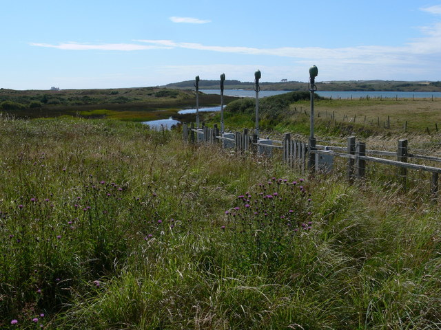
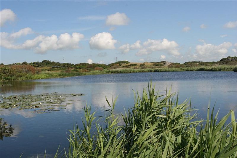
Valley Wetlands

Valley Wetlands (Welsh: Gwlyptiroedd y Fali), formerly Valley Lakes, is a nature reserve in Anglesey, Wales belonging to the Royal Society for the Protection...
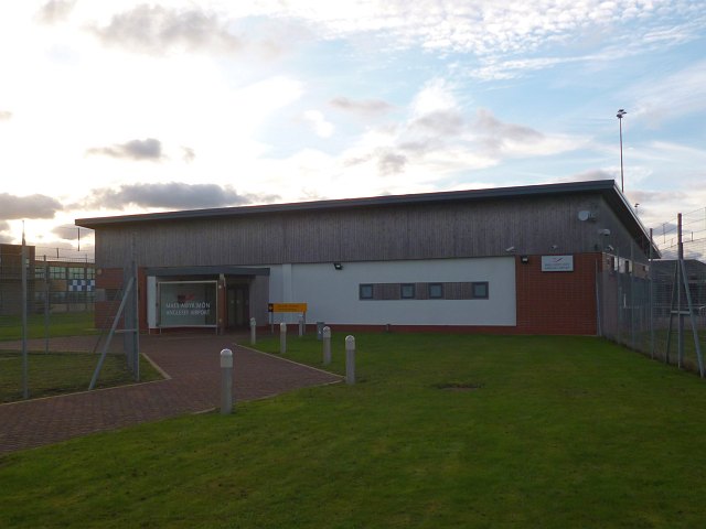
Anglesey Airport

Anglesey Airport (Welsh: Maes Awyr Ynys Môn) (IATA: VLY, ICAO: EGOV) is an airport owned by the Isle of Anglesey County Council on land leased from the...
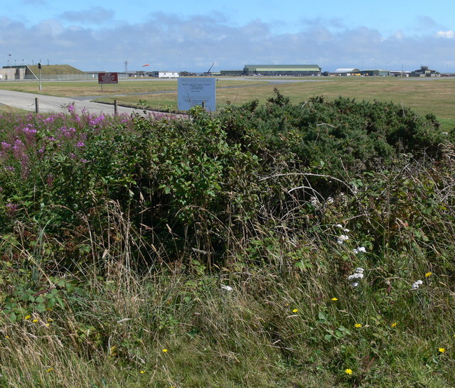
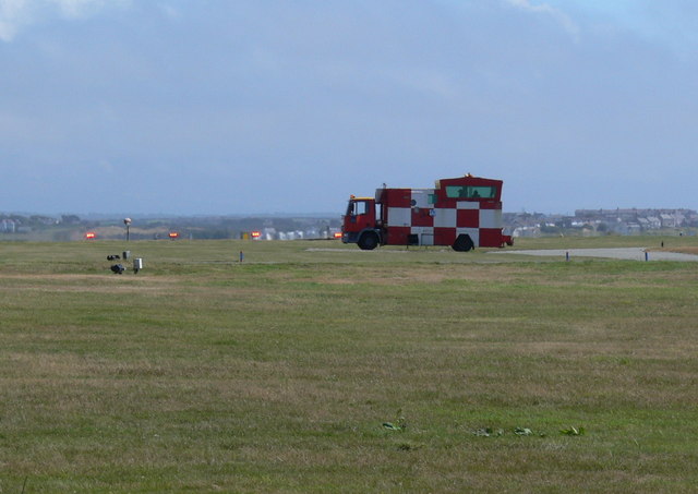
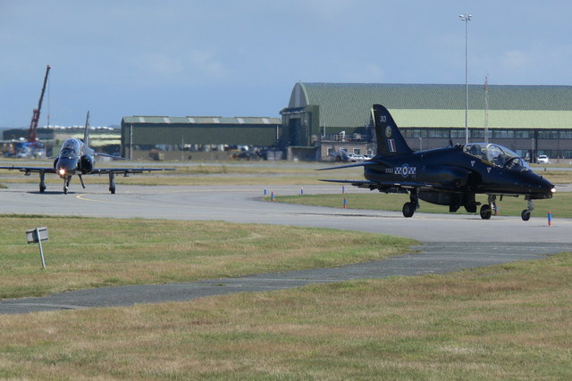
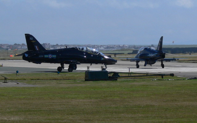
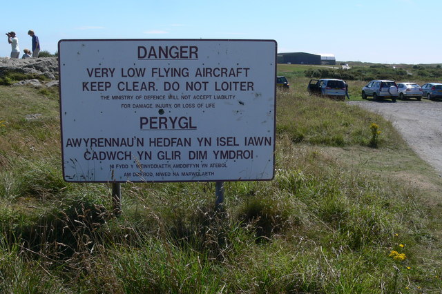
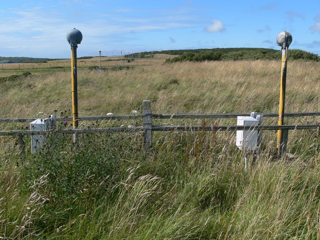
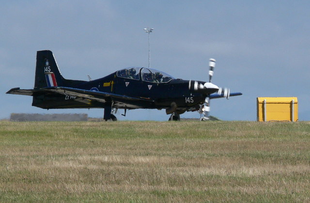
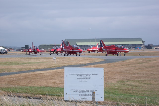
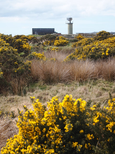
RAF Valley

Royal Air Force Valley or more simply RAF Valley (Welsh: Llu Awyr Brenhinol Y Fali) (IATA: VLY, ICAO: EGOV) is a Royal Air Force station on the island...

Caergeiliog

Caergeiliog is a village in Anglesey, in north-west Wales. It is in the community of Llanfair-yn-Neubwll and has a population of 355. The name derives...

Llanfihangel yn Nhowyn

Llanfihangel yn Nhowyn () is a village in Anglesey, in north-west Wales. The church in the village, St Mihangel's, is a Grade II listed building and is...

Nearby Amenities

Located within 500m of 53.260389,-4.544514
Traffic Signals
Traffic Signals Direction: backward
Lat/Long: 53.2583289/-4.5390177
Llanfair yn Neubwll
Is In: Anglesey
Place: hamlet
Lat/Long: 53.2612796/-4.5516104
Hotel Cymyran
Tourism: hotel
Lat/Long: 53.2605159/-4.5459595
Post Box
Collection Times: Mo-Fr 16:00; Sa 08:00
Operator: Royal Mail
Operator Wikidata: Q638098
Post Box Type: lamp
Ref: LL65 32
Royal Cypher: EIIR
Royal Cypher Wikidata: Q33102113
Lat/Long: 53.2600317/-4.5453331
Man Made: tower
Lat/Long: 53.257424/-4.5441355
The data included in this document is from www.openstreetmap.org. The data is made available under ODbL.

Have you been to Llanfair-yn-Neubwll?

Leave your review of Llanfair-yn-Neubwll below (or comments, questions and feedback).