An t-Òb

Sea, Estuary, Creek in Inverness-shire

Scotland

An t-Òb

Kyle of Locchalsh Kyle of Lochalsh with 158701 waiting for return journey to Inverness
Kyle of Locchalsh Credit: Colin Prosser

An t-Òb, located in Inverness-shire, Scotland, is a picturesque area characterized by its stunning sea, estuary, and creek landscapes. Situated on the west coast of Scotland, it offers a unique blend of natural beauty and historical significance.

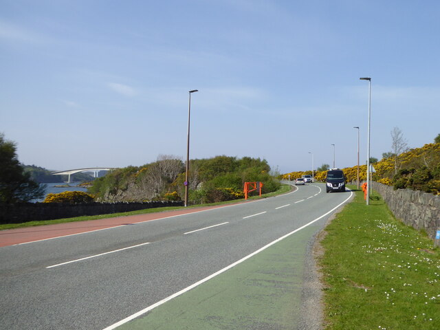
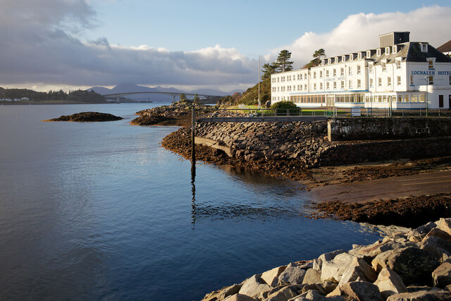
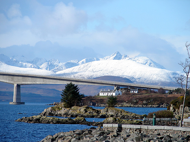
The area is primarily known for its breathtaking sea views. The vast expanse of the ocean stretches out before visitors, creating a mesmerizing backdrop against which the rugged cliffs and rolling hills stand. The sea is a prominent feature of An t-Òb, attracting both locals and tourists who enjoy activities such as fishing, boating, and sailing.

The estuary in An t-Òb is a significant ecological site, where freshwater from rivers flows into the sea. This creates a diverse and thriving ecosystem that supports numerous species of fish, birds, and marine life. The estuary is a popular spot for birdwatching, as it attracts a variety of migratory birds throughout the year.

An t-Òb also boasts a tranquil creek that meanders through the landscape. The creek is a haven for wildlife, providing a habitat for otters, seals, and various bird species. Visitors can explore the creek's banks, enjoying peaceful walks alongside the babbling water and taking in the surrounding natural beauty.

In addition to its natural wonders, An t-Òb has a rich historical heritage. The area is dotted with ancient ruins, including castles and fortifications, that serve as reminders of its past. These sites offer a glimpse into the area's historical significance and provide a fascinating backdrop for exploration.

Overall, An t-Òb in Inverness-shire presents a captivating blend of sea, estuary, and creek landscapes, making it a must-visit destination for nature enthusiasts and history buffs alike.

If you have any feedback on the listing, please let us know in the comments section below.

An t-Òb Images

Images are sourced within 2km of 57.27129/-5.7345163 or Grid Reference NG7426. Thanks to Geograph Open Source API. All images are credited.

Kyle of Locchalsh Kyle of Lochalsh with 158701 waiting for return journey to Inverness
Kyle of Locchalsh
Kyle of Lochalsh with 158701 waiting for return journey to Inverness
Bay in the Plock of Kyle A visit close to high tide.  Seaweed, rock and clear water.
Bay in the Plock of Kyle
A visit close to high tide. Seaweed, rock and clear water.
Still water, Plock of Kyle Overcast on the coast and over Skye.  The forecasters were right! An earlier visit with the same ingredients and a clear sunny sky.  <a href="https://www.geograph.org.uk/photo/4573459">NG7527 : Clear water by the Plock of Kyle</a>
Still water, Plock of Kyle
Overcast on the coast and over Skye. The forecasters were right! An earlier visit with the same ingredients and a clear sunny sky. NG7527 : Clear water by the Plock of Kyle
Cove on the Plock of Kyle A direct footpath leads to this area of the Plock of Kyle.
Cove on the Plock of Kyle
A direct footpath leads to this area of the Plock of Kyle.
A cove with the view but not the silence The continuous noise of traffic on the A87 detracts from this place.
A cove with the view but not the silence
The continuous noise of traffic on the A87 detracts from this place.
The A87 below the Plock of Kyle A view of the Skye bridge on the left.
The A87 below the Plock of Kyle
A view of the Skye bridge on the left.
Kyle of Lochalsh View from the railway station Kyle of Lochalsh, the harbour, and in the distance the bridge which connects the mainland to the Isle of Skye
Kyle of Lochalsh
View from the railway station Kyle of Lochalsh, the harbour, and in the distance the bridge which connects the mainland to the Isle of Skye
Kyle of Lochalsh View off the overhead bridge, of the railway station, the dock, and with the Isle of Skye in background
Kyle of Lochalsh
View off the overhead bridge, of the railway station, the dock, and with the Isle of Skye in background
Harbour at Kyle of Lochalsh Bright sunshine burst through as a break in threatening skies. The large Kyle of Lochalsh Hotel seemed to be shut up.
Harbour at Kyle of Lochalsh
Bright sunshine burst through as a break in threatening skies. The large Kyle of Lochalsh Hotel seemed to be shut up.
The Kyle of Lochalsh Hotel and the Skye Bridge Kyle was very very quiet on a November Sunday.  The one train of the day from Inverness stays 90 minutes at Kyle and the day-trip from Inverness takes just under 7 hours.
The Kyle of Lochalsh Hotel and the Skye Bridge
Kyle was very very quiet on a November Sunday. The one train of the day from Inverness stays 90 minutes at Kyle and the day-trip from Inverness takes just under 7 hours.
View into Loch Alsh from the mainland end of the Skye Bridge Kyle of Lochalsh is invisible from this end of the bridge. The Isle of Skye is the far side of the water.
View into Loch Alsh from the mainland end of the Skye Bridge
Kyle of Lochalsh is invisible from this end of the bridge. The Isle of Skye is the far side of the water.
Loch Alsh near the Kyle of Lochalsh Kyleakin is the village on the southern side of Loch Alsh.
Loch Alsh near the Kyle of Lochalsh
Kyleakin is the village on the southern side of Loch Alsh.
The harbour at Kyle of Lochalsh The train station is right on the harbour and the ScotRail service can be seen at the platform.  A view from the grounds of the Kyle of Lochalsh Hotel.
The harbour at Kyle of Lochalsh
The train station is right on the harbour and the ScotRail service can be seen at the platform. A view from the grounds of the Kyle of Lochalsh Hotel.
The Kyle of Lochalsh Hotel and the Skye Bridge The view to the Skye Bridge from the Kyle of Lochalsh Railway Station.
The Kyle of Lochalsh Hotel and the Skye Bridge
The view to the Skye Bridge from the Kyle of Lochalsh Railway Station.
The Plock of Kyle from the viewpoint The Plock of Kyle at one time was a golf course and the large open area is now a Nature Reserve and Community Park.  There are many footpaths connecting to the shore and wider tracks for prams and buggies.
The Plock of Kyle from the viewpoint
The Plock of Kyle at one time was a golf course and the large open area is now a Nature Reserve and Community Park. There are many footpaths connecting to the shore and wider tracks for prams and buggies.
The view to Skye from the viewpoint on Am Ploc, Kyle of Lochalsh A clear view over the sea but clouds on the higher hills of Skye.
The view to Skye from the viewpoint on Am Ploc, Kyle of Lochalsh
A clear view over the sea but clouds on the higher hills of Skye.
Boats in Fisherman's Bay, Am Ploc A view from the named "Moorland Path" that crosses Am Ploc.
Boats in Fisherman's Bay, Am Ploc
A view from the named "Moorland Path" that crosses Am Ploc.
Moorland of Am Ploc, Kyle of Lochalsh A very pleasant path across the Plock of Kyle is named "The Moorland Path".  It provides an alternative view of the Skye Bridge.
Moorland of Am Ploc, Kyle of Lochalsh
A very pleasant path across the Plock of Kyle is named "The Moorland Path". It provides an alternative view of the Skye Bridge.
Show me another place!

An t-Òb is located at Grid Ref: NG7426 (Lat: 57.27129, Lng: -5.7345163)

Unitary Authority: Highland

Police Authority: Highlands and Islands

What 3 Words

///envoy.repaying.denoting. Near Kyleakin, Highland

Related Wikis

Kyleakin

Kyleakin (; Scottish Gaelic: Caol Àcain) is a village situated on the east coast of the Isle of Skye in the Inner Hebrides, Scotland. The village is along...
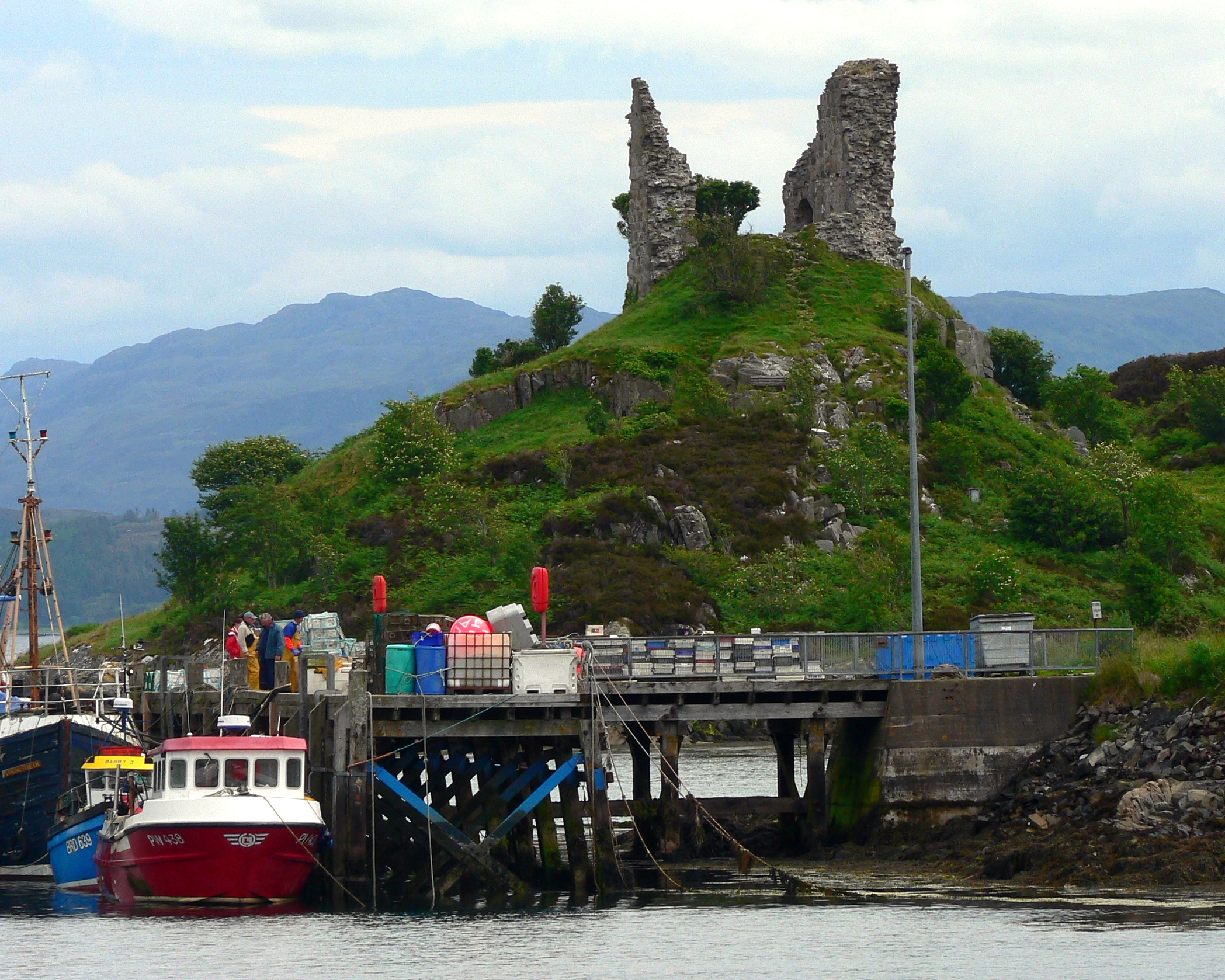
Caisteal Maol

Caisteal Maol (Gaelic: Caisteal, 'Castle', Maol, 'bare') is a ruined castle located near the harbour of the village of Kyleakin, Isle of Skye, Scotland...

Eilean Bàn

Eilean Bàn (Scottish Gaelic meaning White Island) is a six-acre (2.4 ha) island between Kyle of Lochalsh and the Isle of Skye, in the historic county of...
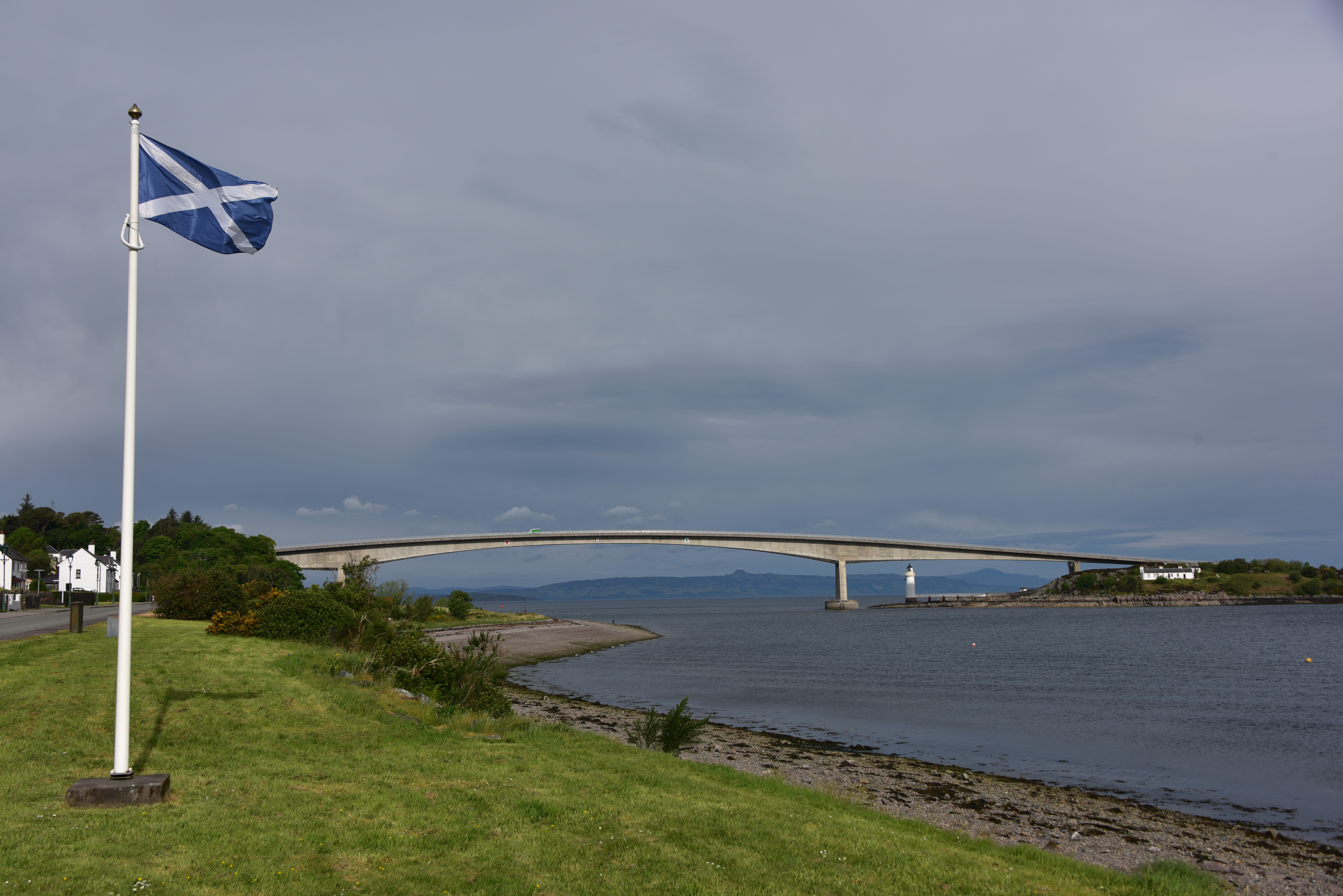
Skye Bridge

The Skye Bridge (Scottish Gaelic: Drochaid an Eilein Sgitheanaich) is a road bridge over Loch Alsh, Scotland, connecting the Isle of Skye to the island...

Nearby Amenities

Located within 500m of 57.27129,-5.7345163
Source: PGS
Lat/Long: 57.273629/-5.7277257
Source: PGS
Lat/Long: 57.2734591/-5.7281465
Source: PGS
Lat/Long: 57.2733094/-5.7283913
Source: PGS
Lat/Long: 57.2729812/-5.7300532
Source: PGS
Lat/Long: 57.273656/-5.7354204
Source: PGS
Lat/Long: 57.2740138/-5.7362208
Source: PGS
Lat/Long: 57.2744124/-5.7373515
Kyleakin
Name Gd: Caol Acainn
Place: village
Population: 300
Source: survey
Wikidata: Q1018753
Wikipedia: en:Kyleakin
Lat/Long: 57.2720989/-5.7308059
Turning Circle
Lat/Long: 57.2728208/-5.7363426
Bus Stop
Kyleside Bus Shelter
Bench: yes
Bin: yes
Bus: yes
Lit: yes
Naptan AtcoCode: 670085953
Naptan Bearing: S
Naptan CommonName: Youth Hostel
Naptan Indicator: opp
Naptan Landmark: Youth Hostel
Naptan NaptanCode: 45326934
Naptan Street: Main Road
Naptan Verified: no
Operator: Citylink
Public Transport: platform
Ref Tiploc: KYLEAKN
Shelter: yes
Source: naptan_import
Tactile Paving: no
Lat/Long: 57.2725888/-5.7291328
Post Box
Post Box Type: lamp
Ref: IV40 115
Source: survey
Lat/Long: 57.2728166/-5.7275619
Pub
Saucy Mary's Lodge
Source: survey
Website: https://www.saucymarys.com/
Lat/Long: 57.2724185/-5.7307481
Fast Food
Harrys Cafe
Addr Postcode: IV41 8PL
Contact Facebook: https://www.facebook.com/harrys2014/
Fhrs Id: 538004
Lat/Long: 57.2730512/-5.7269383
Kings Arms Hotel
Addr Postcode: IV41 8PH
Contact Facebook: https://www.facebook.com/KingsArmsHotelBespokeHotels/
Fhrs Id: 538379
Rooms: 81
Tourism: hotel
Website: https://www.bespokehotels.com/kingsarmshotel
Lat/Long: 57.2729957/-5.7332801
Turning Circle
Lat/Long: 57.2715028/-5.727348
Turning Circle
Lat/Long: 57.272768/-5.7387766
Historic: memorial
Lat/Long: 57.2732998/-5.7274298
Tourism: viewpoint
Lat/Long: 57.2732998/-5.7273681
Recycling
Lat/Long: 57.2722414/-5.7281015
Shop: convenience
Lat/Long: 57.2722783/-5.7303904
Power: pole
Lat/Long: 57.2726247/-5.738937
Material: wood
Power: pole
Lat/Long: 57.2720937/-5.7296283
Material: wood
Power: pole
Lat/Long: 57.2714416/-5.7294823
Material: wood
Power: pole
Lat/Long: 57.2716154/-5.7273793
Material: wood
Power: pole
Lat/Long: 57.2714123/-5.7284502
Material: wood
Power: pole
Lat/Long: 57.2720385/-5.7264455
Material: wood
Power: pole
Lat/Long: 57.2722818/-5.7330334
Material: wood
Power: pole
Lat/Long: 57.2722649/-5.7324347
Material: wood
Power: pole
Lat/Long: 57.2720121/-5.7324504
Material: wood
Power: pole
Lat/Long: 57.2719962/-5.7324364
Material: wood
Power: pole
Lat/Long: 57.272186/-5.7314318
Material: wood
Power: pole
Lat/Long: 57.2721842/-5.7301127
Material: wood
Power: pole
Lat/Long: 57.2723514/-5.7335583
Material: wood
Power: pole
Lat/Long: 57.272384/-5.7339295
Material: wood
Note: last pole of this line
Power: pole
Lat/Long: 57.2720342/-5.7340632
Material: wood
Power: pole
Lat/Long: 57.2710312/-5.7321755
Addr City: Kyleakin
Addr Housenumber: 1
Addr Street: Achmore Road
Lat/Long: 57.2724541/-5.7360868
Addr Housenumber: 2
Lat/Long: 57.2724802/-5.7362719
Addr Housenumber: 3
Lat/Long: 57.2725306/-5.7366181
Addr Housenumber: 4
Lat/Long: 57.2725514/-5.7367614
Addr Housenumber: 5
Lat/Long: 57.2725689/-5.736897
Addr Housenumber: 1
Lat/Long: 57.2727473/-5.7345317
Addr Housenumber: 2
Lat/Long: 57.2727633/-5.7346578
The Mews
Lat/Long: 57.2725138/-5.7342018
Addr Housenumber: 3
Lat/Long: 57.2727676/-5.7348187
Addr Housenumber: 4
Lat/Long: 57.2727821/-5.7349394
Addr Housenumber: 5
Lat/Long: 57.2727995/-5.7350413
Addr Housenumber: 6
Lat/Long: 57.2728255/-5.7353462
Addr Housenumber: 7
Lat/Long: 57.2728387/-5.7354651
Addr Housenumber: 15
Lat/Long: 57.2725066/-5.7346149
Addr Housenumber: 16
Lat/Long: 57.2725066/-5.7347383
Addr Housenumber: 17
Lat/Long: 57.2724848/-5.7348804
Addr Housenumber: 18
Lat/Long: 57.2724776/-5.7350145
Addr Housename: Fir Chlis
Addr Housenumber: 19
Lat/Long: 57.2725297/-5.7351947
Addr Housenumber: 8
Lat/Long: 57.2728704/-5.7355939
Addr Housenumber: 25
Lat/Long: 57.2726746/-5.7364543
Addr Housenumber: 8
Addr Street: Kyleside
Lat/Long: 57.2732401/-5.7348342
Addr Housenumber: 11
Lat/Long: 57.2731125/-5.7355075
Addr Housenumber: 13
Lat/Long: 57.2731661/-5.7358374
Addr Housenumber: 15
Lat/Long: 57.2732009/-5.7361566
Addr Housenumber: 1
Addr Street: Kyleside
Lat/Long: 57.2730907/-5.7338069
Addr Housenumber: 3
Addr Street: Kyleside
Lat/Long: 57.2731531/-5.7341825
Addr Housenumber: 5
Addr Street: Kyleside
Lat/Long: 57.2731864/-5.734456
Addr Housenumber: 9
Lat/Long: 57.2731719/-5.7351561
Addr Housenumber: 19
Lat/Long: 57.2734823/-5.7366903
Addr Housenumber: 23
Lat/Long: 57.2726702/-5.7361807
Addr Housename: Waterside Cottage
Addr Housenumber: 20
Addr Street: Kyleside
Lat/Long: 57.2735062/-5.7368819
Toilets
Access: yes
Description: Comfort partnership with Highland Council permits non customer use
Operator: Saucy Mary
Toilets Disposal: flush
Lat/Long: 57.2724115/-5.7306273
Addr Housenumber: 9
Lat/Long: 57.2729023/-5.7357609
Addr Housenumber: 10
Lat/Long: 57.2729211/-5.7358735
Addr Housenumber: 11
Lat/Long: 57.2729385/-5.7359808
Addr Housenumber: 12
Lat/Long: 57.272953/-5.736123
Addr Housenumber: 13
Lat/Long: 57.2729748/-5.7362383
Addr Housenumber: 14
Lat/Long: 57.2729936/-5.7363724
Addr City: Kyleakin
Addr Housenumber: 17
Addr Street: Kyleside
Lat/Long: 57.2733489/-5.7363966
Addr City: Kyleakin
Addr Housenumber: 18
Addr Street: Kyleside
Lat/Long: 57.2733721/-5.7365387
Restaurant
Castle moil restaurant n gift shop
Addr City: Kyleakin
Addr Country: GB
Addr Postcode: IV41 8PL
Addr Street: Kyleakin
Fhrs Id: 578925
Source Addr: FHRS Open Data
Lat/Long: 57.2727662/-5.7285347
Power: pole
Lat/Long: 57.2685617/-5.7297564
Power: pole
Lat/Long: 57.2685588/-5.7315105
Power: pole
Lat/Long: 57.2685878/-5.7346273
Power: pole
Lat/Long: 57.2685849/-5.7364243
Power: pole
Lat/Long: 57.2682194/-5.7400373
Saucy Mary's Lodge
Addr Postcode: IV41 8PH
Beds: 86
Fhrs Id: 538003
Internet Access: wlan
Internet Access Fee: no
Rooms: 28
Tourism: hostel
Website: https://www.saucymarys.com/
Lat/Long: 57.2723612/-5.7307997
Bench
Backrest: yes
Lat/Long: 57.2730623/-5.7316057
Power: pole
Lat/Long: 57.2685919/-5.7381029
Power: pole
Lat/Long: 57.2697815/-5.7369917
Power: pole
Lat/Long: 57.2712943/-5.7361442
Power: pole
Lat/Long: 57.2713585/-5.736108
Cnoc a' Fhradhairc
Place: locality
Lat/Long: 57.2698522/-5.7266456
Communication Mobile Phone: yes
Man Made: antenna
Material: metal
Lat/Long: 57.274156/-5.7408171
Defibrillator
Access: yes
Defibrillator Location: outside Kyleakin Community Centre - to left of entrance
Emergency: defibrillator
Indoor: no
Lat/Long: 57.2733589/-5.738877
Entrance: yes
Lat/Long: 57.2733592/-5.7390589
Bicycle Parking
Bicycle Parking: stands
Capacity: 10
Covered: yes
Lat/Long: 57.2727534/-5.7292658
Charging Station
Lat/Long: 57.2728568/-5.7306355
The data included in this document is from www.openstreetmap.org. The data is made available under ODbL.

Have you been to An t-Òb?

Leave your review of An t-Òb below (or comments, questions and feedback).