Ob Lusa

Sea, Estuary, Creek in Inverness-shire

Scotland

Ob Lusa

House at Lower Breakish At the eastern end of the Brecais Iosal road, with a view over the mouth of Ob Bhreacais.
House at Lower Breakish Credit: John Allan

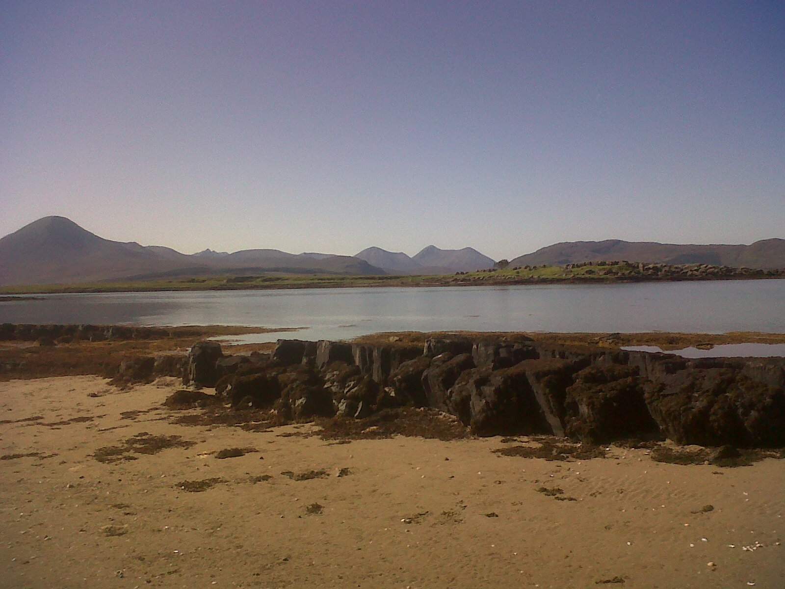
Ob Lusa is a picturesque coastal area located in Inverness-shire, a county in the Scottish Highlands. Situated on the western coast of Scotland, Ob Lusa is known for its stunning sea views, estuary, and creek.

The area is renowned for its natural beauty, with the sea serving as the main attraction. The crystal-clear waters of the sea provide a breathtaking backdrop against the rugged coastline. The pristine sandy beaches offer visitors a chance to relax, unwind, and enjoy the tranquility of the surroundings.

Ob Lusa is also home to an estuary, where the river meets the sea. This estuary is a haven for a wide variety of bird species, making it a popular destination for birdwatchers and nature enthusiasts. The estuary provides an important habitat for both resident and migratory birds throughout the year.

In addition to the sea and estuary, Ob Lusa boasts a charming creek that meanders through the landscape. The creek is surrounded by lush greenery and wildlife, creating a serene and peaceful atmosphere. Visitors can take leisurely walks alongside the creek, immersing themselves in the natural beauty of the area.

The location of Ob Lusa makes it an ideal spot for outdoor activities such as sailing, fishing, and kayaking. The sea and estuary provide ample opportunities for water-based adventures, while the creek offers a serene setting for nature walks and exploration.

Overall, Ob Lusa in Inverness-shire is a coastal gem, offering visitors a chance to experience the beauty of the sea, estuary, and creek in one stunning location.

If you have any feedback on the listing, please let us know in the comments section below.

Ob Lusa Images

Images are sourced within 2km of 57.257471/-5.8119876 or Grid Reference NG7024. Thanks to Geograph Open Source API. All images are credited.
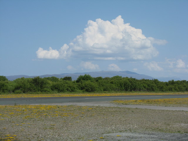
House at Lower Breakish At the eastern end of the Brecais Iosal road, with a view over the mouth of Ob Bhreacais.
House at Lower Breakish
At the eastern end of the Brecais Iosal road, with a view over the mouth of Ob Bhreacais.
Rockwell Commander 114B at Broadford G-OECM at the airfield on Skye. This 21-year-old aircraft is based at Carlisle
Rockwell Commander 114B at Broadford
G-OECM at the airfield on Skye. This 21-year-old aircraft is based at Carlisle
Apron at Isle of Skye [Ashaig] Airfield The runway is just ahead, running left/right.
Apron at Isle of Skye [Ashaig] Airfield
The runway is just ahead, running left/right.
Welcome Isle of Skye [Ashaig] The Broadford airfield office.
Welcome Isle of Skye [Ashaig]
The Broadford airfield office.
The Isle of Skye Airstrip Plaque commemorating the opening of the airstrip by the Hon. George Younger on 14 April 1972. Constructed by the Corps of Royal Engineers, 1969-1971.
The Isle of Skye Airstrip
Plaque commemorating the opening of the airstrip by the Hon. George Younger on 14 April 1972. Constructed by the Corps of Royal Engineers, 1969-1971.
The Broadford Airstrip on Skye Looking across the runway towards the hills of Applecross.
The Broadford Airstrip on Skye
Looking across the runway towards the hills of Applecross.
Eilean na Ruadhaich Looking east from the island, which is accessible at low water.
Eilean na Ruadhaich
Looking east from the island, which is accessible at low water.
Eilean na Ruadhaich Looking north from the island, which is accessible at low water.
The islands in the distance are Pabay (left) and the Crowlin Islands (centre).
Eilean na Ruadhaich
Looking north from the island, which is accessible at low water. The islands in the distance are Pabay (left) and the Crowlin Islands (centre).
Eilean na Ruadhaich Looking NE from the island, which is accessible at low water.
The islands in the distance are the Crowlin Islands (extreme left) and Sgeir Dubh (extreme right).
Eilean na Ruadhaich
Looking NE from the island, which is accessible at low water. The islands in the distance are the Crowlin Islands (extreme left) and Sgeir Dubh (extreme right).
Rough country in Lower Breakish The Red Cuillin hills dominate the background.
Rough country in Lower Breakish
The Red Cuillin hills dominate the background.
Old Milestone by the A87, near Broadford Airstrip, Strath parish Highland granite by the A87, in parish of Strath (District), opposite UC road to Kylerhea, at end of safety barrier.

Inscription once read:-
: (Broadford / 4) : : (Kylerhea / 7) :
(re-located due to roadworks)

Surveyed

Milestone Society National ID: HI_SKBFKA04
Old Milestone by the A87, near Broadford Airstrip, Strath parish
Highland granite by the A87, in parish of Strath (District), opposite UC road to Kylerhea, at end of safety barrier. Inscription once read:- : (Broadford / 4) : : (Kylerhea / 7) : (re-located due to roadworks) Surveyed Milestone Society National ID: HI_SKBFKA04
Broadford Airstrip A Bristow helicopter sits at Broadford Airstrip. In the distance an oil installation is en route to the  fabrication yard at Loch Kishorn, about 15km to the northeast. Exact camera location uncertain.

Scanned from a colour negative.
Broadford Airstrip
A Bristow helicopter sits at Broadford Airstrip. In the distance an oil installation is en route to the fabrication yard at Loch Kishorn, about 15km to the northeast. Exact camera location uncertain. Scanned from a colour negative.
Minor road from Kylerhea approaching its junction with the A87 Looking north-westward.
Minor road from Kylerhea approaching its junction with the A87
Looking north-westward.
Minor road near to Ashaig Looking north-westward.
Minor road near to Ashaig
Looking north-westward.
Track approaching Ashaig Cemetery, Skye Looking north-westward.
Track approaching Ashaig Cemetery, Skye
Looking north-westward.
Isle of Skye, Sign for the Kyle Rhea Ferry The Kyle Rhea Ferry was the earliest regular crossing point to the Isle of Skye. It crosses the shortest gap between the Isle of Skye and the mainland, across the Kyle Rhea. Since the opening of the Skye Bridge, the Glenelg to Kylerhea vehicle ferry now only operates between Easter and October.
Isle of Skye, Sign for the Kyle Rhea Ferry
The Kyle Rhea Ferry was the earliest regular crossing point to the Isle of Skye. It crosses the shortest gap between the Isle of Skye and the mainland, across the Kyle Rhea. Since the opening of the Skye Bridge, the Glenelg to Kylerhea vehicle ferry now only operates between Easter and October.
A87 Bridge across Abhainn Ashik The A87 is a primary route  in the Highland region of Scotland. It runs west for 99 miles from its junction with the A82 at Invergarry, along the north shores of Loch Garry and Loch Cluanie, then through Glen Shiel and along Loch Duich to Kyle of Lochalsh before crossing the Skye Bridge to Kyleakin, Broadford, and Portree, before terminating at Uig in the north of the Isle of Skye.
A87 Bridge across Abhainn Ashik
The A87 is a primary route in the Highland region of Scotland. It runs west for 99 miles from its junction with the A82 at Invergarry, along the north shores of Loch Garry and Loch Cluanie, then through Glen Shiel and along Loch Duich to Kyle of Lochalsh before crossing the Skye Bridge to Kyleakin, Broadford, and Portree, before terminating at Uig in the north of the Isle of Skye.
Abhainn Ashik
Abhainn Ashik
Show me another place!

Ob Lusa is located at Grid Ref: NG7024 (Lat: 57.257471, Lng: -5.8119876)

Unitary Authority: Highland

Police Authority: Highlands and Islands

What 3 Words

///motivate.wage.indulgent. Near Kyleakin, Highland

Nearby Locations

Ob Lusa

Related Wikis

Broadford Airfield

Isle of Skye (Broadford) Airfield (also known as Ashaig Airstrip or Broadford Aerodrome) is a small airfield on the Isle of Skye, Scotland, with a single...

Ashaig

Ashaig (Scottish Gaelic: Aiseag, referring to a ferry) is a small township, situated adjacent to Upper Breakish and Lower Breakish near Broadford on the...

Lower Breakish

Lower Breakish (Scottish Gaelic: Breacais Ìosal) is a village on the Isle of Skye in Scotland. == Gallery... ==

Upper Breakish

Upper Breakish (Scottish Gaelic: Breacais Àrd) is a village on the Isle of Skye in Scotland in the United Kingdom. == References == The geographic coordinates...

Pabay

Pabay is a Scottish island just off the coast of Skye. The name Pabay is derived from an old Norse word meaning "priest's isle" and there are the remains...

Harrapool

Harrapool (Scottish Gaelic: Harrapul) is a village, that lies on the right hand side of Broadford Bay, in Isle of Skye, Scottish Highlands and is in the...

Eilean Bàn

Eilean Bàn (Scottish Gaelic meaning White Island) is a six-acre (2.4 ha) island between Kyle of Lochalsh and the Isle of Skye, in the historic county of...
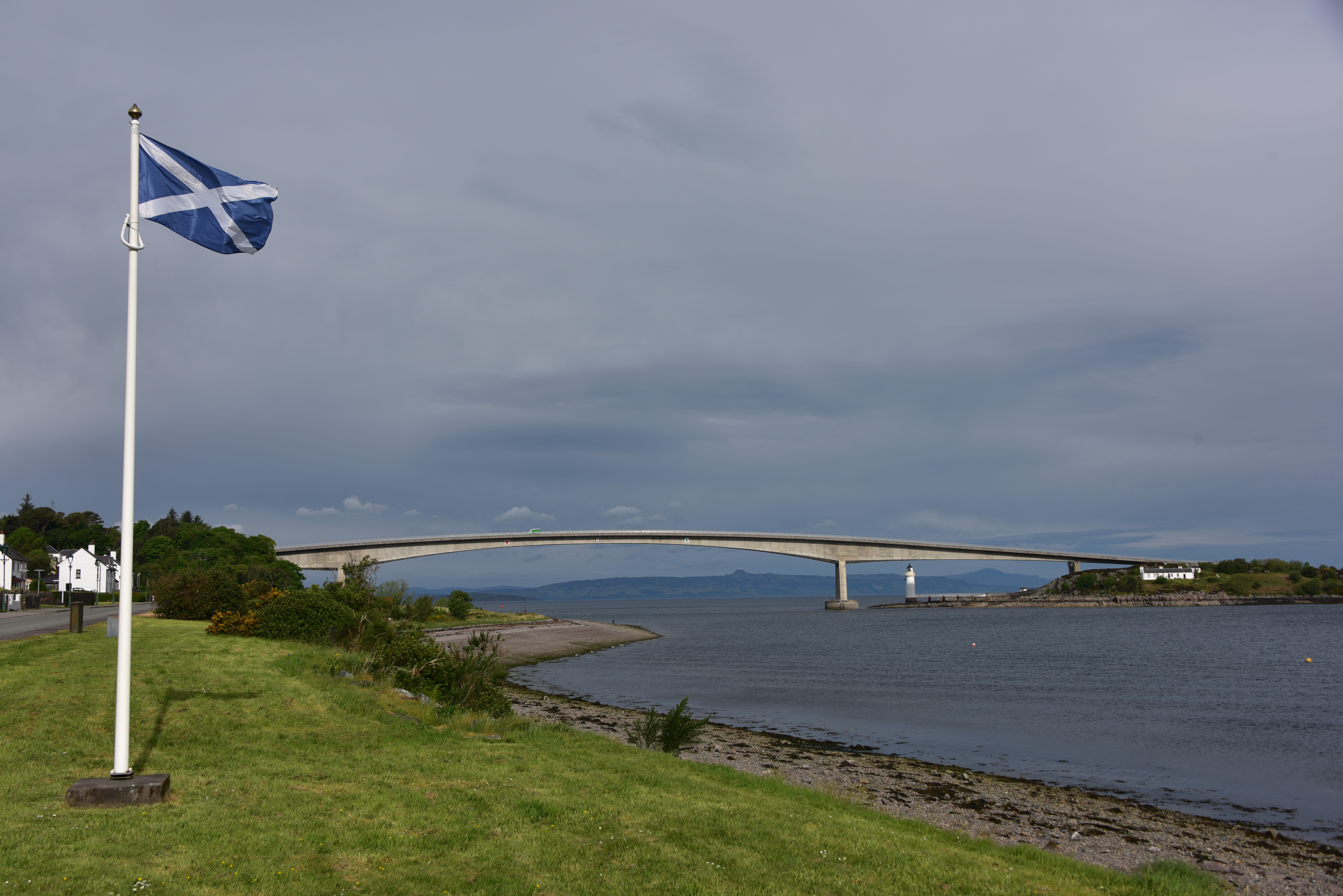
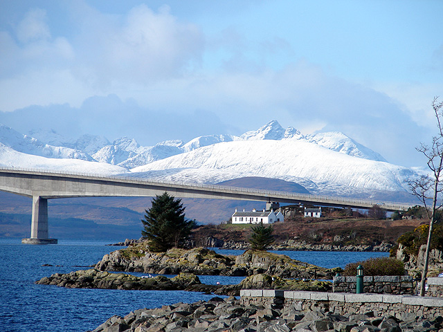
Skye Bridge

The Skye Bridge (Scottish Gaelic: Drochaid an Eilein Sgitheanaich) is a road bridge over Loch Alsh, Scotland, connecting the Isle of Skye to the island...

Nearby Amenities

Located within 500m of 57.257471,-5.8119876
Material: wood
Power: pole
Lat/Long: 57.2533292/-5.8129773
Material: wood
Power: pole
Lat/Long: 57.2542606/-5.810802
Material: wood
Power: pole
Lat/Long: 57.2547496/-5.8096755
Material: wood
Power: pole
Lat/Long: 57.2568503/-5.8044452
Power: pole
Lat/Long: 57.2551671/-5.8086361
Material: wood
Power: pole
Lat/Long: 57.2555807/-5.8076062
Material: wood
Power: pole
Lat/Long: 57.2538105/-5.8118533
Power: pole
Lat/Long: 57.2542584/-5.8128055
Power: pole
Lat/Long: 57.2543663/-5.81287
Power: pole
Lat/Long: 57.2547622/-5.8130871
Power: pole
Lat/Long: 57.2551129/-5.8132983
Power: pole
Lat/Long: 57.2554961/-5.8135418
Power: pole
Lat/Long: 57.2557936/-5.8136914
Lusa
Place: hamlet
Lat/Long: 57.2557425/-5.8144597
Òb Lusa
Natural: bay
Lat/Long: 57.2580172/-5.8120007
The data included in this document is from www.openstreetmap.org. The data is made available under ODbL.

Have you been to Ob Lusa?

Leave your review of Ob Lusa below (or comments, questions and feedback).