An Fhang

Sea, Estuary, Creek in Argyllshire

Scotland

An Fhang

Port Righ A sandy cove at the north end of the Isle of Gigha. The name means King's Port, the same as the town of Portree on the Isle of Skye.
Port Righ Credit: Anne Burgess

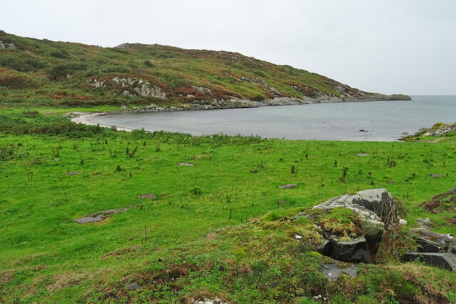
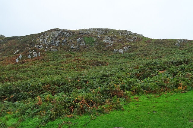
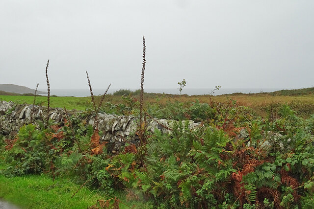
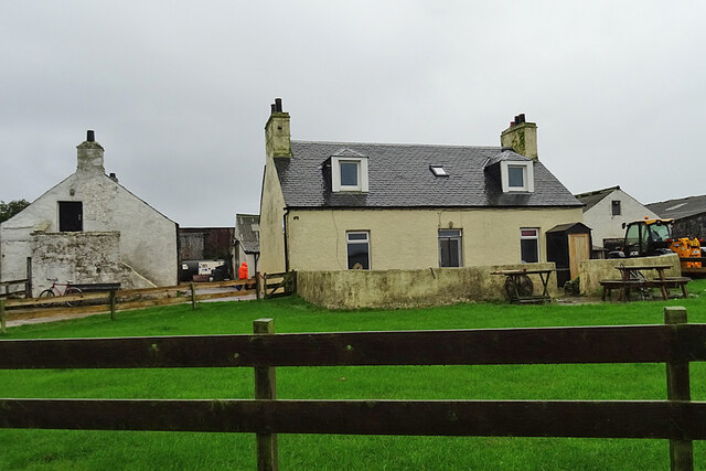
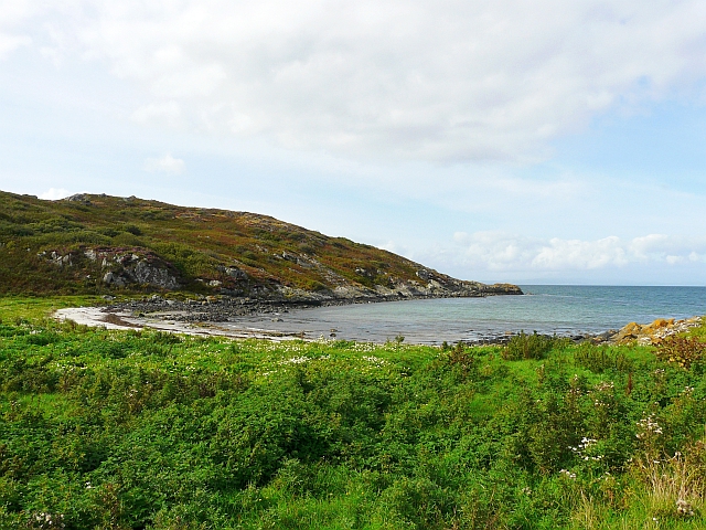
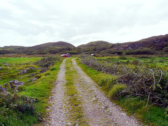
Located in Argyllshire, Scotland, An Fhang is a picturesque coastal region that boasts a stunning combination of sea, estuary, and creek. Nestled between rolling hills and rugged cliffs, this area is a haven for nature enthusiasts and those seeking tranquility amidst breathtaking scenery.

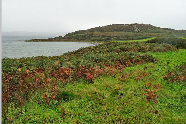
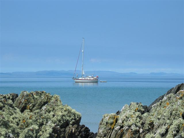
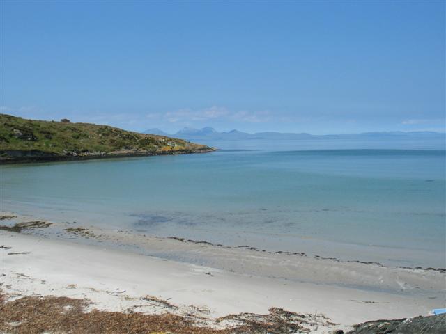
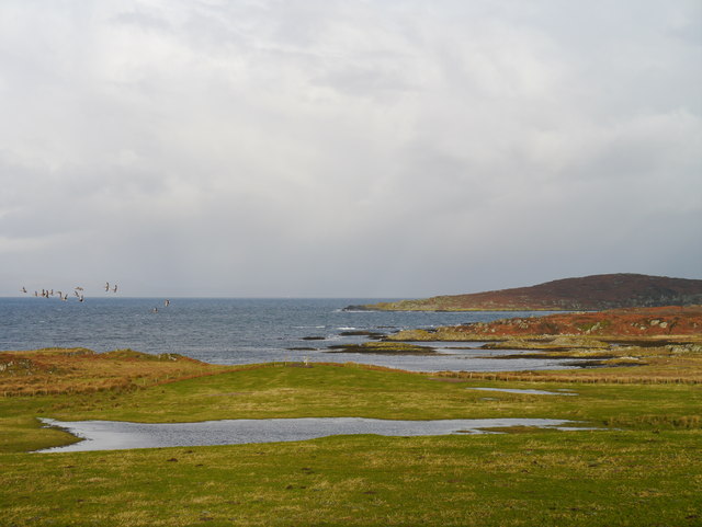
The sea in An Fhang is a mesmerizing sight, with its crystal-clear waters stretching out as far as the eye can see. It provides a myriad of recreational opportunities, including swimming, fishing, and boating. The coastline is dotted with beautiful sandy beaches, perfect for sunbathing or leisurely strolls along the shore.

The estuary in An Fhang is a thriving ecosystem, where the river meets the sea. It supports a diverse range of marine life, including various species of fish, crustaceans, and birds. Visitors can observe the intricate interplay between the river and the sea, as well as the unique flora and fauna that call this estuary home.

The creek in An Fhang is a tranquil and narrow watercourse that winds its way through the landscape, creating a peaceful atmosphere. Ideal for kayaking or canoeing, the creek offers a serene setting for exploration and relaxation. Lined with lush vegetation, it is also a haven for wildlife, with otters, herons, and other bird species often seen along its banks.

An Fhang, Argyllshire, is a true gem of natural beauty, offering a harmonious blend of sea, estuary, and creek. Whether one seeks adventure on the water or simply wishes to immerse themselves in the tranquility of nature, this coastal region is sure to captivate all who visit.

If you have any feedback on the listing, please let us know in the comments section below.
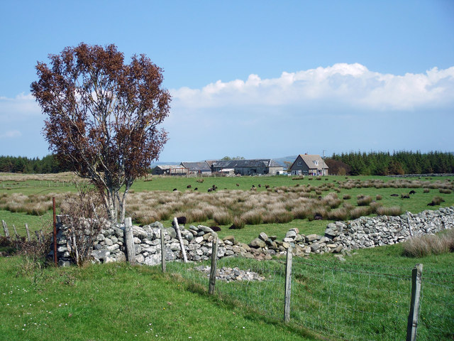
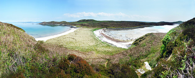
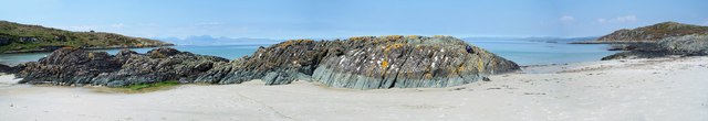
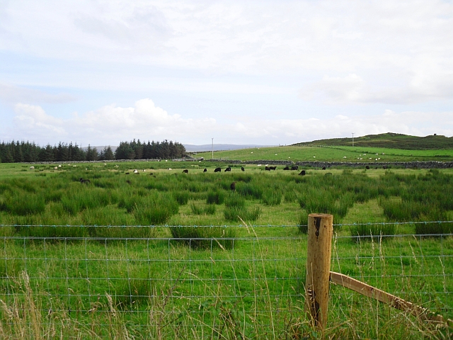
An Fhang Images

Images are sourced within 2km of 55.713241/-5.737938 or Grid Reference NR6552. Thanks to Geograph Open Source API. All images are credited.

Port Righ A sandy cove at the north end of the Isle of Gigha. The name means King's Port, the same as the town of Portree on the Isle of Skye.
Port Righ
A sandy cove at the north end of the Isle of Gigha. The name means King's Port, the same as the town of Portree on the Isle of Skye.
Cnoc nan Gobhar Wet bracken on the slope of Cnoc nan Gobhar, near the north end of the Isle of Gigha.
Cnoc nan Gobhar
Wet bracken on the slope of Cnoc nan Gobhar, near the north end of the Isle of Gigha.
Roadside Dyke On a pleasant day it would be tempting to take a walk to the shore of Bàgh Rubha Ruaidh, of which there is just a glimpse over the top of the dyke.
Roadside Dyke
On a pleasant day it would be tempting to take a walk to the shore of Bàgh Rubha Ruaidh, of which there is just a glimpse over the top of the dyke.
Access Road in the Rain You can tell how wet it is by the drops on the lens, and the drips on the gate. It looks as if the old buildings here have been replaced by a new house, named Balmore.
Access Road in the Rain
You can tell how wet it is by the drops on the lens, and the drips on the gate. It looks as if the old buildings here have been replaced by a new house, named Balmore.
Carragh an Tarbert A distinctive standing stone beside the road at Tarbert on the Isle of Gigha. It is also known as the Druids' Stone, and A Thom, author of 'The standing stones in Argyllshire' and 'Megalithic lunar observatories', considers it to be a lunar obervatory dating from the 1st millennium BC.
Carragh an Tarbert
A distinctive standing stone beside the road at Tarbert on the Isle of Gigha. It is also known as the Druids' Stone, and A Thom, author of 'The standing stones in Argyllshire' and 'Megalithic lunar observatories', considers it to be a lunar obervatory dating from the 1st millennium BC.
East Tarbert Bay In the bay are an offshore fish farm. The ship seems to have been there for at least several days.
East Tarbert Bay
In the bay are an offshore fish farm. The ship seems to have been there for at least several days.
Looking over Tràigh Bhàn If the tide were not so high, the white sand that gives the beach its name would be visible here. The hummock is Cnoc Largie, in the next square.
Looking over Tràigh Bhàn
If the tide were not so high, the white sand that gives the beach its name would be visible here. The hummock is Cnoc Largie, in the next square.
Tarbert Farm The farm houses and steading are set back a little from the road.
Tarbert Farm
The farm houses and steading are set back a little from the road.
Mooring yacht at Bagh na Doirlinne
Bagh na Doirlinne
Bagh na Doirlinne
Kinerarach, Gigha North Gighan farmstead
Kinerarach, Gigha
North Gighan farmstead
Bagh na Doirlinne and Bagh Rubha Ruaidh Gigha.

Panoramic shot of the twin beaches taken from Eilean Garbh with Doirlinne to the left and Rubha Ruaidh to the right.
Bagh na Doirlinne and Bagh Rubha Ruaidh
Gigha. Panoramic shot of the twin beaches taken from Eilean Garbh with Doirlinne to the left and Rubha Ruaidh to the right.
Beach at East End of Bagh na Doirlinne One of the many white sanded beaches of Gigha.
Beach at East End of Bagh na Doirlinne
One of the many white sanded beaches of Gigha.
Black sheep in a rushy field View from the main road at Kinerarach.
Black sheep in a rushy field
View from the main road at Kinerarach.
Port Righ, Isle of Gigha A small bay at the very north of the island.
Port Righ, Isle of Gigha
A small bay at the very north of the island.
Parking area and track, top end of Gigha This track is a continuation of the made-up road which runs the length of the island.
Parking area and track, top end of Gigha
This track is a continuation of the made-up road which runs the length of the island.
Grazing Land At Tarbert Farm Flooded grazing land at Tarbert Farm, with a small skein of Greenland White-fronted Geese in the left of shot.  In the distance, West Tarbert Bay can be noted.
Grazing Land At Tarbert Farm
Flooded grazing land at Tarbert Farm, with a small skein of Greenland White-fronted Geese in the left of shot. In the distance, West Tarbert Bay can be noted.
Standing Stone A lichen-encrusted standing stone beside the road at the northern end of Gigha adjacent to East Tarbert Bay.
Standing Stone
A lichen-encrusted standing stone beside the road at the northern end of Gigha adjacent to East Tarbert Bay.
Show me another place!

An Fhang is located at Grid Ref: NR6552 (Lat: 55.713241, Lng: -5.737938)

Unitary Authority: Argyll and Bute

Police Authority: Argyll and West Dunbartonshire

What 3 Words

///waltzed.action.scooters. Near Craighouse, Argyll & Bute

Related Wikis

Gigha

Gigha (; Scottish Gaelic: Giogha; Scots: Gigha) or the Isle of Gigha (and formerly Gigha Island) is an island off the west coast of Kintyre in Scotland...

Sound of Gigha

The Sound of Gigha is a sound between the Inner Hebridean Isle of Gigha and Kintyre. It forms part of the Atlantic Ocean. == External links ==

Kilchattan Chapel

Kilchattan Chapel (St Cathan's Chapel) is a ruined medieval chapel near Ardminish, Isle of Gigha, Argyll and Bute, Scotland. Built in the 13th century...

Achamore House

Achamore House is a mansion on the Isle of Gigha, Scotland. It was built in 1884 for Lt-Col William James Scarlett, and the extensive gardens were laid...

Nearby Amenities

Located within 500m of 55.713241,-5.737938
Created By: dmgroom_coastlines
Lat/Long: 55.708906/-5.7385355
Created By: dmgroom_coastlines
Lat/Long: 55.7093907/-5.7389357
Created By: dmgroom_coastlines
Lat/Long: 55.7094126/-5.7393162
Created By: dmgroom_coastlines
Lat/Long: 55.709612/-5.739435
Created By: dmgroom_coastlines
Lat/Long: 55.709868/-5.739453
Created By: dmgroom_coastlines
Lat/Long: 55.710645/-5.739054
Created By: dmgroom_coastlines
Lat/Long: 55.711423/-5.738654
Created By: dmgroom_coastlines
Lat/Long: 55.711934/-5.73869
Created By: dmgroom_coastlines
Lat/Long: 55.712446/-5.738726
Created By: dmgroom_coastlines
Lat/Long: 55.712967/-5.738309
Created By: dmgroom_coastlines
Lat/Long: 55.713233/-5.737873
Created By: dmgroom_coastlines
Lat/Long: 55.7135577/-5.7377669
Created By: dmgroom_coastlines
Lat/Long: 55.713765/-5.737003
Created By: dmgroom_coastlines
Lat/Long: 55.7156859/-5.735729
Created By: dmgroom_coastlines
Lat/Long: 55.715822/-5.736693
Created By: dmgroom_coastlines
Lat/Long: 55.716077/-5.736711
Created By: dmgroom_coastlines
Lat/Long: 55.716589/-5.736747
Created By: dmgroom_coastlines
Lat/Long: 55.716845/-5.736765
Created By: dmgroom_coastlines
Lat/Long: 55.717622/-5.736365
West Tarbert Bay
Natural: bay
Lat/Long: 55.7144324/-5.7441759
The data included in this document is from www.openstreetmap.org. The data is made available under ODbL.

Have you been to An Fhang?

Leave your review of An Fhang below (or comments, questions and feedback).