South Channel

Sea, Estuary, Creek in Inverness-shire

Scotland

South Channel

Tidal pool near the end of the road to Rhue Looking out towards the various reefs and islets that fringe the South Channel entrance to Loch nan Ceall. Eigg fills much of the distant scene with the mountains of Rum to the right.
Tidal pool near the end of the road to Rhue Credit: Gordon Hatton

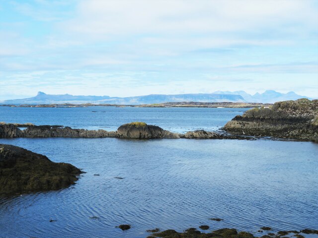
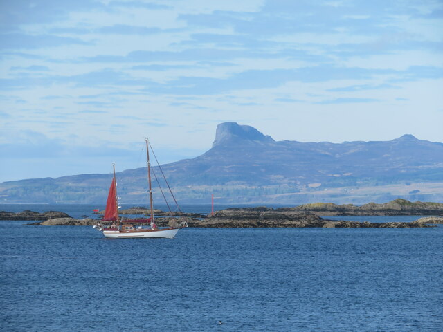
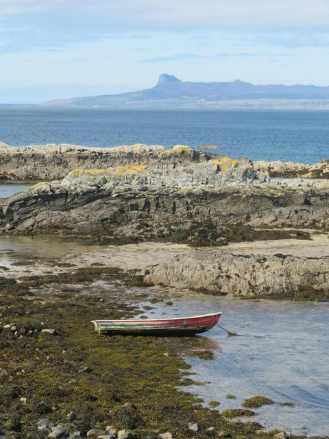
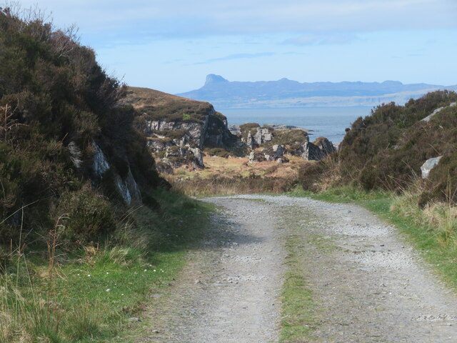
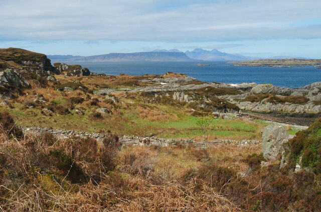
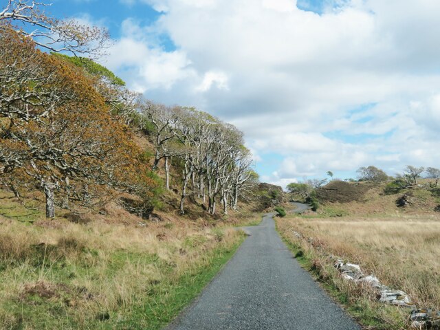
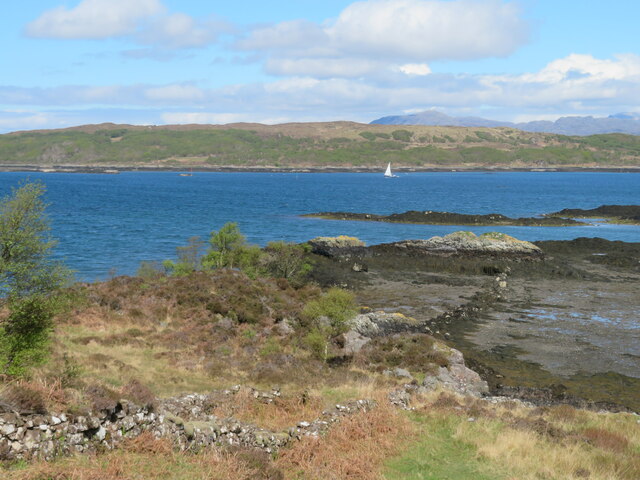
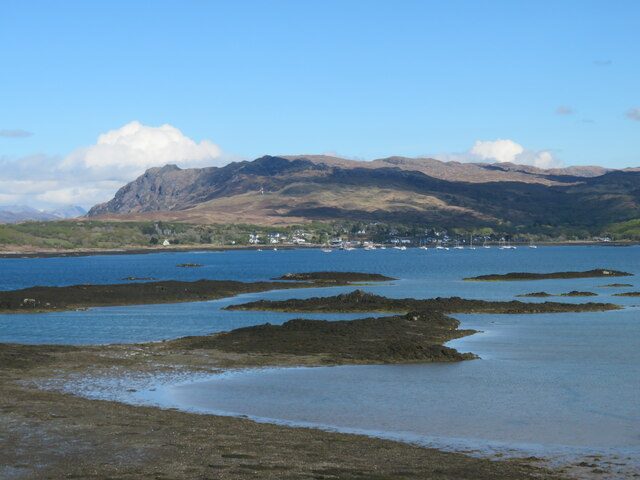
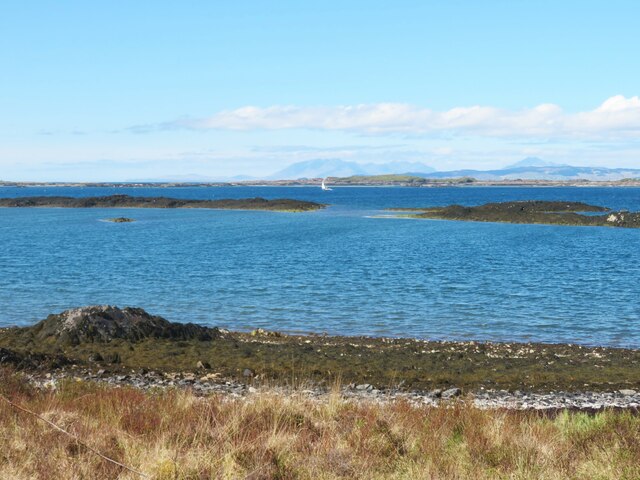
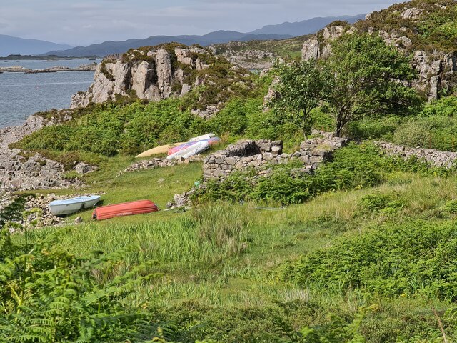
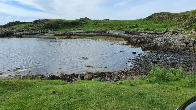
South Channel is a picturesque waterway located in Inverness-shire, Scotland. It is a sea inlet that stretches inland, forming an estuary and eventually narrowing into a creek. The channel is known for its stunning natural beauty and serves as an important habitat for diverse marine and bird species.

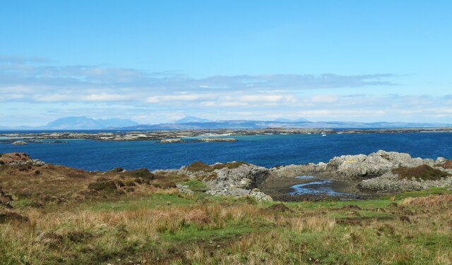
The channel is influenced by the tides, with water levels constantly fluctuating throughout the day. It is surrounded by rolling hills and lush greenery, creating a serene and tranquil atmosphere. The crystal-clear waters reflect the surrounding landscape, adding to the area's visual appeal.

The estuary formed by the South Channel is a crucial breeding ground for various fish species, making it a popular spot for anglers and fishing enthusiasts. It is also home to a rich array of birdlife, including herons, cormorants, and even the occasional osprey. Birdwatchers flock to the area to observe and study these fascinating creatures.

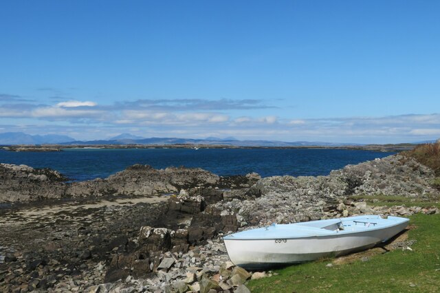
The creek at the end of the South Channel offers a more secluded and intimate setting. Its calm waters and peaceful surroundings make it an ideal location for kayaking and canoeing. Visitors can paddle through the narrow creek, admiring the abundant plant life and enjoying the tranquility of the area.

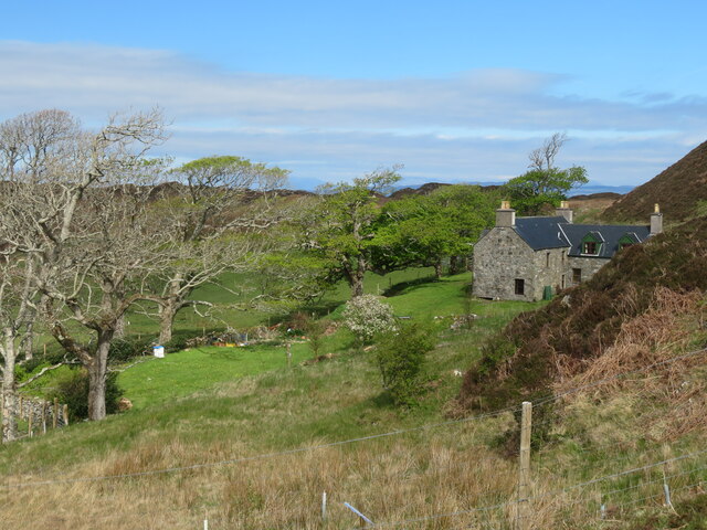
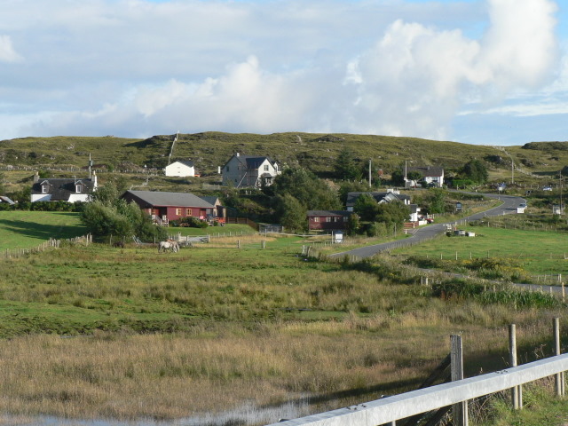
South Channel is a hidden gem in Inverness-shire, offering a unique blend of coastal and inland beauty. Its diverse ecosystem and scenic vistas make it a must-visit destination for nature lovers and outdoor enthusiasts alike.

If you have any feedback on the listing, please let us know in the comments section below.

South Channel Images

Images are sourced within 2km of 56.904325/-5.8997454 or Grid Reference NM6285. Thanks to Geograph Open Source API. All images are credited.

Tidal pool near the end of the road to Rhue Looking out towards the various reefs and islets that fringe the South Channel entrance to Loch nan Ceall. Eigg fills much of the distant scene with the mountains of Rum to the right.
Tidal pool near the end of the road to Rhue
Looking out towards the various reefs and islets that fringe the South Channel entrance to Loch nan Ceall. Eigg fills much of the distant scene with the mountains of Rum to the right.
Passing yacht in the South Channel An idyllic scene with blue skies and sea and with a rather fine traditional yacht passing by between the mainland and rocky skerries. The Sgurr on Eigg is prominent in the distance.
Passing yacht in the South Channel
An idyllic scene with blue skies and sea and with a rather fine traditional yacht passing by between the mainland and rocky skerries. The Sgurr on Eigg is prominent in the distance.
Boat by the shore A view taken from the end of the public road looking out towards Eigg.
Boat by the shore
A view taken from the end of the public road looking out towards Eigg.
The road to Rhue Private road/track to Rhue House & cottage. The Sgurr on Eigg in the distance.
The road to Rhue
Private road/track to Rhue House & cottage. The Sgurr on Eigg in the distance.
Coastal view on the way to Rhue Old walls and signs of former cultivation here, but now reverting to bracken and heather ground. In the distance is the north end of Eigg with the mountains of Rum beyond.
Coastal view on the way to Rhue
Old walls and signs of former cultivation here, but now reverting to bracken and heather ground. In the distance is the north end of Eigg with the mountains of Rum beyond.
Birch by the trackside This tree has given up trying to grow vertically and has been pushed to one side by the prevailing wind.
Birch by the trackside
This tree has given up trying to grow vertically and has been pushed to one side by the prevailing wind.
West Highland seascape A coastal view from the Rhue track looking out over the South Channel towards the maze of skerries and tiny islands towards distant Skye where old favourites can be seen. The main Cuillin range to the left, Blaven in the centre and the Red Hills to the right.
West Highland seascape
A coastal view from the Rhue track looking out over the South Channel towards the maze of skerries and tiny islands towards distant Skye where old favourites can be seen. The main Cuillin range to the left, Blaven in the centre and the Red Hills to the right.
Boat by the shore Sitting above the high tide line below the track to Rhue. The mountains on Skye on the horizon.
Boat by the shore
Sitting above the high tide line below the track to Rhue. The mountains on Skye on the horizon.
Rhue Cottage Tucked below a hill slope where the leaning trees indicate the prevailing wind from the west.
Rhue Cottage
Tucked below a hill slope where the leaning trees indicate the prevailing wind from the west.
Woodland strip by the Rhue road Looking east along the road with a strip of woodland taking advantage of a little shelter from Atlantic gales.
Woodland strip by the Rhue road
Looking east along the road with a strip of woodland taking advantage of a little shelter from Atlantic gales.
Loch nan Ceall from the Rhue Road A view across Loch nan Ceall from near the road to Rhue.
Loch nan Ceall from the Rhue Road
A view across Loch nan Ceall from near the road to Rhue.
Loch nan Ceall shoreline A view across this sea loch towards Arisaig and the hills beyond.
Loch nan Ceall shoreline
A view across this sea loch towards Arisaig and the hills beyond.
Across Loch nan Ceall Looking west of north across skerries and islets towards the distant mountains on Skye where the main Cuillin range is near the photo centre with Blaven off to the right.
Across Loch nan Ceall
Looking west of north across skerries and islets towards the distant mountains on Skye where the main Cuillin range is near the photo centre with Blaven off to the right.
Boats on shore by memorial, Sound of Arisaig
Looking towards Sound of Arisaig
Bay off South Channel Sound of Arisaig
Bay off South Channel
Sound of Arisaig
In Loch nan Ceall Heading for Eigg
In Loch nan Ceall
Heading for Eigg
In Loch nan Ceall Heading for Eigg
In Loch nan Ceall
Heading for Eigg
Show me another place!

South Channel is located at Grid Ref: NM6285 (Lat: 56.904325, Lng: -5.8997454)

Unitary Authority: Highland

Police Authority: Highlands and Islands

What 3 Words

///prowl.corrects.reminds. Near Arisaig, Highland

Related Wikis

Eilean Ighe

Eilean Ighe is a small tidal island near Arisaig in the Inner Hebrides of Scotland. The area is popular for sea kayaking and a challenge for larger boats...

Rhu Peninsula

Rhu Peninsula (Scottish Gaelic: Rudha Arasaig) and originally known as the Rhu Arisaig peninsula is a small, remote and largely deserted peninsula, at...

Back of Keppoch

Back of Keppoch (Gaelic: Cùl na Ceapaich) is a small coastal settlement in the northwest Scottish Highlands, 40 miles (65 kilometres) west of Fort William...

Arisaig

Arisaig (Scottish Gaelic: Àrasaig) is a village in Lochaber, Inverness-shire. It lies 7 miles (11 kilometres) south of Mallaig on the west coast of the...

Nearby Amenities

Located within 500m of 56.904325,-5.8997454
Created By: dmgroom_coastlines
Source: PGS
Lat/Long: 56.904641/-5.893099
Created By: dmgroom_coastlines
Source: PGS
Lat/Long: 56.904374/-5.893547
Created By: dmgroom_coastlines
Source: PGS
Lat/Long: 56.904097/-5.894462
Created By: dmgroom_coastlines
Source: PGS
Lat/Long: 56.903948/-5.895387
Created By: dmgroom_coastlines
Source: PGS
Lat/Long: 56.903431/-5.895582
Created By: dmgroom_coastlines
Source: PGS
Lat/Long: 56.903165/-5.896029
Created By: dmgroom_coastlines
Source: PGS
Lat/Long: 56.902642/-5.896457
Created By: dmgroom_coastlines
Source: PGS
Lat/Long: 56.90212/-5.896884
Created By: dmgroom_coastlines
Source: PGS
Lat/Long: 56.901859/-5.897097
Created By: dmgroom_coastlines
Source: PGS
Lat/Long: 56.901976/-5.897575
Created By: dmgroom_coastlines
Source: PGS
Lat/Long: 56.90222/-5.898062
Created By: dmgroom_coastlines
Source: PGS
Lat/Long: 56.902199/-5.898996
Created By: dmgroom_coastlines
Source: PGS
Lat/Long: 56.902188/-5.899464
Created By: dmgroom_coastlines
Source: PGS
Lat/Long: 56.902294/-5.900408
Created By: dmgroom_coastlines
Source: PGS
Lat/Long: 56.902044/-5.900156
Created By: dmgroom_coastlines
Source: PGS
Lat/Long: 56.901533/-5.900116
Created By: dmgroom_coastlines
Source: PGS
Lat/Long: 56.901266/-5.900564
Created By: dmgroom_coastlines
Source: PGS
Lat/Long: 56.901011/-5.900544
Created By: dmgroom_coastlines
Source: PGS
Lat/Long: 56.900888/-5.900299
Created By: dmgroom_coastlines
Source: PGS
Lat/Long: 56.900766/-5.900056
Created By: dmgroom_coastlines
Source: PGS
Lat/Long: 56.900265/-5.89955
The data included in this document is from www.openstreetmap.org. The data is made available under ODbL.

Have you been to South Channel?

Leave your review of South Channel below (or comments, questions and feedback).