Castle Giver Cove

Sea, Estuary, Creek in Cornwall

England

Castle Giver Cove

Beach Cafe at Godrevy Towans, near Hayle
Beach Cafe at Godrevy Towans, near Hayle Credit: Richard Rogerson

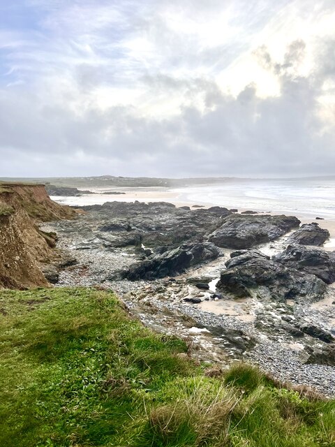
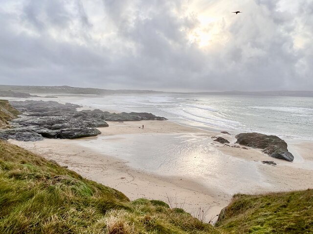
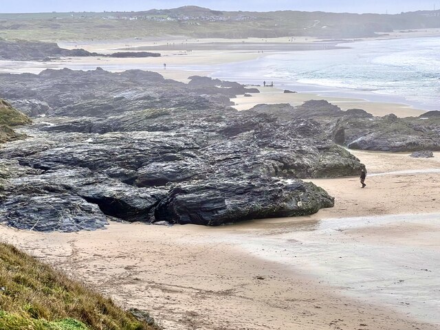
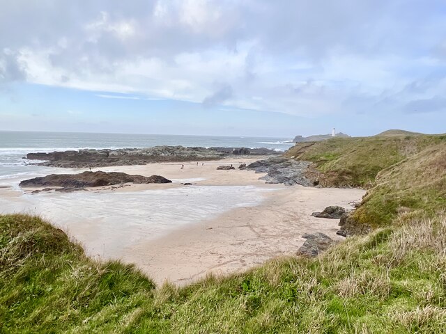
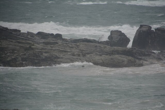
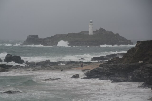
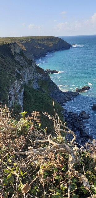
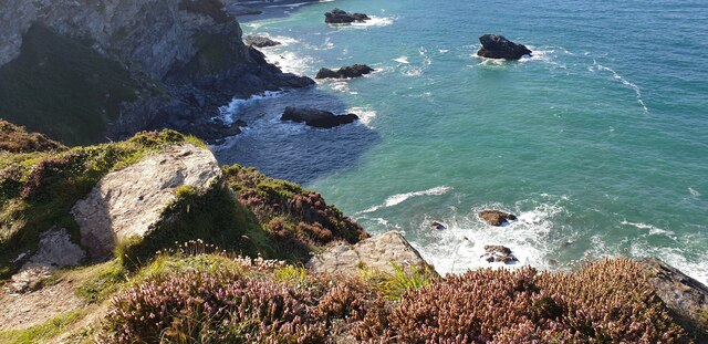
Castle Giver Cove is a picturesque coastal area located in Cornwall, England. Nestled along the rugged coastline, this hidden gem offers a unique combination of sea, estuary, and creek, creating a diverse and captivating landscape.

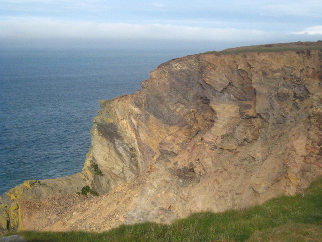
The cove is named after the prominent Castle Giver, a historic castle ruins that overlooks the area. The castle provides a dramatic backdrop to the surrounding natural beauty, adding an air of mystery and intrigue. It is believed to have been built in the 13th century and served as a stronghold during various historical conflicts.

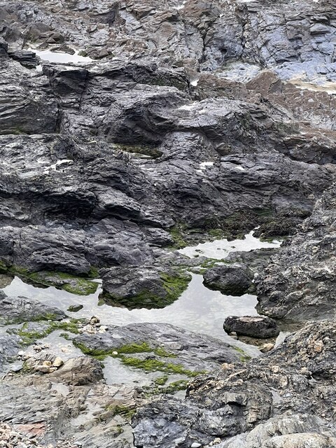
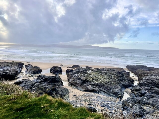
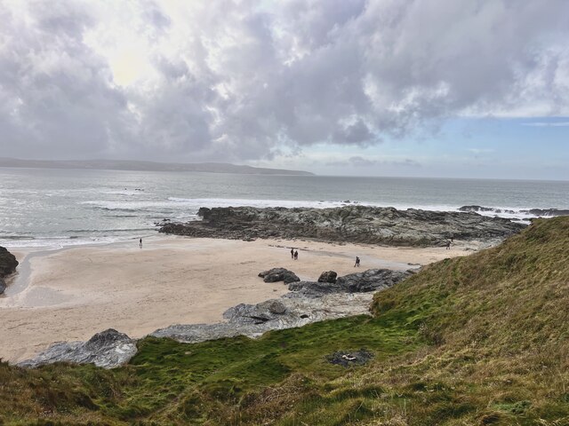
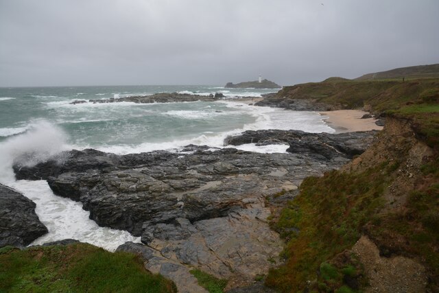
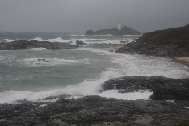
The cove itself is characterized by its pristine sandy beach, which stretches for approximately half a mile. The crystal-clear turquoise waters of the sea offer a refreshing escape for swimmers and water sports enthusiasts, while the golden sands provide the perfect spot for sunbathing and picnicking.

Adjacent to the beach, an estuary flows into the cove, creating a tranquil haven for birdwatchers and nature lovers. The estuary is home to a rich variety of bird species, including herons, egrets, and cormorants. Visitors can observe these birds in their natural habitat, as they gracefully glide across the water or perch on the branches of the surrounding trees.

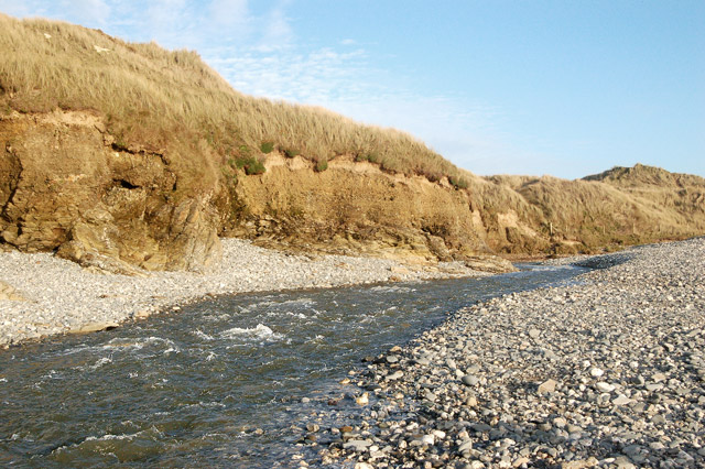
Further inland, a meandering creek winds its way through the lush green landscape, offering a peaceful retreat for those seeking solitude and serenity. The creek is navigable during high tide, attracting kayakers and boaters who can explore the stunning surroundings and discover hidden coves and inlets.

Castle Giver Cove is a haven for outdoor enthusiasts and nature lovers, offering a harmonious blend of sea, estuary, and creek. Its breathtaking beauty and rich historical heritage make it a must-visit destination for anyone seeking an authentic Cornwall experience.

If you have any feedback on the listing, please let us know in the comments section below.

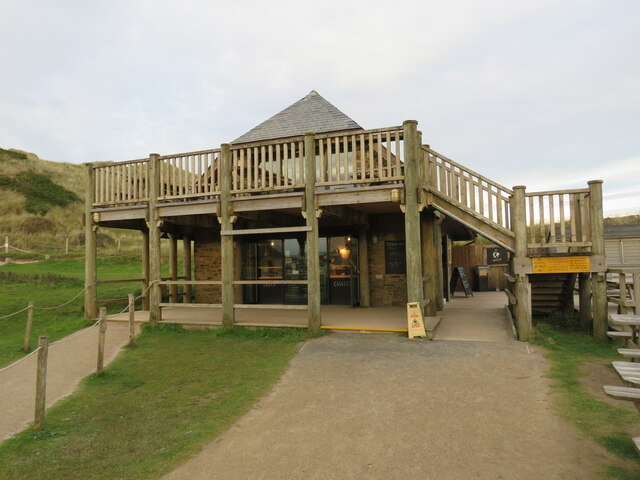
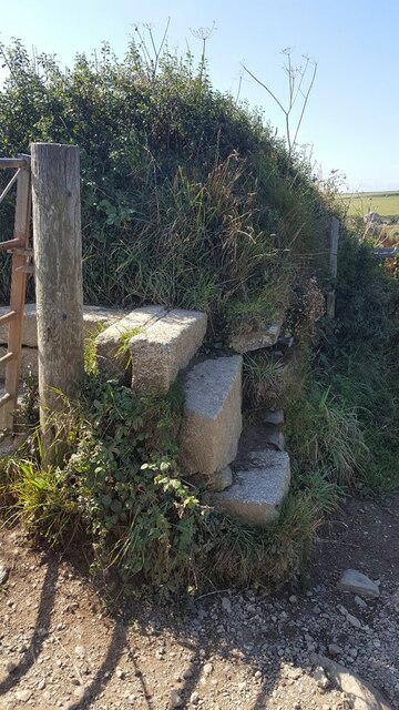
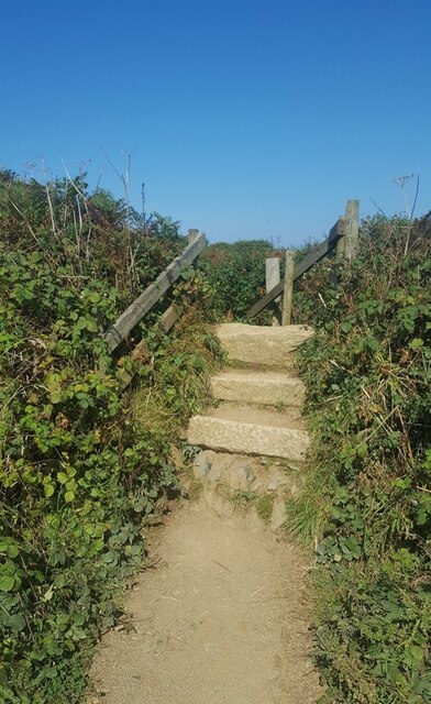
Castle Giver Cove Images

Images are sourced within 2km of 50.237822/-5.3733622 or Grid Reference SW5942. Thanks to Geograph Open Source API. All images are credited.

Beach Cafe at Godrevy Towans, near Hayle
Godrevy Beach Beach and rocks on the foreshore at Godrevy.
Godrevy Beach
Beach and rocks on the foreshore at Godrevy.
Godrevy beach A small beach between the rocky foreshore.
Godrevy beach
A small beach between the rocky foreshore.
Foreshore Rocks Rocks on Godrevy beach, the height can be gauged by a walker on the sand.
Foreshore Rocks
Rocks on Godrevy beach, the height can be gauged by a walker on the sand.
Rock pool One of many  pools amongst the rocks.
Rock pool
One of many pools amongst the rocks.
Godrevy Beach A more northerly section of the beach at Godrevy.
Godrevy Beach
A more northerly section of the beach at Godrevy.
Rocks and Streams There are several streams running through the fissures in the rocks.
Rocks and Streams
There are several streams running through the fissures in the rocks.
Godrevy Beach The northern section of beach in this grid square. Several dog walkers are taking advantage of the relaxed rules regarding dogs on beaches during the winter months.
Godrevy Beach
The northern section of beach in this grid square. Several dog walkers are taking advantage of the relaxed rules regarding dogs on beaches during the winter months.
Stone Stile SW5942 On the Coast Path between Hell’s Mouth and Godrevy Point, overlooking Fishing Cove. 
Beside a galvanised steel farm gate.
Granite steps, turning through ninety degrees, with two granite steps on each side to a granite top step of two blocks at right angles.
Public footpath 203/1/4 gold CP from Hell’s Mouth to Godrevy Point
Stone Stile SW5942
On the Coast Path between Hell’s Mouth and Godrevy Point, overlooking Fishing Cove. Beside a galvanised steel farm gate. Granite steps, turning through ninety degrees, with two granite steps on each side to a granite top step of two blocks at right angles. Public footpath 203/1/4 gold CP from Hell’s Mouth to Godrevy Point
Stone Stile SW5943 On the Coast Path between Hell’s Mouth and Godrevy Point, to the north of Castle Giver Cove.
Granite steps. Two steps on south side and four steps on north side of a top step. Wooden handrails on both sides.
Public footpath 101/47/1, 101/32/1 gold CP from Hell’s Mouth to Godrevy Point.
Stone Stile SW5943
On the Coast Path between Hell’s Mouth and Godrevy Point, to the north of Castle Giver Cove. Granite steps. Two steps on south side and four steps on north side of a top step. Wooden handrails on both sides. Public footpath 101/47/1, 101/32/1 gold CP from Hell’s Mouth to Godrevy Point.
Gwithian : Godrevy Cove Looking across the coastline.
Gwithian : Godrevy Cove
Looking across the coastline.
Gwithian : Godrevy Cove A wet and rough day to be beside the sea.
Gwithian : Godrevy Cove
A wet and rough day to be beside the sea.
Gwithian : Godrevy Cove Looking towards a seal poking his head from the water.
Gwithian : Godrevy Cove
Looking towards a seal poking his head from the water.
Gwithian : Godrevy Cove Looking across Godrevy Cove with Godrevy Island and lighthouse in view.
Gwithian : Godrevy Cove
Looking across Godrevy Cove with Godrevy Island and lighthouse in view.
Gwithian : Road A small road and parking spaces alongside it.
Gwithian : Road
A small road and parking spaces alongside it.
Fishing Cove from cliff A view of Fishing Cove and out to Navax Point headland from a nice spot to sit on a cliff.
Fishing Cove from cliff
A view of Fishing Cove and out to Navax Point headland from a nice spot to sit on a cliff.
Fishing Cove from cliff Another view of Fishing Cove from the cliff.
Fishing Cove from cliff
Another view of Fishing Cove from the cliff.
Fishing Cove A very steep drop down to Fishing Cove from the cliff.
Fishing Cove
A very steep drop down to Fishing Cove from the cliff.
Show me another place!

Castle Giver Cove is located at Grid Ref: SW5942 (Lat: 50.237822, Lng: -5.3733622)

Unitary Authority: Cornwall

Police Authority: Devon and Cornwall

What 3 Words

///liability.condensed.abruptly. Near Camborne, Cornwall

Related Wikis

Hell's Mouth, Cornwall

Hell's Mouth (Cornish: Ganow Yfarn) is situated northeast of Gwithian on the South West Coast Path in the county of Cornwall, England, UK. The land is...

Red River (Koner)

The Red River (Cornish: Dowr Koner) is a small river in north-west Cornwall, England, United Kingdom which issues into St Ives Bay at Godrevy on Cornwall...

Godrevy

Godrevy (Cornish: Godrevi, meaning small farms) ( gə-DREE-vee) is an area on the eastern side of St Ives Bay, west Cornwall, England, United Kingdom, which...

St Gothian Sands

St Gothian Sands (grid reference SW585418) is a Local Nature Reserve near Gwithian, Cornwall. It was declared a Local Nature Reserve in 2005 by the Penwith...

Nearby Amenities

Located within 500m of 50.237822,-5.3733622
Source: PGS
Lat/Long: 50.2363175/-5.3689829
Source: PGS
Lat/Long: 50.2364984/-5.3692495
Source: PGS
Lat/Long: 50.2366581/-5.3695515
Source: PGS
Lat/Long: 50.2372052/-5.3700174
Source: PGS
Lat/Long: 50.2371622/-5.3703688
Source: PGS
Lat/Long: 50.2369054/-5.3714647
Source: PGS
Lat/Long: 50.236877/-5.371925
Source: PGS
Lat/Long: 50.2369131/-5.3720095
Source: PGS
Lat/Long: 50.2373871/-5.3728273
Source: PGS
Lat/Long: 50.2372835/-5.3735311
Source: PGS
Lat/Long: 50.2375013/-5.3738798
Source: PGS
Lat/Long: 50.2377365/-5.3736966
Source: PGS
Lat/Long: 50.2386326/-5.3739543
Source: PGS
Lat/Long: 50.238877/-5.374423
Source: PGS
Lat/Long: 50.2393989/-5.3746925
Source: PGS
Lat/Long: 50.2399182/-5.3749637
Source: PGS
Lat/Long: 50.2409795/-5.3764432
Source: PGS
Lat/Long: 50.241283/-5.3763294
Barrier: stile
Foot: yes
Material: stone
Stile: stepover
Lat/Long: 50.2366614/-5.3739382
Barrier: stile
Material: stone
Stile: stepover
Lat/Long: 50.2381516/-5.3752903
Castle Giver Cove
Natural: bay
Lat/Long: 50.2375631/-5.3734457
Fishing Cove
Natural: bay
Lat/Long: 50.2372052/-5.3723702
The data included in this document is from www.openstreetmap.org. The data is made available under ODbL.

Have you been to Castle Giver Cove?

Leave your review of Castle Giver Cove below (or comments, questions and feedback).