Loch na Cuilce

Sea, Estuary, Creek in Inverness-shire

Scotland

Loch na Cuilce

Scavaig River View of the steppings stone across Scavaig River, the UK's shortest river.
Scavaig River Credit: Ajay Tegala

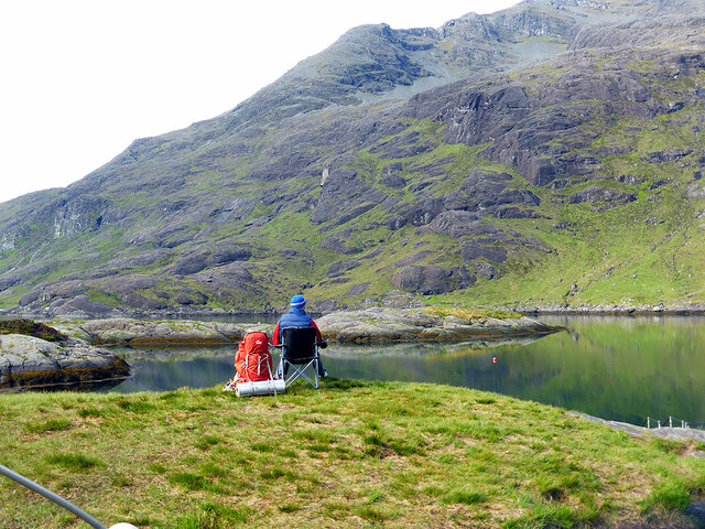
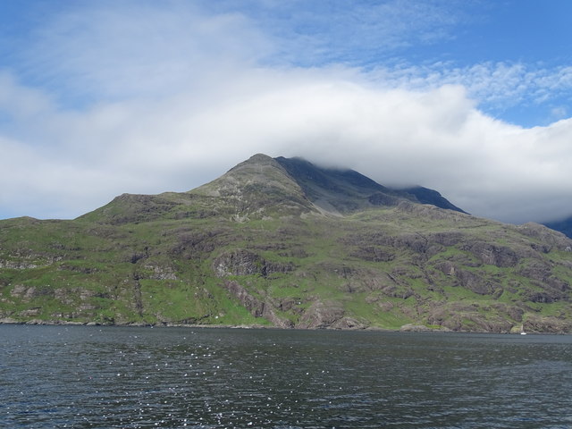
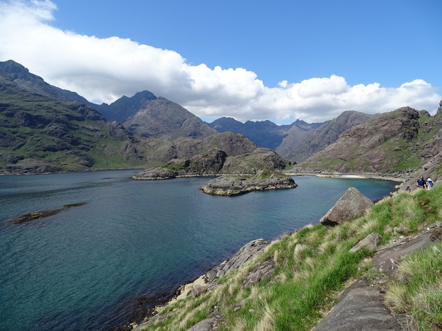
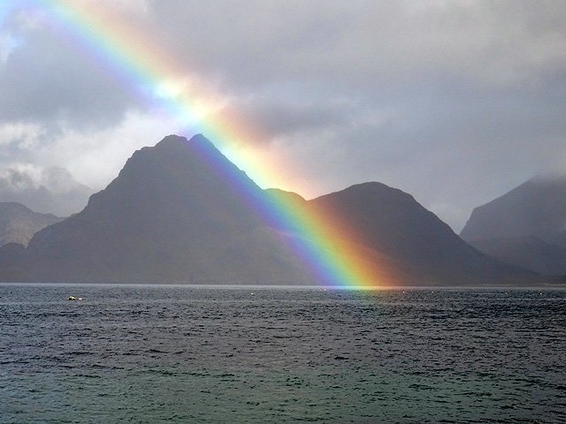
Loch na Cuilce is a picturesque body of water located in Inverness-shire, Scotland. This stunning loch is characterized by its tranquil and serene atmosphere, making it a popular destination for both locals and tourists seeking a peaceful retreat.

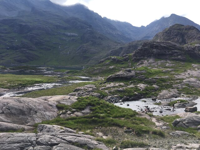
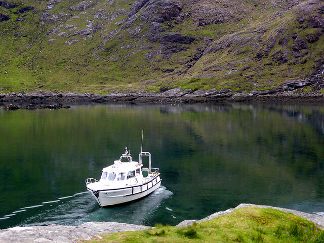
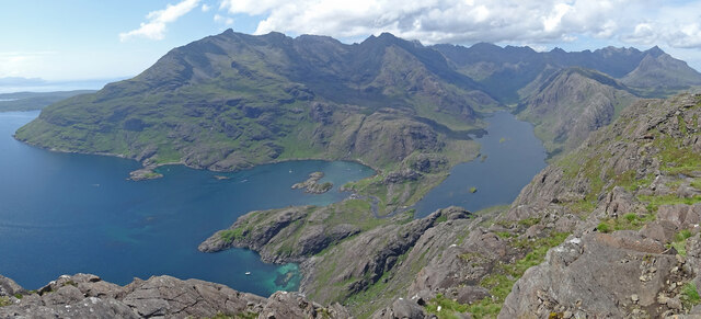
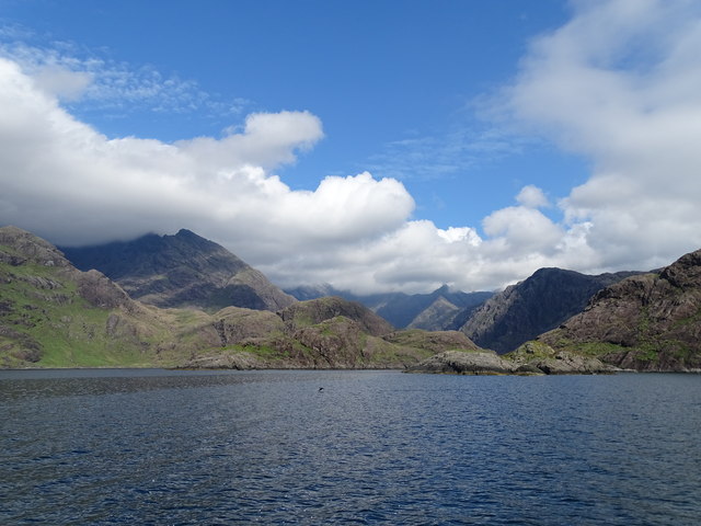
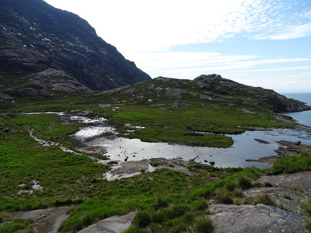
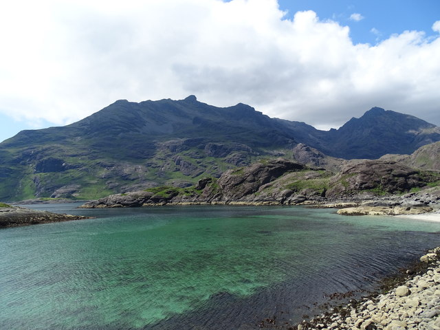
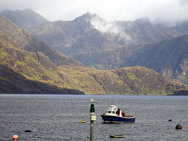
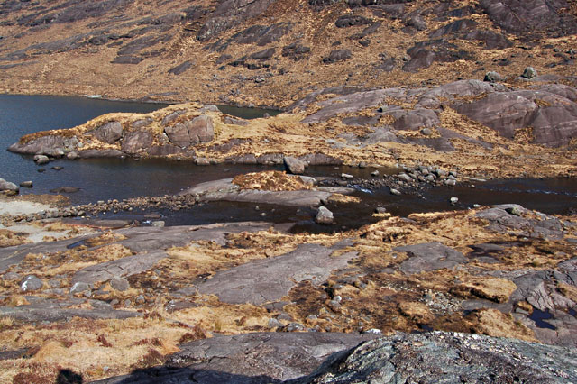
Situated near the coast, Loch na Cuilce is an estuary, where the river meets the sea. The loch is surrounded by lush green hills, providing a breathtaking backdrop to its crystal-clear waters. The area is abundant in wildlife, offering a haven for birdwatchers and nature enthusiasts. Visitors can spot a variety of bird species, including herons, ducks, and sometimes even ospreys.

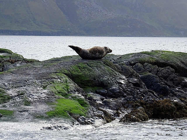
The loch is also home to a diverse range of marine life. It is not uncommon to see seals basking on the rocks or dolphins gracefully swimming in the distance. Fishing is a popular activity in Loch na Cuilce, with anglers often trying their luck at catching salmon or trout.

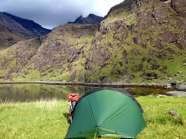
The surrounding landscape is dotted with a few small creeks that flow into the loch, creating a network of waterways that add to the charm of the area. These creeks provide opportunities for exploration, whether by boat or on foot along their banks.

With its stunning natural beauty and abundant wildlife, Loch na Cuilce is a must-visit destination for those seeking a peaceful and idyllic Scottish experience. Whether it's enjoying the tranquility of the loch, observing the rich birdlife, or simply taking in the breathtaking scenery, Loch na Cuilce offers a truly unforgettable experience for all who visit.

If you have any feedback on the listing, please let us know in the comments section below.

Loch na Cuilce Images

Images are sourced within 2km of 57.19259/-6.1619953 or Grid Reference NG4818. Thanks to Geograph Open Source API. All images are credited.

Scavaig River View of the steppings stone across Scavaig River, the UK's shortest river.
Scavaig River
View of the steppings stone across Scavaig River, the UK's shortest river.
The Elgol ferry departing from the Coruisk landing stage
Coruisk Memorial Hut Beneath Black Rock.
Coruisk Memorial Hut
Beneath Black Rock.
Camping by the Coruisk Memorial Hut With the Black Rock rising above.
Camping by the Coruisk Memorial Hut
With the Black Rock rising above.
Waiting for the ferry back to Elgol Not a bad place to wait!
Waiting for the ferry back to Elgol
Not a bad place to wait!
Not a bad view from one's tent! Camping near the Coruisk Memorial Hut, looking across Loch na Cuilce.
Not a bad view from one's tent!
Camping near the Coruisk Memorial Hut, looking across Loch na Cuilce.
The Cuillin from Sgùrr na Stri Taken from the western and slightly lower summit of Sgùrr na Stri this is the view of the whole Black Cuillin ridge - although ironically the highest, Sgurr Alasdair, is the only one of the 11 Munros that cannot be seen. Often cited as the finest viewpoint in Britain, though these things are subjective, it would be in my top 5.  Almost all of Loch Coruisk can be seen along with a number of  boats either moored or coming or going to this dramatic landscape.
The Cuillin from Sgùrr na Stri
Taken from the western and slightly lower summit of Sgùrr na Stri this is the view of the whole Black Cuillin ridge - although ironically the highest, Sgurr Alasdair, is the only one of the 11 Munros that cannot be seen. Often cited as the finest viewpoint in Britain, though these things are subjective, it would be in my top 5. Almost all of Loch Coruisk can be seen along with a number of boats either moored or coming or going to this dramatic landscape.
Loch na Cuilce near Loch Coruisk Loch na Cuilce (loch of the reeds) is a bay near the outflow from Loch Coruisk into Loch Scavaig, surrounded by the Cuillin slopes falling steeply down to sea level. R of centre is the Coruisk Memorial Hut, run by the Junior Mountaineering Club of Scotland. It was built in 1958-9 in memory of two climbers, Peter Drummond Smith and David Monro, who died on Ben Nevis in 1953 - for more background on the hut please see <span class="nowrap"><a title="https://mistyisleboattrips.co.uk/about/our-boat-trips/the-loch-coruisk-memorial-hut/" rel="nofollow ugc noopener" href="https://mistyisleboattrips.co.uk/about/our-boat-trips/the-loch-coruisk-memorial-hut/">Link</a><img style="margin-left:2px;" alt="External link" title="External link - shift click to open in new window" src="https://s1.geograph.org.uk/img/external.png" width="10" height="10"/></span>.
Loch na Cuilce near Loch Coruisk
Loch na Cuilce (loch of the reeds) is a bay near the outflow from Loch Coruisk into Loch Scavaig, surrounded by the Cuillin slopes falling steeply down to sea level. R of centre is the Coruisk Memorial Hut, run by the Junior Mountaineering Club of Scotland. It was built in 1958-9 in memory of two climbers, Peter Drummond Smith and David Monro, who died on Ben Nevis in 1953 - for more background on the hut please see LinkExternal link.
The Cuillin Coire Riabhach viewed across Loch Coruisk with the Scavaig River in the foreground.
The Cuillin
Coire Riabhach viewed across Loch Coruisk with the Scavaig River in the foreground.
Slopes of Gars-bheinn
Loch na Cuilce
Loch na Cuilce
Scavaig River
Scavaig River
Loch Nan Leachd
Loch Nan Leachd
View of Loch Nan Leachd
Loch Scavaig Viewed from Elgol.
Loch Scavaig
Viewed from Elgol.
Rainbow over Loch Scavaig One of the most vivid rainbows that I have ever seen. Sgùrr nan Eag etc. form the backdrop.
Rainbow over Loch Scavaig
One of the most vivid rainbows that I have ever seen. Sgùrr nan Eag etc. form the backdrop.
Common seal on rocks in Loch na Cuilce
Tour boat in Loch na Cuilce
Show me another place!

Loch na Cuilce is located at Grid Ref: NG4818 (Lat: 57.19259, Lng: -6.1619953)

Unitary Authority: Highland

Police Authority: Highlands and Islands

What 3 Words

///strapped.undertook.reversed. Near Elgol, Highland

Related Wikis

Scavaig River

The Scavaig River or River Coruisk is a river on the Isle of Skye, in Scotland. It is located amongst the Cuillin, and flows from Loch Coruisk to meet...

Loch Coruisk

Loch Coruisk (Scottish Gaelic: Coire Uisg, meaning the "Cauldron of Waters") is an inland fresh-water loch, lying at the foot of the Black Cuillin in the...

Cuillin

The Cuillin (Scottish Gaelic: An Cuiltheann) is a range of mostly jagged rocky mountains on the Isle of Skye in Scotland. The main Cuillin ridge is also...

Camasunary

Camasunary is a bay on the Strathaird peninsula of the Isle of Skye, Scotland. Camasunary is the Scots form of the Gaelic name Camas Fhionnairigh, and...

Nearby Amenities

Located within 500m of 57.19259,-6.1619953
Created By: dmgroom_coastlines
Source: PGS
Lat/Long: 57.18864/-6.16479
Source: PGS
Lat/Long: 57.1895514/-6.1633549
Created By: dmgroom_coastlines
Source: PGS
Lat/Long: 57.18939/-6.16427
Created By: dmgroom_coastlines
Source: PGS
Lat/Long: 57.18954/-6.16519
Created By: dmgroom_coastlines
Source: PGS
Lat/Long: 57.18968/-6.16565
Source: PGS
Lat/Long: 57.1900513/-6.1664126
Created By: dmgroom_coastlines
Source: PGS
Lat/Long: 57.19046/-6.16631
Source: PGS
Lat/Long: 57.1905862/-6.1661765
Created By: dmgroom_coastlines
Source: PGS
Lat/Long: 57.1907/-6.16557
Created By: dmgroom_coastlines
Source: PGS
Lat/Long: 57.19173/-6.16573
Source: PGS
Lat/Long: 57.1918302/-6.1654684
Source: PGS
Lat/Long: 57.1919813/-6.1652217
Created By: dmgroom_coastlines
Source: PGS
Lat/Long: 57.19223/-6.16522
Source: PGS
Lat/Long: 57.1933218/-6.1658548
Created By: dmgroom_coastlines
Source: PGS
Lat/Long: 57.19352/-6.16607
Source: PGS
Lat/Long: 57.1936904/-6.166713
Source: PGS
Lat/Long: 57.1937374/-6.1674078
Source: PGS
Lat/Long: 57.1941089/-6.1677215
Created By: dmgroom_coastlines
Source: PGS
Lat/Long: 57.19434/-6.16789
Created By: dmgroom_coastlines
Source: PGS
Lat/Long: 57.1946/-6.16787
Source: PGS
Lat/Long: 57.1968708/-6.1598027
Created By: dmgroom_coastlines
Source: PGS
Lat/Long: 57.19543/-6.15932
Source: PGS
Lat/Long: 57.1949148/-6.1590088
Source: PGS
Lat/Long: 57.1947608/-6.1589927
Source: PGS
Lat/Long: 57.1944693/-6.1588595
Created By: dmgroom_coastlines
Source: PGS
Lat/Long: 57.19412/-6.15823
Source: PGS
Lat/Long: 57.1940051/-6.1576999
Source: PGS
Lat/Long: 57.193979/-6.157024
Source: PGS
Lat/Long: 57.193854/-6.1565305
Loch na Cuilce
Natural: bay
Lat/Long: 57.1949011/-6.162858
The data included in this document is from www.openstreetmap.org. The data is made available under ODbL.

Have you been to Loch na Cuilce?

Leave your review of Loch na Cuilce below (or comments, questions and feedback).