Loch na Keal

Sea, Estuary, Creek in Argyllshire

Scotland

Loch na Keal

Old milepost One of the remaining mileposts on the B8035 road from Salen southwards to join the A849 for the 38 miles from Salen to Fionnphort and the Iona Ferry jetty.   These posts on Mull made by Smith, Patterson of Blaydon are the only ones known to have been cast at that foundry that have a date, 1897.   This post is on the west side of the road north of Balnahard.
Old milepost Credit: John Hicks

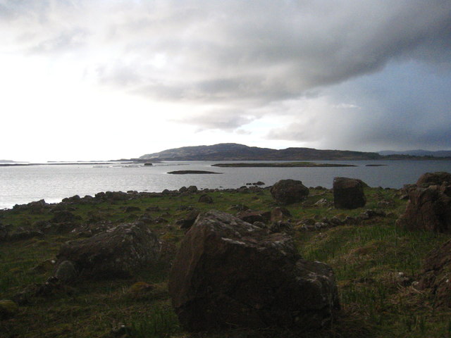
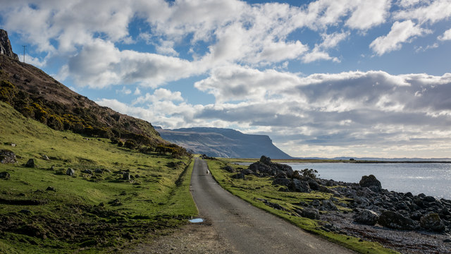
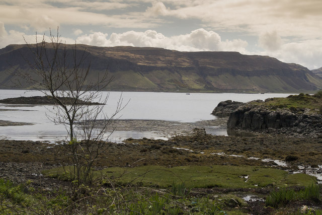
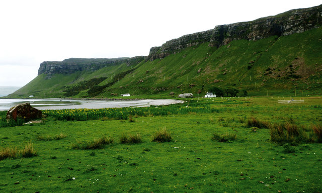
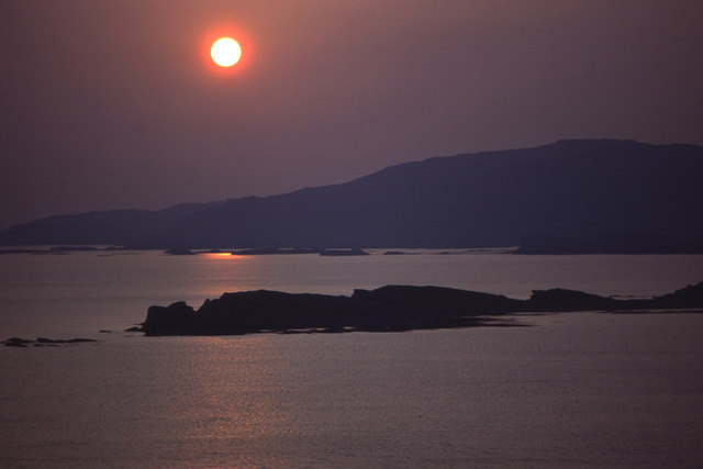
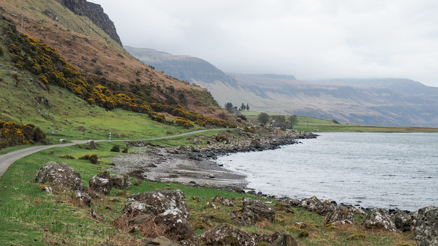
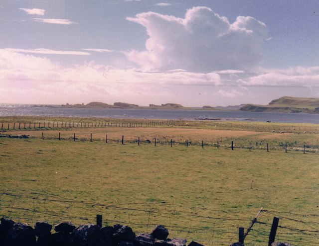
Loch na Keal is a stunning sea loch located in the region of Argyllshire, on the west coast of Scotland. With its breathtaking natural beauty and diverse ecosystem, it has become a popular destination for tourists and nature enthusiasts alike.

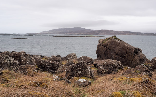
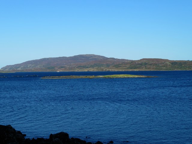
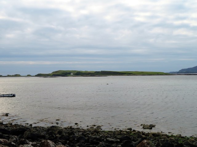
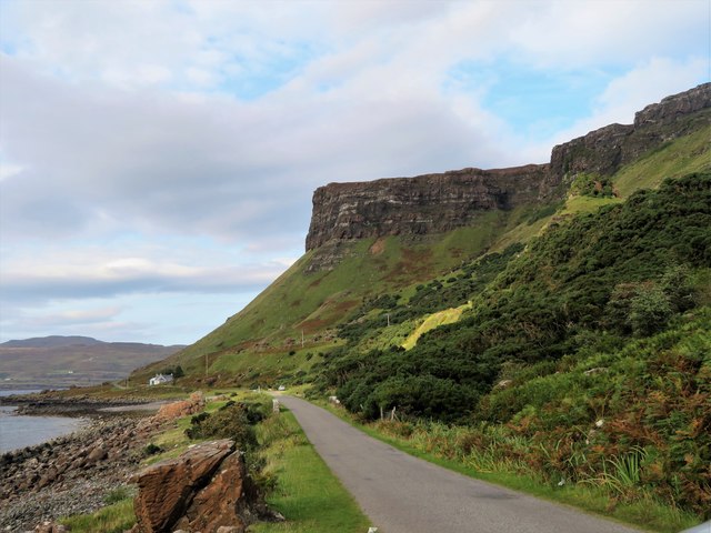
Covering an area of approximately 23 square miles, Loch na Keal stretches for about 10 miles inland, forming a deep and narrow fjord-like shape. Surrounded by majestic mountains and rolling hills, the loch offers awe-inspiring panoramic views that capture the essence of the Scottish Highlands.

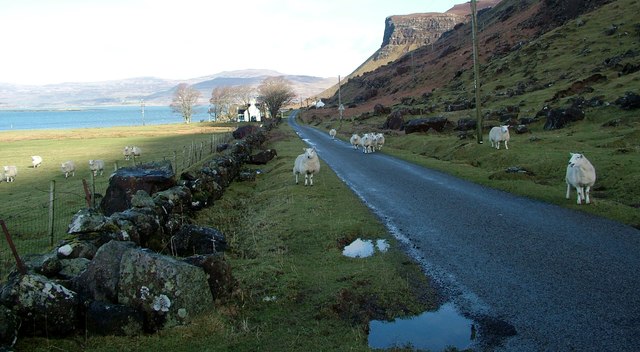
The loch is fed by numerous freshwater streams and rivers, making it an ideal habitat for a wide range of marine and bird species. It is particularly renowned for its rich biodiversity, with seals, otters, dolphins, and whales frequently spotted in its waters. Loch na Keal is also home to an array of birdlife, including golden eagles, white-tailed eagles, and a variety of migratory birds.

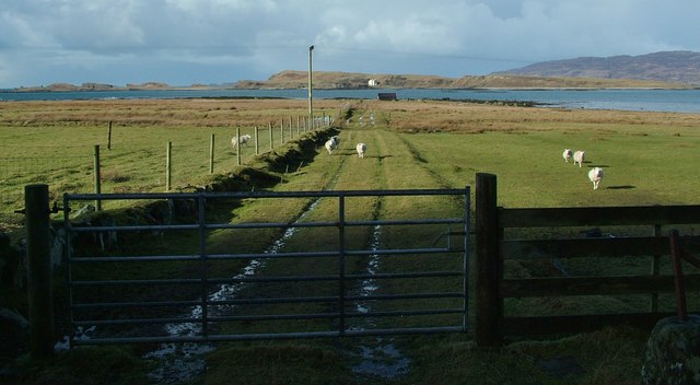
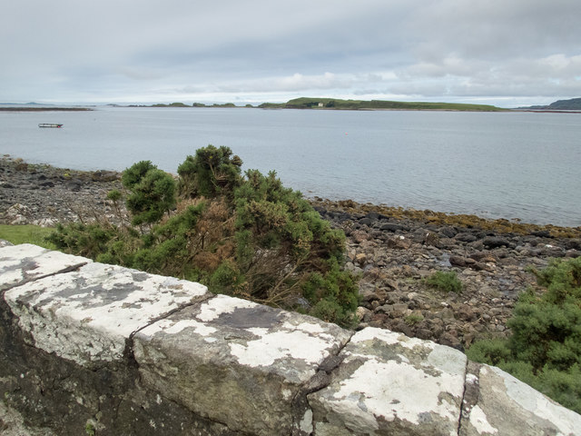
The surrounding area of Loch na Keal offers numerous outdoor activities for visitors to enjoy. From sailing and kayaking to fishing and wildlife watching, there is something for everyone. Additionally, the loch provides access to several small islands, such as Inch Kenneth and Eorsa, which offer their own unique landscapes and wildlife.

For those seeking tranquility and serenity, Loch na Keal provides a peaceful retreat away from the hustle and bustle of daily life. The loch's calm waters and serene atmosphere make it an ideal spot for relaxation and contemplation, allowing visitors to fully immerse themselves in the natural beauty of the Scottish Highlands.

If you have any feedback on the listing, please let us know in the comments section below.

Loch na Keal Images

Images are sourced within 2km of 56.447105/-6.157741 or Grid Reference NM4336. Thanks to Geograph Open Source API. All images are credited.

Old milepost One of the remaining mileposts on the B8035 road from Salen southwards to join the A849 for the 38 miles from Salen to Fionnphort and the Iona Ferry jetty.   These posts on Mull made by Smith, Patterson of Blaydon are the only ones known to have been cast at that foundry that have a date, 1897.   This post is on the west side of the road north of Balnahard.
Old milepost
One of the remaining mileposts on the B8035 road from Salen southwards to join the A849 for the 38 miles from Salen to Fionnphort and the Iona Ferry jetty. These posts on Mull made by Smith, Patterson of Blaydon are the only ones known to have been cast at that foundry that have a date, 1897. This post is on the west side of the road north of Balnahard.
Rocks on the shore of Loch na Keal at Rubha a'Ghearrain The low-lying island in the centre of the photo is Samalan Island.
Rocks on the shore of Loch na Keal at Rubha a'Ghearrain
The low-lying island in the centre of the photo is Samalan Island.
Inch Kenneth from Gribun Field gate and track leading from the B8035 at Gribun, Mull, down to the Loch opposite Inch Kenneth island
Inch Kenneth from Gribun
Field gate and track leading from the B8035 at Gribun, Mull, down to the Loch opposite Inch Kenneth island
Gribun sheep Very inquisitive and/or hungry sheep along the B8035 at Gribun, Mull - February 2016
Gribun sheep
Very inquisitive and/or hungry sheep along the B8035 at Gribun, Mull - February 2016
Road near Clachandhu
Cliffs on Mull The road passes directly below these cliffs. It is very narrow with passing places so you hope not to meet something large coming the other way.
Cliffs on Mull
The road passes directly below these cliffs. It is very narrow with passing places so you hope not to meet something large coming the other way.
Benchmark and lichen The lichen is doing a good job of very slowly obscuring the accompanying arrow of this rivet benchmark (OS description: RIVET E PARA BR 1.3M N END). The bridge parapet is shown in <a href="https://www.geograph.org.uk/photo/5461790">NM4535 : Marvellous scenery on the Mull coast</a>.
Benchmark and lichen
The lichen is doing a good job of very slowly obscuring the accompanying arrow of this rivet benchmark (OS description: RIVET E PARA BR 1.3M N END). The bridge parapet is shown in NM4535 : Marvellous scenery on the Mull coast.
View to Inch Kenneth Beyond the parapet of this bridge over an unnamed stream is a narrow strip of coast and a view to Inch Kenneth two squares to the west. There is a rivet benchmark <a href="https://www.geograph.org.uk/photo/5461820">NM4535 : Benchmark on bridge parapet</a> on the central stone of the parapet.
View to Inch Kenneth
Beyond the parapet of this bridge over an unnamed stream is a narrow strip of coast and a view to Inch Kenneth two squares to the west. There is a rivet benchmark NM4535 : Benchmark on bridge parapet on the central stone of the parapet.
Benchmark on bridge parapet The OS description is: RIVET NW PARA BR 1.6M N END. The bridge is shown in <a href="https://www.geograph.org.uk/photo/5461816">NM4535 : View to Inch Kenneth</a>.
Benchmark on bridge parapet
The OS description is: RIVET NW PARA BR 1.6M N END. The bridge is shown in NM4535 : View to Inch Kenneth.
Clachandhu from Rubha Baile na h-Airde This is the point where the "Wilderness coast" of Mull becomes a little more subdued and is accessible to road building - the B8035 cuts across the Ardmeanach peninsula from Loch Scridain, and here drops down to a wide enough coastal plain on the shore of Loch na Keal. The flat area is at its most extensive just at this point, where a reef extends out into Loch na Keal towards Inch Kenneth and has provided enough shelter from the sea for a wide grassy area to form and provide some grazing, hence the habitation.
Clachandhu from Rubha Baile na h-Airde
This is the point where the "Wilderness coast" of Mull becomes a little more subdued and is accessible to road building - the B8035 cuts across the Ardmeanach peninsula from Loch Scridain, and here drops down to a wide enough coastal plain on the shore of Loch na Keal. The flat area is at its most extensive just at this point, where a reef extends out into Loch na Keal towards Inch Kenneth and has provided enough shelter from the sea for a wide grassy area to form and provide some grazing, hence the habitation.
Setting sun over Inch Kenneth and Ulva Looking across the mouth of Loch na Keal to Ulva. The southern part of Inch Kenneth is nearest the camera.
Setting sun over Inch Kenneth and Ulva
Looking across the mouth of Loch na Keal to Ulva. The southern part of Inch Kenneth is nearest the camera.
Shore of Loch na Keal alongside B8035 The B8035 below steep ground. Inch Kenneth is just offshore, out of view.
Shore of Loch na Keal alongside B8035
The B8035 below steep ground. Inch Kenneth is just offshore, out of view.
Samalan Island Samalan Island lying out in the waters of, or adjacent to, Loch na Keal with another island, Ulva, in the distance.
Samalan Island
Samalan Island lying out in the waters of, or adjacent to, Loch na Keal with another island, Ulva, in the distance.
Samalan Island A small island in Loch na Keal with Ulva in the distance.
Samalan Island
A small island in Loch na Keal with Ulva in the distance.
Loch na Keal Loch na Keal by Clachandhu with Inch Kenneth behind.
Loch na Keal
Loch na Keal by Clachandhu with Inch Kenneth behind.
Coastal Road to the Bungalow A long straight leading to the bungalow, which is all the name given, and the frowning brow of Aoineadh Mor.
Coastal Road to the Bungalow
A long straight leading to the bungalow, which is all the name given, and the frowning brow of Aoineadh Mor.
Coastal pastures at Gribun, 1988 We stopped here as we drove south along the coastal road because I'd spotted an otter lolloping across the fields.  It was the first otter I'd ever seen, but in the next few days we saw a good few more - along the shores of Loch na Keal, by smaller tidal inlets, and by inland lochans.   At Gribun there were also peregrines on the cliffs (behind the camera) - in days before they became a common sight in built-up areas.

In geomorphological terms (or so I was told at the time) the strip of land between the road and the sea is a raised beach - a relic of a higher sea level.  The low-lying but rocky off-shore island is Inch Kenneth.  The tilting mesa-like slabs of rock are highly characteristic of the islands around here.
Coastal pastures at Gribun, 1988
We stopped here as we drove south along the coastal road because I'd spotted an otter lolloping across the fields. It was the first otter I'd ever seen, but in the next few days we saw a good few more - along the shores of Loch na Keal, by smaller tidal inlets, and by inland lochans. At Gribun there were also peregrines on the cliffs (behind the camera) - in days before they became a common sight in built-up areas. In geomorphological terms (or so I was told at the time) the strip of land between the road and the sea is a raised beach - a relic of a higher sea level. The low-lying but rocky off-shore island is Inch Kenneth. The tilting mesa-like slabs of rock are highly characteristic of the islands around here.
Old Milepost by the B8035, Balnahard Blaydon casting by the B8035, in parish of Kilfinichen & Kilvickeon (Mull District), North of Balnahard, on verge.

Inscription reads:-
: SALEN / 11 / MILES : : IONA FERRY / 27 / MILES :
Maker:-
: SMITH PATTERSON / BLAYDON :

Surveyed

Milestone Society National ID: AB_MLSAIF11
Old Milepost by the B8035, Balnahard
Blaydon casting by the B8035, in parish of Kilfinichen & Kilvickeon (Mull District), North of Balnahard, on verge. Inscription reads:- : SALEN / 11 / MILES : : IONA FERRY / 27 / MILES : Maker:- : SMITH PATTERSON / BLAYDON : Surveyed Milestone Society National ID: AB_MLSAIF11
Show me another place!

Loch na Keal is located at Grid Ref: NM4336 (Lat: 56.447105, Lng: -6.157741)

Unitary Authority: Argyll and Bute

Police Authority: Argyll and West Dunbartonshire

What 3 Words

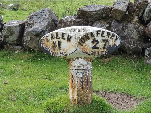
///tasks.waters.perch. Near Salen, Argyll & Bute

Related Wikis

St Kenneth's Chapel

St. Kenneth's Chapel is a ruined chapel on Inch Kenneth Island, Parish of Kilfinichen and Kilvickeon, Isle of Mull, Argyll and Bute, Scotland. It dates...

Inch Kenneth

Inch Kenneth (Scottish Gaelic: Innis Choinnich) is a small grassy island off the west coast of the Isle of Mull, in Scotland. It is at the entrance of...

Samalan Island

Samalan Island is a small island, just off the Isle of Mull at the mouth of Loch na Keal in the Inner Hebrides, Scotland. To its south west is the island...

Ulva Ferry

Ulva Ferry (Scottish Gaelic: Caolas Ulbha) is a hamlet on the Hebridean island of Mull, on its west coast. Ulva Ferry is on the shore of Ulva Sound (Caolas...

Nearby Amenities

Located within 500m of 56.447105,-6.157741
Source: PGS
Lat/Long: 56.4453034/-6.1597592
Source: PGS
Lat/Long: 56.445035/-6.1588191
Source: PGS
Lat/Long: 56.4450491/-6.158668
Source: PGS
Lat/Long: 56.447189/-6.1504583
Source: PGS
Lat/Long: 56.446972/-6.1502351
Source: PGS
Lat/Long: 56.4466527/-6.149976
Source: PGS
Lat/Long: 56.4455507/-6.1578693
Source: PGS
Lat/Long: 56.4451867/-6.1581851
Source: PGS
Lat/Long: 56.4452384/-6.1580943
Source: PGS
Lat/Long: 56.4454943/-6.1579175
Source: PGS
Lat/Long: 56.4453312/-6.1579911
Source: PGS
Lat/Long: 56.4451402/-6.1582899
Source: PGS
Lat/Long: 56.4451036/-6.1583974
Source: PGS
Lat/Long: 56.4450751/-6.1585127
Source: PGS
Lat/Long: 56.4450348/-6.1589459
Source: PGS
Lat/Long: 56.4450478/-6.1590605
The data included in this document is from www.openstreetmap.org. The data is made available under ODbL.

Have you been to Loch na Keal?

Leave your review of Loch na Keal below (or comments, questions and feedback).