Port na h-Eaglaise

Sea, Estuary, Creek in Argyllshire

Scotland

Port na h-Eaglaise

Triangulation pillar, Maol na Sgùrra, Isle of Mull Looking along the southern coastline of the Ross of Mull.
Triangulation pillar, Maol na Sgùrra, Isle of Mull Credit: Claire Pegrum

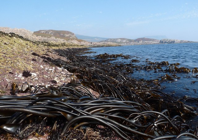
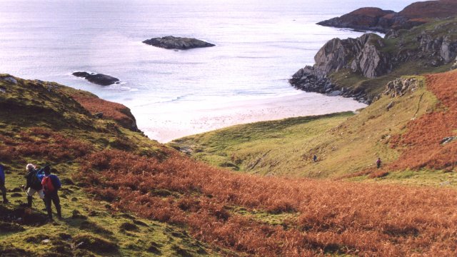
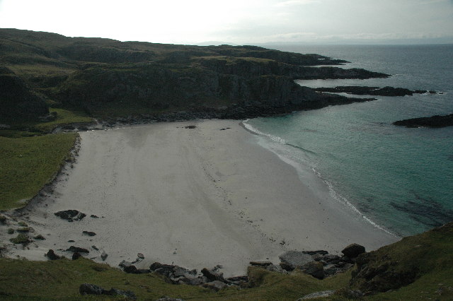
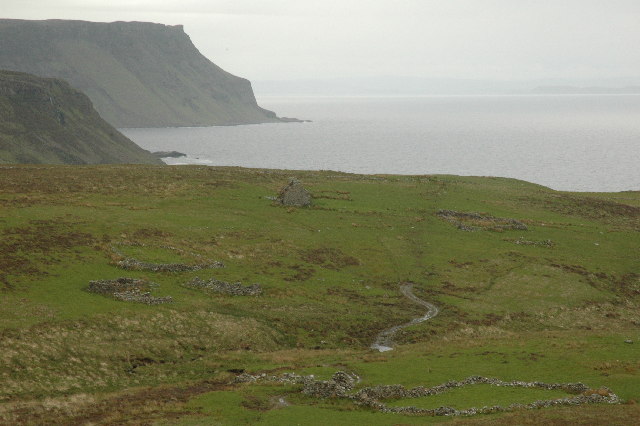
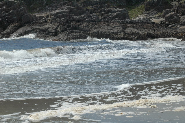
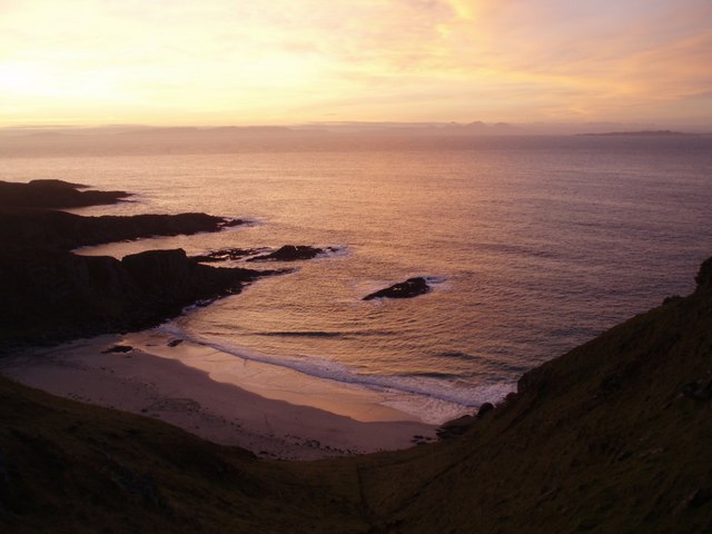
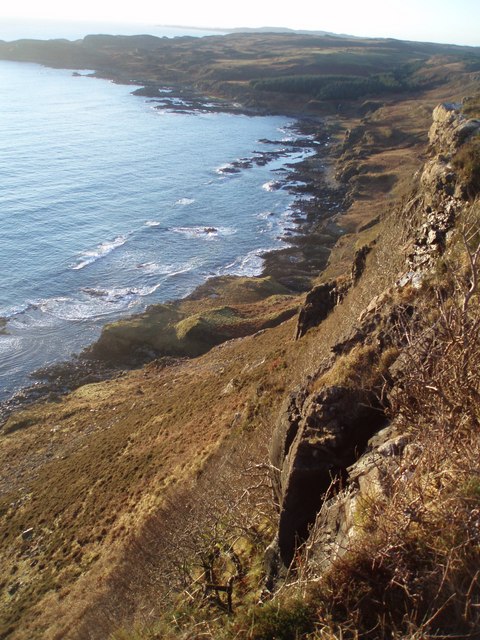
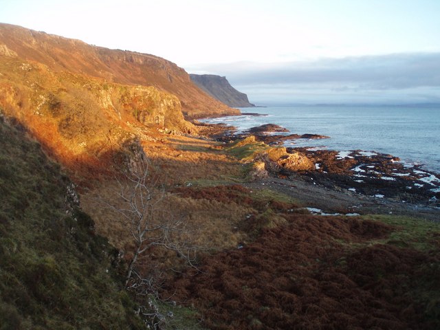
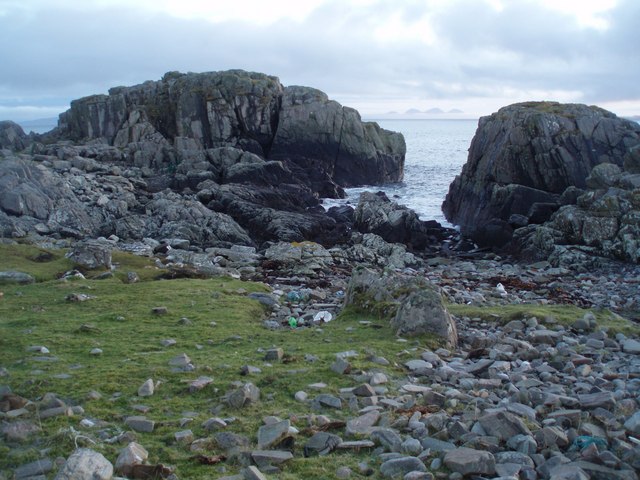
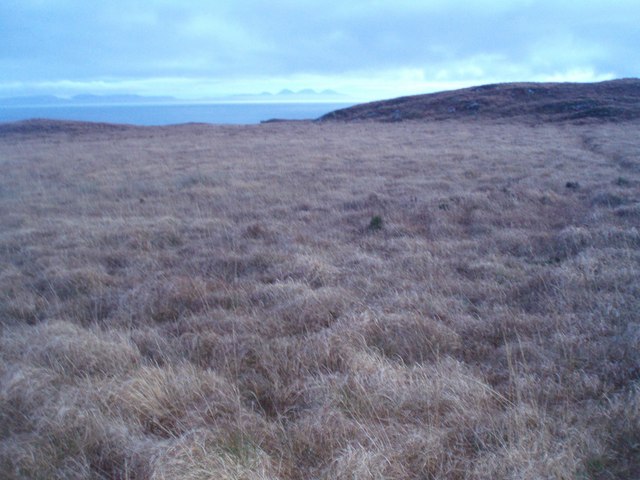
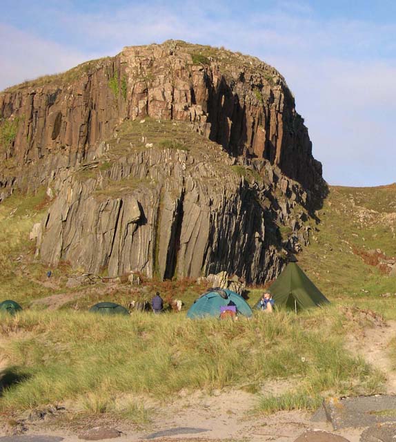
Port na h-Eaglaise, located in Argyllshire, Scotland, is a picturesque coastal area known for its stunning sea views, estuary, and creek. Nestled on the west coast of Scotland, this charming port offers a tranquil escape for nature enthusiasts and those seeking a peaceful retreat.

The port is blessed with a beautiful coastline that stretches along the rugged Argyll landscape. Its crystal-clear waters and sandy beaches make it a popular spot for visitors who enjoy swimming, sunbathing, and beachcombing. The sea in Port na h-Eaglaise is home to a diverse range of marine life, making it a hotspot for snorkeling and diving enthusiasts.

One of the standout features of Port na h-Eaglaise is its estuary. This expansive area of water, where a river meets the sea, is a haven for birdwatchers and wildlife enthusiasts. The estuary is teeming with a variety of bird species, including herons, oystercatchers, and curlews. Visitors can observe these magnificent creatures from observation points and bird hides dotted along the shoreline.

A meandering creek adds to the charm of Port na h-Eaglaise. This small, narrow waterway offers a tranquil setting for kayaking and canoeing, allowing visitors to explore the area from a unique perspective. The creek is also a popular spot for fishing, with anglers often casting their lines in search of salmon, trout, and other freshwater species.

Overall, Port na h-Eaglaise in Argyllshire offers a breathtaking blend of sea, estuary, and creek, making it a must-visit destination for anyone seeking natural beauty and serenity.

If you have any feedback on the listing, please let us know in the comments section below.

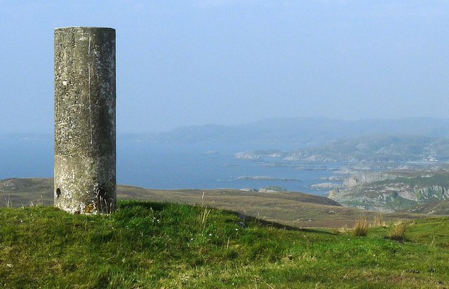
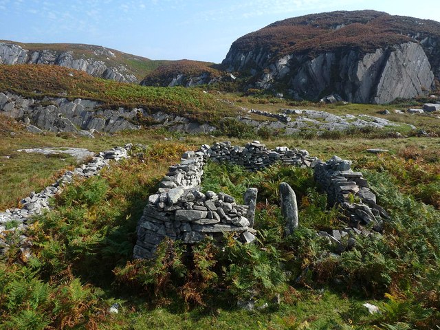
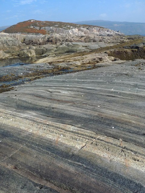
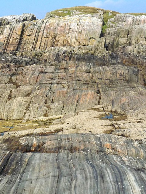
Port na h-Eaglaise Images

Images are sourced within 2km of 56.285536/-6.1417915 or Grid Reference NM4318. Thanks to Geograph Open Source API. All images are credited.

Triangulation pillar, Maol na Sgùrra, Isle of Mull Looking along the southern coastline of the Ross of Mull.
Triangulation pillar, Maol na Sgùrra, Isle of Mull
Looking along the southern coastline of the Ross of Mull.
Ruined building above Tràigh Bhàn, Isle of Mull The building was already shown as unroofed on the 1st edition OS six inch map which was surveyed in 1878.
Ruined building above Tràigh Bhàn, Isle of Mull
The building was already shown as unroofed on the 1st edition OS six inch map which was surveyed in 1878.
Coastline at Rubha nam Bràithrean, Isle of Mull
Kelp on the shoreline of the Ross of Mull, Isle of Mull Looking towards Malcolm's Point (faint high ground on right hand side horizon).
Kelp on the shoreline of the Ross of Mull, Isle of Mull
Looking towards Malcolm's Point (faint high ground on right hand side horizon).
Tràigh Bhàn na Sgùrra One of a series of sandy coves on the south coast of the Ross of Mull
Tràigh Bhàn na Sgùrra
One of a series of sandy coves on the south coast of the Ross of Mull
Traigh Bhan na Sgurra Early morning at Scoor Beach with the tide out.
Traigh Bhan na Sgurra
Early morning at Scoor Beach with the tide out.
Shiaba Shiaba was a crofting township on the Ross of Mull. The 130 residents were cleared to make way for sheep. These are the remains of their houses.
Shiaba
Shiaba was a crofting township on the Ross of Mull. The 130 residents were cleared to make way for sheep. These are the remains of their houses.
Waterfall on Ross of Mull This is one of the many waterfalls in this area.
Waterfall on Ross of Mull
This is one of the many waterfalls in this area.
Traigh Bhan The beach at Traigh Bhan, one of a number on this part of the Ross of Mull.
Traigh Bhan
The beach at Traigh Bhan, one of a number on this part of the Ross of Mull.
Sunrise, South Mull Looking over Traigh Bhan na Sgurra beach towards the distant Paps of Jura on the penultimate day of 2007.
Sunrise, South Mull
Looking over Traigh Bhan na Sgurra beach towards the distant Paps of Jura on the penultimate day of 2007.
Clifftop View This is more like the terrain you would expect for Aoineadh Beag, or
a small steep brae with rocks, as the OS map names on the 1km square to the east. Dramatic scenery all the same with a 300 foot drop beneath my feet!
Clifftop View
This is more like the terrain you would expect for Aoineadh Beag, or a small steep brae with rocks, as the OS map names on the 1km square to the east. Dramatic scenery all the same with a 300 foot drop beneath my feet!
Last  Sun of the Year, Ross of Mull The sun will soon set on 2007 on the Ross of Mull. At the very western extremity of the South Mull Coast SSSI - the best example of coastal tertiary igneous escarpments in the Hebrides - Malcolms Point in the distance.
Last Sun of the Year, Ross of Mull
The sun will soon set on 2007 on the Ross of Mull. At the very western extremity of the South Mull Coast SSSI - the best example of coastal tertiary igneous escarpments in the Hebrides - Malcolms Point in the distance.
Between the Rocks to Jura Paps of Jura seen down an inlet on the rocky coast of the Ross of Mull.
Between the Rocks to Jura
Paps of Jura seen down an inlet on the rocky coast of the Ross of Mull.
Tussocks and Bog You can't see the bog in the photo but it was certainly all around, and typical tussocky Mull terrain - ankle turning at every step.
After a day spent on the dramatic south coast of Mull it seemed an anti-climax to walk across this ground, but at least the views to Jura made up for it.
Tussocks and Bog
You can't see the bog in the photo but it was certainly all around, and typical tussocky Mull terrain - ankle turning at every step. After a day spent on the dramatic south coast of Mull it seemed an anti-climax to walk across this ground, but at least the views to Jura made up for it.
Rocky knoll on the Ross of Mull This is a distinctive knoll at Traigh Bhan na Sgurra.
Rocky knoll on the Ross of Mull
This is a distinctive knoll at Traigh Bhan na Sgurra.
Traigh Bhan na Sgurra View from near the top of Traigh Bhan na Sgurra with Loch Scridain in the distance.  The small lochan (centre-left) was at one time stocked with rainbow trout by one enterprising local, but I doubt whether that is still the case.
Traigh Bhan na Sgurra
View from near the top of Traigh Bhan na Sgurra with Loch Scridain in the distance. The small lochan (centre-left) was at one time stocked with rainbow trout by one enterprising local, but I doubt whether that is still the case.
Rubha nam Bràithrean Unusually, we were paddling into an easterly headwind, so were keeping well tucked into the shelter of various small headlands. There was also a bit of swell, so this provided a degree of rock-hopping fun on our way to Carsaig Arches from Uisken. Rubha nam Bràithrean is the last of the small headlands before a big bay, and Malcolm's Point in the distance. The wind exposure was probably maximum at this point of the journey, before tucking in to the big bay and getting increasing shelter from the big headland. By the time of our return journey the wind had dropped, but heavy showers had arrived - along with a pod of dolphins cavorting just offshore.
Rubha nam Bràithrean
Unusually, we were paddling into an easterly headwind, so were keeping well tucked into the shelter of various small headlands. There was also a bit of swell, so this provided a degree of rock-hopping fun on our way to Carsaig Arches from Uisken. Rubha nam Bràithrean is the last of the small headlands before a big bay, and Malcolm's Point in the distance. The wind exposure was probably maximum at this point of the journey, before tucking in to the big bay and getting increasing shelter from the big headland. By the time of our return journey the wind had dropped, but heavy showers had arrived - along with a pod of dolphins cavorting just offshore.
Show me another place!

Port na h-Eaglaise is located at Grid Ref: NM4318 (Lat: 56.285536, Lng: -6.1417915)

Unitary Authority: Argyll and Bute

Police Authority: Argyll and West Dunbartonshire

What 3 Words

///gross.spreading.suitable. Near Fionnphort, Argyll & Bute

Related Wikis

Shiaba

Shiaba (Scottish Gaelic: Siaba) is a ruined township located on the southwestern peninsula of the Isle of Mull, Scotland. It lies about 8 km to the east...

Uisken

Uisken (Scottish Gaelic: Uisgean, meaning "water-bay") is a settlement on a sandy bay on the Ross of Mull in the south of the Isle of Mull, on the west...
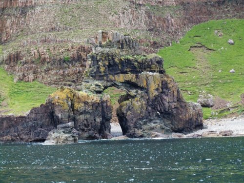
Carsaig Arches

Carsaig Arches are natural arch cliff formations on the Ross of Mull in the south of the Isle of Mull, on the west coast of Scotland. They are situated...

Knockan

Knockan (Scottish Gaelic: An Cnocan) is a township of six crofts in the community of Ardtun, in the south of the Isle of Mull off the west coast of Scotland...

Nearby Amenities

Located within 500m of 56.285536,-6.1417915
Source: PGS
Lat/Long: 56.2887966/-6.136516
Created By: dmgroom_coastlines
Source: PGS
Lat/Long: 56.28885/-6.1369
Created By: dmgroom_coastlines
Source: PGS
Lat/Long: 56.28859/-6.13669
Source: PGS
Lat/Long: 56.2880891/-6.1365386
Source: PGS
Lat/Long: 56.2871691/-6.1371406
Source: PGS
Lat/Long: 56.2867654/-6.1375814
Created By: dmgroom_coastlines
Source: PGS
Lat/Long: 56.28657/-6.13777
Created By: dmgroom_coastlines
Source: PGS
Lat/Long: 56.28631/-6.13755
Source: PGS
Lat/Long: 56.2863811/-6.1384655
Source: PGS
Lat/Long: 56.28642/-6.1388441
Created By: dmgroom_coastlines
Source: PGS
Lat/Long: 56.28672/-6.1389
Source: PGS
Lat/Long: 56.2862382/-6.1397921
Source: PGS
Lat/Long: 56.2866537/-6.1401176
Source: PGS
Lat/Long: 56.286271/-6.1401292
Created By: dmgroom_coastlines
Source: PGS
Lat/Long: 56.28584/-6.13965
Created By: dmgroom_coastlines
Source: PGS
Lat/Long: 56.28572/-6.1399
Source: PGS
Lat/Long: 56.2858339/-6.1423556
Source: PGS
Lat/Long: 56.2854377/-6.1421252
Created By: dmgroom_coastlines
Source: PGS
Lat/Long: 56.28462/-6.14205
Created By: dmgroom_coastlines
Source: PGS
Lat/Long: 56.28449/-6.14229
Created By: dmgroom_coastlines
Source: PGS
Lat/Long: 56.28437/-6.14253
Created By: dmgroom_coastlines
Source: PGS
Lat/Long: 56.28425/-6.14277
Created By: dmgroom_coastlines
Source: PGS
Lat/Long: 56.28427/-6.14369
Created By: dmgroom_coastlines
Source: PGS
Lat/Long: 56.28455/-6.14459
Created By: dmgroom_coastlines
Source: PGS
Lat/Long: 56.28468/-6.14481
Created By: dmgroom_coastlines
Source: PGS
Lat/Long: 56.28545/-6.14499
Created By: dmgroom_coastlines
Source: PGS
Lat/Long: 56.28534/-6.14545
Source: PGS
Lat/Long: 56.2855457/-6.145642
Source: PGS
Lat/Long: 56.2860396/-6.1452717
Created By: dmgroom_coastlines
Source: PGS
Lat/Long: 56.28725/-6.14508
Source: PGS
Lat/Long: 56.287871/-6.1441324
Source: PGS
Lat/Long: 56.2886499/-6.1434391
Source: PGS
Lat/Long: 56.2889524/-6.1438642
Source: PGS
Lat/Long: 56.2888795/-6.1447719
Source: PGS
Lat/Long: 56.2887298/-6.1452538
Source: PGS
Lat/Long: 56.28854/-6.14545
Source: PGS
Lat/Long: 56.2879103/-6.1463147
Created By: dmgroom_coastlines
Source: PGS
Lat/Long: 56.28767/-6.14666
Created By: dmgroom_coastlines
Source: PGS
Lat/Long: 56.28756/-6.1469
Created By: dmgroom_coastlines
Source: PGS
Lat/Long: 56.28743/-6.14714
Created By: dmgroom_coastlines
Source: PGS
Lat/Long: 56.28732/-6.14807
Created By: dmgroom_coastlines
Source: PGS
Lat/Long: 56.28681/-6.14834
Created By: dmgroom_coastlines
Source: PGS
Lat/Long: 56.28669/-6.14858
Created By: dmgroom_coastlines
Source: PGS
Lat/Long: 56.28658/-6.14951
Created By: dmgroom_coastlines
Source: PGS
Lat/Long: 56.28608/-6.14978
Source: PGS
Lat/Long: 56.286724/-6.1449682
Source: PGS
Lat/Long: 56.2886737/-6.1431947
Source: PGS
Lat/Long: 56.289342/-6.1434595
Source: PGS
Lat/Long: 56.2890114/-6.1440409
Source: PGS
Lat/Long: 56.2886055/-6.1450394
Source: PGS
Lat/Long: 56.2884666/-6.1454116
Source: PGS
Lat/Long: 56.287884/-6.1441947
The data included in this document is from www.openstreetmap.org. The data is made available under ODbL.

Have you been to Port na h-Eaglaise?

Leave your review of Port na h-Eaglaise below (or comments, questions and feedback).