Am Poll Gorm

Sea, Estuary, Creek in Argyllshire

Scotland

Am Poll Gorm

The summit of Beinn Oronsay A substantial and well-built cairn for a hill only 93m high.  But Oronsay is a popular island to visit. It is tidal, and can be easily walked to from Colonsay except near low tide. There are the ruins of an Augustinian priory nearby. And the hill is low, and an easy walk!

Just left of the cairn is Beinn Eibhne on the mainland of Colonsay.
The summit of Beinn Oronsay Credit: Michael Earnshaw

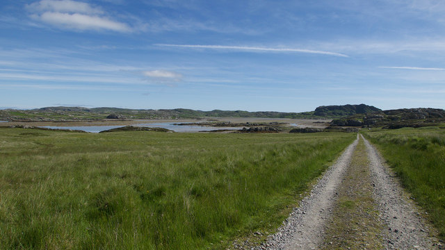
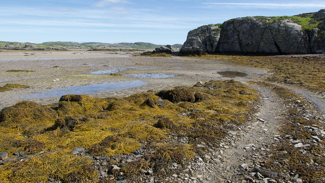
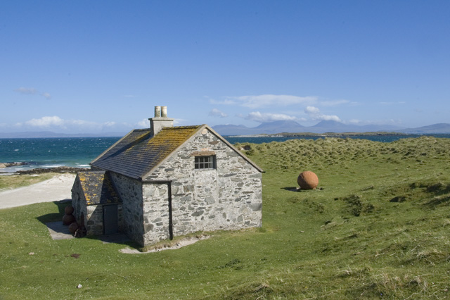
Am Poll Gorm is a picturesque coastal area located in Argyllshire, Scotland. Nestled between the rugged hills and the vast Atlantic Ocean, it encompasses a range of stunning natural features including a sea, estuary, and creek.

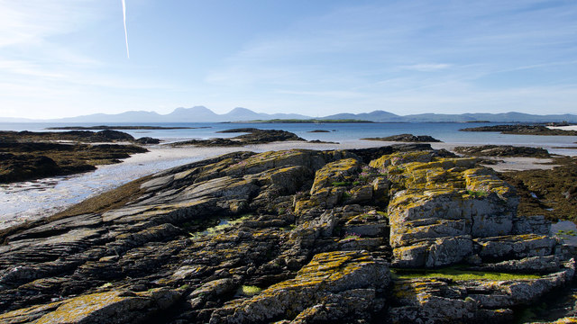
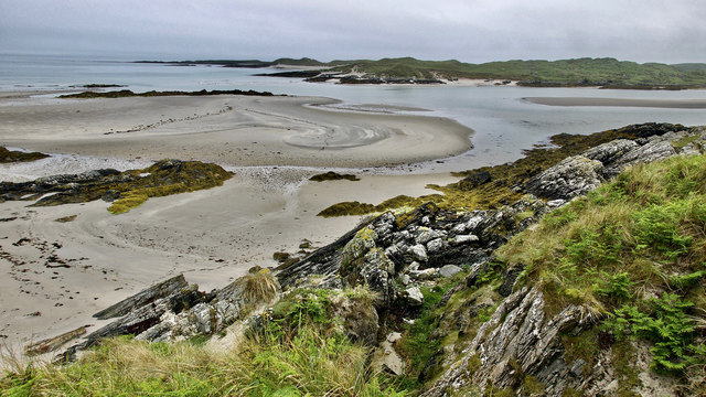
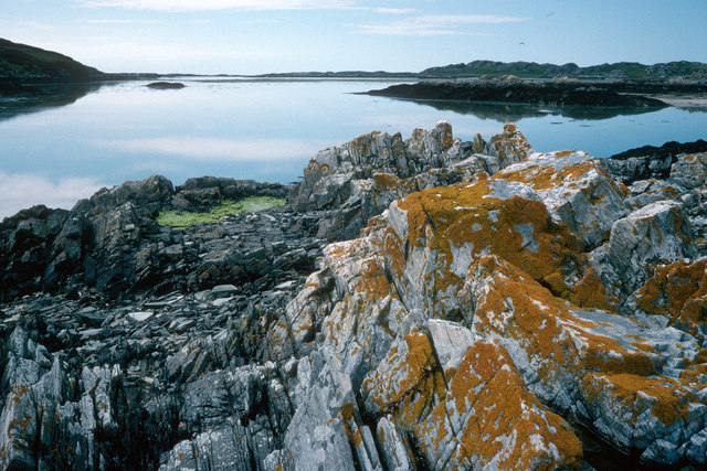
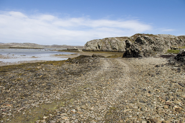
The sea at Am Poll Gorm is known for its crystal-clear turquoise waters, which are teeming with marine life. Visitors can observe a variety of species such as seals, dolphins, and seabirds that call this area home. The sea is also popular for water activities like swimming, snorkeling, and fishing.

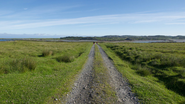
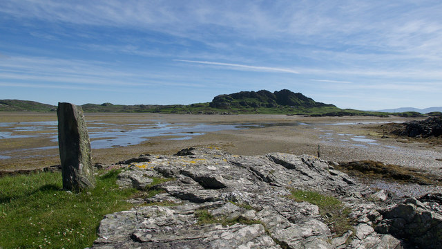
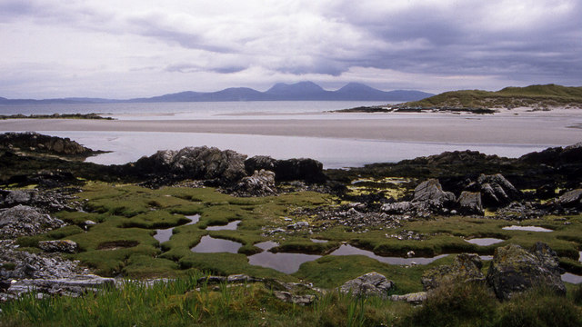
The estuary at Am Poll Gorm is a unique ecosystem where a river meets the sea. It is characterized by a mix of saltwater and freshwater, creating a rich and diverse habitat for both plants and animals. The estuary is a haven for birdwatchers, as it attracts a wide range of wading birds and waterfowl throughout the year.

The creek at Am Poll Gorm is a small, narrow waterway that meanders through the surrounding hills and eventually joins the estuary. It provides a tranquil setting for nature enthusiasts and is often explored by kayakers and canoeists.

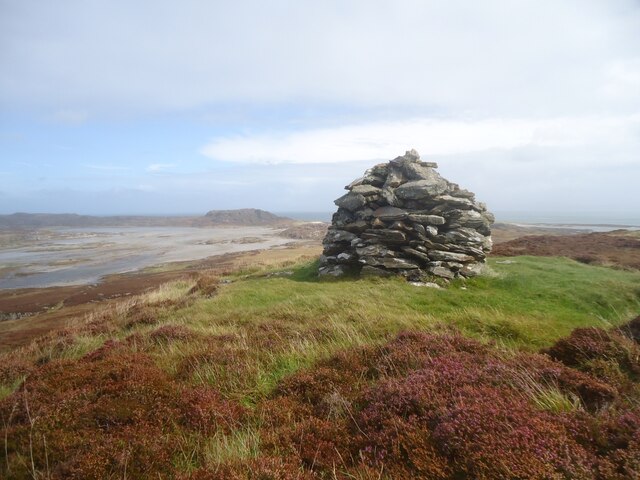
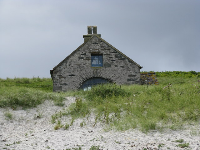
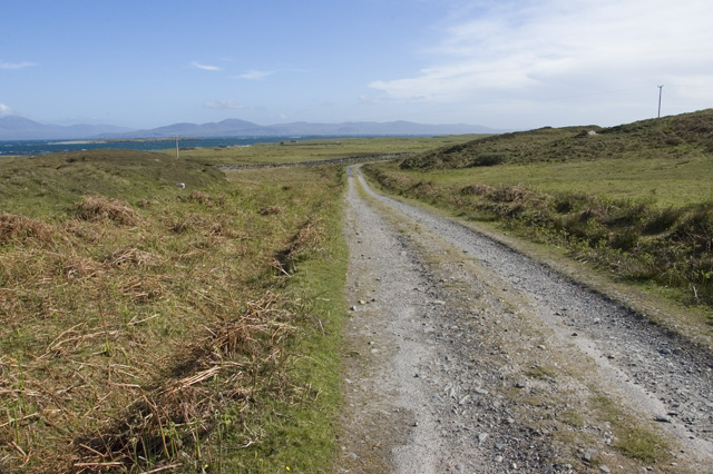
The entire area of Am Poll Gorm is renowned for its breathtaking landscapes and is a popular destination for hikers and nature lovers. The coastal cliffs offer stunning panoramic views of the sea, estuary, and creek, making it a photographer's paradise.

In conclusion, Am Poll Gorm in Argyllshire is a captivating coastal area that boasts a beautiful sea, estuary, and creek. Its natural beauty and diverse wildlife make it a must-visit location for those seeking an authentic Scottish coastal experience.

If you have any feedback on the listing, please let us know in the comments section below.

Am Poll Gorm Images

Images are sourced within 2km of 56.028285/-6.2192786 or Grid Reference NR3789. Thanks to Geograph Open Source API. All images are credited.

The summit of Beinn Oronsay A substantial and well-built cairn for a hill only 93m high.  But Oronsay is a popular island to visit. It is tidal, and can be easily walked to from Colonsay except near low tide. There are the ruins of an Augustinian priory nearby. And the hill is low, and an easy walk!

Just left of the cairn is Beinn Eibhne on the mainland of Colonsay.
The summit of Beinn Oronsay
A substantial and well-built cairn for a hill only 93m high. But Oronsay is a popular island to visit. It is tidal, and can be easily walked to from Colonsay except near low tide. There are the ruins of an Augustinian priory nearby. And the hill is low, and an easy walk! Just left of the cairn is Beinn Eibhne on the mainland of Colonsay.
Dunes south of Port a' Chapuill, Colonsay Having turned Colonsay's SW corner you head on fine white sand towards the Strand.  This can be a warm place in northerly winds.
Dunes south of Port a' Chapuill, Colonsay
Having turned Colonsay's SW corner you head on fine white sand towards the Strand. This can be a warm place in northerly winds.
Dunes at south-east corner of Colonsay Looking over to Jura
Dunes at south-east corner of Colonsay
Looking over to Jura
Seal Cottage A remote holiday cottage
Seal Cottage
A remote holiday cottage
Track to Oronsay Priory An excellent track connects the farmland of Oronsay with the tidal route across the Strand.
Track to Oronsay Priory
An excellent track connects the farmland of Oronsay with the tidal route across the Strand.
Rocks of Oronsay's east coast A delightful bay of rock and sand close to Seal Cottage. The Paps of Jura form a fitting backcloth.
Rocks of Oronsay's east coast
A delightful bay of rock and sand close to Seal Cottage. The Paps of Jura form a fitting backcloth.
Descent to the Strand A straight evenly falling path back to sea level.
Descent to the Strand
A straight evenly falling path back to sea level.
Land Rover track by the Strand, Oronsay Having crossed the Strand, the track hugs the coast before heading inland.
Land Rover track by the Strand, Oronsay
Having crossed the Strand, the track hugs the coast before heading inland.
Landfall markers for the Strand crossing, Oronsay An older standing stone on a prominent hillock and a newer marker at sea level show where the best route for crossing the Strand makes landfall.
Landfall markers for the Strand crossing, Oronsay
An older standing stone on a prominent hillock and a newer marker at sea level show where the best route for crossing the Strand makes landfall.
Coastline below Beinn Eibhne, Colonsay A cloudy evening after rain but still an exciting place to be.
Coastline below Beinn Eibhne, Colonsay
A cloudy evening after rain but still an exciting place to be.
The Strand between Colonsay and Oronsay After low tide the Strand fills with water and the oysters are happy while those on Oronsay must await the next low water to cross back to the shop or their ferry.  Yellow lichens are a feature of Colonsay.
The Strand between Colonsay and Oronsay
After low tide the Strand fills with water and the oysters are happy while those on Oronsay must await the next low water to cross back to the shop or their ferry. Yellow lichens are a feature of Colonsay.
The East end of the Strand The Strand is the area of tidal sands separating Colonsay and Oronsay.
Looking SE from Rubha Bagh nan Capull, Colonsay. The sand dunes on the right are Rubha Ban, Oronsay.
Jura is in the distance.
The East end of the Strand
The Strand is the area of tidal sands separating Colonsay and Oronsay. Looking SE from Rubha Bagh nan Capull, Colonsay. The sand dunes on the right are Rubha Ban, Oronsay. Jura is in the distance.
Road to Oronsay Priory
The Coal House Oronsay The alcove showing in the gable end was the site of a Crow or maybe Chough's nest with chicks in.
The Coal House Oronsay
The alcove showing in the gable end was the site of a Crow or maybe Chough's nest with chicks in.
Seal Cottage, Oronsay Looking towards the Paps of Jura. The cottage is quite swish inside with a picture window facing the sea
Seal Cottage, Oronsay
Looking towards the Paps of Jura. The cottage is quite swish inside with a picture window facing the sea
Oyster Farm on Rubha Bagh nan Capull It looks disused but all the machinery was well oiled and covered up.
Oyster Farm on Rubha Bagh nan Capull
It looks disused but all the machinery was well oiled and covered up.
Rock formations south-east corner of Colonsay Looking across to the very eastern tip of Oronsay
Rock formations south-east corner of Colonsay
Looking across to the very eastern tip of Oronsay
The Colonsay to Oronsay Road
Show me another place!

Am Poll Gorm is located at Grid Ref: NR3789 (Lat: 56.028285, Lng: -6.2192786)

Unitary Authority: Argyll and Bute

Police Authority: Argyll and West Dunbartonshire

What 3 Words

///diver.teaspoons.buns. Near Scalasaig, Argyll & Bute

Related Wikis

Dùn Cholla

Dùn Cholla is a hill fort located on the Inner Hebridean island of Colonsay, Scotland. The site is located at grid reference NR37759150.According to tradition...

Oronsay, Colonsay

Oronsay (Scottish Gaelic: Orasaigh), also sometimes spelt and pronounced Oransay by the local community, is a small tidal island south of Colonsay in the...

Ardskenish

Ardskenish is a hamlet on the island of Colonsay, in the civil parish of Colonsay and Oronsay, in the council area of Argyll and Bute, Scotland. ��2�...

Oronsay Priory

Oronsay Priory was a monastery of canons regular on the island of Oronsay, Inner Hebrides, Argyll, off the coast of Scotland. It was in existence by 1353...

Nearby Amenities

Located within 500m of 56.028285,-6.2192786
Power: pole
Lat/Long: 56.0242561/-6.2198768
Power: pole
Lat/Long: 56.0262414/-6.2200805
Power: pole
Lat/Long: 56.027475/-6.2207285
Power: pole
Lat/Long: 56.0277718/-6.2198959
Power: pole
Lat/Long: 56.0285381/-6.2178314
Power: pole
Lat/Long: 56.0290475/-6.2170139
Power: pole
Lat/Long: 56.0293929/-6.2164233
Power: pole
Lat/Long: 56.0312779/-6.2165664
Power: pole
Lat/Long: 56.0317594/-6.216603
Power: pole
Lat/Long: 56.0316721/-6.2152773
Power: pole
Lat/Long: 56.032403/-6.2171749
Power: pole
Lat/Long: 56.0307442/-6.2165259
Power: pole
Lat/Long: 56.0301845/-6.2164834
Power: pole
Lat/Long: 56.0267871/-6.2203671
Power: pole
Lat/Long: 56.025614/-6.2200161
Power: pole
Lat/Long: 56.0249836/-6.2199514
Power: pole
Lat/Long: 56.0239429/-6.220815
The data included in this document is from www.openstreetmap.org. The data is made available under ODbL.

Have you been to Am Poll Gorm?

Leave your review of Am Poll Gorm below (or comments, questions and feedback).