Tòb na Gile Mòire

Sea, Estuary, Creek in Ross-shire

Scotland

Tòb na Gile Mòire

Coastal View Near Tòb Eisgein The track is looking better maintained as a coastal view opens up on our route to Eisgein.
Coastal View Near Tòb Eisgein Credit: Rude Health

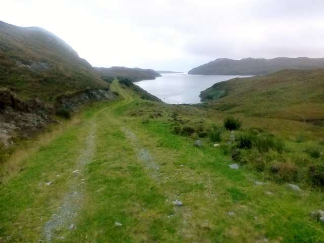
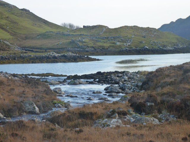
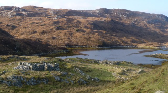
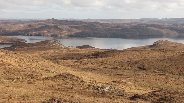
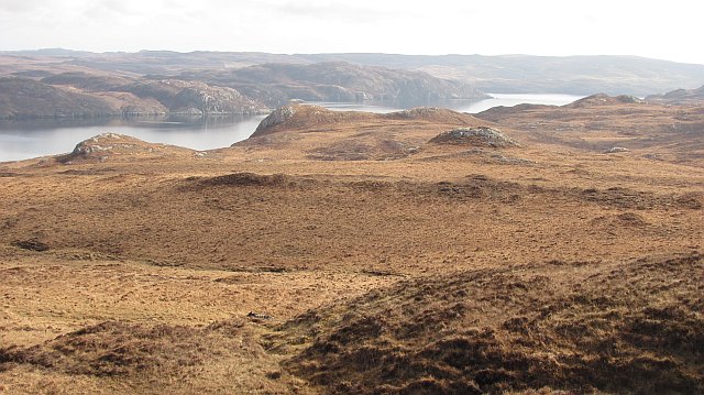
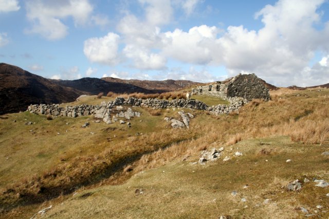
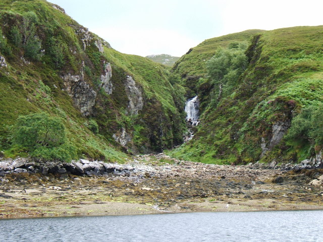
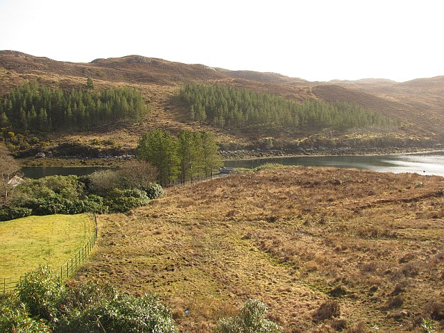
Tòb na Gile Mòire is a small body of water located in Ross-shire, Scotland. It is a sea loch that opens into the Cromarty Firth, creating a beautiful estuary where the water meets the land. The surrounding area is characterized by rugged cliffs and rolling hills, making it a picturesque location for outdoor enthusiasts and nature lovers.

The loch is home to a variety of marine life, including fish, seals, and seabirds. It is a popular spot for fishing, with anglers coming to try their luck at catching salmon, trout, and other species.

Tòb na Gile Mòire is also a haven for birdwatchers, as it attracts a wide range of bird species throughout the year. Visitors can spot seabirds such as gannets, puffins, and guillemots, as well as wading birds like curlews and oystercatchers.

The calm waters of the loch make it a peaceful and tranquil place to relax and enjoy the natural beauty of the Scottish Highlands. Whether you want to take a leisurely boat ride, go for a walk along the shoreline, or simply sit and admire the stunning views, Tòb na Gile Mòire is a must-visit destination for anyone exploring the Ross-shire area.

If you have any feedback on the listing, please let us know in the comments section below.

Tòb na Gile Mòire Images

Images are sourced within 2km of 57.999789/-6.5077654 or Grid Reference NB3310. Thanks to Geograph Open Source API. All images are credited.

Coastal View Near Tòb Eisgein The track is looking better maintained as a coastal view opens up on our route to Eisgein.
Coastal View Near Tòb Eisgein
The track is looking better maintained as a coastal view opens up on our route to Eisgein.
The abandoned township of Stiomrabhaigh
The township of Stiomrabhaigh looking North West
Garbh Allt Moorland beside the Garbh Allt, a burn flowing northwards into Loch Sealg. The inlet of Tòb Eisgein is visible across the loch.
Garbh Allt
Moorland beside the Garbh Allt, a burn flowing northwards into Loch Sealg. The inlet of Tòb Eisgein is visible across the loch.
Druim na Crich Moorland south of Loch Sealg. Part of the long uninhabited area (cleared) of Pairc, south of the loch.
Druim na Crich
Moorland south of Loch Sealg. Part of the long uninhabited area (cleared) of Pairc, south of the loch.
Tob Eisgein, Isle of Lewis View of boats on Tob Eisgein from the jetty at Eisgein on Loch Sealg
Tob Eisgein, Isle of Lewis
View of boats on Tob Eisgein from the jetty at Eisgein on Loch Sealg
Ruined blackhouse at Stiomrabhaig The census of 1851 shows that the village consisted of 16 dwellings and supported a population of 81. By 1858 there were none. Clearances had been well underway in the area during the first half of the 19th century; many of them brutal and uncaring. The residents of Stiomrabhaigh were better placed of than most, having leases directly with the land owner. But when these expired, they accepted an offer of crofts in Leumrabhagh. Lewis was relatively prosperous right up until World War I, which put an end to the herring trade with Russia and Eastern Europe and in spite of the clearances, the increasing population put pressure on land. There were numerous requests to resettle Stiomrabhaigh, all of which were resisted by the landowners and it was not until 1921 when Lord Leverhulme abandoned his ambitious plan for Lewis that crofters returned to the township. Even the resettlement was marked with tragedy as two young men were drowned while transporting household goods from Calbost. These settlers were never officially recognized as crofters by the government;  they received no help and no road was built to the township. Given the difficulties of living without facilities, over the next twenty years, a number of the families drifted back to Leumrabhagh. At the start of World War II only two families remained and by the end of the 1940’s, Stiomrabhaigh was once again deserted. Today there is much of the township to be seen; its ruined buildings, lazybeds and field walls standing in splendid isolation between the moor and the sea.
Ruined blackhouse at Stiomrabhaig
The census of 1851 shows that the village consisted of 16 dwellings and supported a population of 81. By 1858 there were none. Clearances had been well underway in the area during the first half of the 19th century; many of them brutal and uncaring. The residents of Stiomrabhaigh were better placed of than most, having leases directly with the land owner. But when these expired, they accepted an offer of crofts in Leumrabhagh. Lewis was relatively prosperous right up until World War I, which put an end to the herring trade with Russia and Eastern Europe and in spite of the clearances, the increasing population put pressure on land. There were numerous requests to resettle Stiomrabhaigh, all of which were resisted by the landowners and it was not until 1921 when Lord Leverhulme abandoned his ambitious plan for Lewis that crofters returned to the township. Even the resettlement was marked with tragedy as two young men were drowned while transporting household goods from Calbost. These settlers were never officially recognized as crofters by the government; they received no help and no road was built to the township. Given the difficulties of living without facilities, over the next twenty years, a number of the families drifted back to Leumrabhagh. At the start of World War II only two families remained and by the end of the 1940’s, Stiomrabhaigh was once again deserted. Today there is much of the township to be seen; its ruined buildings, lazybeds and field walls standing in splendid isolation between the moor and the sea.
Allt Gil Mhic Phaic burn Showing the mouth of the Allt Gil Mhic Phaic burn flowing into Tob na Gile Moire on Loch Shell (Loch Sealg)
Allt Gil Mhic Phaic burn
Showing the mouth of the Allt Gil Mhic Phaic burn flowing into Tob na Gile Moire on Loch Shell (Loch Sealg)
Tòb Eisgein An inlet off Loch Sealg (Loch Shell on some maps). Around the estate buildings at Eisgein there are several maturing woodlands, absent from maps.
Tòb Eisgein
An inlet off Loch Sealg (Loch Shell on some maps). Around the estate buildings at Eisgein there are several maturing woodlands, absent from maps.
Moorland, Eisgein Moorland on the north side of Loch Sealg, looking towards Rubha na Mòine.
Moorland, Eisgein
Moorland on the north side of Loch Sealg, looking towards Rubha na Mòine.
Eisgein View of Eisgein and Tòb Eisgein from Uisinis. North of Loch Sealg the landscape is low lying with an uninterrupted view towards Beinn Mholach near Stornoway.
Eisgein
View of Eisgein and Tòb Eisgein from Uisinis. North of Loch Sealg the landscape is low lying with an uninterrupted view towards Beinn Mholach near Stornoway.
Show me another place!

Tòb na Gile Mòire is located at Grid Ref: NB3310 (Lat: 57.999789, Lng: -6.5077654)

Unitary Authority: Na h-Eileanan an Iar

Police Authority: Highlands and Islands

What 3 Words

///extension.positives.including. Near Leurbost, Na h-Eileanan Siar

Related Wikis

Stiomrabhaig

Stiomrabhaig is an abandoned crofter's village on the Isle of Lewis in the Outer Hebrides. == History == The United Kingdom Census 1851 shows that the...

Orinsay

Orinsay (Scottish Gaelic: Orasaigh) is a crofting village on the Isle of Lewis in the district of Pairc, in the Outer Hebrides, Scotland. The settlement...

Park, Lewis

Park (Scottish Gaelic: A' Phàirc), also known as South Lochs, is a huge area of land connected to the rest of Lewis only by a narrow neck between Loch...

Eilean Liubhaird

Eilean Liubhaird or Eilean Iubhard is an island in the Outer Hebrides, to the east of Lewis. == Geography and geology == The rock is "gneiss bedrock with...

Nearby Amenities

Located within 500m of 57.999789,-6.5077654
Created By: dmgroom_coastlines
Lat/Long: 57.99896/-6.51534
Created By: dmgroom_coastlines
Lat/Long: 57.99993/-6.51238
Created By: dmgroom_coastlines
Lat/Long: 57.99977/-6.50419
Budhanais
Place: locality
Lat/Long: 57.9987387/-6.5150809
The data included in this document is from www.openstreetmap.org. The data is made available under ODbL.

Have you been to Tòb na Gile Mòire?

Leave your review of Tòb na Gile Mòire below (or comments, questions and feedback).