Llaneilfyw

Settlement in Pembrokeshire

Wales

Llaneilfyw

Solva harbour Low tide at Solva harbour, lime kilns on the far shore.
Solva harbour Credit: E Gammie

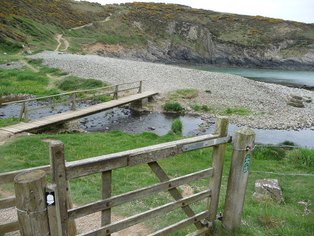
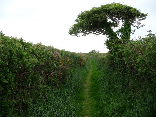
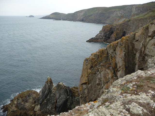
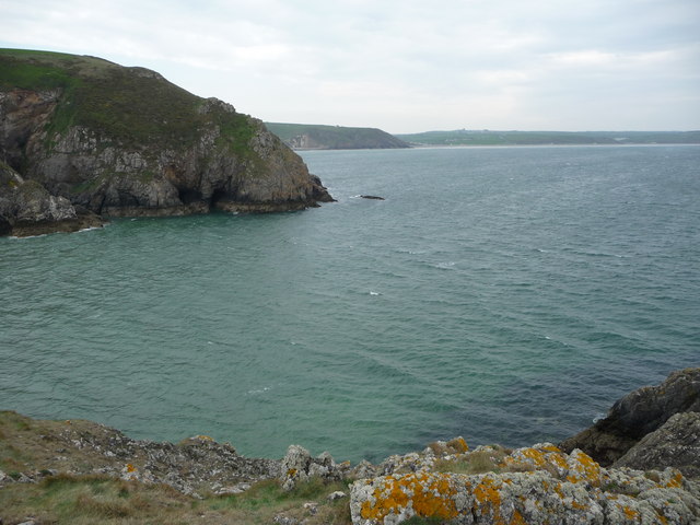
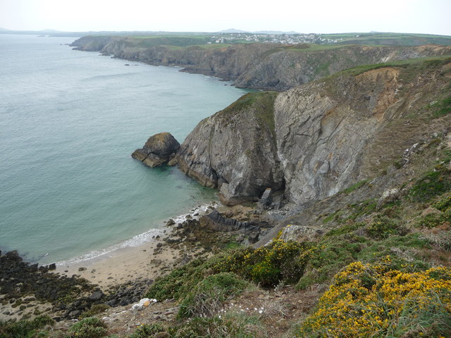
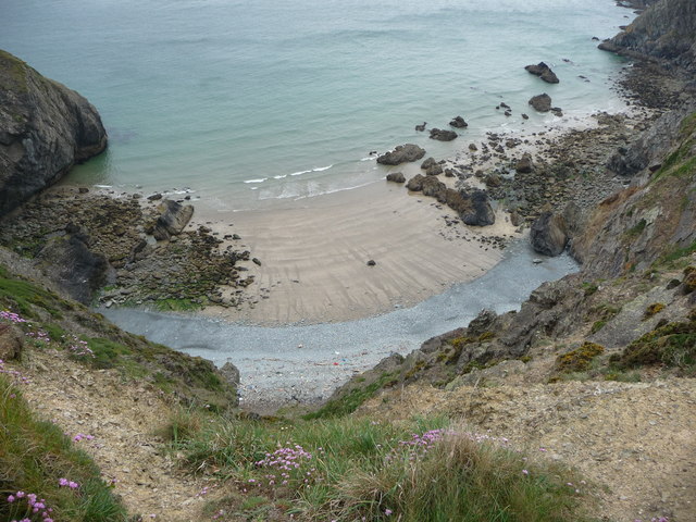
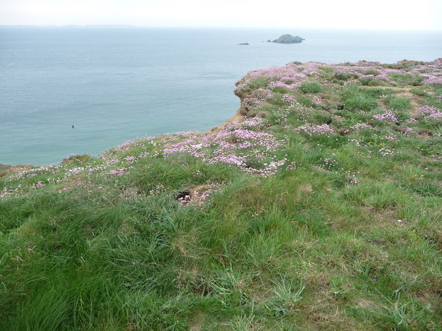
Llaneilfyw is a small village located in the county of Pembrokeshire, Wales. Situated in the northwestern part of the county, it is nestled within a rural and picturesque landscape. The village is part of the wider community of Llanrhian and is surrounded by rolling hills, lush green fields, and a coastline dotted with rugged cliffs and sandy beaches.

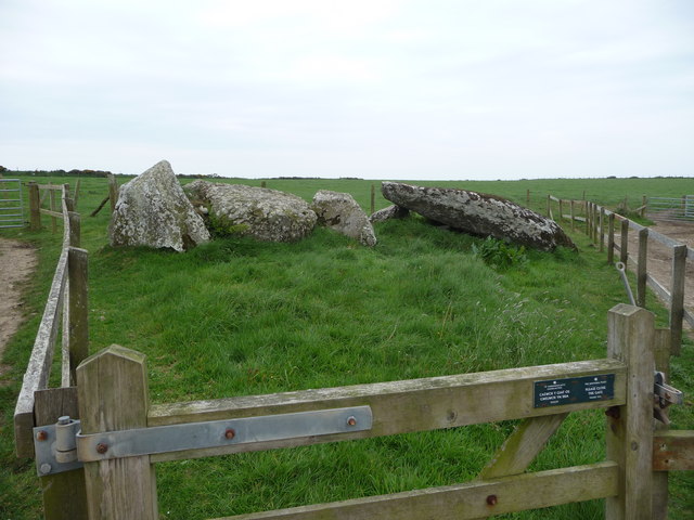
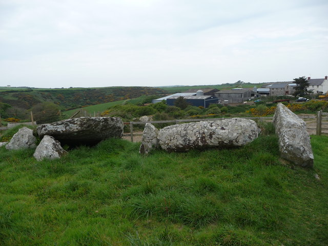
The name Llaneilfyw is derived from the Welsh language, with "llan" meaning church and "eilfyw" believed to be the name of an early Christian saint. This hints at the village's rich history, which dates back centuries. The area is known for its ancient monuments, including standing stones and burial chambers, which provide insights into its early settlement.

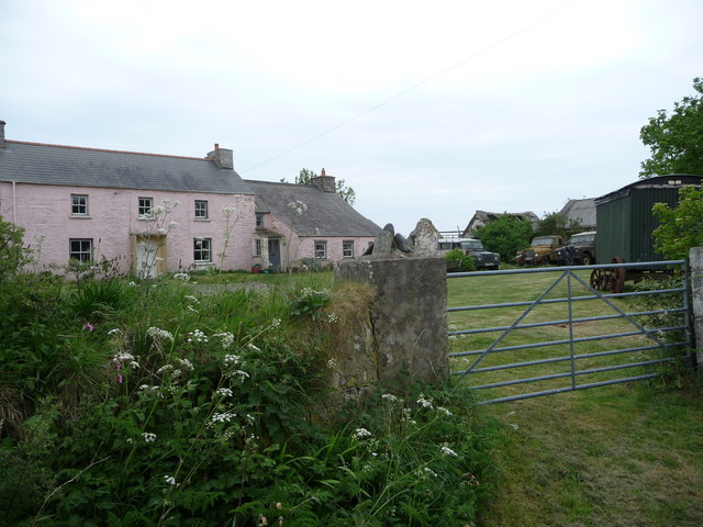
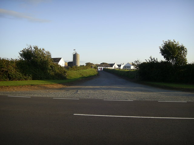
Llaneilfyw is a close-knit community with a population of around 200 residents. The village has a quaint and charming atmosphere, with traditional stone houses and a small church at its heart. Despite its size, it boasts a strong sense of community spirit, with various events and gatherings held throughout the year.

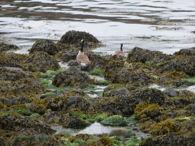
Nature enthusiasts are drawn to Llaneilfyw due to its proximity to the Pembrokeshire Coast National Park, which offers ample opportunities for hiking, birdwatching, and other outdoor activities. The village is also within reach of popular tourist destinations such as St Davids, the smallest city in Britain, and the vibrant town of Fishguard.

Overall, Llaneilfyw provides a tranquil retreat for those seeking a peaceful escape amidst the natural beauty of Pembrokeshire. Its idyllic setting, rich history, and welcoming community make it a hidden gem within the county.

If you have any feedback on the listing, please let us know in the comments section below.
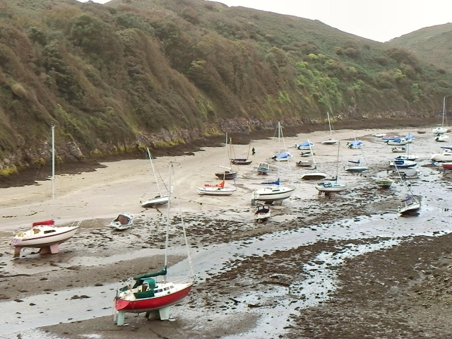
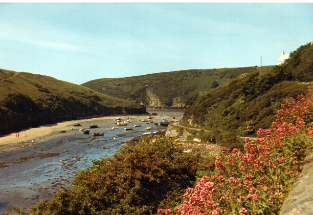
Llaneilfyw Images

Images are sourced within 2km of 51.871466/-5.1826673 or Grid Reference SM8124. Thanks to Geograph Open Source API. All images are credited.

Solva harbour Low tide at Solva harbour, lime kilns on the far shore.
Solva harbour
Low tide at Solva harbour, lime kilns on the far shore.
Lower Solva from Gribin Lower Solva lies behind Solva Harbour, which itself is in a 'fjord-like' inlet in the coastline here. Gribin is also known as the Cribyn ridge locally.
Lower Solva from Gribin
Lower Solva lies behind Solva Harbour, which itself is in a 'fjord-like' inlet in the coastline here. Gribin is also known as the Cribyn ridge locally.
Solva harbour from Gribin The houses of Upper Solva lie above the inlet, some overlooking the picturesque harbour.
Solva harbour from Gribin
The houses of Upper Solva lie above the inlet, some overlooking the picturesque harbour.
Rocks and islands off Solva harbour Beyond Penrhyn Head are St. Elvis' Rock and Black Rock and out to sea is larger Green Scar with The Mare and Black Scar each side. Quite a coastline.
Rocks and islands off Solva harbour
Beyond Penrhyn Head are St. Elvis' Rock and Black Rock and out to sea is larger Green Scar with The Mare and Black Scar each side. Quite a coastline.
Gate and footbridge at Gwadn The pebbly storm beach here is interesting and it's a lovely spot.
Gate and footbridge at Gwadn
The pebbly storm beach here is interesting and it's a lovely spot.
Canada Geese with goslings on Gwadn This little family waddled off seawards at my approach, just as well as a dog off its lead came in a few minutes later.
Canada Geese with goslings on Gwadn
This little family waddled off seawards at my approach, just as well as a dog off its lead came in a few minutes later.
St. Elvis cromlech This Neolithic burial chamber is around 5,000 years old and sited between farm tracks. Saint Elvis was an Irish saint in the 6th century and baptised St. David and an old church dedicated to St. Elvis was sited nearby, now somewhere underneath St. Elvis Farm adjacent.
St. Elvis cromlech
This Neolithic burial chamber is around 5,000 years old and sited between farm tracks. Saint Elvis was an Irish saint in the 6th century and baptised St. David and an old church dedicated to St. Elvis was sited nearby, now somewhere underneath St. Elvis Farm adjacent.
St. Elvis cromlech One of the oldest man-made structures in Pembrokeshire lies sandwiched between farm tracks.
St. Elvis cromlech
One of the oldest man-made structures in Pembrokeshire lies sandwiched between farm tracks.
Footpath between St. Elvis Farm and Lochvane This narrow and quiet path between cow pastures is warm and sheltered and a haven for wildlife.
Footpath between St. Elvis Farm and Lochvane
This narrow and quiet path between cow pastures is warm and sheltered and a haven for wildlife.
Old farm at Lochvane A collection of classic Landy's outside but not much sign of life.
Old farm at Lochvane
A collection of classic Landy's outside but not much sign of life.
The coastline between Dinas Fach and Solva An impressive stretch comprising numerous tall cliffs, small and medium sized bays and smaller inlets.
The coastline between Dinas Fach and Solva
An impressive stretch comprising numerous tall cliffs, small and medium sized bays and smaller inlets.
Part of Aber West and Dinas Fawr A medium sized bay with the headland jutting out and long Newgale Sands stretching out further around the coast eastward..
Part of Aber West and Dinas Fawr
A medium sized bay with the headland jutting out and long Newgale Sands stretching out further around the coast eastward..
Aber West bay looking west towards Solva It's easy to see how this section of coast is so popular with walkers.
Aber West bay looking west towards Solva
It's easy to see how this section of coast is so popular with walkers.
Bay near Solva The high tide line shows the usual collection of flotsam and jetsam, mainly plastic in various forms. Hardly surprising with all the traffic out to sea and inshore.
Bay near Solva
The high tide line shows the usual collection of flotsam and jetsam, mainly plastic in various forms. Hardly surprising with all the traffic out to sea and inshore.
Thrift growing on the cliff top near Solva Rabbits have colonised the fenced-off cliff edge and Thrift grows well here also, always a beautiful sight.
Thrift growing on the cliff top near Solva
Rabbits have colonised the fenced-off cliff edge and Thrift grows well here also, always a beautiful sight.
Track to Caermedris Farm Entrance to the short farm track from A487 road.
Track to Caermedris Farm
Entrance to the short farm track from A487 road.
Solva 1971
Solva 1971
Show me another place!

Llaneilfyw is located at Grid Ref: SM8124 (Lat: 51.871466, Lng: -5.1826673)

Unitary Authority: Pembrokeshire

Police Authority: Dyfed Powys

Also known as: St Elvis

What 3 Words

///bucked.retrieves.punctual. Near St Davids, Pembrokeshire

Nearby Locations

Llaneilfyw St Elvis

Related Wikis

St Elvis, Pembrokeshire

St Elvis (Welsh: Llaneilfyw, [ɬanəilvəu]) is a parish in Pembrokeshire, Wales, about 4 miles (6 km) east of St David's. At 200 acres (81 ha) it is one...

Pembrokeshire Coast Path

The Pembrokeshire Coast Path (Welsh: Llwybr Arfordir Sir Benfro), often called the Pembrokeshire Coastal Path, is a designated National Trail in Pembrokeshire...

River Solva

The River Solva (Welsh: Afon Solfach) is a small river in Pembrokeshire, Wales. Its source is a few hundred metres southeast of Croesgoch and flows ten...

Solva limekilns

The Solva limekilns are a row of disused limekilns in the harbour of the village of Solva, Pembrokeshire, Wales. The kilns have a Grade II heritage listing...

Nearby Amenities

Located within 500m of 51.871466,-5.1826673
Source: OS_Opendata_Vectormap_District
Lat/Long: 51.8735167/-5.1890644
Ford: stepping_stones
Lat/Long: 51.8724322/-5.1871401
Source: OS_Opendata_Vectormap_District
Lat/Long: 51.8676051/-5.1839788
Source: OS_Opendata_Vectormap_District
Lat/Long: 51.8677463/-5.1847351
Burial Chamber
Historic: archaeological_site
Lat/Long: 51.870995/-5.1797066
Source: OS_Opendata_Vectormap_District
Lat/Long: 51.8732368/-5.189293
Source: OS_Opendata_Vectormap_District
Lat/Long: 51.8733135/-5.1892126
Power: pole
Lat/Long: 51.8720265/-5.1788038
Power: pole
Lat/Long: 51.8715115/-5.175671
The data included in this document is from www.openstreetmap.org. The data is made available under ODbL.

Have you been to Llaneilfyw?

Leave your review of Llaneilfyw below (or comments, questions and feedback).