Port Chreag Fada

Sea, Estuary, Creek in Argyllshire

Scotland

Port Chreag Fada

Octofad Pipe <span class="nowrap"><a title="http://trigpointing.uk/trig/9483" rel="nofollow ugc noopener" href="http://trigpointing.uk/trig/9483">Link</a><img style="margin-left:2px;" alt="External link" title="External link - shift click to open in new window" src="https://s1.geograph.org.uk/img/external.png" width="10" height="10"/></span>
<span class="nowrap"><a title="http://trigpointing.uk/wiki/Pipe" rel="nofollow ugc noopener" href="http://trigpointing.uk/wiki/Pipe">Link</a><img style="margin-left:2px;" alt="External link" title="External link - shift click to open in new window" src="https://s1.geograph.org.uk/img/external.png" width="10" height="10"/></span>
Not much is known about pipes. There are 21 listed on T:UK, all in Scotland.
Lewis and Harris (1)
Islay (16)
Gigha (3)
Kintyre Peninsula (1)
Octofad Pipe Credit: thejackrustles

Port Chreag Fada is a picturesque coastal area located in Argyllshire, Scotland. Nestled along the western coast, it is renowned for its stunning sea views, tranquil estuary, and charming creek. The name "Port Chreag Fada" translates to "Long Rock Harbor" in English, which aptly describes the prominent rocky formations that characterize the area.

Situated on the shores of the Atlantic Ocean, Port Chreag Fada offers visitors breathtaking vistas of the vast sea. The crashing waves and rugged cliffs provide a dramatic backdrop, creating a sense of awe and tranquility. The pristine sandy beaches are ideal for leisurely walks or picnics, while the rock pools offer a glimpse into the diverse marine life that inhabits the area.

The estuary at Port Chreag Fada is a haven for birdwatchers and nature enthusiasts. The calm waters and marshlands attract a wide variety of bird species, including herons, waders, and ducks. It is a designated nature reserve, ensuring the protection of its rich biodiversity.

At the heart of Port Chreag Fada lies a charming creek that meanders through the landscape. The creek is a popular spot for boating and fishing, with plenty of opportunities to catch salmon, trout, and other freshwater fish. Its peaceful ambiance and lush surroundings make it a serene spot for relaxation and contemplation.

Overall, Port Chreag Fada is a hidden gem in Argyllshire, offering visitors a chance to immerse themselves in the beauty of Scotland's coastal landscape. Whether it's admiring the sea views, exploring the estuary, or enjoying the tranquility of the creek, this coastal haven is a must-see for nature lovers and those seeking a peaceful getaway.

If you have any feedback on the listing, please let us know in the comments section below.

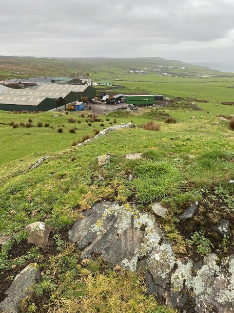
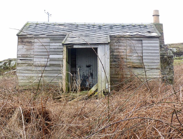
Port Chreag Fada Images

Images are sourced within 2km of 55.714775/-6.4051704 or Grid Reference NR2355. Thanks to Geograph Open Source API. All images are credited.

Octofad Pipe <span class="nowrap"><a title="http://trigpointing.uk/trig/9483" rel="nofollow ugc noopener" href="http://trigpointing.uk/trig/9483">Link</a><img style="margin-left:2px;" alt="External link" title="External link - shift click to open in new window" src="https://s1.geograph.org.uk/img/external.png" width="10" height="10"/></span>
<span class="nowrap"><a title="http://trigpointing.uk/wiki/Pipe" rel="nofollow ugc noopener" href="http://trigpointing.uk/wiki/Pipe">Link</a><img style="margin-left:2px;" alt="External link" title="External link - shift click to open in new window" src="https://s1.geograph.org.uk/img/external.png" width="10" height="10"/></span>
Not much is known about pipes. There are 21 listed on T:UK, all in Scotland.
Lewis and Harris (1)
Islay (16)
Gigha (3)
Kintyre Peninsula (1)
Octofad Pipe
LinkExternal link LinkExternal link Not much is known about pipes. There are 21 listed on T:UK, all in Scotland. Lewis and Harris (1) Islay (16) Gigha (3) Kintyre Peninsula (1)
Medieval graves, Nerabus Protected by plate glass, these are a fine set of medieval grave slabs with intricate carvings.
Medieval graves, Nerabus
Protected by plate glass, these are a fine set of medieval grave slabs with intricate carvings.
Medieval grave slabs - Nerabus Detail of two of the medieval grave slabs at Nerabus, showing swords with intricate carved patterns surrounding.
Medieval grave slabs - Nerabus
Detail of two of the medieval grave slabs at Nerabus, showing swords with intricate carved patterns surrounding.
Remains of medieval chapel, Nerabus Slight remains of a chapel adjacent to the carved grave slabs at Nerabus.
Remains of medieval chapel, Nerabus
Slight remains of a chapel adjacent to the carved grave slabs at Nerabus.
Island bus at Nerabus Islay Coaches provide a regular bus service linking the main villages on the island. Seen here passing through the hamlet of Nerabus.
Island bus at Nerabus
Islay Coaches provide a regular bus service linking the main villages on the island. Seen here passing through the hamlet of Nerabus.
Alpacas Ahead Part of the biodiversity of the Rhinns! A flock of alpacas grazing near Carn.
Alpacas Ahead
Part of the biodiversity of the Rhinns! A flock of alpacas grazing near Carn.
Carn Clifftop A clifftop near Carn with a view to Laggan Point.
Carn Clifftop
A clifftop near Carn with a view to Laggan Point.
Coast View A change of coastal view off the A847 from the grass topped cliff a mile or so earlier.
Coast View
A change of coastal view off the A847 from the grass topped cliff a mile or so earlier.
Rocky Outcrop A rocky outcrop amongst bracken on the Rhinns.
Rocky Outcrop
A rocky outcrop amongst bracken on the Rhinns.
Hut on the Hill A disused hut by Craigfad Farm.
Hut on the Hill
A disused hut by Craigfad Farm.
Craigfad Farm A small farmstead by the A847 on the Rhinns of Islay.
Craigfad Farm
A small farmstead by the A847 on the Rhinns of Islay.
Sheep by Nerabus Sheep grazing in rough pasture by Nerabus.
Sheep by Nerabus
Sheep grazing in rough pasture by Nerabus.
Nerabus Farmhouse A whitewashed house amongst trees at Nerabus.
Nerabus Farmhouse
A whitewashed house amongst trees at Nerabus.
Milestone between Portnahaven and Port Charlotte, Islay
Bridge across the Abhainn Ardnish, Islay
Craigfad Farm, Islay
Boarded up and Derelict, near Portnahaven, Islay
Milestone near Craigfad, Islay
Show me another place!

Port Chreag Fada is located at Grid Ref: NR2355 (Lat: 55.714775, Lng: -6.4051704)

Unitary Authority: Argyll and Bute

Police Authority: Argyll and West Dunbartonshire

What 3 Words

///starting.shoelaces.reply. Near Port Charlotte, Argyll & Bute

Related Wikis

Nerabus

Nerabus (otherwise Nereabolls) is a hamlet in the west of the isle of Islay in Scotland. The vicinity is noted for its scenic qualities and diverse birdlife...

Clark Cottage

Clark Cottage is a residential building in the Scottish village of Port Charlotte on the island of Islay. The building is on the eastern side of Main Street...

Port Charlotte, Islay

Port Charlotte (Scottish Gaelic: Port Sgioba) is a village on the island of Islay in the Inner Hebrides, Scotland. It was founded in 1828. In 1991 it...

Port Charlotte distillery

Port Charlotte distillery (also known as Rhins distillery and Lochindaal distillery) was a Scotch whisky distillery on the island of Islay, off the west...

Nearby Amenities

Located within 500m of 55.714775,-6.4051704
Passing Place
Lat/Long: 55.7152202/-6.4075605
Power: pole
Lat/Long: 55.7178058/-6.4048348
Power: pole
Lat/Long: 55.7168148/-6.4064198
Power: pole
Lat/Long: 55.7155039/-6.409369
Power: pole
Lat/Long: 55.7140225/-6.4125495
Power: pole
Lat/Long: 55.718845/-6.4030018
Power: pole
Lat/Long: 55.7183983/-6.4037474
Power: pole
Lat/Long: 55.7181026/-6.4042893
Power: pole
Lat/Long: 55.7172988/-6.405583
Power: pole
Lat/Long: 55.7164057/-6.4073493
Power: pole
Lat/Long: 55.7159631/-6.4083758
Power: pole
Lat/Long: 55.7150596/-6.4103229
Power: pole
Lat/Long: 55.7148027/-6.4108745
Power: pole
Lat/Long: 55.7142954/-6.4119636
Passing Place
Lat/Long: 55.7186873/-6.402575
Craigfad
Name Gd: A' Chreag Fhada
Place: isolated_dwelling
Lat/Long: 55.7168677/-6.4053871
The data included in this document is from www.openstreetmap.org. The data is made available under ODbL.

Have you been to Port Chreag Fada?

Leave your review of Port Chreag Fada below (or comments, questions and feedback).