Port a' Chromain

Sea, Estuary, Creek in Argyllshire

Scotland

Port a' Chromain

Trig point at Calgary Point
Trig point at Calgary Point Credit: Peter Edwards

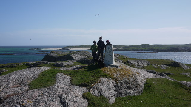
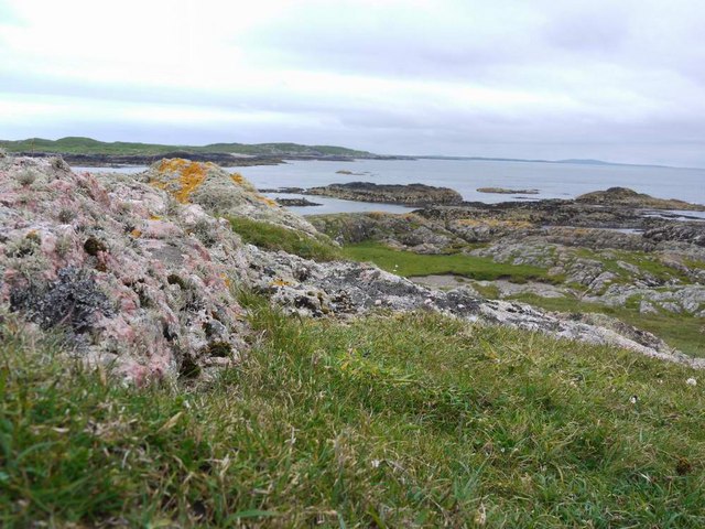
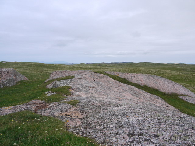
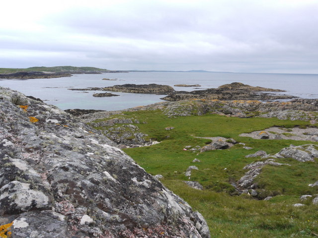
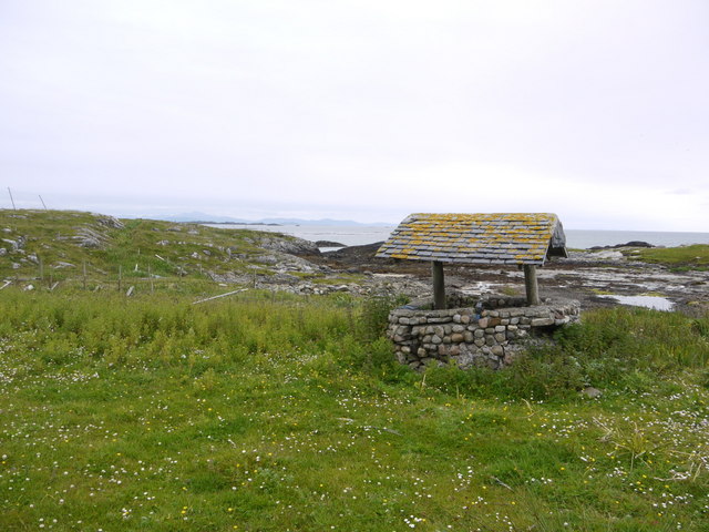
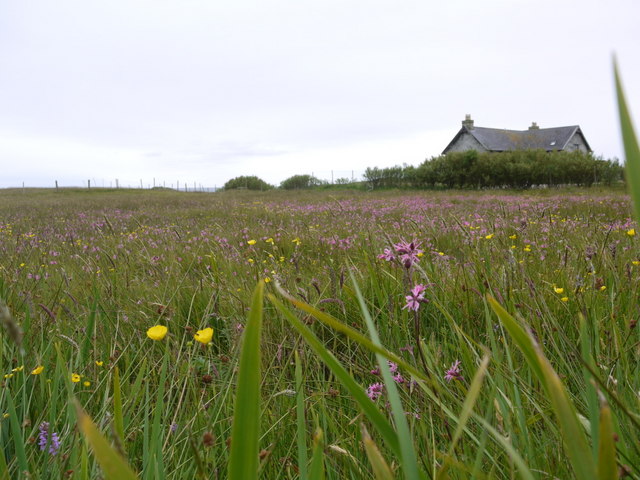
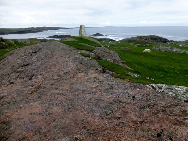
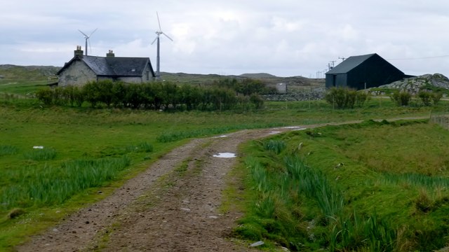
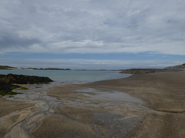
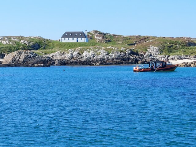
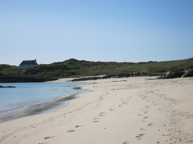
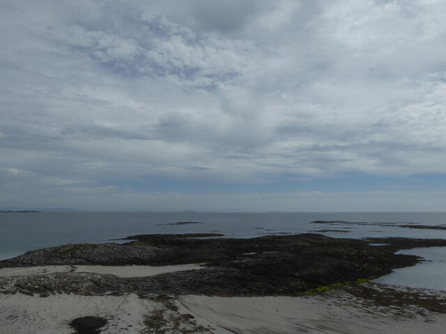
Port a' Chromain is a picturesque coastal settlement located in Argyllshire, Scotland. Nestled along the western coast, it is renowned for its stunning sea views, tranquil estuary, and charming creek. The area is a haven for nature enthusiasts and those seeking a peaceful retreat.

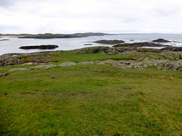
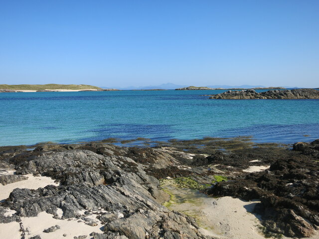
The sea surrounding Port a' Chromain offers breathtaking vistas, with its crystal-clear waters and crashing waves. It is a popular spot for water activities such as sailing, kayaking, and fishing. Visitors can witness an array of marine life, including seals, dolphins, and a variety of seabirds.

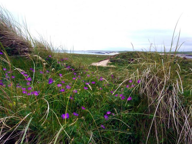
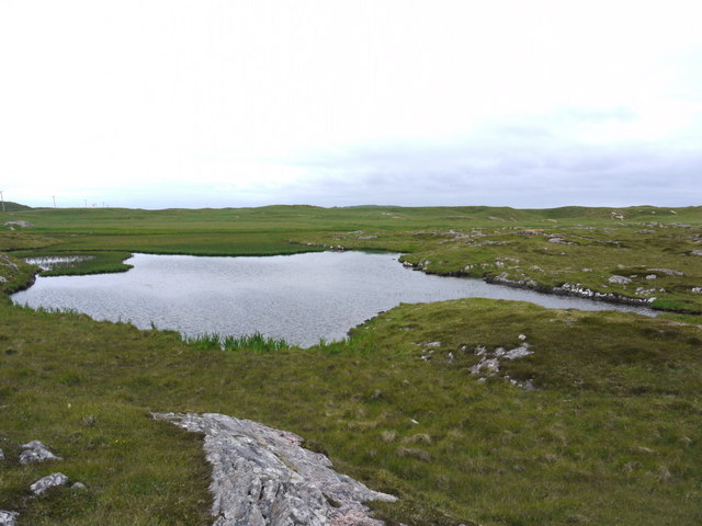
The estuary of Port a' Chromain is a significant feature of the landscape. This tidal inlet extends inland from the sea, forming a peaceful and sheltered body of water. The estuary is home to a diverse ecosystem, supporting a wide range of plant and animal species. It offers opportunities for birdwatching and exploring the unique flora and fauna of the area.

The creek in Port a' Chromain adds to the charm of the village, meandering through the scenic countryside. Its gentle flow and tranquil surroundings make it an ideal place for leisurely walks and picnics. The creek is often dotted with colorful boats, adding to the picturesque atmosphere.

Port a' Chromain is a hidden gem in Argyllshire, offering a serene coastal experience. With its stunning sea views, peaceful estuary, and charming creek, it is the perfect destination for nature lovers and those seeking a peaceful escape from the bustling city life.

If you have any feedback on the listing, please let us know in the comments section below.

Port a' Chromain Images

Images are sourced within 2km of 56.562801/-6.6882336 or Grid Reference NM1251. Thanks to Geograph Open Source API. All images are credited.

Trig point at Calgary Point
Calgary Point Looking over to Gunna
Calgary Point
Looking over to Gunna
Exposed rock at Calgary Point The hills of Rum just visible in the distance.
Exposed rock at Calgary Point
The hills of Rum just visible in the distance.
The trig at Calgary Point The hills of Rum visible in the distance.
The trig at Calgary Point
The hills of Rum visible in the distance.
Calgary Point Looking over to the island of Gunna and, beyond that, Tiree.
Calgary Point
Looking over to the island of Gunna and, beyond that, Tiree.
Bloody cranesbill and dunes at Traigh nan Siolag Tiree in the distance.
Bloody cranesbill and dunes at Traigh nan Siolag
Tiree in the distance.
Lochan a' Chuirn
Lochan a' Chuirn
Well at Coales House Known by this name on the OS 50,000 mapping, but named "Walkers Cottage" on the 25,000 version.  This well has what appears to be a pump and waterpipe emerging so is not merely decorative.  Caoles House appears to be derelict.
Well at Coales House
Known by this name on the OS 50,000 mapping, but named "Walkers Cottage" on the 25,000 version. This well has what appears to be a pump and waterpipe emerging so is not merely decorative. Caoles House appears to be derelict.
Caoles House (aka Walkers Cottage) Seen over the machair in full bloom.
Caoles House (aka Walkers Cottage)
Seen over the machair in full bloom.
View Towards Gunna A view towards Gunna from Calgary Point.
View Towards Gunna
A view towards Gunna from Calgary Point.
Calgary Point Trig A view towards Calgary Point trig and across to Gunna
Calgary Point Trig
A view towards Calgary Point trig and across to Gunna
Walkers Cottage Walkers Cottage looks rather neglected now although the wind turbines look relatively new.
Walkers Cottage
Walkers Cottage looks rather neglected now although the wind turbines look relatively new.
Wind turbines near Crossapol,  Isle of Coll
Wind turbines near Crossapol, Isle of Coll
Beach on south west of Coll
House on Gunna Modern house in retro style on Gunna
House on Gunna
Modern house in retro style on Gunna
Beach on South side of Gunna White sand beach on Gunna island, taken on beautiful September day. New build in the style of a black house at one end of the bay - a perfect retreat.
Beach on South side of Gunna
White sand beach on Gunna island, taken on beautiful September day. New build in the style of a black house at one end of the bay - a perfect retreat.
View over entrance to Caolas Ban between Gunna and Coll View over channel between Gunna and Coll, Caolas Ban, with Western edge of Coll to left and Ben More on Mull in the background.
View over entrance to Caolas Ban between Gunna and Coll
View over channel between Gunna and Coll, Caolas Ban, with Western edge of Coll to left and Ben More on Mull in the background.
Rocks off Rubh' a' Chromain, Isle of Coll
Show me another place!

Port a' Chromain is located at Grid Ref: NM1251 (Lat: 56.562801, Lng: -6.6882336)

Unitary Authority: Argyll and Bute

Police Authority: Argyll and West Dunbartonshire

What 3 Words

///mows.treatment.tricycle. Near Scarinish, Argyll & Bute

Related Wikis

Gunna, Scotland

Gunna (Gaelic: Gunnaigh) is an island in the Inner Hebrides of Scotland. == Geography and geology == Gunna lies between Coll and Tiree, closer to Coll...

Breachacha crannog

The Breachacha crannog is a crannog located near Loch Breachacha, on the Inner Hebridean island of Coll. The crannog is recognised in the United Kingdom...

Breachacha Castle

Breachacha Castle (also spelled Breacachadh) is either of two structures on the shore of Loch Breachacha, on the Inner Hebridean island of Coll, Scotland...

Coll Airport

Coll Island Airport (IATA: COL, ICAO: EGEL) (Scottish Gaelic: Port-adhair Cholla) is located 5 NM (9.3 km; 5.8 mi) west southwest of Arinagour on the island...

Nearby Amenities

Located within 500m of 56.562801,-6.6882336
Natural: rock
Source: OS7
Tidal: yes
Lat/Long: 56.563055/-6.696141
Natural: rock
Source: OS7
Tidal: yes
Lat/Long: 56.5639257/-6.6958476
Natural: rock
Source: OS7
Tidal: yes
Lat/Long: 56.5621033/-6.6928038
Natural: rock
Source: OS7
Tidal: yes
Lat/Long: 56.5613744/-6.6937207
Natural: rock
Source: OS7
Tidal: yes
Lat/Long: 56.5604429/-6.6940507
Natural: rock
Source: OS7
Tidal: yes
Lat/Long: 56.5607466/-6.6933173
Natural: rock
Source: OS7
Tidal: yes
Lat/Long: 56.5601999/-6.6933539
Natural: rock
Source: OS7
Tidal: yes
Lat/Long: 56.5595721/-6.6933173
Natural: rock
Source: OS7
Tidal: yes
Lat/Long: 56.5599974/-6.6855429
Natural: rock
Source: OS7
Tidal: yes
Lat/Long: 56.5604631/-6.6845893
Natural: rock
Source: OS7
Tidal: yes
Lat/Long: 56.5604024/-6.6831591
Natural: rock
Source: OS7
Tidal: yes
Lat/Long: 56.5606859/-6.6837092
Natural: rock
Source: OS7
Tidal: yes
Lat/Long: 56.5608884/-6.6842593
Natural: rock
Source: OS7
Tidal: yes
Lat/Long: 56.5611516/-6.6846994
Natural: rock
Source: OS7
Tidal: yes
Lat/Long: 56.5612934/-6.6856528
Natural: rock
Source: OS7
Tidal: yes
Lat/Long: 56.5625893/-6.6858362
Natural: rock
Source: OS7
Tidal: yes
Lat/Long: 56.5632778/-6.6843327
Natural: rock
Source: OS7
Tidal: yes
Lat/Long: 56.5626298/-6.6819123
Natural: rock
Source: OS7
Tidal: yes
Lat/Long: 56.5643509/-6.684296
Natural: rock
Source: OS7
Tidal: yes
Lat/Long: 56.5637637/-6.6852128
Natural: rock
Source: OS7
Tidal: yes
Lat/Long: 56.562245/-6.6873764
Natural: rock
Source: OS7
Tidal: yes
Lat/Long: 56.5601999/-6.6895034
The data included in this document is from www.openstreetmap.org. The data is made available under ODbL.

Have you been to Port a' Chromain?

Leave your review of Port a' Chromain below (or comments, questions and feedback).