Berie Beag

Sea, Estuary, Creek in Ross-shire

Scotland

Berie Beag

Mangurstadh Coastline Looking South The cliffs here are spectacular and the Lewisian Gneiss makes for some great climbing.
Mangurstadh Coastline Looking South Credit: RIJones

Berie Beag is a picturesque coastal village located in Ross-shire, Scotland. Situated on the shores of the North Sea, it is known for its stunning natural beauty and tranquil atmosphere. The village is nestled between rolling hills and a pristine coastline, offering breathtaking views of the sea, estuary, and creek.

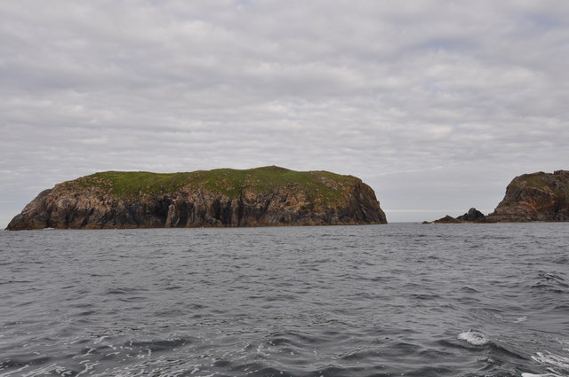
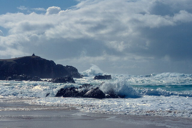
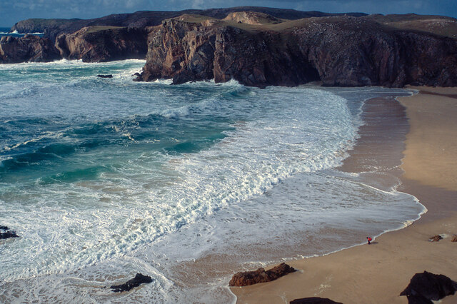
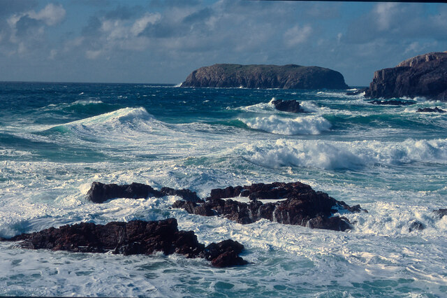
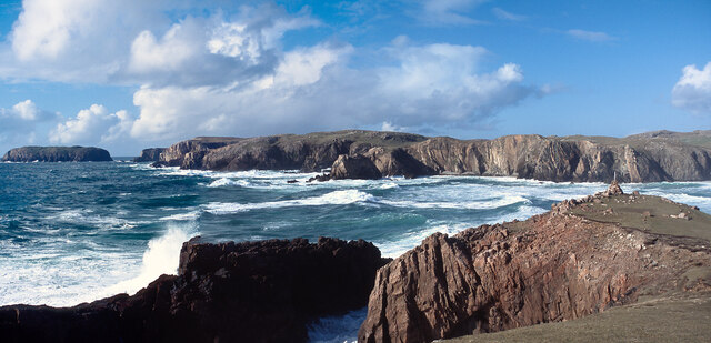
The sea surrounding Berie Beag is a prominent feature, with its mesmerizing blue waters stretching as far as the eye can see. It provides ample opportunities for various water activities, such as sailing, fishing, and swimming. The village's idyllic beach is a popular spot for locals and tourists alike to enjoy a relaxing day in the sun.

The estuary, which gently flows into the sea, adds another dimension to Berie Beag's natural charm. It is a haven for wildlife, attracting a diverse range of bird species and marine life. Nature enthusiasts can explore the estuary's rich ecosystem through walking trails and observation points.

A highlight of Berie Beag is its picturesque creek, which winds its way through the village. This tranquil waterway provides a serene setting for leisurely walks, as well as a habitat for various plant and animal species. The creek also plays a vital role in the village's history, as it was once used for transportation and trade.

Overall, Berie Beag in Ross-shire is a gem of a coastal village, offering a harmonious blend of natural beauty and historical significance. It is a place where visitors can immerse themselves in the wonders of the sea, estuary, and creek, while enjoying the peaceful ambiance of a traditional Scottish village.

If you have any feedback on the listing, please let us know in the comments section below.

Berie Beag Images

Images are sourced within 2km of 58.169221/-7.0985532 or Grid Reference NB0031. Thanks to Geograph Open Source API. All images are credited.

Mangurstadh Coastline Looking South The cliffs here are spectacular and the Lewisian Gneiss makes for some great climbing.
Mangurstadh Coastline Looking South
The cliffs here are spectacular and the Lewisian Gneiss makes for some great climbing.
Eilean Molach Showing the narrow gap between it and mainland Lewis.
Eilean Molach
Showing the narrow gap between it and mainland Lewis.
A pretty lochan This is Lochan Mealabhat, two thirds of which is in this square. It is a pleasing geograph photo, because it clearly shows what you can see on the map: I'm standing on a little tongue of land that sticks out into the lochan, the tongue is in the square, and I'm looking across to a similar tongue.
A pretty lochan
This is Lochan Mealabhat, two thirds of which is in this square. It is a pleasing geograph photo, because it clearly shows what you can see on the map: I'm standing on a little tongue of land that sticks out into the lochan, the tongue is in the square, and I'm looking across to a similar tongue.
Rubh' an Taroin headland
Rubh' an Taroin
Rubh' an Taroin
Coastal moor at Mullach an Tàroin
North end of Traigh Mhangarstaidh A beautiful beach with a fine Atlantic swell pounding in.
North end of Traigh Mhangarstaidh
A beautiful beach with a fine Atlantic swell pounding in.
Atlantic swell, Traigh Mhangarstaidh An exciting time being beside to a tumultuous sea - and at close range.
Atlantic swell, Traigh Mhangarstaidh
An exciting time being beside to a tumultuous sea - and at close range.
Looking down on Traigh Mhangarstaidh A walk for the view with my son on the beach.
Looking down on Traigh Mhangarstaidh
A walk for the view with my son on the beach.
Sea off Traigh Mhangarstaidh Exhilarating!
Sea off Traigh Mhangarstaidh
Exhilarating!
Coast line near Traigh Mhangarstaidh A wide view from stitching images.  An amazing experience.
Coast line near Traigh Mhangarstaidh
A wide view from stitching images. An amazing experience.
Radio masts at Mangastra/Mhangarstaidh, Lewis, 1989 Compared to more recent images, it would appear a number of these buildings and one mast have been demolished in the intervening years.
Radio masts at Mangastra/Mhangarstaidh, Lewis, 1989
Compared to more recent images, it would appear a number of these buildings and one mast have been demolished in the intervening years.
Geodha an Fhithich I spotted this on the map and I just had to visit it. Fhithich, as some of my regular readers will know is the domain name for this blog. It’s Gaelic for raven. Geodha means a chasm or ravine. So this is the ravine of the raven. I must admit I was a bit disappointed. I’ve seen geodha before which have much more vertical sides but the sea stacks in the bay across to the headland Àird Feinis were spectacular.

From my blog <span class="nowrap"><a title="https://fhithich.wordpress.com/2017/08/23/geodha-an-fhithich/" rel="nofollow ugc noopener" href="https://fhithich.wordpress.com/2017/08/23/geodha-an-fhithich/">Link</a><img style="margin-left:2px;" alt="External link" title="External link - shift click to open in new window" src="https://s1.geograph.org.uk/img/external.png" width="10" height="10"/></span>
Geodha an Fhithich
I spotted this on the map and I just had to visit it. Fhithich, as some of my regular readers will know is the domain name for this blog. It’s Gaelic for raven. Geodha means a chasm or ravine. So this is the ravine of the raven. I must admit I was a bit disappointed. I’ve seen geodha before which have much more vertical sides but the sea stacks in the bay across to the headland Àird Feinis were spectacular. From my blog LinkExternal link
WWII Islibhig  Chain Home Low radar station
WWII Islibhig Chain Home Low radar station
Rubh an Taroin The headland of Rubh an Taroin is a good feature of this coast.  In this view northwards Ard More Mangersta dominates the skyline.
Rubh an Taroin
The headland of Rubh an Taroin is a good feature of this coast. In this view northwards Ard More Mangersta dominates the skyline.
Rubha an Taroin Some of the splendid cliffs of pink Uig granite south of Mangurstadh.
Rubha an Taroin
Some of the splendid cliffs of pink Uig granite south of Mangurstadh.
Rubha an Taroin A more detailed view into the cove sheltered by Rubha an Taroin. Note how clear the water is - every submerged rock is clearly visible.
Rubha an Taroin
A more detailed view into the cove sheltered by Rubha an Taroin. Note how clear the water is - every submerged rock is clearly visible.
The coast at Mhangarstadh
Show me another place!

Berie Beag is located at Grid Ref: NB0031 (Lat: 58.169221, Lng: -7.0985532)

Unitary Authority: Na h-Eileanan an Iar

Police Authority: Highlands and Islands

What 3 Words

///reporters.extend.prowess. Near Carloway, Na h-Eileanan Siar

Related Wikis

Stac Dhòmhnaill Chaim

Stac Dhòmnuill Chaim, or Stac Dhòmhnaill Chaim, or Stac Domhnuill Chaim, is a fortified promontory located near Mangursta (or Mangersta, Scottish Gaelic...

Abhainn Dearg distillery

Abhainn Dearg distillery ( AV-in JAIRG) or Red River distillery is a Scotch whisky distillery in Uig, on the west coast of the Isle of Lewis in the Outer...

Gasker

Gasker is a small uninhabited islet in the Outer Hebrides of Scotland, 8 kilometres (4+1⁄2 nautical miles) southwest of Scarp, off the west coast of Harris...

Ardroil

Ardroil (Scottish Gaelic: Eadar Dhà Fhadhail) is a village on the Isle of Lewis in the Outer Hebrides, Scotland. Ardroil is within the parish of Uig....

Nearby Amenities

Located within 500m of 58.169221,-7.0985532
Bus Stop
Mangersta Village
Bus: yes
Naptan AtcoCode: 6010731745
Naptan Bearing: E
Naptan CommonName: Mangersta Village
Naptan Indicator: Mangersta Village
Naptan Landmark: Mangersta Village
Naptan NaptanCode: 94723789
Naptan Street: Mangersta Village
Naptan Verified: no
Shelter: no
Source: naptan_import
Lat/Long: 58.1697704/-7.0918812
Passing Place
Lat/Long: 58.1710374/-7.092411
Turning Circle
Lat/Long: 58.1697077/-7.0918304
Barrier: cattle_grid
Lat/Long: 58.1698227/-7.0917505
Barrier: cattle_grid
Lat/Long: 58.1708142/-7.0920543
Stac Dhòmhnaill Chaim
Archaeological Site: fortification
Historic: archaeological_site
Wikidata: Q7595803
Wikipedia: en:Stac Dhòmhnaill Chaim
Lat/Long: 58.1704428/-7.1003372
Tourism: attraction
Lat/Long: 58.1693289/-7.0975134
Mangersta Stack
Tourism: viewpoint
Lat/Long: 58.1685717/-7.0952906
Power: pole
Lat/Long: 58.1709602/-7.0923922
Power: pole
Lat/Long: 58.1696804/-7.0908782
Rubha Thisgeis
Natural: cape
Lat/Long: 58.1684265/-7.0993253
Berie Mor
Natural: bay
Lat/Long: 58.1702174/-7.098805
Berie Beag
Natural: bay
Lat/Long: 58.1693205/-7.0983544
The data included in this document is from www.openstreetmap.org. The data is made available under ODbL.

Have you been to Berie Beag?

Leave your review of Berie Beag below (or comments, questions and feedback).