Beul a' Chaolais

Sea, Estuary, Creek in Inverness-shire

Scotland

Beul a' Chaolais

Baleshare - North Uist Causeway Looking east from Samhla to North Uist. Interestingly, although both sides are open to the sea, there is water to the south but it was dry on the north.
Baleshare - North Uist Causeway Credit: M J Richardson

Beul a' Chaolais is a small coastal village situated in the picturesque region of Inverness-shire, Scotland. Nestled along the shores of the North Sea, this charming settlement is known for its stunning natural beauty and tranquil atmosphere.

The village is blessed with a diverse range of geographical features, including a sea, estuary, and creek, making it a haven for nature lovers and outdoor enthusiasts. The sea surrounding Beul a' Chaolais offers breathtaking views of the horizon, with its sparkling blue waters stretching as far as the eye can see. This coastline is a popular spot for fishing and sailing, attracting visitors from near and far.

The estuary of Beul a' Chaolais is a unique ecosystem, where the sea meets a freshwater river. This convergence creates a rich habitat for a variety of marine and bird species. Visitors can witness an array of wildlife, including seals, otters, and a wide range of seabirds, such as gannets and puffins.

A notable feature of Beul a' Chaolais is the picturesque creek that winds its way through the village. Surrounded by lush greenery and rolling hills, this serene waterway provides a peaceful setting for leisurely walks and picnics.

In addition to its natural beauty, Beul a' Chaolais offers a warm and welcoming community. The village is home to a small population, with residents who take pride in their heritage and the preservation of their surroundings. Local amenities include quaint shops, cozy cafes, and traditional pubs, where visitors can experience the warm hospitality and authentic Scottish culture.

Overall, Beul a' Chaolais in Inverness-shire is a hidden gem, offering a harmonious blend of natural wonders and a close-knit community.

If you have any feedback on the listing, please let us know in the comments section below.

Beul a' Chaolais Images

Images are sourced within 2km of 57.550339/-7.3731794 or Grid Reference NF7863. Thanks to Geograph Open Source API. All images are credited.
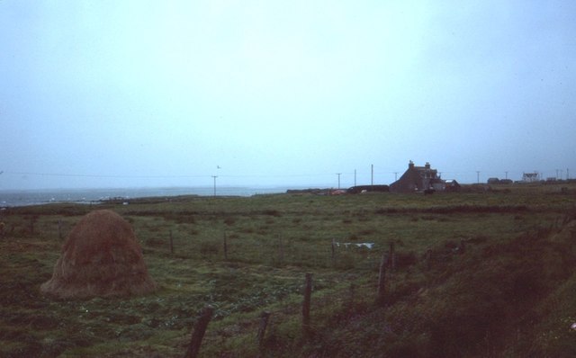
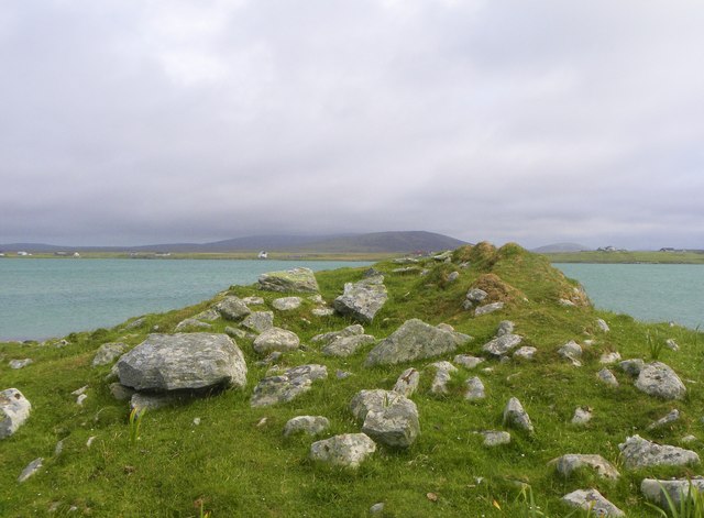
Baleshare - North Uist Causeway Looking east from Samhla to North Uist. Interestingly, although both sides are open to the sea, there is water to the south but it was dry on the north.
Baleshare - North Uist Causeway
Looking east from Samhla to North Uist. Interestingly, although both sides are open to the sea, there is water to the south but it was dry on the north.
Shore at Samhla Looking south from the west end of the causeway.
Shore at Samhla
Looking south from the west end of the causeway.
Cladach Iolaraigh West side of North Uist
Cladach Iolaraigh
West side of North Uist
Carnan Nan Long chambered cairn Neolithic chambered cairn on the coastline. <span class="nowrap"><a title="https://canmore.org.uk/site/10005/north-uist-baleshare-carnan-nan-long" rel="nofollow ugc noopener" href="https://canmore.org.uk/site/10005/north-uist-baleshare-carnan-nan-long">Link</a><img style="margin-left:2px;" alt="External link" title="External link - shift click to open in new window" src="https://s1.geograph.org.uk/img/external.png" width="10" height="10"/></span>
Carnan Nan Long chambered cairn
Neolithic chambered cairn on the coastline. LinkExternal link
Field wall next to beach on Baile Sear Walls were often erected to prevent stock on beaches getting onto adjacent arable ground (Scale 1m).
Field wall next to beach on Baile Sear
Walls were often erected to prevent stock on beaches getting onto adjacent arable ground (Scale 1m).
The shore near Cladach Chireboist Looking towards the gap between Eilean Chircebost (Kirkibost Island), on the right, and Baile Sear (Baleshare) on the left.
The map of Baleshare is littered with tiny 10m contours, though the northern tip seen here is much lower. Kirkibost has not a single 10m contour, though in this and other photos it appears to reach at least that height. One relevant factor is that the photos all seem to have been taken at low tide whereas height is measured above Mean Sea Level. However I suspect that the Ordnance Survey do not devote too much time to surveying islands like this which are hardly used and comprise mostly sand dunes which can and do shift! Perhaps at present this southern tip of Kirkibost is slightly higher than 10m.
The shore near Cladach Chireboist
Looking towards the gap between Eilean Chircebost (Kirkibost Island), on the right, and Baile Sear (Baleshare) on the left. The map of Baleshare is littered with tiny 10m contours, though the northern tip seen here is much lower. Kirkibost has not a single 10m contour, though in this and other photos it appears to reach at least that height. One relevant factor is that the photos all seem to have been taken at low tide whereas height is measured above Mean Sea Level. However I suspect that the Ordnance Survey do not devote too much time to surveying islands like this which are hardly used and comprise mostly sand dunes which can and do shift! Perhaps at present this southern tip of Kirkibost is slightly higher than 10m.
Claddach Kirkibost foreshore Just before dusk the sun breaks through.
Claddach Kirkibost foreshore
Just before dusk the sun breaks through.
Claddach Kirkibost croft land Wind plucked plastic litters the roadside
Claddach Kirkibost croft land
Wind plucked plastic litters the roadside
Cladach Chirceboist Fattening the calves
Cladach Chirceboist
Fattening the calves
Cladach Chirceboist The road to the moor.
Cladach Chirceboist
The road to the moor.
Along the dune ridge at Slugan
The tidal channel that separates Eilean Chirceboist I think the channel has moved a little way south of its marked position on the map(s), but either way, it helps explain why there are currently several unclaimed squares just north & west of here. It may be possible to reach the island across the sands of Tràigh Leathann from the road around N Uist, but as it's a fairly long walk there & back, I suspect it would involve 'marooning' yourself on the island while the tide's in. Or just get a boat/kayak. Or wade this channel.
The tidal channel that separates Eilean Chirceboist
I think the channel has moved a little way south of its marked position on the map(s), but either way, it helps explain why there are currently several unclaimed squares just north & west of here. It may be possible to reach the island across the sands of Tràigh Leathann from the road around N Uist, but as it's a fairly long walk there & back, I suspect it would involve 'marooning' yourself on the island while the tide's in. Or just get a boat/kayak. Or wade this channel.
Chambered cairn on Baleshare Neolithic chambered tomb on the northern coast of Baleshare island.
Chambered cairn on Baleshare
Neolithic chambered tomb on the northern coast of Baleshare island.
Old crofting settlement, Balilleray An extensive area of old walls and ruined crofts at Balilleray on Baleshare island. The settlement was abandoned [or possible cleared] in the 19th century.
Old crofting settlement, Balilleray
An extensive area of old walls and ruined crofts at Balilleray on Baleshare island. The settlement was abandoned [or possible cleared] in the 19th century.
Pebbles, sand and water There's not a lot of land in this square, but a photo is possible from the point where the sand spit at the north end of Baleshare turns the corner. Across the sands are crofts on North Uist.
Pebbles, sand and water
There's not a lot of land in this square, but a photo is possible from the point where the sand spit at the north end of Baleshare turns the corner. Across the sands are crofts on North Uist.
Kirkibost Island from Baleshare At low tide the narrow channel between these two sandy islands looks easy enough to wade across, but only the brave or foolish would try such a crossing as the channel is probably deeper than it looks and has a strong current.
Kirkibost Island from Baleshare
At low tide the narrow channel between these two sandy islands looks easy enough to wade across, but only the brave or foolish would try such a crossing as the channel is probably deeper than it looks and has a strong current.
Cladach Kirkibost: postbox № HS6 38 This small postbox on the A865 is emptied at 9am on weekdays and at 8:15am on Saturdays. It may (but just as possibly may not!) provide a clue as to the location of the former Claddach Kirkibost (with the 'dd') Post Office, which opened in 1935 and closed on 31 December 1971.
Cladach Kirkibost: postbox № HS6 38
This small postbox on the A865 is emptied at 9am on weekdays and at 8:15am on Saturdays. It may (but just as possibly may not!) provide a clue as to the location of the former Claddach Kirkibost (with the 'dd') Post Office, which opened in 1935 and closed on 31 December 1971.
Baleshare: postbox № HS6 31 The island's postbox stands at the very start of the island, in terms of the road which arrives on it along the causeway from North Uist.
Baleshare: postbox № HS6 31
The island's postbox stands at the very start of the island, in terms of the road which arrives on it along the causeway from North Uist.
Show me another place!

Beul a' Chaolais is located at Grid Ref: NF7863 (Lat: 57.550339, Lng: -7.3731794)

Unitary Authority: Na h-Eileanan an Iar

Police Authority: Highlands and Islands

What 3 Words

///stub.averages.slung. Near Balivanich, Na h-Eileanan Siar

Related Wikis

Baleshare

Baleshare (Scottish Gaelic: Baile Sear) is a flat tidal island in the Outer Hebrides of Scotland. Baleshare lies to the south-west of North Uist. Its economics...

Kirkibost

Kirkibost (Scottish Gaelic: Eilean Chirceaboist) is a low-lying island west of North Uist in the Outer Hebrides of Scotland. == Geography == Kirkibost...

Ardheisker

Ardheisker (Scottish Gaelic: Àird Heillsgeir) is a settlement on North Uist, in the Outer Hebrides, Scotland. Ardheisker is within the parish of North...

Teampull na Trionaid

Teampull na Trionaid ("trinity church") is a ruined 13th-century Augustinian nunnery at Carinish, on North Uist, in the Outer Hebrides of Scotland. �...

Battle of Carinish

The Battle of Carinish was a Scottish clan battle fought in North Uist in 1601. It was part of a year of feuding between Clan MacLeod of Dunvegan and the...

Carinish

Carinish (Scottish Gaelic: Càirinis), is a hamlet on North Uist, in the Outer Hebrides, Scotland. It is in the south of the island, about two miles (three...

Bail' Iochdrach

Bail' Iochdrach or Baliochrach (Scottish Gaelic: Am Baile Ìochdrach) is a village on Benbecula in the Outer Hebrides, Scotland. Baliochrach is within the...

North Uist

North Uist (Scottish Gaelic: Uibhist a Tuath; Scots: North Uise) is an island and community in the Outer Hebrides of Scotland. == Etymology == In Donald...

Nearby Amenities

Located within 500m of 57.550339,-7.3731794
Turning Circle
Lat/Long: 57.5469184/-7.3698501
Bus Stop
Baleshare
Bus: yes
Naptan AtcoCode: 6010731529
Naptan Bearing: S
Naptan BusStopType: CUS
Naptan CommonName: Baleshare
Naptan Indicator: Island
Naptan Landmark: bus turning area
Naptan NaptanCode: 94723538
Naptan Street: Island
Naptan Verified: no
Public Transport: platform
Source: naptan_import
Lat/Long: 57.5467829/-7.3697921
Power: pole
Lat/Long: 57.5466907/-7.370663
Power: pole
Lat/Long: 57.5474435/-7.3704028
Power: pole
Lat/Long: 57.5480796/-7.370156
The data included in this document is from www.openstreetmap.org. The data is made available under ODbL.

Have you been to Beul a' Chaolais?

Leave your review of Beul a' Chaolais below (or comments, questions and feedback).