Bardsey Sound

Sea, Estuary, Creek in Caernarfonshire

Wales

Bardsey Sound

Milestone
Milestone Credit: Adrian Dust

Bardsey Sound is a narrow sea channel located off the western coast of Caernarfonshire, Wales. It stretches between the Llŷn Peninsula to the north and Bardsey Island to the south, connecting the Celtic Sea to the north with St George's Channel to the south. The sound is approximately 3 miles long and varies in width between 1 and 2 miles.

The area is characterized by strong tidal currents, with the ebb and flow of water significantly impacting the landscape and wildlife. The tides and currents create an estuarine environment, leading to the formation of extensive salt marshes along the shores. These marshes provide important habitats for a diverse range of plant and animal species, including wading birds, mollusks, and various marine plants.

Bardsey Sound is also renowned for its rich biodiversity. The surrounding waters are teeming with marine life, including seals, dolphins, and a variety of fish species. The strong currents in the sound make it an ideal location for fishing, attracting both recreational anglers and commercial fishermen.

Additionally, the sound holds historical significance. Bardsey Island, located at the southern end of the sound, has been a site of pilgrimage since medieval times, earning it the nickname "The Island of 20,000 Saints." The island's historical and religious importance adds to the allure of Bardsey Sound, attracting visitors from near and far.

Overall, Bardsey Sound is a stunning natural feature that offers a unique blend of ecological diversity, historical significance, and recreational opportunities.

If you have any feedback on the listing, please let us know in the comments section below.

Bardsey Sound Images

Images are sourced within 2km of 52.779936/-4.7636021 or Grid Reference SH1323. Thanks to Geograph Open Source API. All images are credited.

Milestone
Milestone
The southern slopes of Mynydd Mawr Bardsey Island in the hazy background.
The southern slopes of Mynydd Mawr
Bardsey Island in the hazy background.
Steps to the summit of Mynydd Mawr I presume that the steps, and the concrete platform at their foot, are the remains of constructions during World War II.
Steps to the summit of Mynydd Mawr
I presume that the steps, and the concrete platform at their foot, are the remains of constructions during World War II.
The summit of Mynydd y Gwyddel This small hill is 99m high. Bardsey Island is in a rather misty distance.
The summit of Mynydd y Gwyddel
This small hill is 99m high. Bardsey Island is in a rather misty distance.
Trwy'r gat / Through a gate Cerddwyr yn mynd trwy gat yn Uwchfynydd.

Walkers going through gate at Uwchfynydd (trans. above mountain).
Trwy'r gat / Through a gate
Cerddwyr yn mynd trwy gat yn Uwchfynydd. Walkers going through gate at Uwchfynydd (trans. above mountain).
Llwybr yn Uwchfynydd / Path at Uwchfynydd Llwybr yn mynd drwy gaeau yn Uwchfynydd. Nid yw'r llwybr ar y ddaear yn dilyn yr un a ddynodir ar y Map OS. 

A path going through fields in Uwchfynydd (trans. above mountain). The path on the ground does not correspond with that as shown by the OS Map.
Llwybr yn Uwchfynydd / Path at Uwchfynydd
Llwybr yn mynd drwy gaeau yn Uwchfynydd. Nid yw'r llwybr ar y ddaear yn dilyn yr un a ddynodir ar y Map OS. A path going through fields in Uwchfynydd (trans. above mountain). The path on the ground does not correspond with that as shown by the OS Map.
Tuag at Fynydd Mawr / Towards Mynydd Mawr Cerddwyr yn cyrraedd hen ddisgwylfa wylwyr y glannau ar Fynydd Mawr.

Walkers approaching the former coastguard lookout on Mynydd Mawr (trans. big mountain).
Tuag at Fynydd Mawr / Towards Mynydd Mawr
Cerddwyr yn cyrraedd hen ddisgwylfa wylwyr y glannau ar Fynydd Mawr. Walkers approaching the former coastguard lookout on Mynydd Mawr (trans. big mountain).
Misty coastline from Mynydd y Gwyddel Looking down from the southern slopes of Mynydd y Gwyddel towards the waymarked coast path. A sea mist has reached this far from the NW side of the peninsula.
Misty coastline from Mynydd y Gwyddel
Looking down from the southern slopes of Mynydd y Gwyddel towards the waymarked coast path. A sea mist has reached this far from the NW side of the peninsula.
Waymarker on the coast path Waymarker on the Wales coast path below Mynydd y Gwyddel with a fine specimen of a parasol mushroom [Macropiota procera] close by.
Waymarker on the coast path
Waymarker on the Wales coast path below Mynydd y Gwyddel with a fine specimen of a parasol mushroom [Macropiota procera] close by.
View across Porth Felen Part of the most southerly section of the Llyn coastline. Still a little sea mist reaching this far from the NW coast.
View across Porth Felen
Part of the most southerly section of the Llyn coastline. Still a little sea mist reaching this far from the NW coast.
Trwyn y Gwyddel Trwyn y Gwyddel is this small headland on the west side of Porth Felen.
Trwyn y Gwyddel
Trwyn y Gwyddel is this small headland on the west side of Porth Felen.
North west along the coast Looking NW towards Trwyn y Gwyddel headland.
North west along the coast
Looking NW towards Trwyn y Gwyddel headland.
Heading uphill on the coast path The coast path above Trwyn Bychestyn with mist enshrouded Bardsey in the distance.
Heading uphill on the coast path
The coast path above Trwyn Bychestyn with mist enshrouded Bardsey in the distance.
Across Parwyd inlet Parwyd is the rocky cove below, with the point of Trwyn Bychestyn beyond. Out to sea, just the top of Bardsey is visible poking out of a sea mist rolling in from the north. Nearer to hand is the reef of Carreg Ddu [Black rock].
Across Parwyd inlet
Parwyd is the rocky cove below, with the point of Trwyn Bychestyn beyond. Out to sea, just the top of Bardsey is visible poking out of a sea mist rolling in from the north. Nearer to hand is the reef of Carreg Ddu [Black rock].
Old Milestone by Uwchmynydd, Aberdaron Parish By the UC road, in parish of Aberdaron (Gwynedd District), Uwchmynydd.

Inscription reads:-
C35
N13
P18
S7½ 
(To Caernarfon, Nefyn, Pwllheli and Sarn)

Grade II listed by Cadw.
Reference Number 20044: <span class="nowrap"><a title="https://cadwpublic-api.azurewebsites.net/reports/listedbuilding/FullReport?lang=&id=20044" rel="nofollow ugc noopener" href="https://cadwpublic-api.azurewebsites.net/reports/listedbuilding/FullReport?lang=&id=20044">Link</a><img style="margin-left:2px;" alt="External link" title="External link - shift click to open in new window" src="https://s1.geograph.org.uk/img/external.png" width="10" height="10"/></span>

Surveyed

Milestone Society National ID: CAE_CVAD35
Old Milestone by Uwchmynydd, Aberdaron Parish
By the UC road, in parish of Aberdaron (Gwynedd District), Uwchmynydd. Inscription reads:- C35 N13 P18 S7½ (To Caernarfon, Nefyn, Pwllheli and Sarn) Grade II listed by Cadw. Reference Number 20044: LinkExternal link Surveyed Milestone Society National ID: CAE_CVAD35
Pen y Cil The tip of the Lleyn peninsula, seen from the boat taking us to Bardsey Island.
Pen y Cil
The tip of the Lleyn peninsula, seen from the boat taking us to Bardsey Island.
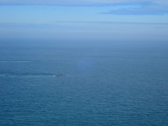
Maen Bugail Maen Bugail is a small rock, which lies about 0.3 mile N of the N end of Bardsey Island. A heavy tide race extends nearly 0.5 mile N from this rock.
Maen Bugail
Maen Bugail is a small rock, which lies about 0.3 mile N of the N end of Bardsey Island. A heavy tide race extends nearly 0.5 mile N from this rock.
View to the mainland from Mynydd Enlli The farthest tip of the Lleyn peninsula seen from the top of the mountain on Bardsey Island
View to the mainland from Mynydd Enlli
The farthest tip of the Lleyn peninsula seen from the top of the mountain on Bardsey Island
Show me another place!

Bardsey Sound is located at Grid Ref: SH1323 (Lat: 52.779936, Lng: -4.7636021)

Unitary Authority: Gwynedd

Police Authority: North Wales

Also known as: Swnt Enlli

What 3 Words

///stunts.meant.cemented. Near Nefyn, Gwynedd

Nearby Locations

Swnt Enlli Bardsey Sound

Related Wikis

Bardsey Island

Bardsey Island (Welsh: Ynys Enlli), known as the legendary "Island of 20,000 Saints", is located 1.9 miles (3.1 km) off the Llŷn Peninsula in the Welsh...

Bardsey Bird and Field Observatory

Bardsey Bird and Field Observatory is a bird observatory on Bardsey Island, off the Welsh coast. It was founded in 1953 by a group of ornithologists from...

Bardsey Lighthouse

Bardsey Lighthouse stands on the southerly tip of Bardsey Island, off the Llŷn Peninsula in Gwynedd, Wales, and guides vessels passing through St George...

St Hywyn's Church, Aberdaron

The Church of St Hywyn, Aberdaron, Gwynedd, Wales, is a parish church dating from the 12th century. Its origins are earlier, as a clas church from the...

Have you been to Bardsey Sound?

Leave your review of Bardsey Sound below (or comments, questions and feedback).