Sound of Gigha

Sea, Estuary, Creek in Argyllshire

Scotland

Sound of Gigha

Buoy marking the skerry at Sgeir a' Caolas
Buoy marking the skerry at Sgeir a' Caolas Credit: John Ferguson

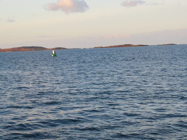
The Sound of Gigha is a body of water located in Argyllshire, Scotland. It is a narrow strait that separates the Isle of Gigha from the mainland, connecting the Atlantic Ocean to the east with the Firth of Clyde to the west. The Sound of Gigha is approximately 7 miles long and varies in width, with the narrowest point being around 1 mile wide.

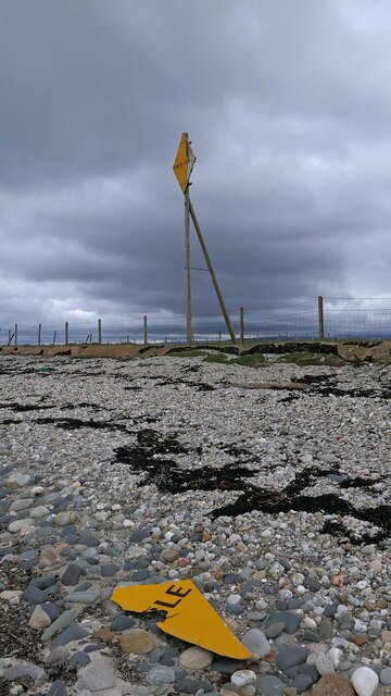
The waters of the Sound of Gigha are known for their strong currents, making it a popular spot for marine wildlife such as seals, dolphins, and seabirds. The surrounding landscape is characterized by rugged coastline, rocky cliffs, and sandy beaches, providing a picturesque backdrop for visitors.

The Sound of Gigha is also home to several small islands and islets, adding to the area's natural beauty and charm. The waters are popular for sailing, fishing, and kayaking, with many visitors drawn to the tranquility and stunning views offered by this remote and unspoiled corner of Scotland.

Overall, the Sound of Gigha is a peaceful and scenic body of water that offers a glimpse into the wild and untamed beauty of the Scottish coastline.

If you have any feedback on the listing, please let us know in the comments section below.

Sound of Gigha Images

Images are sourced within 2km of 55.668726/-5.6941989 or Grid Reference NR6747. Thanks to Geograph Open Source API. All images are credited.

Buoy marking the skerry at Sgeir a' Caolas
Ferry Terminal and shelter With the ferry from Gigha approaching.
Ferry Terminal and shelter
With the ferry from Gigha approaching.
The Silver Lining at Tayinloan The jetty at Tayinloan is not for the exclusive use of the Calmac ferry to Gigha; here we see the prawn boat Silver Lining using it, long after the ferries have stopped for the night, to land her catch and to refuel.
The Silver Lining at Tayinloan
The jetty at Tayinloan is not for the exclusive use of the Calmac ferry to Gigha; here we see the prawn boat Silver Lining using it, long after the ferries have stopped for the night, to land her catch and to refuel.
Tayinloan Ferry Terminal The MV Loch Ranza, which has been operating on the Tayinloan to Gigha route since July 1992, is arriving at the terminal.
Tayinloan Ferry Terminal
The MV Loch Ranza, which has been operating on the Tayinloan to Gigha route since July 1992, is arriving at the terminal.
Beach, Point Sands, 1990 Looking to visit Scotland for our annual family holiday, we found this fabulous little caravan park on the Argyll peninsula with its own beach.
Beach, Point Sands, 1990
Looking to visit Scotland for our annual family holiday, we found this fabulous little caravan park on the Argyll peninsula with its own beach.
Sunset with boats From the beach at Point Sands Caravan Park, near Tayinloan, Argyll Peninsula.
Sunset with boats
From the beach at Point Sands Caravan Park, near Tayinloan, Argyll Peninsula.
Buoy marking Sgeir a' Caolas taken from the Gigha Ferry
The ferry to Gigha The ferry looks very rusty but that did not put us off having a day out on the island of Gigha.

Taken on film in 1985.
The ferry to Gigha
The ferry looks very rusty but that did not put us off having a day out on the island of Gigha. Taken on film in 1985.
Trig pillar at Rhunahaorine Point, Kintyre Jura in the far distance
Trig pillar at Rhunahaorine Point, Kintyre
Jura in the far distance
Under-sea power cable warning sign, Rhunahaorine Point, Argyll The cable links the island of Gigha to the national grid.
Under-sea power cable warning sign, Rhunahaorine Point, Argyll
The cable links the island of Gigha to the national grid.
Rhunahaorine Point, Argyll Foyle Fishermen's Co-op is based in Greencastle, Co Donegal.  I hope taking a photo of their box doesn't count as unauthorised use........
Rhunahaorine Point, Argyll
Foyle Fishermen's Co-op is based in Greencastle, Co Donegal. I hope taking a photo of their box doesn't count as unauthorised use........
Footbridge, Tayinloan, Argyll This footbridge lies on the Kintyre Way and is the narrowest I've ever seen, its width being less than the length of my size 7 walking boot.

The terminal for the Gigha ferry can be seen beyond the bridge and the island to the right.
Footbridge, Tayinloan, Argyll
This footbridge lies on the Kintyre Way and is the narrowest I've ever seen, its width being less than the length of my size 7 walking boot. The terminal for the Gigha ferry can be seen beyond the bridge and the island to the right.
Fence, Rhunahaorine Point, Argyll The building, which lies partially in this grid square and partially in the one to the north, was an observation post for Balure Range, a WWII live bombing range.  It is described at <span class="nowrap"><a title="http://www.secretscotland.org.uk/index.php/Secrets/BalureRange" rel="nofollow ugc noopener" href="http://www.secretscotland.org.uk/index.php/Secrets/BalureRange">Link</a><img style="margin-left:2px;" alt="External link" title="External link - shift click to open in new window" src="https://s1.geograph.org.uk/img/external.png" width="10" height="10"/></span> .
Fence, Rhunahaorine Point, Argyll
The building, which lies partially in this grid square and partially in the one to the north, was an observation post for Balure Range, a WWII live bombing range. It is described at LinkExternal link .
Posts on the beach to the north of Tayinloan, Argyll These are probably former fence posts which carried an extension of a field fence across the beach, similar to one to the north: <a href="https://www.geograph.org.uk/photo/6873809">NR6948 : Fence, Rhunahaorine Point, Argyll</a>.
Posts on the beach to the north of Tayinloan, Argyll
These are probably former fence posts which carried an extension of a field fence across the beach, similar to one to the north: NR6948 : Fence, Rhunahaorine Point, Argyll.
The Island Queen: high and dry Registration KY15 (ex K420), built in 1972.  The vessel appears to have been beached since 2012.  Photographs, such as this <span class="nowrap"><a title="http://www.shipspotting.com/gallery/photo.php?lid=941797" rel="nofollow ugc noopener" href="http://www.shipspotting.com/gallery/photo.php?lid=941797">Link</a><img style="margin-left:2px;" alt="External link" title="External link - shift click to open in new window" src="https://s1.geograph.org.uk/img/external.png" width="10" height="10"/></span> show her in St Andrews, Fife.  How she came to be on the other side of the country, and wrecked on the beach north of Tayinloan, is a mystery.

This photograph was taken during the Coronavirus (COVID-19) pandemic of 2020/21.
The Island Queen: high and dry
Registration KY15 (ex K420), built in 1972. The vessel appears to have been beached since 2012. Photographs, such as this LinkExternal link show her in St Andrews, Fife. How she came to be on the other side of the country, and wrecked on the beach north of Tayinloan, is a mystery. This photograph was taken during the Coronavirus (COVID-19) pandemic of 2020/21.
Triangulation pillar at Rhunahaorine Point: the lowest in Scotland The trig pillar at Rhunahaorine Point offers a superb view over the Sound of Gigha.  The Isle of Gigha and the Paps of Jura can be seen to the far left of shot.  This trig pillar is the lowest in Scotland at 2 metres above sea level (see <span class="nowrap"><a title="http://trigpointing.uk/trig/5666" rel="nofollow ugc noopener" href="http://trigpointing.uk/trig/5666">Link</a><img style="margin-left:2px;" alt="External link" title="External link - shift click to open in new window" src="https://s1.geograph.org.uk/img/external.png" width="10" height="10"/></span> ); the lowest in the UK (at -1 metre) is at Little Ouse in Cambridgeshire, see <a href="https://www.geograph.org.uk/photo/3846990">TL6189 : Little Ouse Ordnance Survey Trig Pillar</a> 

This photograph was taken during the Coronavirus (COVID-19) pandemic of 2020/21.
Triangulation pillar at Rhunahaorine Point: the lowest in Scotland
The trig pillar at Rhunahaorine Point offers a superb view over the Sound of Gigha. The Isle of Gigha and the Paps of Jura can be seen to the far left of shot. This trig pillar is the lowest in Scotland at 2 metres above sea level (see LinkExternal link ); the lowest in the UK (at -1 metre) is at Little Ouse in Cambridgeshire, see TL6189 : Little Ouse Ordnance Survey Trig Pillar This photograph was taken during the Coronavirus (COVID-19) pandemic of 2020/21.
Water lapping the shore at Rhunahaorine Point A beautiful, largely deserted shoreline north of Tayinloan.

This photograph was taken during the Coronavirus (COVID-19) pandemic of 2020/21.
Water lapping the shore at Rhunahaorine Point
A beautiful, largely deserted shoreline north of Tayinloan. This photograph was taken during the Coronavirus (COVID-19) pandemic of 2020/21.
Shoreline at Rhunahaorine Point A shingle shore at Rhunahaorine Point with the Isle of Gigha and Isle of Jura in the distance, far left of shot.

This photograph was taken during the Coronavirus (COVID-19) pandemic of 2020/21.
Shoreline at Rhunahaorine Point
A shingle shore at Rhunahaorine Point with the Isle of Gigha and Isle of Jura in the distance, far left of shot. This photograph was taken during the Coronavirus (COVID-19) pandemic of 2020/21.
Show me another place!

Sound of Gigha is located at Grid Ref: NR6747 (Lat: 55.668726, Lng: -5.6941989)

Unitary Authority: Argyll and Bute

Police Authority: Argyll and West Dunbartonshire

What 3 Words

///manuals.disengage.cleansed. Near Lochranza, North Ayrshire

Nearby Locations

Sound of Gigha

Related Wikis

Sound of Gigha

The Sound of Gigha is a sound between the Inner Hebridean Isle of Gigha and Kintyre. It forms part of the Atlantic Ocean. == External links ==

Tayinloan

Tayinloan (Scottish Gaelic: Taigh an Lòin, pronounced [t̪ɤj ə ˈl̪ˠɔːɲ]) is a village situated on the west coast of the Kintyre peninsula in Argyll and...

Battle of Rhunahaorine Moss

The Battle of Rhunahaorine Moss was a battle between Covenanters led by General David Leslie and Royalist forces led by Alasdair Mac Colla Chiotaich (Sir...

Largie Castle, Rhunahaorine

Largie Castle is a ruined castle at Rhunahaorine, Argyll and Bute, Scotland. == History == The castle was built by Clan MacDonald of Largie.After the battle...

Have you been to Sound of Gigha?

Leave your review of Sound of Gigha below (or comments, questions and feedback).