Houb of Lunnister

Sea, Estuary, Creek in Shetland

Scotland

Houb of Lunnister

Clothister, Sullom
Clothister, Sullom Credit: Mike Pennington

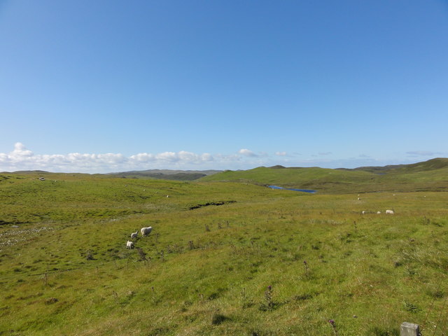
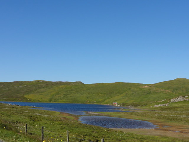
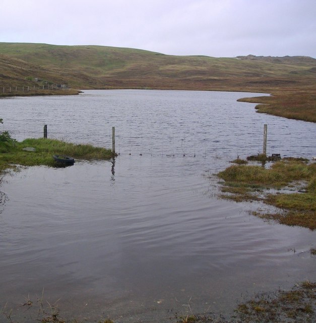
Houb of Lunnister is a picturesque sea inlet located on the island of Shetland, Scotland. Nestled within the rugged coastline, this natural harbor is formed by the convergence of the sea, estuary, and creek, creating a unique and diverse ecosystem.

The Houb of Lunnister is characterized by its stunning beauty and tranquil surroundings. The clear blue waters of the sea blend seamlessly with the brackish waters of the estuary, creating a mesmerizing sight. The creek, with its meandering path, adds to the charm of this natural attraction. The area is rich in marine life, and visitors can often spot seals, otters, and various species of seabirds.

The Houb of Lunnister is not only a visual delight but also a place of historical significance. It has been a crucial hub for fishing and trading activities for centuries. The sheltered waters provide a safe anchorage for fishing boats and vessels, making it an important maritime location.

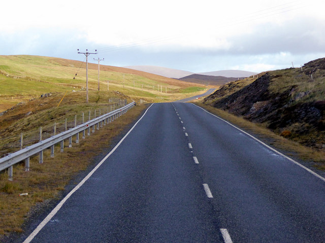
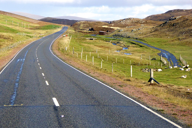
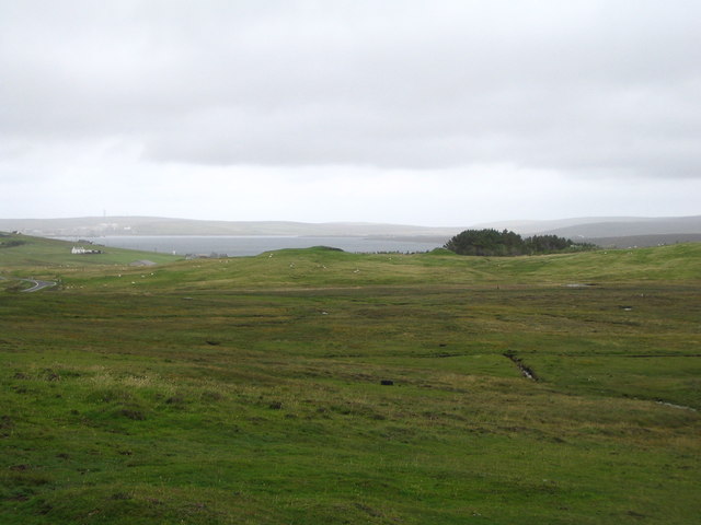
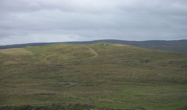
The surrounding landscape is a blend of rugged cliffs, sandy beaches, and rolling hills. The area offers excellent opportunities for outdoor activities such as hiking, birdwatching, and photography. The Houb of Lunnister is also a popular spot for water sports enthusiasts, who can indulge in activities like kayaking, paddleboarding, and sailing.

In summary, Houb of Lunnister is a captivating sea inlet that showcases the natural beauty of Shetland. Its unique combination of sea, estuary, and creek provides a diverse habitat for marine life and offers a range of recreational activities for visitors to enjoy.

If you have any feedback on the listing, please let us know in the comments section below.

Houb of Lunnister Images

Images are sourced within 2km of 60.429316/-1.3615662 or Grid Reference HU3571. Thanks to Geograph Open Source API. All images are credited.

Clothister, Sullom
Clothister, Sullom
Sheep on the moor View of Stanes Moor
Sheep on the moor
View of Stanes Moor
Wind Turbine Road side wind turbine
Wind Turbine
Road side wind turbine
Loch of Lunnister View from the road
Loch of Lunnister
View from the road
Northbound A970 near Mangaster The A970 runs for 71 miles across most of the length of the "Mainland" in the Shetland Islands. It is a good-quality single-carriageway road for most of its route. Travelling from south to north, the road begins at Grutness near Sumburgh Airport and winds around the many hills and inlets passing close to a number of small villages without going through any large ones before Lerwick. After looping around Lerwick, a short spur runs to Scalloway whilst the main route continues northwards towards Brae where it crosses the narrow isthmus of Mavis Grind. At Sandy Lochs the road splits and a four-mile spur goes through Urafirth to Hillswick. The main route continuing to the right towards its northern terminus at Isbister. This last part of the route tends to be narrower with passing places.

<span class="nowrap"><a title="https://www.sabre-roads.org.uk/wiki/index.php?title=A970" rel="nofollow ugc noopener" href="https://www.sabre-roads.org.uk/wiki/index.php?title=A970">Link</a><img style="margin-left:2px;" alt="External link" title="External link - shift click to open in new window" src="https://s1.geograph.org.uk/img/external.png" width="10" height="10"/></span>  SABRE
Northbound A970 near Mangaster
The A970 runs for 71 miles across most of the length of the "Mainland" in the Shetland Islands. It is a good-quality single-carriageway road for most of its route. Travelling from south to north, the road begins at Grutness near Sumburgh Airport and winds around the many hills and inlets passing close to a number of small villages without going through any large ones before Lerwick. After looping around Lerwick, a short spur runs to Scalloway whilst the main route continues northwards towards Brae where it crosses the narrow isthmus of Mavis Grind. At Sandy Lochs the road splits and a four-mile spur goes through Urafirth to Hillswick. The main route continuing to the right towards its northern terminus at Isbister. This last part of the route tends to be narrower with passing places. LinkExternal link SABRE
A970 Northbound The A970 runs for 71 miles across most of the length of the "Mainland" in the Shetland Islands. It is a good-quality single-carriageway road for most of its route. Travelling from south to north, the road begins at Grutness near Sumburgh Airport and winds around the many hills and inlets passing close to a number of small villages without going through any large ones before Lerwick. After looping around Lerwick, a short spur runs to Scalloway whilst the main route continues northwards towards Brae where it crosses the narrow isthmus of Mavis Grind. At Sandy Lochs the road splits and a four-mile spur goes through Urafirth to Hillswick. The main route continuing to the right towards its northern terminus at Isbister. This last part of the route tends to be narrower with passing places.

<span class="nowrap"><a title="https://www.sabre-roads.org.uk/wiki/index.php?title=A970" rel="nofollow ugc noopener" href="https://www.sabre-roads.org.uk/wiki/index.php?title=A970">Link</a><img style="margin-left:2px;" alt="External link" title="External link - shift click to open in new window" src="https://s1.geograph.org.uk/img/external.png" width="10" height="10"/></span>  SABRE
A970 Northbound
The A970 runs for 71 miles across most of the length of the "Mainland" in the Shetland Islands. It is a good-quality single-carriageway road for most of its route. Travelling from south to north, the road begins at Grutness near Sumburgh Airport and winds around the many hills and inlets passing close to a number of small villages without going through any large ones before Lerwick. After looping around Lerwick, a short spur runs to Scalloway whilst the main route continues northwards towards Brae where it crosses the narrow isthmus of Mavis Grind. At Sandy Lochs the road splits and a four-mile spur goes through Urafirth to Hillswick. The main route continuing to the right towards its northern terminus at Isbister. This last part of the route tends to be narrower with passing places. LinkExternal link SABRE
A970 near Mangaster The A970 runs for 71 miles across most of the length of the "Mainland" in the Shetland Islands. It is a good-quality single-carriageway road for most of its route. Travelling from south to north, the road begins at Grutness near Sumburgh Airport and winds around the many hills and inlets passing close to a number of small villages without going through any large ones before Lerwick. After looping around Lerwick, a short spur runs to Scalloway whilst the main route continues northwards towards Brae where it crosses the narrow isthmus of Mavis Grind. At Sandy Lochs the road splits and a four-mile spur goes through Urafirth to Hillswick. The main route continuing to the right towards its northern terminus at Isbister. This last part of the route tends to be narrower with passing places.

<span class="nowrap"><a title="https://www.sabre-roads.org.uk/wiki/index.php?title=A970" rel="nofollow ugc noopener" href="https://www.sabre-roads.org.uk/wiki/index.php?title=A970">Link</a><img style="margin-left:2px;" alt="External link" title="External link - shift click to open in new window" src="https://s1.geograph.org.uk/img/external.png" width="10" height="10"/></span>  SABRE
A970 near Mangaster
The A970 runs for 71 miles across most of the length of the "Mainland" in the Shetland Islands. It is a good-quality single-carriageway road for most of its route. Travelling from south to north, the road begins at Grutness near Sumburgh Airport and winds around the many hills and inlets passing close to a number of small villages without going through any large ones before Lerwick. After looping around Lerwick, a short spur runs to Scalloway whilst the main route continues northwards towards Brae where it crosses the narrow isthmus of Mavis Grind. At Sandy Lochs the road splits and a four-mile spur goes through Urafirth to Hillswick. The main route continuing to the right towards its northern terminus at Isbister. This last part of the route tends to be narrower with passing places. LinkExternal link SABRE
Loch of Haggrister
Loch of Haggrister
Scora Water View east to Scora Vird.
Scora Water
View east to Scora Vird.
Stanes Water View ENE to Stanes Moor.
Stanes Water
View ENE to Stanes Moor.
Lunnister Shun Small weedy lochan north of the Lunnister loch.
Lunnister Shun
Small weedy lochan north of the Lunnister loch.
The tree plantation at Gaza seen across the moor
House at Sullom
House at Sullom
Pier and house at Gaza, Sullom
Sand bar at Bight of Haggrister
Hill of Stack Houlls.
Clothister
Clothister
Foreshore to west of Calna Taing showing fenceline going into the ebb
Show me another place!

Houb of Lunnister is located at Grid Ref: HU3571 (Lat: 60.429316, Lng: -1.3615662)

Unitary Authority: Shetland Islands

Police Authority: Highlands and Islands

What 3 Words

///reset.carpeted.justifies. Near Brae, Shetland Islands

Nearby Locations

Houb of Lunnister

Related Wikis

Nearby Amenities

Located within 500m of 60.429316,-1.3615662
Power: pole
Lat/Long: 60.4265512/-1.3677952
Power: pole
Lat/Long: 60.4271985/-1.3673285
Power: pole
Lat/Long: 60.4278286/-1.3668859
Power: pole
Lat/Long: 60.4283938/-1.3664567
Power: pole
Lat/Long: 60.429/-1.3660222
Power: pole
Lat/Long: 60.4295441/-1.3656896
Power: pole
Lat/Long: 60.4301662/-1.3652551
Power: pole
Lat/Long: 60.430775/-1.3648126
Power: pole
Lat/Long: 60.4313574/-1.3644075
Power: pole
Lat/Long: 60.4319186/-1.3639945
Power: pole
Lat/Long: 60.4325791/-1.3635331
Power: pole
Lat/Long: 60.433217/-1.3631067
The data included in this document is from www.openstreetmap.org. The data is made available under ODbL.

Have you been to Houb of Lunnister?

Leave your review of Houb of Lunnister below (or comments, questions and feedback).