Loch Ranza

Sea, Estuary, Creek in Buteshire

Scotland

Loch Ranza

Old Whisky still Outside Lochranza Whisky Distillery
Old Whisky still Credit: Chris Morgan

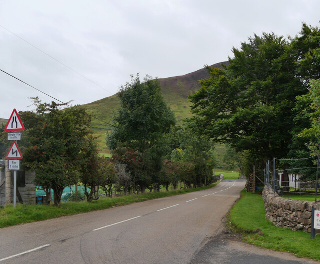
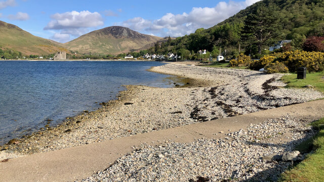
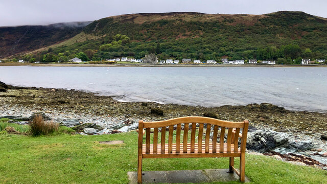
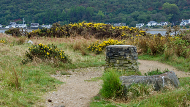
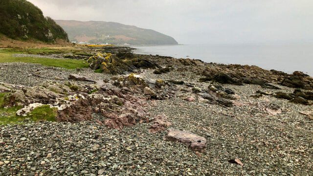
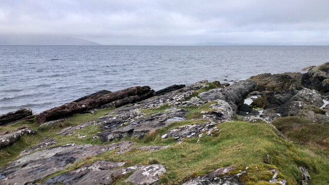
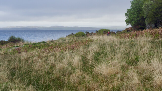
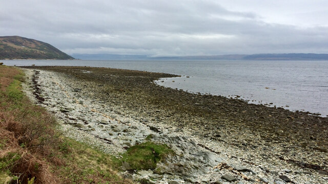
Loch Ranza is a picturesque sea loch situated on the northern coast of the Isle of Arran in the county of Buteshire, Scotland. Nestled amidst stunning natural beauty, the loch is surrounded by rolling hills and dense woodlands, making it a popular destination for nature enthusiasts and tourists alike.

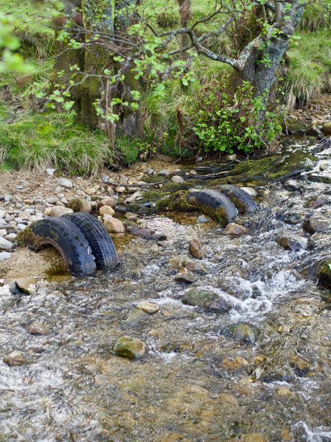
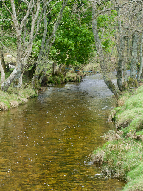
Covering an area of approximately 2 square kilometers (0.8 square miles), Loch Ranza is a tidal sea loch that connects to the Firth of Clyde. The loch is fed by the Glenashdale Burn, a small creek that flows through the adjacent Glen Ashdale Forest and cascades down a series of beautiful waterfalls before entering the loch.

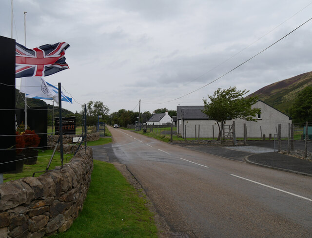
The village of Lochranza, named after the loch, sits on its northern shore. This charming village is home to a small population and features a historic castle, Lochranza Castle, which dates back to the 13th century. The castle stands as a remnant of the area's rich history and offers a glimpse into the region's past.

Loch Ranza is renowned for its tranquil waters, which provide a sheltered anchorage for boats and yachts. The loch also offers excellent opportunities for various water-based activities, including sailing, fishing, and kayaking. It is a haven for wildlife, with seals often seen basking on the rocks, and a wide variety of bird species, including herons and terns, frequenting the area.

The scenic beauty of Loch Ranza, combined with its rich history and diverse wildlife, make it a must-visit destination for those seeking a peaceful retreat in the heart of nature.

If you have any feedback on the listing, please let us know in the comments section below.

Loch Ranza Images

Images are sourced within 2km of 55.709214/-5.2997071 or Grid Reference NR9251. Thanks to Geograph Open Source API. All images are credited.

Old Whisky still Outside Lochranza Whisky Distillery
Old Whisky still
Outside Lochranza Whisky Distillery
Arran Distillery, Lochranza
The grounds of the Arran Distillery, Lochranza, Arran
The Arran Distillery, Lochranza, Arran
The A481 at The Arran Distillery, Lochranza, Arran The A841 is the only A-road on the Isle of Arran and forms the island's primary transport route, as it connects all the major settlements on the island - Brodick, Lochranza, Blackwaterfoot and Whiting Bay. It used to make a complete circuit of the Isle of Arran on its 55-mile course around the coast. In the early 2000s, the road was reclassified so that the western and southern sides of the route are now unclassified.
The A481 at The Arran Distillery, Lochranza, Arran
The A841 is the only A-road on the Isle of Arran and forms the island's primary transport route, as it connects all the major settlements on the island - Brodick, Lochranza, Blackwaterfoot and Whiting Bay. It used to make a complete circuit of the Isle of Arran on its 55-mile course around the coast. In the early 2000s, the road was reclassified so that the western and southern sides of the route are now unclassified.
The Arran Distillery, Lochranza, Arran
Loch Ranza Shoreline
Bench, Loch Ranza
Bench, Loch Ranza
Toposcope, Newton Point
Coast below North Newton
Lorry axle, Glen Chalmadale river
Glen Chalmadale river
Foreshore at Rubha Creagan Dubha
Coast below Creag nan Cadhag
House on the coast road Auchnamara.
House on the coast road
Auchnamara.
Hawser at the pier end
Show me another place!

Loch Ranza is located at Grid Ref: NR9251 (Lat: 55.709214, Lng: -5.2997071)

Unitary Authority: North Ayrshire

Police Authority: Ayrshire

What 3 Words

///boast.scouting.plates. Near Lochranza, North Ayrshire

Nearby Locations

Loch Ranza

Related Wikis

Lochranza

Lochranza (Scottish Gaelic: Loch Raonasa) is a village located on the Isle of Arran in the Firth of Clyde, Scotland. The population, somewhat in decline...

Lochranza Castle

Lochranza Castle is an L-plan fortified tower house situated on a promontory in Lochranza, on the northern part of the Isle of Arran in Scotland. Most...
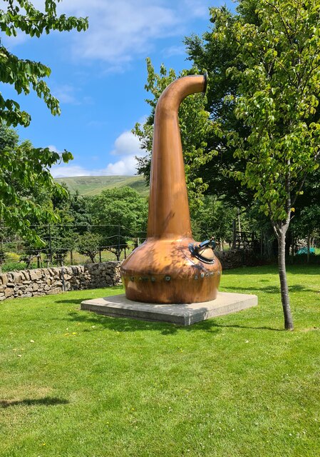
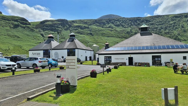
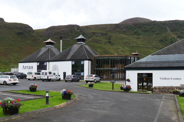
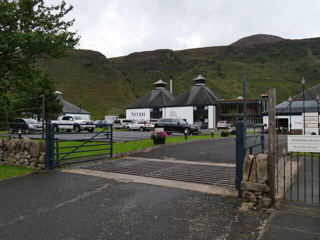
Arran distillery

Arran distillery is a whisky distillery in Lochranza, Scotland, Isle of Arran. In 1994 Arran Distillers was founded by Harold Currie, former director of...

HMS Vandal

HMS Vandal (P64) was a Royal Navy U-class submarine built by Vickers-Armstrong at Barrow-in-Furness, yard number 838. The submarine had the shortest career...

Catacol

Catacol (Scottish Gaelic: Catagal) is a small village on the Isle of Arran, Scotland. == Geography == Catacol is located on the north west side of the...

Torr Meadhonach

Torr Meadhonach is a hill 332 metres (1,089 ft) high at the northernmost part of the Isle of Arran in western Scotland, east of the village of Lochranza...

Catacol Bay

Catacol Bay (Scottish Gaelic: Catagal bhàigh) is a small shallow-curved tidal, 310° facing, rocky coastal embayment located on the northwest tip of the...

Creag Ghlas Laggan

Creag Ghlas Laggan (also known as Fionn Bhealach) is a hill on the Isle of Arran in south-western Scotland. It is the highest point of the seven-mile-long...

Nearby Amenities

Located within 500m of 55.709214,-5.2997071
Source: PGS
Lat/Long: 55.707478/-5.3066825
Source: PGS
Lat/Long: 55.7076218/-5.3061976
Source: PGS
Lat/Long: 55.7078521/-5.3028738
Source: PGS
Lat/Long: 55.7076989/-5.3014512
Source: PGS
Lat/Long: 55.7076021/-5.3013452
Created By: dmgroom_coastlines
Source: PGS
Lat/Long: 55.707482/-5.300323
Source: PGS
Lat/Long: 55.7072011/-5.2990276
Source: PGS
Lat/Long: 55.7069273/-5.2985822
Source: PGS
Lat/Long: 55.7066669/-5.2984716
Source: PGS
Lat/Long: 55.7063521/-5.2977492
Source: PGS
Lat/Long: 55.7060349/-5.2974757
Source: PGS
Lat/Long: 55.7054898/-5.2960342
Source: PGS
Lat/Long: 55.7094015/-5.2917377
Source: PGS
Lat/Long: 55.7100003/-5.2925664
Source: PGS
Lat/Long: 55.7102307/-5.2929694
Created By: dmgroom_coastlines
Source: PGS
Lat/Long: 55.710813/-5.293487
Source: PGS
Lat/Long: 55.7114845/-5.2938117
Source: PGS
Lat/Long: 55.7122804/-5.2945407
Turning Circle
Lat/Long: 55.7112235/-5.2934509
Parking
Lat/Long: 55.710481/-5.292683
Ferry: yes
Public Transport: stop_position
Lat/Long: 55.7079029/-5.3013993
Loch Ranza
Natural: bay
Wikidata: Q1867258
Lat/Long: 55.7085322/-5.2946362
Toilets
Lochranza Loos
Fee: no
Lat/Long: 55.707405/-5.303515
Parking
Access: yes
Fee: no
Parking: surface
Lat/Long: 55.707623/-5.303882
Parking
Access: yes
Fee: no
Parking: surface
Lat/Long: 55.70769/-5.303149
Seamark Light Category: vertical
Seamark Light Character: F
Seamark Light Colour: green
Seamark Light Height: 4
Seamark Light Multiple: 2
Seamark Light Range: 3
Seamark Light Reference: A 4291
Seamark Type: light_minor
Source: US NGA Pub. 114. 2011-05-26.
Lat/Long: 55.7083333/-5.3003333
Post Box
Collection Times: Mo-Fr 12:15; Sa 11:00
Operator: Royal Mail
Operator Wikidata: Q638098
Post Box Type: wall
Ref: KA27 76
Royal Cypher: GR
Royal Cypher Wikidata: Q33102273
Lat/Long: 55.7070481/-5.2992005
Bus Stop
Lochranza Ferry
Bench: no
Bin: no
Lit: no
Naptan AtcoCode: 6170986
Naptan NaptanCode: 62976746
Operator: Stagecoach Scotland
Shelter: no
Tactile Paving: no
Lat/Long: 55.7075142/-5.3029811
Arran Butcher
Shop: butcher
Lat/Long: 55.7069992/-5.2994657
Coillemore
Place: neighbourhood
Lat/Long: 55.7070727/-5.3009289
Urinbeg
Place: neighbourhood
Lat/Long: 55.7057615/-5.2988304
Cafe
The Sandwich Station
Addr City: Isle of Arran
Addr Postcode: KA27 8HL
Addr Street: A841
Addr Suburb: Lochranza
Contact Email: thesandwichstationlochranza@gmail.com
Contact Phone: +44 7393 602806
Contact Website: https://thesandwichstation.weebly.com
Cuisine: sandwich
Opening Hours: Mo-Sa 08:45-16:00; Su 08:45-15:30
Outdoor Seating: yes
Lat/Long: 55.7074679/-5.3026946
Toilets
Lat/Long: 55.7077556/-5.3019521
Power: pole
Lat/Long: 55.7050214/-5.299212
Power: pole
Lat/Long: 55.7053545/-5.2986891
Bicycle Repair Station
Service Bicycle Pump: yes
Service Bicycle Tools: yes
Lat/Long: 55.7074844/-5.302497
The data included in this document is from www.openstreetmap.org. The data is made available under ODbL.

Have you been to Loch Ranza?

Leave your review of Loch Ranza below (or comments, questions and feedback).