An Caolas

Sea, Estuary, Creek in Argyllshire

Scotland

An Caolas

Tinkers Hole anchorage Erraid
Tinkers Hole anchorage Erraid Credit: sue middleton

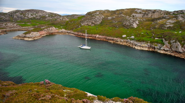
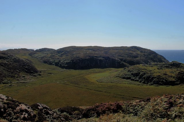
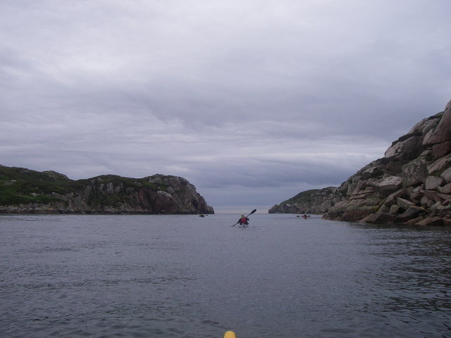
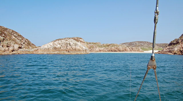
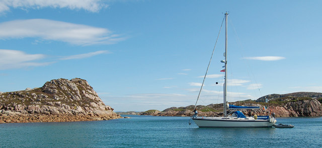
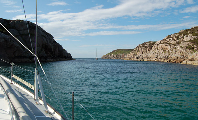
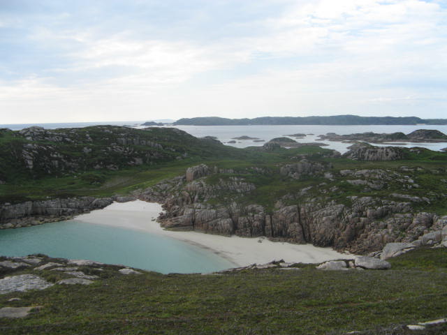
An Caolas is a picturesque sea inlet located in Argyllshire, Scotland. Also known as The Narrows, it is nestled between the Isle of Mull and the mainland, serving as a natural border between the two. The name "An Caolas" translates to "the narrows" in Scottish Gaelic, accurately describing its narrow and elongated shape.

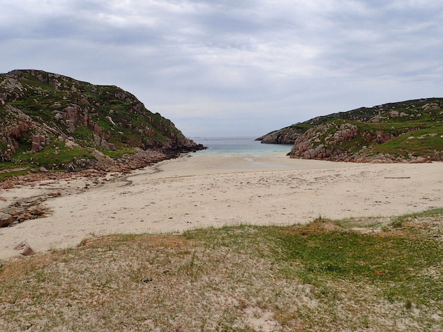
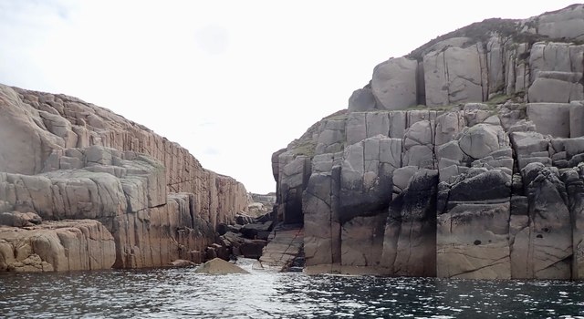
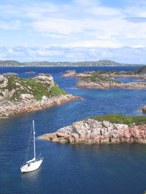
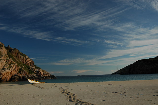
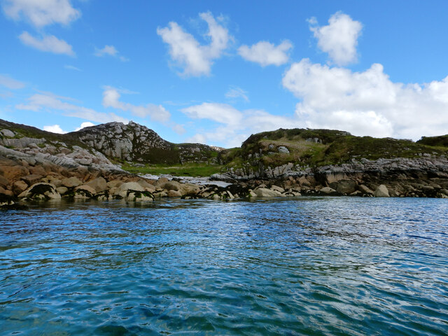
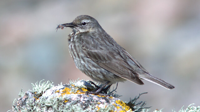
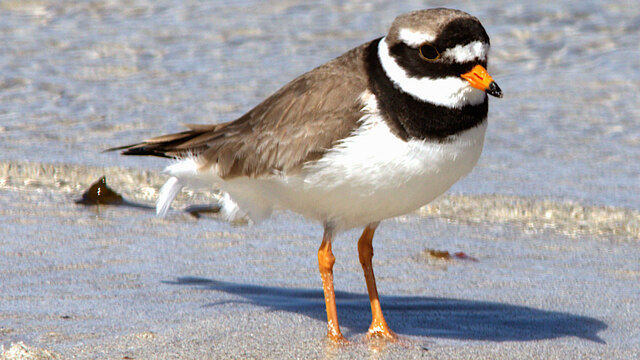
This estuary boasts stunning natural beauty, with its crystal-clear waters reflecting the surrounding majestic mountains and lush green landscapes. The area is a haven for wildlife, with numerous bird species and marine creatures making their home here. Visitors may spot seals basking in the sun on the rocky shores or catch glimpses of dolphins gracefully swimming through the waves.

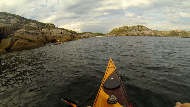
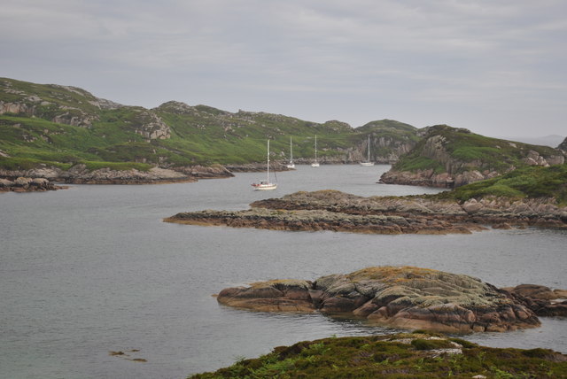
The waters of An Caolas are a sailor's paradise, providing a sheltered passage for boats navigating between the mainland and the Isle of Mull. This makes it a popular destination for sailing enthusiasts and a starting point for exploring the nearby islands. The strong tidal currents that flow through the narrow channel create a challenging environment for sailors, adding an element of excitement and adventure to their journeys.

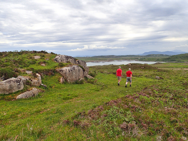
For those seeking tranquility and solitude, An Caolas offers plenty of secluded spots along its shores. The area is a perfect destination for nature walks, where visitors can explore the rugged coastline, observe the diverse flora and fauna, and breathe in the invigorating sea air.

In summary, An Caolas is a scenic and vibrant estuary in Argyllshire, Scotland, offering a perfect blend of natural beauty, wildlife, and recreational opportunities. It is a must-visit destination for nature lovers, sailors, and anyone looking to immerse themselves in the stunning Scottish landscape.

If you have any feedback on the listing, please let us know in the comments section below.

An Caolas Images

Images are sourced within 2km of 56.302009/-6.3663965 or Grid Reference NM2920. Thanks to Geograph Open Source API. All images are credited.

Tinkers Hole anchorage Erraid
Heading for Traigh Gheal past Rubha Calachain Rounding the southern end of Erraid on an evening paddle, heading for Traigh Gheal - a fantastic beach with almost no plastic debris despite facing south into the weather. The jointed Ross of Mull granite, of Devonian age, intruded towards the end of the Caledonian orogeny, offers easy rock-hopping opportunities in the very minimal swell we experienced on this trip and weathers to a clean white sand in the shallower inlets like this one. Sea kayak is by far the best way to visit these isolated beaches, as crossing the island involves bog, midges and a certain amount of fighting with willow scrub, as we found when we tried to cross the area to the left of this photo to get to the top of an impressive geo we'd found from below.
Heading for Traigh Gheal past Rubha Calachain
Rounding the southern end of Erraid on an evening paddle, heading for Traigh Gheal - a fantastic beach with almost no plastic debris despite facing south into the weather. The jointed Ross of Mull granite, of Devonian age, intruded towards the end of the Caledonian orogeny, offers easy rock-hopping opportunities in the very minimal swell we experienced on this trip and weathers to a clean white sand in the shallower inlets like this one. Sea kayak is by far the best way to visit these isolated beaches, as crossing the island involves bog, midges and a certain amount of fighting with willow scrub, as we found when we tried to cross the area to the left of this photo to get to the top of an impressive geo we'd found from below.
Tràigh Gheal (Balfour's Bay) Following in the footsteps of David Balfour, the hero of Robert Louis Stevenson's Kidnapped, as he makes his way back to Edinburgh to confront his wicked uncle.

Stage 1, June 2016 from Erraid to Fishnish on the Isle of Mull.

See <span class="nowrap"><a title="http://www.stevensonway.org.uk" rel="nofollow ugc noopener" href="http://www.stevensonway.org.uk">Link</a><img style="margin-left:2px;" alt="External link" title="External link - shift click to open in new window" src="https://s1.geograph.org.uk/img/external.png" width="10" height="10"/></span>
Tràigh Gheal (Balfour's Bay)
Following in the footsteps of David Balfour, the hero of Robert Louis Stevenson's Kidnapped, as he makes his way back to Edinburgh to confront his wicked uncle. Stage 1, June 2016 from Erraid to Fishnish on the Isle of Mull. See LinkExternal link
Crossing Erraid Following in the footsteps of David Balfour, the hero of Robert Louis Stevenson's Kidnapped, as he makes his way back to Edinburgh to confront his wicked uncle.

Stage 1, June 2016 from Erraid to Fishnish on the Isle of Mull.

See <span class="nowrap"><a title="http://www.stevensonway.org.uk" rel="nofollow ugc noopener" href="http://www.stevensonway.org.uk">Link</a><img style="margin-left:2px;" alt="External link" title="External link - shift click to open in new window" src="https://s1.geograph.org.uk/img/external.png" width="10" height="10"/></span>
Crossing Erraid
Following in the footsteps of David Balfour, the hero of Robert Louis Stevenson's Kidnapped, as he makes his way back to Edinburgh to confront his wicked uncle. Stage 1, June 2016 from Erraid to Fishnish on the Isle of Mull. See LinkExternal link
Wet Plain on Erraid A boggy flat section between hills to the east of Balfour's Bay.
Wet Plain on Erraid
A boggy flat section between hills to the east of Balfour's Bay.
Deep gorge cutting into Erraid A view of the deep gorge clearly visible on the OS map.
Deep gorge cutting into Erraid
A view of the deep gorge clearly visible on the OS map.
Tinker's Hole, Ross of Mull (Erraid) Popular west coast anchorage on the western edge of Erraid.  Feels like a flooded quarry and surrounded by pink granite.  Iona visible to the north
Tinker's Hole, Ross of Mull (Erraid)
Popular west coast anchorage on the western edge of Erraid. Feels like a flooded quarry and surrounded by pink granite. Iona visible to the north
Traigh Gheal On Erraid Possibly the finest beach on the planet; pink granite, white sand and turquoise water.
Traigh Gheal On Erraid
Possibly the finest beach on the planet; pink granite, white sand and turquoise water.
Four Kayakers entering Tinker's Hole
Traigh Gheal On Erraid An "occasional" or "settled weather" anchorage, Traigh Gheal is a beautiful spot and an alternative to Tinker's (Fiddler's) Hole. Traigh Gheal is also known as David Balfour's Bay, from the shipwreck story in Robert Louis Stevenson's "Kidnapped".  Stevenson's family, being designers and builders of lighthouses, had a strong association with Erraid.  At the back of the bay there is a granite wall that gives reasonable bouldering and short climbs of around HS/VS standard.
Traigh Gheal On Erraid
An "occasional" or "settled weather" anchorage, Traigh Gheal is a beautiful spot and an alternative to Tinker's (Fiddler's) Hole. Traigh Gheal is also known as David Balfour's Bay, from the shipwreck story in Robert Louis Stevenson's "Kidnapped". Stevenson's family, being designers and builders of lighthouses, had a strong association with Erraid. At the back of the bay there is a granite wall that gives reasonable bouldering and short climbs of around HS/VS standard.
Tinker's (Fiddler's) Hole, Erraid, looking NE
Tinker's (Fiddler's) Hole, Erraid, looking SW
Traigh Gheall Beautiful white beach on Erraid
Traigh Gheall
Beautiful white beach on Erraid
Yachts at anchor Tinkers Hole Mull
Cattle graze in clearing shower, road to Toba Bhreaca
NW coast of Erraid Erraid being a tidal island, one must get the timing right to visit its environs. Usually the tide is in when we would like to walk to it, and out when we would like to paddle the channel between it and the Ross of Mull, which is frustrating but mainly our own fault for not bothering to plan in advance. Today we are paddling the west side to get the square I keep missing. The gleaming white observatory forms a prominent landmark as long as you don't get too close to the shore so it hides behind the outcrops (it is just visible in this view).
NW coast of Erraid
Erraid being a tidal island, one must get the timing right to visit its environs. Usually the tide is in when we would like to walk to it, and out when we would like to paddle the channel between it and the Ross of Mull, which is frustrating but mainly our own fault for not bothering to plan in advance. Today we are paddling the west side to get the square I keep missing. The gleaming white observatory forms a prominent landmark as long as you don't get too close to the shore so it hides behind the outcrops (it is just visible in this view).
Rock Pipit with shrimp at Fidden
Ringed Plover feeding on the water's edge at Fidden
Show me another place!

An Caolas is located at Grid Ref: NM2920 (Lat: 56.302009, Lng: -6.3663965)

Unitary Authority: Argyll and Bute

Police Authority: Argyll and West Dunbartonshire

What 3 Words

///wiped.stewing.shrub. Near Fionnphort, Argyll & Bute

Related Wikis

Erraid

Erraid (Scottish Gaelic: Eilean Earraid) is a tidal island approximately one mile (two kilometres) square located in the Inner Hebrides of Scotland. It...

Aridhglas

Aridhglas is a village on the Ross of Mull, Isle of Mull in Argyll and Bute, Scotland. == References ==

Sound of Iona

The Sound of Iona is a sound between the Inner Hebridean islands of Mull and Iona in western Scotland. It forms part of the Atlantic Ocean. The tidal...

Fionnphort

Fionnphort (English: , Scottish Gaelic: [ˈfjun̪ˠafɔrˠt̪]) is the principal port of the Ross of Mull, and the second largest settlement in the area (its...

Bishop's House, Iona

Bishop's House is a retreat house for the Scottish Episcopal Church, located on the island of Iona, off the west coast of Scotland. == History == It was...

Iona Abbey

Iona Abbey is an abbey located on the island of Iona, just off the Isle of Mull on the West Coast of Scotland. It is one of the oldest Christian religious...

St Oran's Chapel

St Oran's Chapel (Odhráin/Orain/Odran) is a medieval chapel located on the island of Iona in the Inner Hebrides off the west coast of Scotland. Built in...

Iona

Iona (; Scottish Gaelic: Ì Chaluim Chille [ˈiː ˈxal̪ˠɪm ˈçiʎə] , sometimes simply Ì) is a small island in the Inner Hebrides, off the Ross of Mull on the...

Nearby Amenities

Located within 500m of 56.302009,-6.3663965
Source: PGS
Lat/Long: 56.3010482/-6.3742063
Source: PGS
Lat/Long: 56.3008914/-6.3730655
Source: PGS
Lat/Long: 56.3008875/-6.3721302
Source: PGS
Lat/Long: 56.3009191/-6.3715399
Source: PGS
Lat/Long: 56.3008938/-6.3695455
Source: PGS
Lat/Long: 56.3010612/-6.3684907
Source: PGS
Lat/Long: 56.3009078/-6.3659114
Source: PGS
Lat/Long: 56.3009835/-6.3657406
Source: PGS
Lat/Long: 56.3010607/-6.3654526
Source: PGS
Lat/Long: 56.3011158/-6.3642709
Source: PGS
Lat/Long: 56.3009255/-6.3633526
Source: PGS
Lat/Long: 56.3004759/-6.3638255
Source: PGS
Lat/Long: 56.2998211/-6.3635301
Source: PGS
Lat/Long: 56.2995989/-6.36232
Source: PGS
Lat/Long: 56.2994737/-6.3617508
Source: PGS
Lat/Long: 56.29985/-6.3601759
Source: PGS
Lat/Long: 56.3036615/-6.3593443
Source: PGS
Lat/Long: 56.3031401/-6.3593625
Source: PGS
Lat/Long: 56.3037038/-6.3609751
Source: PGS
Lat/Long: 56.3032878/-6.3621868
Created By: dmgroom_coastlines
Source: PGS
Lat/Long: 56.30354/-6.36573
Source: PGS
Lat/Long: 56.303932/-6.3657154
Source: PGS
Lat/Long: 56.3044058/-6.3666749
Source: PGS
Lat/Long: 56.3043848/-6.3669904
Source: PGS
Lat/Long: 56.3043229/-6.3674638
Created By: dmgroom_coastlines
Source: PGS
Lat/Long: 56.3045/-6.36843
Created By: dmgroom_coastlines
Source: PGS
Lat/Long: 56.30467/-6.37073
Created By: dmgroom_coastlines
Source: PGS
Lat/Long: 56.30482/-6.37164
Source: PGS
Lat/Long: 56.305588/-6.3710606
Source: PGS
Lat/Long: 56.3043011/-6.3678234
Source: PGS
Lat/Long: 56.30313/-6.364407
Place Of Worship
Erraid Findhorn Foundation
Lat/Long: 56.3007364/-6.367513
Barrier: hampshire_gate
Locked: yes
Lat/Long: 56.3000658/-6.3680203
An Caolas
Natural: bay
Lat/Long: 56.3022296/-6.3665557
Power: pole
Lat/Long: 56.2989326/-6.3644511
Power: pole
Lat/Long: 56.2993554/-6.3679083
Power: pole
Lat/Long: 56.2991225/-6.3659752
Power: pole
Lat/Long: 56.2987463/-6.3630789
Man Made: water_well
Pump: manual
Lat/Long: 56.3001751/-6.3683463
The data included in this document is from www.openstreetmap.org. The data is made available under ODbL.

Have you been to An Caolas?

Leave your review of An Caolas below (or comments, questions and feedback).