Saltisford Common

Urban Greenspace in Warwickshire Warwick

England

Saltisford Common

House clearance, Warwick A small house in Chapel Street looks to be at the start of a refurb. It may be that a number of properties in the area became vacant with the removal of Warwick High School for Girls to Banbury Road.
House clearance, Warwick Credit: Robin Stott

Saltisford Common is a serene and picturesque urban greenspace located in Warwickshire, England. Covering an area of approximately 20 acres, it offers a tranquil escape from the bustling city life, making it a popular spot for locals and tourists alike.

The common is characterized by its expansive open grassland, dotted with a variety of mature trees, including oak, willow, and ash. These trees provide shade during the summer months and add to the overall aesthetic appeal of the area. Additionally, the common is crisscrossed by several footpaths, allowing visitors to explore the space and enjoy leisurely walks or bike rides.

One of the main attractions of Saltisford Common is its wildlife. The grassland provides a habitat for a diverse range of species, including birds, butterflies, and small mammals. Birdwatchers can spot a variety of species, such as blue tits, woodpeckers, and robins, while nature enthusiasts can enjoy the colorful display of wildflowers that bloom throughout the year.

Facilities at Saltisford Common include a children's play area, picnic benches, and ample parking space, making it a great destination for families. The common also hosts various events and activities, including outdoor concerts and community gatherings, enhancing its appeal as a social hub for the local community.

Overall, Saltisford Common offers a peaceful and scenic retreat, providing visitors with the opportunity to connect with nature and enjoy recreational activities in a beautiful urban greenspace.

If you have any feedback on the listing, please let us know in the comments section below.

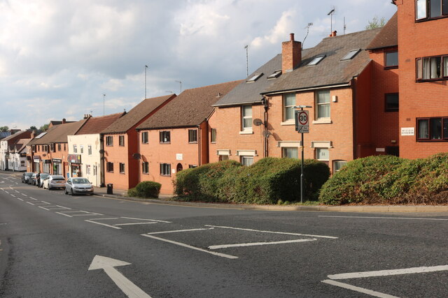
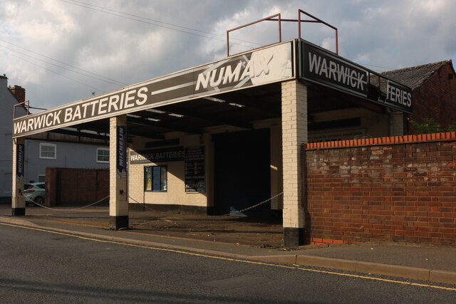
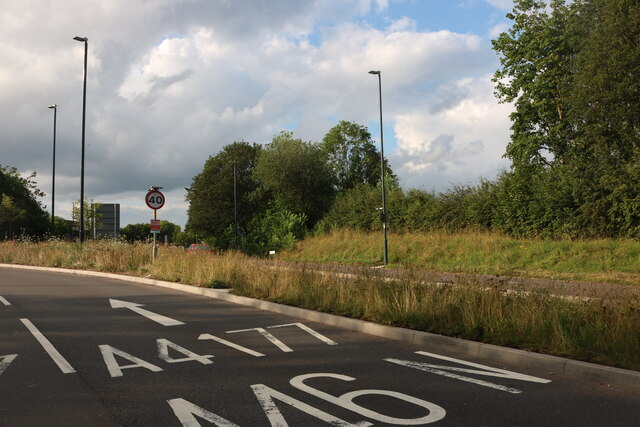
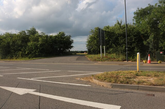
Saltisford Common Images

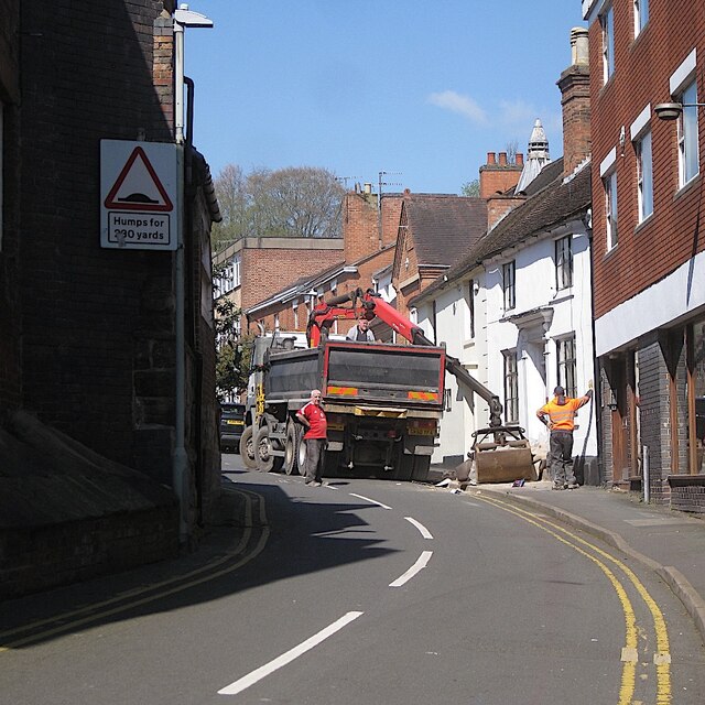
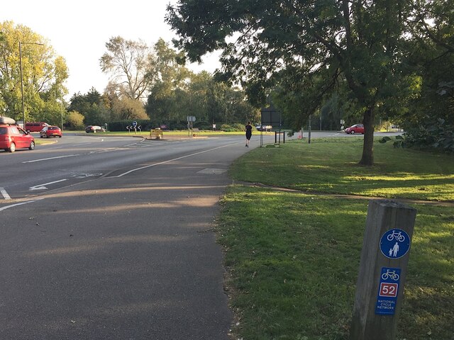
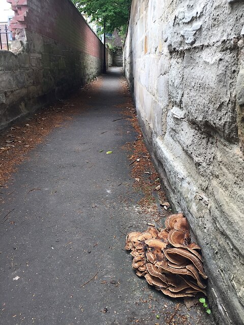
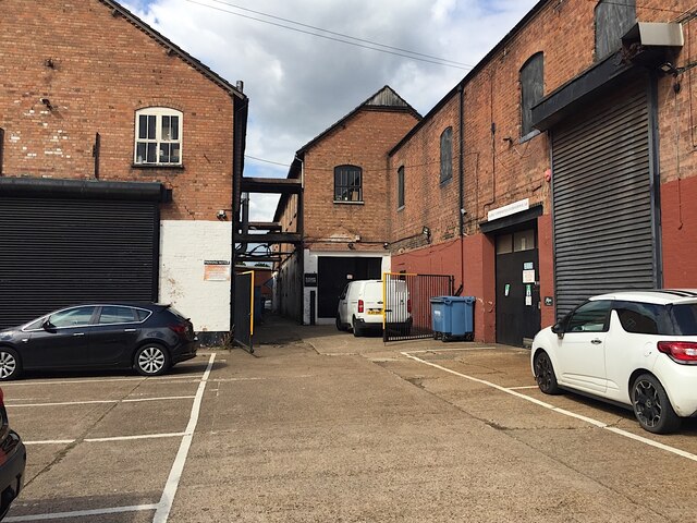
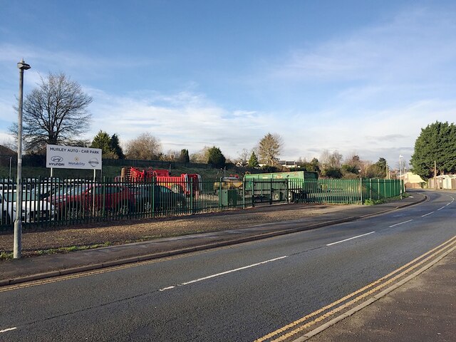
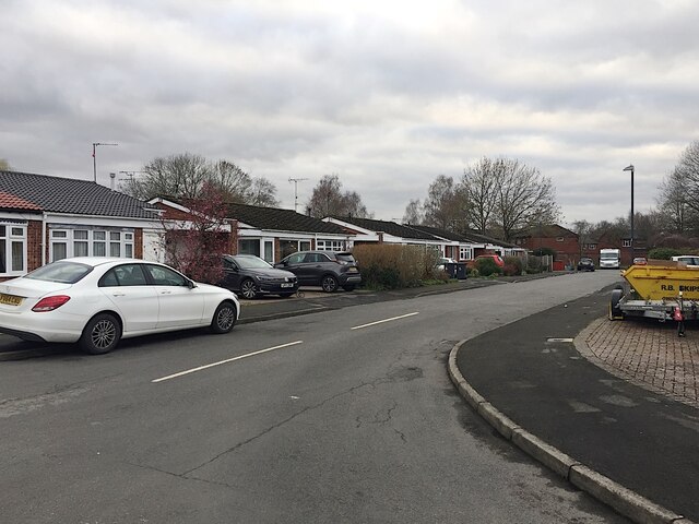
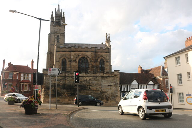
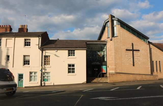
Images are sourced within 2km of 52.289156/-1.6004345 or Grid Reference SP2765. Thanks to Geograph Open Source API. All images are credited.

House clearance, Warwick A small house in Chapel Street looks to be at the start of a refurb. It may be that a number of properties in the area became vacant with the removal of Warwick High School for Girls to Banbury Road.
House clearance, Warwick
A small house in Chapel Street looks to be at the start of a refurb. It may be that a number of properties in the area became vacant with the removal of Warwick High School for Girls to Banbury Road.
Coventry Road approaching Warwick A busy junction: Primrose Hill comes in from Woodloes Park to the right; Spinney Hill is to the left.
Coventry Road approaching Warwick
A busy junction: Primrose Hill comes in from Woodloes Park to the right; Spinney Hill is to the left.
Fungus by the Tink-a-Tank, Warwick This may be related to old trees in the public garden on the other side of the wall.
Fungus by the Tink-a-Tank, Warwick
This may be related to old trees in the public garden on the other side of the wall.
Former gelatines factory, Wharf Street, Warwick The Nelson family operated a business here for many years. The buildings facing the canal, right, have been occupied by other businesses; parts of the buildings fronting Wharf Street, left, have become flats.
Former gelatines factory, Wharf Street, Warwick
The Nelson family operated a business here for many years. The buildings facing the canal, right, have been occupied by other businesses; parts of the buildings fronting Wharf Street, left, have become flats.
Agricultural machinery and car compound, Nelson Lane, Warwick Over the years, Murley have gradually occupied more and more of a piece of vacant land – and now they have fenced it.
Agricultural machinery and car compound, Nelson Lane, Warwick
Over the years, Murley have gradually occupied more and more of a piece of vacant land – and now they have fenced it.
Edmondes Close, Woodloes Park, Warwick Woodloes Park is a residential development on about 400 hectares of farmland north of the Grand Union Canal. It was laid out between the mid-1970s and the early 1980s. There is a mix of private and public housing, all low-rise. Residents enjoy ample open space, play areas and off-road footpaths. Many trees and lengths of hedgerow were retained. There is a primary school, a pub and busy local shops at Reardon Court. The estate extends west into SP2766.
Edmondes Close, Woodloes Park, Warwick
Woodloes Park is a residential development on about 400 hectares of farmland north of the Grand Union Canal. It was laid out between the mid-1970s and the early 1980s. There is a mix of private and public housing, all low-rise. Residents enjoy ample open space, play areas and off-road footpaths. Many trees and lengths of hedgerow were retained. There is a primary school, a pub and busy local shops at Reardon Court. The estate extends west into SP2766.
Church on Castle Hill, Warwick
Castle Hill Baptist Church, Warwick
Saltisford, Warwick
Saltisford, Warwick
Warwick Batteries on Birmingham Road Although this is now the A425 the road name gives away it is all part of what was the A41 and still goes to Birmingham on the same route.
Warwick Batteries on Birmingham Road
Although this is now the A425 the road name gives away it is all part of what was the A41 and still goes to Birmingham on the same route.
Birmingham Road at the A46 intersection
Birmingham Road leaving Warwick
Banbury Road, Warwick
Flush Bracket Bench Mark, Castle Bridge Bench Mark Database: <span class="nowrap"><a title="https://www.bench-marks.org.uk/bm2365" rel="nofollow ugc noopener" href="https://www.bench-marks.org.uk/bm2365">Link</a><img style="margin-left:2px;" alt="External link" title="External link - shift click to open in new window" src="https://s1.geograph.org.uk/img/external.png" width="10" height="10"/></span>
Flush Bracket Bench Mark, Castle Bridge
Bench Mark Database: LinkExternal link
Castle Bridge, Warwick There is a flush bracket bench mark on the parapet to the right of the photograph and a closer view can be seen here: <a href="https://www.geograph.org.uk/photo/6922504">SP2864 : Flush Bracket Bench Mark, Castle Bridge</a>.
Castle Bridge, Warwick
There is a flush bracket bench mark on the parapet to the right of the photograph and a closer view can be seen here: SP2864 : Flush Bracket Bench Mark, Castle Bridge.
Woodland by Banbury Road, Warwick
The new Priory Medical Centre, Warwick This recently replaced a very similar building which was the police station, but which had two storeys.
The new Priory Medical Centre, Warwick
This recently replaced a very similar building which was the police station, but which had two storeys.
Welcome to Priory Park
Show me another place!

Saltisford Common is located at Grid Ref: SP2765 (Lat: 52.289156, Lng: -1.6004345)

Administrative County: Warwickshire

District: Warwick

Police Authority: Warwickshire

What 3 Words

///single.fever.racing. Near Warwick, Warwickshire

Related Wikis

Saltisford Canal Arm

The Saltisford Canal Arm is a short stretch of canal located in the town of Warwick, Warwickshire, England. Opened in the 1790s, originally it wasn't an...

St Michael's Hospital, Warwick

St Michael's Hospital is a National Health Service psychiatric hospital situated in Warwick, Warwickshire, England run by Coventry and Warwickshire Partnership...

Warwick Parkway railway station

Warwick Parkway is a railway station with park and ride facilities on the western outskirts of Warwick in Warwickshire, England. It also serves the village...

The Old Barracks, Warwick

The Old Barracks is a former military installation in Barrack Road, Warwick, England. It is a Grade I listed building. == History == The building was designed...

St Mary Immaculate Catholic Primary School

St Mary Immaculate Catholic Primary is a Catholic school in Warwick, England for children aged 4–11. It has an on-site pre-school for children from age...

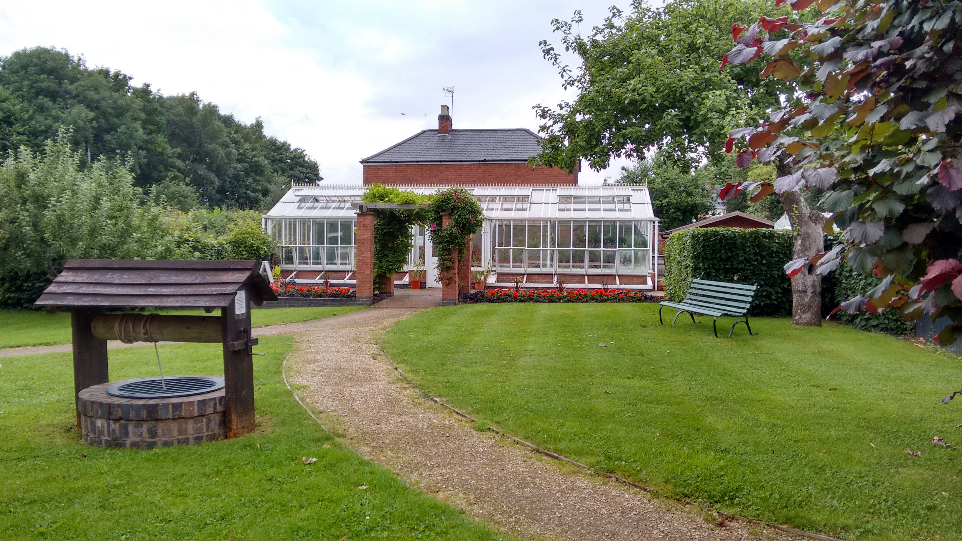
Hill Close Gardens, Warwick

Hill Close Gardens is a group of 18 surviving Victorian detached gardens on a hillside in Warwick, Warwickshire, England. It is listed Grade II* in Historic...
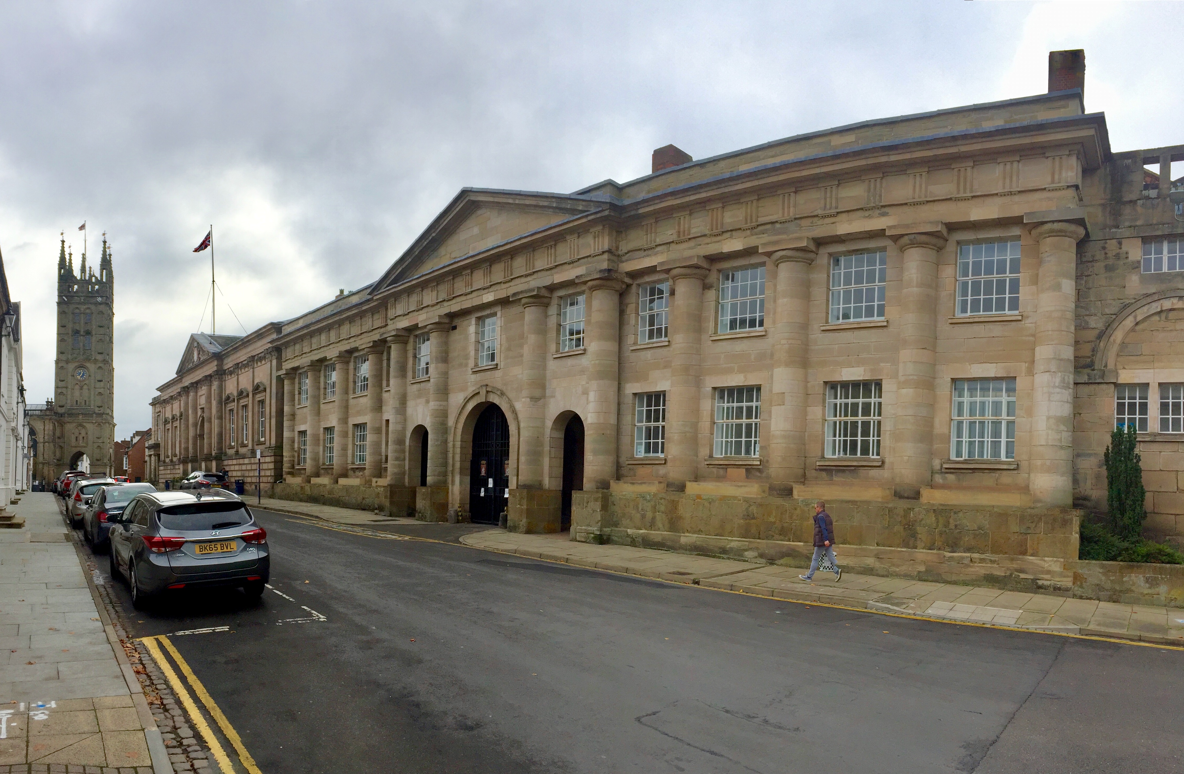
Shire Hall, Warwick

Shire Hall is a building complex located in Northgate Street in Warwick, England. It is the main office and the meeting place of Warwickshire County Council...

Warwick Racecourse

Warwick Racecourse is a horse racing course in Warwick, England. It is a National Hunt racing course and has a programme of 25 meetings throughout the...

Nearby Amenities

Located within 500m of 52.289156,-1.6004345
Crossing
Button Operated: yes
Crossing: traffic_signals
Crossing Island: no
Crossing Markings: dots
Crossing Ref: toucan
Kerb: lowered
Tactile Paving: yes
Traffic Signals Sound: yes
Traffic Signals Vibration: yes
Lat/Long: 52.2895724/-1.5946408
Direction: both
Source: Warwicks CC Aerial Imagery 2013
Traffic Calming: cushion
Lat/Long: 52.289682/-1.5932263
Crossing
Crossing: unmarked
Crossing Markings: no
Lat/Long: 52.29114/-1.5949095
Waterway: turning_point
Lat/Long: 52.2876204/-1.6005444
Turning Circle
Lat/Long: 52.2879017/-1.6023404
Bus Stop
St Michaels Road
Bench: yes
Bin: no
Bus: yes
Covered: no
Lit: yes
Naptan AtcoCode: 4200F072300
Naptan Bearing: SE
Naptan CommonName: St Michaels Road
Naptan Crossing: St Michaels Road
Naptan Indicator: Opp
Naptan NaptanCode: waragpgm
Naptan PlusbusZoneRef: LMNGTNS
Naptan Street: Cape Road
Network: Stagecoach Midlands
Network Wikidata: Q16932890
Passenger Information Display: no
Physically Present: yes
Public Transport: platform
Route Ref: 1
Shelter: yes
Source: naptan_import
Tactile Paving: no
Lat/Long: 52.2889505/-1.5934643
Bus Stop
Saltisford Gardens
Bench: yes
Bin: no
Bus: yes
Covered: no
Lit: yes
Naptan AtcoCode: 4200F074600
Naptan Bearing: N
Naptan CommonName: Saltisford Gardens
Naptan Crossing: Saltisford Gardens
Naptan Indicator: Opp
Naptan NaptanCode: waradtwt
Naptan PlusbusZoneRef: LMNGTNS
Naptan Street: St Michaels Road
Network: Stagecoach Midlands
Network Wikidata: Q16932890
Passenger Information Display: no
Physically Present: yes
Public Transport: platform
Route Ref: 1
Shelter: yes
Source: naptan_import
Tactile Paving: yes
Lat/Long: 52.2885658/-1.599087
Bus Stop
St Michaels Road
Bench: no
Bin: no
Bus: yes
Covered: no
Lit: yes
Naptan AtcoCode: 4200F074602
Naptan Bearing: NW
Naptan CommonName: St Michaels Road
Naptan Crossing: St Michaels Road
Naptan Indicator: Opp
Naptan NaptanCode: waradwag
Naptan PlusbusZoneRef: LMNGTNS
Naptan Street: Birmingham Road
Network: Stagecoach Midlands
Network Wikidata: Q16932890
Passenger Information Display: no
Physically Present: yes
Public Transport: platform
Route Ref: 1
Shelter: no
Source: naptan_import
Tactile Paving: yes
Lat/Long: 52.2875813/-1.5991531
Bus Stop
Hospital
Bench: no
Bin: no
Bus: yes
Covered: no
Lit: yes
Naptan AtcoCode: 4200F100100
Naptan Bearing: SW
Naptan CommonName: Hospital
Naptan Indicator: Opp
Naptan Landmark: Hospital
Naptan NaptanCode: warajawg
Naptan PlusbusZoneRef: LMNGTNS
Naptan Street: St Michaels Road
Network: Stagecoach Midlands
Network Wikidata: Q16932890
Passenger Information Display: no
Physically Present: no
Public Transport: platform
Shelter: no
Source: naptan_import
Tactile Paving: no
Lat/Long: 52.2885211/-1.5935169
Bus Stop
Railway Bridge
Bench: no
Bin: no
Bus: yes
Covered: no
Lit: yes
Naptan AtcoCode: 4200F145801
Naptan Bearing: SE
Naptan CommonName: Railway Bridge
Naptan Indicator: Adj
Naptan Landmark: Leper Hospital
Naptan NaptanCode: waragamw
Naptan PlusbusZoneRef: LMNGTNS
Naptan Street: Birmingham Road
Network: Stagecoach Midlands
Network Wikidata: Q16932890
Passenger Information Display: no
Physically Present: yes
Public Transport: platform
Route Ref: 1
Shelter: no
Source: naptan_import
Tactile Paving: yes
Lat/Long: 52.2861161/-1.5957351
Bus Stop
Hospital
Bench: no
Bin: no
Bus: yes
Covered: no
Lit: yes
Naptan AtcoCode: 4200F146101
Naptan Bearing: NE
Naptan CommonName: Hospital
Naptan Indicator: Adj
Naptan Landmark: Hospital
Naptan NaptanCode: waragapj
Naptan PlusbusZoneRef: LMNGTNS
Naptan Street: St Michaels Road
Network: Stagecoach Midlands
Network Wikidata: Q16932890
Passenger Information Display: no
Physically Present: yes
Public Transport: platform
Route Ref: 1
Shelter: no
Source: naptan_import
Tactile Paving: yes
Lat/Long: 52.2885409/-1.5936517
Bus Stop
St Christophers Close
Bench: no
Bin: no
Bus: yes
Covered: no
Lit: yes
Naptan AtcoCode: 4200F146201
Naptan Bearing: NW
Naptan CommonName: St Christophers Close
Naptan Crossing: St Christophers Close
Naptan Indicator: Adj
Naptan NaptanCode: waragapm
Naptan PlusbusZoneRef: LMNGTNS
Naptan Street: St Michaels Road
Network: Stagecoach Midlands
Network Wikidata: Q16932890
Passenger Information Display: no
Public Transport: platform
Route Ref: 1
Shelter: no
Source: naptan_import
Tactile Paving: yes
Lat/Long: 52.2883068/-1.5967508
Bus Stop
St Christophers Close
Bench: no
Bin: no
Bus: yes
Covered: no
Lit: yes
Naptan AtcoCode: 4200F146202
Naptan Bearing: SE
Naptan CommonName: St Christophers Close
Naptan Crossing: St Christophers Close
Naptan Indicator: Opp
Naptan NaptanCode: waragapt
Naptan PlusbusZoneRef: LMNGTNS
Naptan Street: St Michaels Road
Network: Stagecoach Midlands
Network Wikidata: Q16932890
Passenger Information Display: no
Physically Present: yes
Public Transport: platform
Route Ref: 1
Shelter: no
Source: naptan_import
Tactile Paving: yes
Lat/Long: 52.2881717/-1.5962138
Bus Stop
Saltisford Gardens
Bench: yes
Bin: no
Bus: yes
Covered: no
Lit: yes
Naptan AtcoCode: 4200F146301
Naptan Bearing: S
Naptan CommonName: Saltisford Gardens
Naptan Crossing: Saltisford Gardens
Naptan Indicator: Adj
Naptan NaptanCode: waragapw
Naptan PlusbusZoneRef: LMNGTNS
Naptan Street: St Michaels Road
Network: Stagecoach Midlands
Network Wikidata: Q16932890
Passenger Information Display: no
Physically Present: yes
Public Transport: platform
Route Ref: 1
Shelter: yes
Source: naptan_import
Tactile Paving: yes
Lat/Long: 52.2880924/-1.5992265
Bus Stop
Lower Cape
Bench: yes
Bin: no
Bus: yes
Covered: no
Lit: yes
Naptan AtcoCode: 4200F146401
Naptan Bearing: SE
Naptan CommonName: Lower Cape
Naptan Crossing: Lower Cape
Naptan Indicator: Adj
Naptan NaptanCode: waragata
Naptan PlusbusZoneRef: LMNGTNS
Naptan Street: Cape Road
Network: Stagecoach Midlands
Network Wikidata: Q16932890
Passenger Information Display: no
Physically Present: yes
Public Transport: platform
Route Ref: 1
Shelter: yes
Source: naptan_import
Tactile Paving: yes
Lat/Long: 52.2905618/-1.5964479
Bus Stop
Landor Road
Bench: yes
Bin: no
Bus: yes
Covered: no
Lit: yes
Naptan AtcoCode: 4200F146402
Naptan Bearing: NW
Naptan CommonName: Landor Road
Naptan Indicator: Adj
Naptan Landmark: Governors House
Naptan NaptanCode: waragatd
Naptan PlusbusZoneRef: LMNGTNS
Naptan Street: Cape Road
Network: Stagecoach Midlands
Network Wikidata: Q16932890
Passenger Information Display: no
Physically Present: yes
Public Transport: platform
Route Ref: 1
Shelter: yes
Source: naptan_import
Tactile Paving: yes
Lat/Long: 52.2902529/-1.5959709
Bus Stop
IBM
Bench: yes
Bin: no
Bus: yes
Covered: no
Lit: yes
Naptan AtcoCode: 4200F146501
Naptan Bearing: N
Naptan CommonName: IBM
Naptan Indicator: Adj
Naptan Landmark: IBM
Naptan NaptanCode: waragatg
Naptan PlusbusZoneRef: LMNGTNS
Naptan Street: Wedgnock Lane
Network: Stagecoach Midlands
Network Wikidata: Q16932890
Passenger Information Display: no
Physically Present: yes
Public Transport: platform
Route Ref: 1
Shelter: yes
Source: naptan_import
Tactile Paving: yes
Lat/Long: 52.2921601/-1.5998866
Bus Stop
IBM
Bench: yes
Bin: no
Bus: yes
Covered: no
Lit: yes
Naptan AtcoCode: 4200F146502
Naptan Bearing: S
Naptan CommonName: IBM
Naptan Indicator: Opp
Naptan Landmark: IBM
Naptan NaptanCode: waragatj
Naptan PlusbusZoneRef: LMNGTNS
Naptan Street: Wedgnock Lane
Network: Stagecoach Midlands
Network Wikidata: Q16932890
Passenger Information Display: no
Physically Present: yes
Public Transport: platform
Route Ref: 1
Shelter: yes
Source: naptan_import
Tactile Paving: yes
Lat/Long: 52.2926822/-1.5998204
Post Box
Brand: Royal Mail
Brand Wikidata: Q638098
Brand Wikipedia: en:Royal Mail
Collection Times: Mo-Fr 18:15; Sa 12:30
Operator: Royal Mail
Operator Wikidata: Q638098
Ref: CV34 257
Royal Cypher: EIIR
Royal Cypher Wikidata: Q33102113
Source: survey
Lat/Long: 52.2917551/-1.6011164
Disused Amenity: place_of_worship
Lat/Long: 52.2892132/-1.6054525
Disused Amenity: place_of_worship
Lat/Long: 52.2891476/-1.6050234
Traffic Calming: table
Lat/Long: 52.2910597/-1.5948546
Crossing
Crossing: unmarked
Crossing Island: no
Crossing Markings: no
Kerb: lowered
Tactile Paving: yes
Lat/Long: 52.2916775/-1.5994822
Direction: both
Traffic Calming: cushion
Lat/Long: 52.2889915/-1.5936664
Give Way
Direction: forward
Lat/Long: 52.2875186/-1.5970863
Noexit: yes
Lat/Long: 52.2878657/-1.597718
Noexit: yes
Lat/Long: 52.2879924/-1.5976334
Maxheight: 4.1
Source: Warwicks OpenData
Lat/Long: 52.2868734/-1.5971264
Access: delivery
Entrance: main
Wheelchair: yes
Lat/Long: 52.2855713/-1.5970511
Traffic Signals
Crossing Markings: no
Source: estimate
Traffic Signals: signal
Traffic Signals Direction: forward
Lat/Long: 52.2880961/-1.6019702
Traffic Calming: hump
Lat/Long: 52.2896936/-1.6071685
Traffic Calming: hump
Lat/Long: 52.2918385/-1.6042241
Traffic Calming: hump
Lat/Long: 52.2925122/-1.6015558
Traffic Calming: hump
Lat/Long: 52.2912346/-1.6060219
Give Way
Direction: backward
Source: Warwicks CC Aerial Imagery 2013
Lat/Long: 52.2898739/-1.5952019
Direction: backward
Maxspeed: 40 mph
Traffic Sign: maxspeed
Lat/Long: 52.2916775/-1.599436
Waste Disposal
Lat/Long: 52.2877519/-1.6032931
Crossing
Lat/Long: 52.2911591/-1.5997787
Crossing
Crossing: unmarked
Crossing Island: no
Crossing Markings: no
Kerb: lowered
Tactile Paving: yes
Lat/Long: 52.291991/-1.5998284
Crossing
Crossing: unmarked
Crossing Markings: no
Tactile Paving: no
Lat/Long: 52.2927817/-1.6000795
Crossing
Crossing: unmarked
Crossing Island: no
Crossing Markings: no
Kerb: lowered
Tactile Paving: yes
Lat/Long: 52.293446/-1.6000506
Veterinary
Avonvale Veterinary Hospital
Addr Housenumber: 6
Addr Postcode: CV34 5QF
Addr Street: Broxell Close
Source: survey
Website: https://www.avonvets.co.uk/
Lat/Long: 52.2921557/-1.6003775
EagleBurgmann
Industry: sealing
Lat/Long: 52.292878/-1.5975003
LA Fitness
Brand: LA Fitness
Brand Wikidata: Q6457180
Brand Wikipedia: en:LA Fitness
Leisure: fitness_centre
Lat/Long: 52.2924562/-1.5974266
Moretech International
Addr City: Warwick
Addr Housenumber: 5
Addr Postcode: CV34 5QF
Addr Street: Broxell Close
Industry: car_parts
Lat/Long: 52.2921268/-1.6005314
Trust Pet
Industry: pet_food
Lat/Long: 52.291964/-1.6019713
Royal Mail
Industry: distribution_centre
Lat/Long: 52.2920037/-1.601045
Taylor Davis
Industry: packaging
Lat/Long: 52.2918678/-1.60246
Pub
Warwick Cavern
Lat/Long: 52.2925455/-1.5970723
Welton Road Warwick
Brand: National Grid
Brand Wikidata: Q1465461
Designation: Welton Road 0573
Frequency: 50
Location: indoor
Operator: National Grid Electricity Distribution
Operator Old: Western Power Distribution
Operator Wikidata: Q7988183
Owner: National Grid Electricity Distribution (East Midlands) Plc
Owner Wikidata: Q114348127
Power: substation
Source: survey
Substation: minor_distribution
Voltage: 11000
Lat/Long: 52.2923376/-1.5966554
Crossing
Crossing: uncontrolled
Crossing Island: no
Kerb: lowered
Source: survey
Tactile Paving: yes
Lat/Long: 52.2935568/-1.5989765
Tele-traffic UK
Addr Housename: Unit C2
Contact Website: http://www.teletrafficuk.com/
Lat/Long: 52.2909096/-1.6004221
MES Warwickshire
Addr Housename: Unit A2
Addr Postcode: CV34 5JU
Addr Street: Harris Road
Industry: engineering
Lat/Long: 52.2907977/-1.6006579
Post Box
Brand: Royal Mail
Brand Wikidata: Q638098
Brand Wikipedia: en:Royal Mail
Collection Times: Mo-Fr 09:00; Sa 07:00
Operator: Royal Mail
Operator Wikidata: Q638098
Post Box Type: lamp
Ref: CV34 137D
Royal Cypher: EIIR
Royal Cypher Wikidata: Q33102113
Source: survey
Lat/Long: 52.2882074/-1.6055074
Barrier: bollard
Lat/Long: 52.2895292/-1.6027733
Post Box
Brand: Royal Mail
Brand Wikidata: Q638098
Brand Wikipedia: en:Royal Mail
Collection Times: Mo-Fr 09:00; Sa 07:00
Note: new collection plate has a D on the end of the ref no
Operator: Royal Mail
Operator Wikidata: Q638098
Post Box Type: lamp
Ref: CV34 170D
Royal Cypher: EIIR
Royal Cypher Wikidata: Q33102113
Source: survey
Lat/Long: 52.2883478/-1.5988797
Crossing
Bicycle: yes
Crossing: uncontrolled
Crossing Island: no
Kerb: lowered
Tactile Paving: yes
Lat/Long: 52.2886836/-1.5934117
Post Box
Brand: Royal Mail
Brand Wikidata: Q638098
Brand Wikipedia: en:Royal Mail
Collection Times: Mo-Fr 09:00, Sa 07:00
Operator: Royal Mail
Operator Wikidata: Q638098
Post Box Type: pillar
Ref: CV34 124D
Royal Cypher: EIIR
Royal Cypher Wikidata: Q33102113
Source: survey
Lat/Long: 52.2887789/-1.593421
Bench
Backrest: yes
Check Date: 2021-08-21
Source: survey
Lat/Long: 52.2870057/-1.5979297
Crossing
Crossing: unmarked
Crossing Island: no
Crossing Markings: no
Kerb: lowered
Tactile Paving: yes
Lat/Long: 52.2878819/-1.5994764
Barrier: motocycle_barrier
Lat/Long: 52.2858944/-1.6035934
Contechs
Addr Housename: Unit 3
Building: industrial
Lat/Long: 52.2869257/-1.6068113
Batchflow
Addr Housename: Unit 2
Building: industrial
Lat/Long: 52.2869904/-1.6065958
Batchflow
Addr Housename: Unit 1b
Building: industrial
Lat/Long: 52.28706/-1.6063804
Addr Housename: Unit 1a
Building: industrial
Lat/Long: 52.2870725/-1.6061588
CCS Central Chemical Services
Addr Housename: Unit A1
Lat/Long: 52.2909544/-1.6007473
Taylors - Asset Management
Addr Housename: Unit 1
Building: commercial
Lat/Long: 52.2869216/-1.6044729
Fleetworx
Addr Housename: Unit 1
Building: commercial
Lat/Long: 52.2868946/-1.6044605
On Centre Surveys
Addr Housename: Unit 2
Building: commercial
Lat/Long: 52.2868935/-1.6046003
Sansom & Company
Addr Housename: Unit 3
Building: commercial
Lat/Long: 52.2868405/-1.6046446
Barter-Male Associates Engineering Services
Addr Housename: Unit 3
Building: commercial
Lat/Long: 52.2867571/-1.6045897
G. One Source
Addr Housename: Unit 4
Building: commercial
Note: Apex Procurement Ltd Essential Fruit Ltd
Lat/Long: 52.2866878/-1.6045437
Warwickshire Vision Support
Addr Housename: Unit 5
Building: commercial
Lat/Long: 52.2865817/-1.6045968
Consumer Insight
Addr Housename: Unit 6
Building: commercial
Lat/Long: 52.2865969/-1.6047313
DSA Warwick Driving Test Centre
Addr Housename: Unit 7
Building: commercial
Lat/Long: 52.2866521/-1.6047738
Qualsurv
Addr Housename: Unit 8
Addr Housenumber: Charles Court
Addr Street: Budbrooke Road
Building: commercial
Phone: +44 1926 499750
Website: https://qualsurv.co.uk/
Lat/Long: 52.2867149/-1.6048109
PT&A
Addr Housename: Unit 1
Building: commercial
Lat/Long: 52.2866928/-1.6056971
Addr Housename: Unit 3
Building: commercial
Lat/Long: 52.286498/-1.605598
DCA Design International
Addr Housename: Unit 4
Building: commercial
Lat/Long: 52.2864092/-1.605552
Blue Diamond
Addr Housename: Unit 5
Building: commercial
Lat/Long: 52.2864547/-1.6053538
Signs Express
Addr Housename: Unit 6
Building: commercial
Lat/Long: 52.2865521/-1.6053963
SRM Electrical
Addr Housename: Unit 7
Building: commercial
Lat/Long: 52.2866387/-1.6054494
Colemans Office Interiors
Addr Housename: Unit 8
Building: commercial
Lat/Long: 52.2867405/-1.6054954
CLS Fabrication
Addr Housename: Unit 9
Building: industrial
Lat/Long: 52.2860802/-1.6048583
CLS Fabrication
Addr Housename: Unit 10
Building: industrial
Lat/Long: 52.286052/-1.6051096
CLS Fabrication
Addr Housename: Unit 11
Building: industrial
Lat/Long: 52.2860195/-1.6053998
UK Changes
Addr Postcode: CV34 5AR
Building: commercial
Lat/Long: 52.2871974/-1.6053171
Direction: forward
Maxspeed: 40 mph
Traffic Sign: maxspeed
Lat/Long: 52.2885284/-1.6022073
Waste Basket
Check Date: 2021-08-10
Operator: Warwick District Council
Lat/Long: 52.2897838/-1.5995682
Bench
Backrest: yes
Lat/Long: 52.2897882/-1.5995647
Barrier: cycle_barrier
Bicycle: yes
Cycle Barrier: double
Cycle Barrier Installation: fixed
Foot: yes
Material: metal
Lat/Long: 52.2882742/-1.5937044
Bench
Backrest: yes
Check Date: 2021-04-10
Lat/Long: 52.2888287/-1.5934771
Crossing
Crossing: uncontrolled
Crossing Ref: zebra
Lat/Long: 52.2883773/-1.5943904
Crossing
Crossing: uncontrolled
Crossing Ref: zebra
Lat/Long: 52.2885715/-1.594704
Give Way
Direction: backward
Source: Warwicks CC Aerial Imagery 2013
Lat/Long: 52.2887873/-1.5932883
Give Way
Direction: forward
Lat/Long: 52.2891238/-1.593841
Direction: both
Source: Warwicks CC Aerial Imagery 2013
Traffic Calming: cushion
Lat/Long: 52.2892731/-1.5936821
Give Way
Direction: forward
Source: Warwicks CC Aerial Imagery 2013
Lat/Long: 52.2903139/-1.5958854
Give Way
Direction: backward
Source: Warwicks CC Aerial Imagery 2013
Lat/Long: 52.2881011/-1.5962508
Crossing
Crossing: unmarked
Crossing Island: no
Crossing Markings: no
Tactile Paving: no
Lat/Long: 52.2888921/-1.5988787
Noexit: yes
Lat/Long: 52.2896305/-1.6077055
Noexit: yes
Lat/Long: 52.2905746/-1.5949987
Noexit: yes
Lat/Long: 52.2903035/-1.5951688
Crossing
Crossing: uncontrolled
Crossing Island: no
Kerb: lowered
Tactile Paving: yes
Lat/Long: 52.2913887/-1.5942463
Noexit: yes
Lat/Long: 52.2905139/-1.5951837
La Motte Europe
Addr City: Warwick
Addr Housename: Benford court
Addr Postcode: CV34 5DA
Addr Street: Lower Cape
Addr Unit: 1
Office: research
Source: survey
Website: https://www.lamotte-europe.com/welcome.php
Lat/Long: 52.2903656/-1.5955903
Fabric Architechture
Addr City: Warwick
Addr Housename: Benford Court
Addr Postcode: CV34 5DA
Addr Street: Lower Cape
Addr Unit: 2
Office: company
Source: survey
Lat/Long: 52.2903287/-1.5955196
Arcam CAD to Metal Ltd
Addr City: Warwick
Addr Housename: Benford Court
Addr Postcode: CV34 5DA
Addr Street: Lower Cape
Addr Unit: 3
Office: yes
Lat/Long: 52.2902898/-1.5954364
Sino international Products Ltd
Addr City: Warwick
Addr Housename: Benford Court
Addr Postcode: CV34 5DA
Addr Street: Lower Cape
Addr Unit: 4
Office: yes
Source: survey
Lat/Long: 52.2902477/-1.595336
Stem tech
Addr City: Warwick
Addr Housename: Benford Court
Addr Postcode: CV34 5DA
Addr Street: Lower Cape
Addr Unit: 5
Office: yes
Source: survey
Lat/Long: 52.2904654/-1.5951338
Axiom Traffic Ltd
Addr City: Warwick
Addr Housename: Benford Court
Addr Postcode: CV34 5DA
Addr Street: Lower Cape
Addr Unit: 6
Office: yes
Source: survey
Lat/Long: 52.2905267/-1.5950566
Noexit: yes
Lat/Long: 52.2910241/-1.5968656
Grit Bin
Seasonal: no
Lat/Long: 52.2911622/-1.5966384
Fergies Canal Side Cottage
Addr Housenumber: 60
Email: fergiescottage@gmail.com
Internet Access: wlan
Operator: Emma & Steve Jury
Phone: +44 7453 731082
Tourism: hotel
Lat/Long: 52.2922242/-1.5955321
Barrier: lift_gate
Lat/Long: 52.2856519/-1.5964056
Recycling
Access: private
Recycling Cans: yes
Recycling Cardboard: yes
Recycling Glass: no
Recycling Glass Bottles: yes
Recycling Paper: yes
Recycling Plastic: yes
Recycling Plastic Bottles: yes
Recycling Type: container
Lat/Long: 52.28564/-1.596287
Waste Disposal
Access: private
Lat/Long: 52.2855435/-1.5966675
Access: private
Entrance: yes
Wheelchair: yes
Lat/Long: 52.2853826/-1.5971199
Fixme: stub
Lat/Long: 52.2883148/-1.5976716
Entrance: yes
Lat/Long: 52.2902154/-1.596177
Noexit: yes
Lat/Long: 52.2875725/-1.5978018
Noexit: yes
Lat/Long: 52.2874647/-1.5978743
Noexit: yes
Lat/Long: 52.2907331/-1.5960627
Barrier: kerb
Kerb: lowered
Tactile Paving: yes
Lat/Long: 52.2913988/-1.5942879
Barrier: bollard
Bollard: fixed
Foot: yes
Material: wood
Lat/Long: 52.2918798/-1.5956406
Noexit: yes
Lat/Long: 52.2908634/-1.5965491
Grit Bin
Seasonal: no
Lat/Long: 52.2913865/-1.5971967
Traffic Calming: hump
Lat/Long: 52.2915302/-1.5966304
Barrier: bollard
Bollard: fixed
Foot: yes
Material: wood
Lat/Long: 52.2918191/-1.5957905
Generator Method: photovoltaic
Generator Output Electricity: yes
Generator Source: solar
Generator Type: solar_photovoltaic_panel
Location: roof
Power: generator
Lat/Long: 52.2914754/-1.5944713
Water Point
Cape Top Lock Water Point
Access: permissive
Drinking Water: yes
Man Made: water_tap
Operator: Canal and River Trust
Waterway: water_point
Lat/Long: 52.2924354/-1.5958845
Generator Method: thermal
Generator Output Electricity: no
Generator Source: solar
Generator Type: solar_thermal_collector
Location: roof
Power: generator
Lat/Long: 52.2912284/-1.597945
Generator Method: photovoltaic
Generator Output Electricity: yes
Generator Source: solar
Generator Type: solar_photovoltaic_panel
Location: roof
Power: generator
Lat/Long: 52.2880472/-1.5974797
Generator Method: photovoltaic
Generator Output Electricity: yes
Generator Source: solar
Generator Type: solar_photovoltaic_panel
Location: roof
Power: generator
Lat/Long: 52.2874997/-1.6067778
Generator Method: photovoltaic
Generator Output Electricity: yes
Generator Source: solar
Generator Type: solar_photovoltaic_panel
Location: roof
Power: generator
Lat/Long: 52.2879446/-1.607114
Generator Method: photovoltaic
Generator Output Electricity: yes
Generator Source: solar
Generator Type: solar_photovoltaic_panel
Location: roof
Power: generator
Lat/Long: 52.2879738/-1.6070857
Generator Method: photovoltaic
Generator Output Electricity: yes
Generator Source: solar
Generator Type: solar_photovoltaic_panel
Location: roof
Power: generator
Lat/Long: 52.2875755/-1.6070715
Crossing
Crossing: traffic_signals
Crossing Markings: dots
Crossing Ref: toucan
Tactile Paving: yes
Lat/Long: 52.2892002/-1.6077743
Traffic Signals
Crossing Markings: no
Traffic Signals: signal
Traffic Signals Direction: forward
Lat/Long: 52.289605/-1.5946905
Traffic Signals
Crossing Markings: no
Traffic Signals: signal
Traffic Signals Direction: backward
Lat/Long: 52.2895407/-1.5945872
Lower Cape
Bus: yes
Public Transport: stop_position
Traffic Sign: GB:970
Lat/Long: 52.2905182/-1.5964748
Saltisford Gardens
Bus: yes
Public Transport: stop_position
Traffic Sign: GB:970
Lat/Long: 52.2881142/-1.5993207
St Christophers Close
Bus: yes
Public Transport: stop_position
Traffic Sign: GB:970
Lat/Long: 52.2883334/-1.5966884
St Christophers Close
Bus: yes
Public Transport: stop_position
Traffic Sign: GB:970
Lat/Long: 52.2881379/-1.5962542
IBM
Public Transport: stop_position
Traffic Sign: GB:970
Lat/Long: 52.2921657/-1.5997785
Direction: both
Traffic Calming: cushion
Lat/Long: 52.2913959/-1.5985979
St Michaels Road
Bus: yes
Public Transport: stop_position
Traffic Sign: GB:970
Lat/Long: 52.2876208/-1.5991213
Railway Bridge
Bus: yes
Public Transport: stop_position
Traffic Sign: GB:970
Lat/Long: 52.2860819/-1.5957739
St Michaels Road
Bus: yes
Public Transport: stop_position
Traffic Sign: GB:970
Lat/Long: 52.288914/-1.5934952
Saltisford Gardens
Bus: yes
Public Transport: stop_position
Traffic Sign: GB:970
Lat/Long: 52.2885497/-1.5990243
IBM
Bus: yes
Public Transport: stop_position
Traffic Sign: GB:970
Lat/Long: 52.2926679/-1.5999398
Landor Road
Bus: yes
Public Transport: stop_position
Traffic Sign: GB:970
Lat/Long: 52.290296/-1.5959323
Hospital
Bus: yes
Public Transport: stop_position
Traffic Sign: GB:970
Lat/Long: 52.2885197/-1.5936075
Direction: both
Traffic Calming: cushion
Lat/Long: 52.2916156/-1.5991308
Street Lamp
Lamp Mount: bent_mast
Lamp Type: led
Lat/Long: 52.289829/-1.5931622
Street Lamp
Lamp Mount: bent_mast
Lamp Type: led
Lat/Long: 52.2896372/-1.5934229
Street Lamp
Lamp Mount: bent_mast
Lamp Type: led
Ref: 2
Lat/Long: 52.2893957/-1.5934297
Street Lamp
Lamp Mount: bent_mast
Lamp Type: led
Ref: 1
Lat/Long: 52.2892888/-1.5937959
Traffic Signals
Crossing: traffic_signals
Crossing Markings: no
Source: estimate
Traffic Signals: signal
Traffic Signals Direction: forward
Lat/Long: 52.2891208/-1.6077107
Crossing
Crossing: traffic_signals
Crossing Markings: dots
Crossing Ref: toucan
Tactile Paving: yes
Lat/Long: 52.2890928/-1.6077578
Source: estimate
Lat/Long: 52.2893152/-1.6074332
Street Lamp
Lamp Mount: straight_mast
Lamp Type: led
Lat/Long: 52.2880643/-1.6021764
Street Lamp
Lamp Mount: bent_mast
Lamp Type: led
Ref: 7
Lat/Long: 52.2878603/-1.5996947
Street Lamp
Lamp Mount: bent_mast
Lamp Type: led
Ref: 19
Lat/Long: 52.2889755/-1.5988133
Crossing
Button Operated: yes
Crossing: traffic_signals
Crossing Markings: dots
Kerb: lowered
Tactile Paving: yes
Traffic Signals Sound: no
Traffic Signals Vibration: yes
Lat/Long: 52.2881706/-1.6025118
Crossing
Button Operated: yes
Crossing: traffic_signals
Crossing Markings: dots
Kerb: lowered
Tactile Paving: yes
Traffic Signals Sound: no
Traffic Signals Vibration: yes
Lat/Long: 52.2880787/-1.6026741
Street Lamp
Lamp Mount: straight_mast
Lamp Type: led
Lat/Long: 52.2880418/-1.6027766
Street Lamp
Lamp Mount: straight_mast
Lamp Type: led
Man Made: utility_pole
Material: steel
Lat/Long: 52.2883332/-1.6020325
Crossing
Crossing: unmarked
Crossing Markings: no
Kerb: lowered
Tactile Paving: yes
Lat/Long: 52.2880368/-1.6010193
Street Lamp
Lamp Mount: straight_mast
Lamp Type: led
Lat/Long: 52.2880341/-1.6015543
Crossing
Button Operated: yes
Crossing: traffic_signals
Crossing Markings: dots
Tactile Paving: yes
Traffic Signals Sound: no
Traffic Signals Vibration: yes
Lat/Long: 52.2883336/-1.6022948
Street Lamp
Lamp Mount: straight_mast
Lamp Type: led
Lat/Long: 52.2880121/-1.6032427
Street Lamp
Lamp Mount: straight_mast
Lamp Type: led
Lat/Long: 52.2879667/-1.6001036
Street Lamp
Lamp Mount: straight_mast
Lamp Type: led
Lat/Long: 52.2879806/-1.6036965
Street Lamp
Lamp Mount: bent_mast
Lamp Type: led
Ref: 23
Lat/Long: 52.2879436/-1.5995332
Street Lamp
Lamp Mount: bent_mast
Lamp Type: led
Ref: 21
Lat/Long: 52.2884934/-1.5991587
Street Lamp
Lamp Mount: straight_mast
Lamp Type: led
Ref: 1
Lat/Long: 52.2877973/-1.6038751
Street Lamp
Lamp Mount: straight_mast
Lamp Type: led
Ref: 9
Lat/Long: 52.2880068/-1.6001278
Street Lamp
Lamp Mount: straight_mast
Lamp Type: led
Ref: 20
Lat/Long: 52.2888008/-1.598963
Street Lamp
Lamp Mount: straight_mast
Lamp Type: led
Lat/Long: 52.2879506/-1.6041453
Street Lamp
Lamp Mount: bent_mast
Lamp Type: led
Ref: 6
Lat/Long: 52.2876962/-1.5995862
Street Lamp
Lamp Mount: straight_mast
Lamp Type: led
Lat/Long: 52.2880222/-1.6011998
Traffic Signals
Crossing Markings: no
Traffic Signals: signal
Traffic Signals Direction: forward
Lat/Long: 52.2881618/-1.6025742
Street Lamp
Lamp Mount: bent_mast
Lamp Type: led
Ref: 22
Lat/Long: 52.2881917/-1.5993673
Crossing
Crossing: unmarked
Crossing Markings: no
Kerb: lowered
Tactile Paving: yes
Lat/Long: 52.2880747/-1.6010097
Street Lamp
Lamp Mount: straight_mast
Lamp Type: led
Lat/Long: 52.2881977/-1.6018992
Crossing
Button Operated: yes
Crossing: traffic_signals
Crossing Markings: dots
Kerb: lowered
Tactile Paving: yes
Traffic Signals Sound: no
Traffic Signals Vibration: yes
Lat/Long: 52.2882653/-1.602145
Street Lamp
Lamp Mount: straight_mast
Lamp Type: led
Man Made: utility_pole
Material: steel
Lat/Long: 52.2882408/-1.6024811
Street Lamp
Lamp Mount: straight_mast
Lamp Type: led
Man Made: utility_pole
Material: steel
Lat/Long: 52.2887054/-1.6021172
Street Lamp
Lamp Mount: straight_mast
Lamp Type: led
Man Made: utility_pole
Material: steel
Lat/Long: 52.2884813/-1.6023766
Traffic Signals
Crossing Markings: no
Traffic Signals: signal
Traffic Signals Direction: forward
Lat/Long: 52.2883124/-1.6021444
Barrier: kerb
Kerb: lowered
Tactile Paving: no
Lat/Long: 52.2888393/-1.5989151
Barrier: kerb
Kerb: lowered
Tactile Paving: no
Lat/Long: 52.2889282/-1.598852
Street Lamp
Lamp Mount: bent_mast
Lamp Type: led
Ref: 24
Lat/Long: 52.2859023/-1.5955263
Street Lamp
Lamp Mount: bent_mast
Lamp Type: led
Ref: 25
Lat/Long: 52.286164/-1.5958373
Street Lamp
Lamp Mount: bent_mast
Lamp Type: led
Ref: 26
Lat/Long: 52.2863329/-1.5963265
Street Lamp
Lamp Mount: bent_mast
Lamp Type: led
Ref: 27
Lat/Long: 52.2866246/-1.5965941
Street Lamp
Lamp Mount: bent_mast
Lamp Type: led
Ref: 28
Lat/Long: 52.2867343/-1.59698
Street Lamp
Lamp Mount: bent_mast
Lamp Type: led
Ref: 1
Lat/Long: 52.2869985/-1.5972801
Street Lamp
Lamp Mount: bent_mast
Lamp Type: led
Ref: 2
Lat/Long: 52.287172/-1.5977059
Street Lamp
Lamp Mount: bent_mast
Lamp Type: led
Ref: 3
Lat/Long: 52.2872757/-1.5982374
Street Lamp
Lamp Mount: bent_mast
Lamp Type: led
Ref: 4
Lat/Long: 52.2875235/-1.5986347
Street Lamp
Lamp Mount: bent_mast
Lamp Type: led
Ref: 5
Lat/Long: 52.2876544/-1.5990722
Street Lamp
Lamp Mount: bent_mast
Lamp Type: led
Man Made: utility_pole
Material: steel
Ref: 31
Lat/Long: 52.2899343/-1.5950905
Street Lamp
Lamp Mount: bent_mast
Lamp Type: led
Man Made: utility_pole
Material: steel
Ref: 32
Lat/Long: 52.2901596/-1.5954724
Street Lamp
Lamp Mount: straight_mast
Lamp Type: led
Ref: 1
Lat/Long: 52.2904599/-1.5959214
Direction: backward
Maxspeed: 20 mph
Traffic Sign: maxspeed
Lat/Long: 52.2903873/-1.5957999
Street Lamp
Lamp Mount: bent_mast
Lamp Type: high_pressure_sodium
Lat/Long: 52.2906112/-1.5956147
Give Way
Direction: backward
Lat/Long: 52.2882499/-1.594048
Give Way
Direction: forward
Lat/Long: 52.2888848/-1.598855
Give Way
Direction: backward
Lat/Long: 52.288422/-1.5990599
Give Way
Direction: forward
Lat/Long: 52.2882556/-1.5992776
Give Way
Direction: forward
Lat/Long: 52.2877841/-1.5995416
Give Way
Direction: backward
Lat/Long: 52.2874943/-1.5970016
Street Lamp
Lamp Mount: bent_mast
Lamp Type: led
Man Made: utility_pole
Material: steel
Ref: 25
Lat/Long: 52.2888286/-1.5931757
Street Lamp
Lamp Mount: bent_mast
Lamp Type: led
Man Made: utility_pole
Material: steel
Ref: 26
Lat/Long: 52.2888892/-1.5935939
Street Lamp
Lamp Mount: bent_mast
Lamp Type: led
Man Made: utility_pole
Material: steel
Ref: 27
Lat/Long: 52.2890645/-1.5939573
Street Lamp
Lamp Mount: bent_mast
Lamp Type: led
Man Made: utility_pole
Material: steel
Ref: 28
Lat/Long: 52.2892864/-1.5943115
Street Lamp
Lamp Mount: bent_mast
Lamp Type: led
Man Made: utility_pole
Material: steel
Ref: 29
Lat/Long: 52.2894567/-1.5945697
Street Lamp
Lamp Mount: bent_mast
Lamp Type: led
Man Made: utility_pole
Material: steel
Ref: 32
Lat/Long: 52.2897332/-1.5947628
Give Way
Direction: forward
Lat/Long: 52.2904353/-1.596377
Street Lamp
Lamp Mount: bent_mast
Lamp Type: led
Man Made: utility_pole
Material: steel
Ref: 33
Lat/Long: 52.2902634/-1.5960129
Street Lamp
Lamp Mount: bent_mast
Lamp Type: led
Man Made: utility_pole
Material: steel
Ref: 34
Lat/Long: 52.2904937/-1.5962612
Give Way
Direction: forward
Lat/Long: 52.2909835/-1.5975152
Give Way
Direction: forward
Lat/Long: 52.2908051/-1.5953581
Give Way
Direction: backward
Lat/Long: 52.2909138/-1.595082
Give Way
Direction: backward
Lat/Long: 52.2911739/-1.594373
Barrier: kerb
Kerb: lowered
Tactile Paving: yes
Lat/Long: 52.2911292/-1.5949501
Give Way
Direction: forward
Lat/Long: 52.291091/-1.594876
Street Lamp
Lamp Mount: bent_mast
Lamp Type: led
Man Made: utility_pole
Material: steel
Ref: 35
Lat/Long: 52.2905646/-1.5967328
Give Way
Direction: forward
Lat/Long: 52.2908433/-1.597365
Street Lamp
Lamp Mount: bent_mast
Lamp Type: led
Man Made: utility_pole
Material: steel
Ref: 36
Lat/Long: 52.2907275/-1.5971366
Street Lamp
Lamp Mount: bent_mast
Lamp Type: led
Man Made: utility_pole
Material: steel
Ref: 37
Lat/Long: 52.2909641/-1.5973862
Direction: backward
Maxspeed: 20 mph
Traffic Sign: maxspeed
Lat/Long: 52.291049/-1.5974451
Street Lamp
Lamp Mount: bent_mast
Lamp Type: led
Man Made: utility_pole
Material: steel
Ref: 38
Lat/Long: 52.2911006/-1.5977407
Street Lamp
Lamp Mount: bent_mast
Lamp Type: led
Man Made: utility_pole
Material: steel
Ref: 39
Lat/Long: 52.2912377/-1.5980952
Street Lamp
Lamp Mount: bent_mast
Lamp Type: led
Man Made: utility_pole
Material: steel
Ref: 40
Lat/Long: 52.2913562/-1.5986271
Street Lamp
Lamp Mount: bent_mast
Lamp Type: led
Man Made: utility_pole
Material: steel
Ref: 41
Lat/Long: 52.2916083/-1.5989718
Give Way
Direction: backward
Lat/Long: 52.2916954/-1.5992612
Give Way
Direction: backward
Lat/Long: 52.2916738/-1.5995914
Street Lamp
Lamp Mount: bent_mast
Lamp Type: led
Man Made: utility_pole
Material: steel
Ref: 42
Lat/Long: 52.2915953/-1.5994321
Give Way
Direction: backward
Lat/Long: 52.2919968/-1.5997833
Give Way
Direction: forward
Lat/Long: 52.2927885/-1.6000365
Give Way
Direction: backward
Lat/Long: 52.2934366/-1.6001289
Street Lamp
Lamp Mount: bent_mast
Lamp Type: led
Man Made: utility_pole
Material: steel
Ref: 24
Lat/Long: 52.2931351/-1.5999818
Street Lamp
Lamp Mount: bent_mast
Lamp Type: led
Man Made: utility_pole
Material: steel
Ref: 25
Lat/Long: 52.2933774/-1.6002482
Street Lamp
Lamp Mount: bent_mast
Lamp Type: led
Man Made: utility_pole
Material: steel
Ref: 23
Lat/Long: 52.2928023/-1.5998933
Street Lamp
Lamp Mount: bent_mast
Lamp Type: led
Man Made: utility_pole
Material: steel
Ref: 22
Lat/Long: 52.2925159/-1.5998107
Street Lamp
Lamp Mount: bent_mast
Lamp Type: led
Man Made: utility_pole
Material: steel
Ref: 21
Lat/Long: 52.2921941/-1.5998695
Street Lamp
Lamp Mount: bent_mast
Lamp Type: led
Man Made: utility_pole
Material: steel
Ref: 20
Lat/Long: 52.2918828/-1.5996068
Street Lamp
Lamp Mount: bent_mast
Lamp Type: led
Man Made: utility_pole
Material: steel
Ref: 19
Lat/Long: 52.2916715/-1.5997303
Street Lamp
Lamp Mount: bent_mast
Lamp Type: led
Man Made: utility_pole
Material: steel
Ref: 18
Lat/Long: 52.2914614/-1.5995383
Street Lamp
Lamp Mount: bent_mast
Lamp Type: led
Man Made: utility_pole
Material: steel
Lat/Long: 52.2911836/-1.5995231
Street Lamp
Lamp Mount: bent_mast
Lamp Type: led
Man Made: utility_pole
Material: steel
Lat/Long: 52.2909209/-1.5997535
Street Lamp
Lamp Mount: bent_mast
Lamp Type: led
Man Made: utility_pole
Material: steel
Lat/Long: 52.2905968/-1.5996088
Street Lamp
Lamp Mount: bent_mast
Lamp Type: led
Man Made: utility_pole
Material: steel
Lat/Long: 52.2903887/-1.5996915
Street Lamp
Lamp Mount: bent_mast
Lamp Type: led
Man Made: utility_pole
Material: steel
Lat/Long: 52.2901878/-1.599859
Street Lamp
Lamp Mount: bent_mast
Lamp Type: led
Man Made: utility_pole
Material: steel
Lat/Long: 52.2900398/-1.6001424
Street Lamp
Lamp Mount: bent_mast
Lamp Type: led
Man Made: utility_pole
Material: steel
Lat/Long: 52.2899305/-1.600493
Street Lamp
Lamp Mount: bent_mast
Lamp Type: led
Man Made: utility_pole
Material: steel
Lat/Long: 52.2898516/-1.6013812
Street Lamp
Lamp Mount: bent_mast
Lamp Type: led
Man Made: utility_pole
Material: steel
Lat/Long: 52.2897253/-1.6016709
Street Lamp
Lamp Mount: bent_mast
Lamp Type: led
Man Made: utility_pole
Material: steel
Lat/Long: 52.2895661/-1.6019183
Street Lamp
Lamp Mount: bent_mast
Lamp Type: led
Man Made: utility_pole
Material: steel
Lat/Long: 52.2889364/-1.6022683
Street Lamp
Lamp Mount: bent_mast
Lamp Type: led
Man Made: utility_pole
Material: steel
Lat/Long: 52.2891505/-1.6022234
Street Lamp
Lamp Mount: bent_mast
Lamp Type: led
Man Made: utility_pole
Material: steel
Lat/Long: 52.2893502/-1.6021143
Street Lamp
Lamp Mount: bent_mast
Lamp Type: led
Ref: 18
Lat/Long: 52.2890684/-1.5985792
Street Lamp
Lamp Mount: bent_mast
Lamp Type: led
Ref: 17
Lat/Long: 52.2890577/-1.5981825
Street Lamp
Lamp Mount: bent_mast
Lamp Type: led
Ref: 16
Lat/Long: 52.2889188/-1.5978645
Street Lamp
Lamp Mount: bent_mast
Lamp Type: led
Ref: 15
Lat/Long: 52.2886501/-1.5975493
Street Lamp
Lamp Mount: bent_mast
Lamp Type: led
Ref: 14
Lat/Long: 52.2885768/-1.5970866
Street Lamp
Lamp Mount: bent_mast
Lamp Type: led
Ref: 13
Lat/Long: 52.2883245/-1.5968216
Street Lamp
Lamp Mount: bent_mast
Lamp Type: led
Ref: 12
Lat/Long: 52.2881717/-1.5964695
Street Lamp
Lamp Mount: bent_mast
Lamp Type: led
Ref: 11
Lat/Long: 52.2881704/-1.5961652
Street Lamp
Lamp Mount: bent_mast
Lamp Type: led
Ref: 10
Lat/Long: 52.2879598/-1.5959899
Street Lamp
Lamp Mount: bent_mast
Lamp Type: led
Ref: 9
Lat/Long: 52.2877973/-1.595622
Street Lamp
Lamp Mount: bent_mast
Lamp Type: led
Ref: 8
Lat/Long: 52.2876549/-1.5952744
Street Lamp
Lamp Mount: bent_mast
Lamp Type: led
Ref: 7
Lat/Long: 52.287605/-1.5949313
Street Lamp
Lamp Mount: bent_mast
Lamp Type: led
Ref: 6
Lat/Long: 52.2876694/-1.5946064
Street Lamp
Lamp Mount: bent_mast
Lamp Type: led
Ref: 5
Lat/Long: 52.2878702/-1.594291
Generator Method: photovoltaic
Generator Output Electricity: yes
Generator Source: solar
Generator Type: solar_photovoltaic_panel
Location: roof
Power: generator
Lat/Long: 52.2882881/-1.5935884
Street Lamp
Lamp Mount: bent_mast
Lamp Type: led
Ref: 3
Lat/Long: 52.2882896/-1.59378
Street Lamp
Lamp Mount: bent_mast
Lamp Type: led
Ref: 2
Lat/Long: 52.2885809/-1.5936547
Street Lamp
Lamp Mount: bent_mast
Lamp Type: led
Ref: 1
Lat/Long: 52.2886739/-1.5933151
Give Way
Direction: backward
Lat/Long: 52.2886798/-1.6076218
Give Way
Direction: backward
Lat/Long: 52.2895771/-1.5973629
Barrier: lift_gate
Lat/Long: 52.2914062/-1.6026621
Street Lamp
Lamp Mount: straight_mast
Lamp Type: high_pressure_sodium
Lat/Long: 52.2910231/-1.5973902
Street Lamp
Lamp Mount: straight_mast
Lamp Type: high_pressure_sodium
Lat/Long: 52.2912731/-1.5970932
Street Lamp
Lamp Mount: straight_mast
Lamp Type: high_pressure_sodium
Lat/Long: 52.2914586/-1.5967185
Street Lamp
Lamp Mount: straight_mast
Lamp Type: metal-halide
Lat/Long: 52.2916071/-1.5963034
Street Lamp
Lamp Mount: straight_mast
Lamp Type: high_pressure_sodium
Lat/Long: 52.2917379/-1.5959819
Street Lamp
Lamp Mount: straight_mast
Lamp Type: high_pressure_sodium
Lat/Long: 52.2918852/-1.5956179
Street Lamp
Lamp Mount: straight_mast
Lamp Type: high_pressure_sodium
Lat/Long: 52.2918125/-1.5962556
Street Lamp
Lamp Mount: straight_mast
Lamp Type: high_pressure_sodium
Ref: 2
Lat/Long: 52.29036/-1.595712
Street Lamp
Lamp Mount: straight_mast
Lamp Type: high_pressure_sodium
Lat/Long: 52.2907793/-1.5952053
Street Lamp
Lamp Mount: straight_mast
Lat/Long: 52.2909134/-1.5954218
Street Lamp
Lamp Mount: straight_mast
Lamp Type: high_pressure_sodium
Lat/Long: 52.2910251/-1.5951059
Street Lamp
Lamp Mount: straight_mast
Lamp Type: high_pressure_sodium
Lat/Long: 52.2910137/-1.5947472
Street Lamp
Lamp Mount: straight_mast
Lamp Type: high_pressure_sodium
Lat/Long: 52.2910971/-1.5944587
Street Lamp
Lamp Mount: straight_mast
Lat/Long: 52.2912496/-1.5945318
Street Lamp
Lamp Mount: straight_mast
Lamp Type: high_pressure_sodium
Lat/Long: 52.2913638/-1.5941797
Street Lamp
Lamp Mount: straight_mast
Lat/Long: 52.2909939/-1.5957528
Street Lamp
Lamp Mount: straight_mast
Lamp Type: high_pressure_sodium
Lat/Long: 52.2910677/-1.5960747
Street Lamp
Lamp Mount: straight_mast
Lamp Type: high_pressure_sodium
Lat/Long: 52.2912268/-1.5957434
Street Lamp
Lamp Mount: straight_mast
Lamp Type: high_pressure_sodium
Lat/Long: 52.2912449/-1.5949133
Street Lamp
Lamp Mount: straight_mast
Lamp Type: high_pressure_sodium
Lat/Long: 52.2915512/-1.5951084
Street Lamp
Lamp Mount: straight_mast
Lamp Type: high_pressure_sodium
Lat/Long: 52.2919358/-1.5954016
Street Lamp
Lamp Mount: straight_mast
Lamp Type: high_pressure_sodium
Lat/Long: 52.2920557/-1.595376
Street Lamp
Lat/Long: 52.29228/-1.5956442
Street Lamp
Lamp Mount: straight_mast
Lamp Type: led
Lat/Long: 52.2884002/-1.5997408
Street Lamp
Lamp Mount: straight_mast
Lat/Long: 52.2885723/-1.5993844
Street Lamp
Lamp Mount: straight_mast
Lamp Type: led
Ref: 3
Lat/Long: 52.2891327/-1.5993954
Street Lamp
Lamp Mount: straight_mast
Lamp Type: led
Lat/Long: 52.2889386/-1.5994826
Street Lamp
Lat/Long: 52.2894023/-1.5992133
Street Lamp
Lat/Long: 52.2895469/-1.5988917
Street Lamp
Lamp Mount: straight_mast
Lamp Type: metal-halide
Lat/Long: 52.2879135/-1.5963947
Street Lamp
Lamp Mount: straight_mast
Lamp Type: led
Lat/Long: 52.2876965/-1.5968037
Street Lamp
Lamp Mount: straight_mast
Lamp Type: led
Lat/Long: 52.2874353/-1.5970725
Street Lamp
Lamp Mount: straight_mast
Lamp Type: led
Lat/Long: 52.2872744/-1.5973433
Street Lamp
Lat/Long: 52.2874727/-1.5978945
Street Lamp
Lat/Long: 52.287725/-1.5974064
Street Lamp
Lat/Long: 52.2879553/-1.5977237
Street Lamp
Lat/Long: 52.2872067/-1.5960545
Street Lamp
Lat/Long: 52.2872607/-1.5965465
Street Lamp
Lat/Long: 52.2872667/-1.5955732
Street Lamp
Lamp Mount: straight_mast
Lamp Type: led
Ref: 1
Lat/Long: 52.2883386/-1.598861
Street Lamp
Lamp Mount: straight_mast
Lat/Long: 52.2882657/-1.5983328
Street Lamp
Lamp Mount: straight_mast
Lat/Long: 52.2881537/-1.5979966
Street Lamp
Lat/Long: 52.2879336/-1.5981016
Street Lamp
Lamp Mount: straight_mast
Lamp Type: led
Lat/Long: 52.2876367/-1.5983901
Street Lamp
Lat/Long: 52.2877976/-1.5986986
Street Lamp
Lat/Long: 52.2880861/-1.5988
Street Lamp
Lamp Mount: straight_mast
Lamp Type: led
Lat/Long: 52.290143/-1.5966415
Street Lamp
Lamp Mount: straight_mast
Lamp Type: led
Lat/Long: 52.289861/-1.597108
Street Lamp
Lamp Mount: straight_mast
Lamp Type: metal-halide
Lat/Long: 52.2902527/-1.5981347
Street Lamp
Lamp Mount: straight_mast
Lamp Type: metal-halide
Lat/Long: 52.2899714/-1.5984732
Street Lamp
Lamp Mount: straight_mast
Lamp Type: metal-halide
Lat/Long: 52.2897555/-1.5979398
Street Lamp
Lamp Mount: straight_mast
Lamp Type: metal-halide
Lat/Long: 52.2894912/-1.5974354
Street Lamp
Lamp Mount: straight_mast
Lamp Type: metal-halide
Lat/Long: 52.28935/-1.5968066
Street Lamp
Lamp Mount: straight_mast
Lamp Type: metal-halide
Lat/Long: 52.2889857/-1.5962664
Street Lamp
Lamp Mount: straight_mast
Lamp Type: metal-halide
Lat/Long: 52.2893874/-1.5959331
Street Lamp
Lamp Mount: straight_mast
Lamp Type: metal-halide
Ref: 1
Lat/Long: 52.289637/-1.5954668
Street Lamp
Lat/Long: 52.2874553/-1.6039028
Street Lamp
Lat/Long: 52.2872217/-1.6042136
Street Lamp
Lat/Long: 52.2870774/-1.6046922
Street Lamp
Lat/Long: 52.2869756/-1.6051353
Street Lamp
Lat/Long: 52.2868489/-1.6057009
Street Lamp
Lat/Long: 52.2867855/-1.6060049
Street Lamp
Lat/Long: 52.2872302/-1.6038652
Street Lamp
Lat/Long: 52.2870052/-1.6038408
Street Lamp
Lat/Long: 52.2872424/-1.6032641
Street Lamp
Lat/Long: 52.2870716/-1.6035533
Street Lamp
Lat/Long: 52.2873142/-1.6028523
Street Lamp
Lat/Long: 52.2872211/-1.6025124
Street Lamp
Lat/Long: 52.2870197/-1.6024223
Street Lamp
Lat/Long: 52.2869813/-1.6019499
Street Lamp
Lat/Long: 52.2871924/-1.6016736
Street Lamp
Lat/Long: 52.2873281/-1.6012239
Street Lamp
Lat/Long: 52.2870202/-1.6009468
Street Lamp
Lat/Long: 52.2871327/-1.6006004
Street Lamp
Lat/Long: 52.2870983/-1.6002183
Street Lamp
Lat/Long: 52.2878146/-1.6072356
Street Lamp
Lat/Long: 52.2876611/-1.6068571
Street Lamp
Lat/Long: 52.2876364/-1.6063439
Street Lamp
Lat/Long: 52.2878925/-1.606169
Street Lamp
Lamp Mount: straight_mast
Lamp Type: metal-halide
Lat/Long: 52.2905545/-1.5976231
Street Lamp
Lamp Mount: bent_mast
Lamp Type: led
Lat/Long: 52.2935191/-1.5998274
Street Lamp
Lamp Mount: bent_mast
Lamp Type: led
Lat/Long: 52.2934733/-1.5992593
Street Lamp
Lamp Mount: straight_mast
Lamp Type: led
Lat/Long: 52.2935149/-1.5989337
Street Lamp
Lat/Long: 52.2929489/-1.597013
Street Lamp
Lamp Mount: bent_mast
Lamp Type: led
Lat/Long: 52.2926197/-1.5969297
Street Lamp
Lamp Mount: bent_mast
Lamp Type: led
Lat/Long: 52.2922879/-1.596868
Street Lamp
Lamp Mount: bent_mast
Lamp Type: led
Lat/Long: 52.2919161/-1.5999716
Street Lamp
Lamp Mount: bent_mast
Lamp Type: led
Lat/Long: 52.2918066/-1.6004672
Street Lamp
Lamp Mount: bent_mast
Lamp Type: led
Lat/Long: 52.2916918/-1.6010071
Street Lamp
Lamp Mount: bent_mast
Lamp Type: led
Lat/Long: 52.2915679/-1.6015402
Street Lamp
Lat/Long: 52.291437/-1.6020385
Street Lamp
Lat/Long: 52.2903083/-1.6072369
Street Lamp
Lat/Long: 52.2900583/-1.6071699
Street Lamp
Lat/Long: 52.2904424/-1.6069783
Street Lamp
Lat/Long: 52.2908912/-1.6065299
Street Lamp
Lat/Long: 52.2913092/-1.6060025
Street Lamp
Lat/Long: 52.2910967/-1.6064149
Street Lamp
Lat/Long: 52.2912595/-1.6068783
Bench
Backrest: yes
Lat/Long: 52.289739/-1.6006029
Waste Basket
Lat/Long: 52.2897896/-1.6004796
Bench
Backrest: yes
Lat/Long: 52.288963/-1.6003015
Waste Basket
Lat/Long: 52.2888467/-1.6000495
Noexit: yes
Lat/Long: 52.2888655/-1.5956769
Street Lamp
Lamp Mount: straight_mast
Lamp Type: led
Ref: 5
Lat/Long: 52.2892938/-1.5987211
Give Way
Direction: backward
Lat/Long: 52.2870499/-1.6037509
Give Way
Direction: forward
Lat/Long: 52.2869291/-1.602397
Give Way
Direction: backward
Lat/Long: 52.2873125/-1.6040754
Give Way
Direction: forward
Lat/Long: 52.287121/-1.6039203
Street Lamp
Lamp Mount: straight_mast
Lamp Type: led
Lat/Long: 52.2907887/-1.5947653
Street Lamp
Lamp Mount: straight_mast
Lamp Type: led
Lat/Long: 52.2908948/-1.5949642
Addr Housenumber: 107A
Addr Street: Birmingham Road
Ref GB Uprn: 100070259097
Urpn Count: 1
Lat/Long: 52.2879063/-1.6056313
Addr Housenumber: 101
Addr Street: Birmingham Road
Ref GB Uprn: 100070259094
Urpn Count: 1
Lat/Long: 52.287768/-1.6050693
Addr Housenumber: 103
Addr Street: Birmingham Road
Ref GB Uprn: 100070259095
Urpn Count: 1
Lat/Long: 52.2877964/-1.6051929
Addr Housenumber: 105
Addr Street: Birmingham Road
Urpn Count: 2
Lat/Long: 52.2878215/-1.6053489
Addr Housenumber: 107
Addr Street: Birmingham Road
Ref GB Uprn: 100070259098
Urpn Count: 1
Lat/Long: 52.2878805/-1.6055117
Addr Housenumber: 109
Addr Street: Birmingham Road
Ref GB Uprn: 100070259100
Urpn Count: 1
Lat/Long: 52.2879334/-1.6057565
Addr Housenumber: 109A
Addr Street: Birmingham Road
Ref GB Uprn: 100070259099
Urpn Count: 1
Lat/Long: 52.287961/-1.6058841
Addr Housenumber: 115
Addr Street: Birmingham Road
Ref GB Uprn: 100070259103
Urpn Count: 1
Lat/Long: 52.2880353/-1.6062287
Addr Housenumber: 113
Addr Street: Birmingham Road
Ref GB Uprn: 100070259102
Urpn Count: 1
Lat/Long: 52.2880117/-1.6061177
Addr Housenumber: 111
Addr Street: Birmingham Road
Ref GB Uprn: 100070259101
Urpn Count: 1
Lat/Long: 52.2879873/-1.606006
Addr Housenumber: 117
Addr Street: Birmingham Road
Ref GB Uprn: 100070259104
Urpn Count: 1
Lat/Long: 52.2880617/-1.6063515
Addr Housenumber: 119
Addr Street: Birmingham Road
Ref GB Uprn: 100070259105
Urpn Count: 1
Lat/Long: 52.2880934/-1.6064903
Addr Housenumber: 121
Addr Street: Birmingham Road
Ref GB Uprn: 100070259106
Urpn Count: 1
Lat/Long: 52.2881192/-1.6065941
Fire Hydrant
Emergency: fire_hydrant
Fire Hydrant Diameter Signed: no
Fire Hydrant Position: lane
Fire Hydrant Type: underground
Operator: Severn Trent Water
Water Source: main
Lat/Long: 52.2921609/-1.5955596
Cape of Good Hope
Brand: National Grid
Brand Wikidata: Q1465461
Frequency: 50
Location: outdoor
Operator: National Grid Electricity Distribution
Operator Old: Western Power Distribution
Operator Wikidata: Q7988183
Owner: National Grid Electricity Distribution (East Midlands) Plc
Owner Wikidata: Q114348127
Power: substation
Ref: 42D 2370
Substation: minor_distribution
Voltage: 11000
Lat/Long: 52.292101/-1.5953626
Addr Housenumber: 129
Addr Street: Birmingham Road
Ref GB Uprn: 100070259108
Urpn Count: 1
Lat/Long: 52.2882123/-1.6071541
Addr Housenumber: 125
Addr Street: Birmingham Road
Ref GB Uprn: 100070259107
Urpn Count: 1
Lat/Long: 52.2882846/-1.6068275
Addr Housenumber: 131
Addr Street: Birmingham Road
Ref GB Uprn: 100070259109
Urpn Count: 1
Lat/Long: 52.2882711/-1.6072477
Addr Housenumber: 137
Addr Street: Birmingham Road
Ref GB Uprn: 100071510382
Urpn Count: 1
Lat/Long: 52.2883373/-1.6075079
Addr Housenumber: 133
Addr Street: Birmingham Road
Ref GB Uprn: 100070259110
Urpn Count: 1
Lat/Long: 52.2882876/-1.6073219
Addr Housenumber: 135
Addr Street: Birmingham Road
Ref GB Uprn: 100070259111
Urpn Count: 1
Lat/Long: 52.2883205/-1.6074369
Addr Housenumber: 139
Addr Street: Birmingham Road
Ref GB Uprn: 100070259112
Urpn Count: 1
Lat/Long: 52.2883849/-1.607659
Hospital
Bus: yes
Public Transport: stop_position
Traffic Sign: GB:970
Lat/Long: 52.2885416/-1.5935814
Street Lamp
Lamp Mount: straight_mast
Lamp Type: led
Lat/Long: 52.2877619/-1.5991496
Barrier: kerb
Kerb: lowered
Tactile Paving: yes
Lat/Long: 52.288669/-1.5933758
Man Made: utility_pole
Material: wood
Operator: Openreach
Utility: telecom
Lat/Long: 52.2866636/-1.5966311
Barrier: kerb
Kerb: lowered
Tactile Paving: yes
Lat/Long: 52.2887/-1.593452
Fire Hydrant
Emergency: fire_hydrant
Fire Hydrant Diameter Signed: no
Fire Hydrant Position: sidewalk
Fire Hydrant Type: underground
Operator: Severn Trent Water
Water Source: main
Lat/Long: 52.2892766/-1.5937887
Man Made: street_cabinet
Lat/Long: 52.2893692/-1.5937151
Man Made: street_cabinet
Lat/Long: 52.289578/-1.5934994
Man Made: utility_pole
Material: wood
Operator: Openreach
Utility: telecom
Lat/Long: 52.289555/-1.5934609
Man Made: street_cabinet
Lat/Long: 52.2902522/-1.5956805
Man Made: utility_pole
Material: wood
Operator: Openreach
Utility: telecom
Lat/Long: 52.2893739/-1.5959291
Man Made: utility_pole
Material: wood
Operator: Openreach
Utility: telecom
Lat/Long: 52.2901047/-1.594832
Man Made: utility_pole
Material: wood
Operator: Openreach
Utility: telecom
Lat/Long: 52.2909022/-1.597273
Man Made: utility_pole
Material: wood
Operator: Openreach
Utility: telecom
Lat/Long: 52.2904904/-1.5962839
Hazard: road_narrows
Lat/Long: 52.2907707/-1.5970972
Man Made: utility_pole
Material: wood
Operator: Openreach
Utility: telecom
Lat/Long: 52.2899397/-1.5950945
Man Made: utility_pole
Material: wood
Operator: Openreach
Utility: telecom
Lat/Long: 52.2891209/-1.5962576
Generator Method: photovoltaic
Generator Output Electricity: yes
Generator Source: solar
Generator Type: solar_photovoltaic_panel
Location: roof
Power: generator
Lat/Long: 52.2903011/-1.5967036
Generator Method: photovoltaic
Generator Output Electricity: yes
Generator Source: solar
Generator Type: solar_photovoltaic_panel
Location: roof
Power: generator
Lat/Long: 52.290787/-1.5976173
Fire Hydrant
Emergency: fire_hydrant
Fire Hydrant Diameter Signed: no
Fire Hydrant Position: lane
Fire Hydrant Type: underground
Operator: Severn Trent Water
Water Source: main
Lat/Long: 52.290358/-1.5958981
Crossing
Crossing: unmarked
Crossing Markings: no
Kerb: no
Tactile Paving: no
Lat/Long: 52.2904994/-1.5955663
Barrier: kerb
Kerb: lowered
Tactile Paving: no
Lat/Long: 52.2901294/-1.5954609
Crossing
Crossing: unmarked
Crossing Markings: no
Kerb: lowered
Tactile Paving: no
Lat/Long: 52.2900715/-1.5953569
Barrier: kerb
Kerb: lowered
Tactile Paving: yes
Lat/Long: 52.2908717/-1.5950855
Crossing
Crossing: unmarked
Crossing Markings: no
Kerb: lowered
Tactile Paving: yes
Lat/Long: 52.2911665/-1.5943625
Crossing
Crossing: unmarked
Crossing Markings: no
Kerb: lowered
Tactile Paving: no
Lat/Long: 52.289964/-1.5951643
Barrier: kerb
Kerb: lowered
Tactile Paving: yes
Lat/Long: 52.2909144/-1.5949982
Crossing
Crossing: unmarked
Crossing Island: no
Crossing Markings: no
Kerb: lowered
Tactile Paving: yes
Lat/Long: 52.2908925/-1.595043
Barrier: kerb
Kerb: lowered
Tactile Paving: no
Lat/Long: 52.2899421/-1.5951265
Barrier: kerb
Kerb: lowered
Tactile Paving: yes
Lat/Long: 52.2895572/-1.5946672
Barrier: kerb
Kerb: lowered
Tactile Paving: yes
Lat/Long: 52.2895907/-1.5946094
Barrier: kerb
Kerb: lowered
Tactile Paving: yes
Lat/Long: 52.2912019/-1.5943066
Barrier: kerb
Kerb: lowered
Tactile Paving: no
Lat/Long: 52.2900119/-1.5952466
Barrier: kerb
Kerb: lowered
Tactile Paving: yes
Lat/Long: 52.2911249/-1.5944282
Barrier: kerb
Kerb: lowered
Tactile Paving: no
Lat/Long: 52.2900424/-1.5953046
Crossing
Crossing: unmarked
Crossing Markings: no
Kerb: no
Tactile Paving: no
Lat/Long: 52.2906206/-1.5954176
Crossing
Kerb: lowered
Lat/Long: 52.2898904/-1.5950427
Barrier: kerb
Kerb: lowered
Tactile Paving: no
Lat/Long: 52.2899239/-1.5950966
Barrier: kerb
Kerb: lowered
Tactile Paving: no
Lat/Long: 52.2898684/-1.5950072
Alliance Medical
Addr City: Warwick
Addr Housename: The Woods
Addr Postcode: CV34 5AH
Addr Street: Haywood Road
Office: company
Phone: +44 1926 482 000
Website: https://www.alliancemedical.co.uk/
Lat/Long: 52.292375/-1.6040537
Quanta Dialysis Technologies
Addr City: Warwick
Addr Housename: The Woods
Addr Postcode: CV34 5AH
Addr Street: Haywood Road
Office: company
Website: https://www.quantadt.com/
Lat/Long: 52.2927581/-1.604399
Fire Hydrant
Emergency: fire_hydrant
Fire Hydrant Diameter: 100
Fire Hydrant Position: sidewalk
Fire Hydrant Type: underground
Operator: Severn Trent Water
Water Source: main
Lat/Long: 52.2912392/-1.5981312
Recycling
Recycling Beverage Cartons: no
Recycling Cans: yes
Recycling Paper: yes
Recycling Plastic: no
Recycling Plastic Bottles: yes
Recycling Plastic Packaging: no
Recycling Type: container
Lat/Long: 52.2924688/-1.595785
Man Made: utility_pole
Material: wood
Operator: Openreach
Utility: telecom
Lat/Long: 52.292535/-1.5959028
Bench
Backrest: yes
Material: wood
Seats: 4
Lat/Long: 52.2924894/-1.5957301
Location Transition: yes
Man Made: utility_pole
Material: wood
Operator: National Grid Electricity Distribution
Operator Wikidata: Q7988183
Power: pole
Utility: power
Lat/Long: 52.2923339/-1.5952387
Man Made: utility_pole
Material: wood
Operator: Openreach
Utility: telecom
Lat/Long: 52.2922712/-1.5966411
Man Made: utility_pole
Material: wood
Operator: Openreach
Utility: telecom
Lat/Long: 52.2921031/-1.597017
Man Made: utility_pole
Material: wood
Operator: Openreach
Utility: telecom
Lat/Long: 52.2914687/-1.5986391
Man Made: utility_pole
Material: wood
Operator: Openreach
Utility: telecom
Lat/Long: 52.291764/-1.5978615
Waste Basket
Waste: cigarettes;dog_excrement;trash
Lat/Long: 52.2898696/-1.5953045
Man Made: street_cabinet
Lat/Long: 52.2897573/-1.5952914
Man Made: utility_pole
Material: wood
Operator: Openreach
Utility: telecom
Lat/Long: 52.2900261/-1.5982344
Fire Hydrant
Emergency: fire_hydrant
Fire Hydrant Diameter Signed: no
Fire Hydrant Position: sidewalk
Fire Hydrant Type: underground
Operator: Severn Trent Water
Water Source: main
Lat/Long: 52.2895492/-1.5972774
Man Made: utility_pole
Material: wood
Operator: Openreach
Utility: telecom
Lat/Long: 52.290336/-1.5978952
Fire Hydrant
Emergency: fire_hydrant
Fire Hydrant Diameter Signed: no
Fire Hydrant Position: sidewalk
Fire Hydrant Type: underground
Operator: Severn Trent Water
Water Source: main
Lat/Long: 52.2908113/-1.5973323
Man Made: utility_pole
Material: wood
Operator: Openreach
Utility: telecom
Lat/Long: 52.2911155/-1.5977747
Generator Method: photovoltaic
Generator Output Electricity: yes
Generator Source: solar
Generator Type: solar_photovoltaic_panel
Location: roof
Power: generator
Lat/Long: 52.2900755/-1.5985695
Man Made: utility_pole
Material: wood
Operator: Openreach
Utility: telecom
Lat/Long: 52.2898215/-1.5979147
Man Made: utility_pole
Material: wood
Operator: Openreach
Utility: telecom
Lat/Long: 52.289628/-1.5973859
Generator Method: photovoltaic
Generator Output Electricity: yes
Generator Source: solar
Generator Type: solar_photovoltaic_panel
Location: roof
Power: generator
Lat/Long: 52.2900866/-1.59852
Man Made: utility_pole
Material: wood
Operator: Openreach
Utility: telecom
Lat/Long: 52.289346/-1.5968313
Fire Hydrant
Emergency: fire_hydrant
Fire Hydrant Diameter Signed: no
Fire Hydrant Position: sidewalk
Fire Hydrant Type: underground
Operator: Severn Trent Water
Water Source: main
Lat/Long: 52.2897946/-1.5978307
Generator Method: photovoltaic
Generator Output Electricity: yes
Generator Source: solar
Generator Type: solar_photovoltaic_panel
Location: roof
Power: generator
Lat/Long: 52.2901032/-1.598568
Man Made: utility_pole
Material: steel
Operator: Openreach
Utility: telecom
Lat/Long: 52.2899204/-1.5970234
Generator Method: photovoltaic
Generator Output Electricity: yes
Generator Source: solar
Generator Type: solar_photovoltaic_panel
Location: roof
Power: generator
Lat/Long: 52.289671/-1.5953001
Fire Hydrant
Emergency: fire_hydrant
Fire Hydrant Diameter Signed: no
Fire Hydrant Position: sidewalk
Fire Hydrant Type: underground
Operator: Severn Trent Water
Water Source: main
Lat/Long: 52.2896396/-1.5956229
Street Lamp
Lamp Mount: straight_mast
Lamp Type: led
Lat/Long: 52.2905956/-1.5938615
Street Lamp
Lamp Mount: straight_mast
Lamp Type: led
Lat/Long: 52.291104/-1.5944168
Street Lamp
Lamp Mount: straight_mast
Lamp Type: led
Lat/Long: 52.290881/-1.5940602
Street Lamp
Lamp Mount: straight_mast
Lamp Type: led
Lat/Long: 52.2911736/-1.5942544
Street Lamp
Lamp Mount: straight_mast
Lamp Type: led
Lat/Long: 52.2910341/-1.5941059
Street Lamp
Lamp Mount: straight_mast
Lamp Type: led
Lat/Long: 52.2908694/-1.5938726
Generator Method: photovoltaic
Generator Output Electricity: yes
Generator Source: solar
Generator Type: solar_photovoltaic_panel
Location: roof
Power: generator
Lat/Long: 52.2908108/-1.5946797
Generator Method: photovoltaic
Generator Output Electricity: yes
Generator Source: solar
Generator Type: solar_photovoltaic_panel
Location: roof
Power: generator
Lat/Long: 52.2907888/-1.5949844
Generator Method: photovoltaic
Generator Output Electricity: yes
Generator Source: solar
Generator Type: solar_photovoltaic_panel
Location: roof
Power: generator
Lat/Long: 52.2906974/-1.5950966
Street Lamp
Lamp Mount: straight_mast
Lamp Type: led
Lat/Long: 52.2906037/-1.594799
Generator Method: photovoltaic
Generator Output Electricity: yes
Generator Source: solar
Generator Type: solar_photovoltaic_panel
Location: roof
Power: generator
Lat/Long: 52.290769/-1.5946392
Generator Method: photovoltaic
Generator Output Electricity: yes
Generator Source: solar
Generator Type: solar_photovoltaic_panel
Location: roof
Power: generator
Lat/Long: 52.2908495/-1.5947264
Generator Method: photovoltaic
Generator Output Electricity: yes
Generator Source: solar
Generator Type: solar_photovoltaic_panel
Location: roof
Power: generator
Lat/Long: 52.2908815/-1.5947873
Generator Method: photovoltaic
Generator Output Electricity: yes
Generator Source: solar
Generator Type: solar_photovoltaic_panel
Location: roof
Power: generator
Lat/Long: 52.2909252/-1.5948235
Generator Method: photovoltaic
Generator Output Electricity: yes
Generator Source: solar
Generator Type: solar_photovoltaic_panel
Location: roof
Power: generator
Lat/Long: 52.2906581/-1.5951569
Generator Method: photovoltaic
Generator Output Electricity: yes
Generator Source: solar
Generator Type: solar_photovoltaic_panel
Location: roof
Power: generator
Lat/Long: 52.2907311/-1.5950513
Street Lamp
Lamp Mount: straight_mast
Lamp Type: led
Lat/Long: 52.2907132/-1.593923
Barrier: kerb
Kerb: lowered
Tactile Paving: yes
Lat/Long: 52.2911459/-1.594887
Barrier: kerb
Kerb: lowered
Tactile Paving: yes
Lat/Long: 52.2908882/-1.5954396
Man Made: street_cabinet
Lat/Long: 52.2910197/-1.5948037
Grit Bin
Seasonal: no
Lat/Long: 52.2911828/-1.5953469
Man Made: street_cabinet
Lat/Long: 52.2903795/-1.5962831
Give Way
Direction: backward
Lat/Long: 52.2879896/-1.6039411
Direction: backward
Maxspeed: 40 mph
Traffic Sign: maxspeed
Lat/Long: 52.2919624/-1.5999949
Direction: backward
Maxspeed: 40 mph
Traffic Sign: maxspeed
Lat/Long: 52.2934563/-1.5999504
Street Lamp
Lamp Mount: straight_mast
Lamp Type: metal-halide
Ref: 4
Lat/Long: 52.2881647/-1.5941792
Fire Hydrant
Emergency: fire_hydrant
Fire Hydrant Type: underground
Water Source: main
Lat/Long: 52.2910283/-1.5974963
Fire Hydrant
Emergency: fire_hydrant
Fire Hydrant Type: underground
Water Source: main
Lat/Long: 52.2892586/-1.5940885
Bus Stop
Birch Meadow Close
Bench: no
Bin: no
Bus: yes
Lit: yes
Naptan AtcoCode: 4200F156940
Naptan CommonName: Birch Meadow Close
Naptan Indicator: NW
Naptan NaptanCode: wardmdmp
Naptan Verified: no
Public Transport: platform
Shelter: no
Tactile Paving: yes
Lat/Long: 52.2859511/-1.595604
Birch Meadow Close
Bus: yes
Public Transport: stop_position
Lat/Long: 52.2859811/-1.5955751
Street Lamp
Lat/Long: 52.2885196/-1.607363
Street Lamp
Lamp Mount: straight_mast
Lamp Type: led
Lat/Long: 52.2892221/-1.6073924
Street Lamp
Lat/Long: 52.2879694/-1.6049856
Street Lamp
Lat/Long: 52.2882875/-1.6059368
Street Lamp
Lat/Long: 52.287937/-1.6045673
Street Lamp
Lat/Long: 52.2884042/-1.6069659
Street Lamp
Lamp Mount: straight_mast
Lamp Type: led
Lat/Long: 52.2890694/-1.6076562
Street Lamp
Lat/Long: 52.2880214/-1.6054315
Street Lamp
Lat/Long: 52.2887379/-1.6074132
Street Lamp
Lat/Long: 52.2882924/-1.6065612
Street Lamp
Lat/Long: 52.2895645/-1.6071355
The data included in this document is from www.openstreetmap.org. The data is made available under ODbL.

Have you been to Saltisford Common?

Leave your review of Saltisford Common below (or comments, questions and feedback).