South Beach
Beach in Norfolk Great Yarmouth
England
South Beach

South Beach, Norfolk, also known as South Beach, is a stunning coastal area located in the city of Norfolk, Virginia. Situated along the Chesapeake Bay, it is a popular destination for both locals and tourists alike.
South Beach offers a picturesque and serene environment, boasting beautiful sandy shores, crystal-clear waters, and breathtaking sunsets. The beach spans approximately half a mile, providing ample space for visitors to relax, swim, or engage in various water activities. The beach is well-maintained, with clean facilities and lifeguards on duty during peak seasons, ensuring the safety and enjoyment of beachgoers.
In addition to its natural beauty, South Beach offers a range of amenities and attractions. The area features a boardwalk, perfect for leisurely strolls or cycling, and provides access to nearby parks and recreational areas. Visitors can also find a variety of dining options, from casual beachside cafes to upscale restaurants offering panoramic views of the bay.
South Beach is a hub for outdoor enthusiasts, offering opportunities for fishing, kayaking, paddleboarding, and boating. The beach is also a popular spot for birdwatching, with a diverse range of species frequenting the area.
Overall, South Beach, Norfolk is a hidden gem along the Virginia coastline, offering a tranquil escape from the hustle and bustle of city life. Its natural beauty, recreational opportunities, and amenities make it a must-visit destination for those seeking a beach getaway.
If you have any feedback on the listing, please let us know in the comments section below.
South Beach Images
Images are sourced within 2km of 52.581319/1.7395786 or Grid Reference TG5304. Thanks to Geograph Open Source API. All images are credited.


South Beach is located at Grid Ref: TG5304 (Lat: 52.581319, Lng: 1.7395786)
Administrative County: Norfolk
District: Great Yarmouth
Police Authority: Norfolk
What 3 Words
///noted.verb.carpentry. Near Gorleston-on-Sea, Norfolk
Nearby Locations
Related Wikis
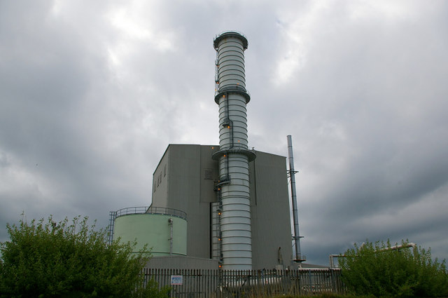
Great Yarmouth Power Station
Great Yarmouth Power Station is combined cycle gas turbine power station on South Denes Road in Great Yarmouth in Norfolk, England, with a maximum output...
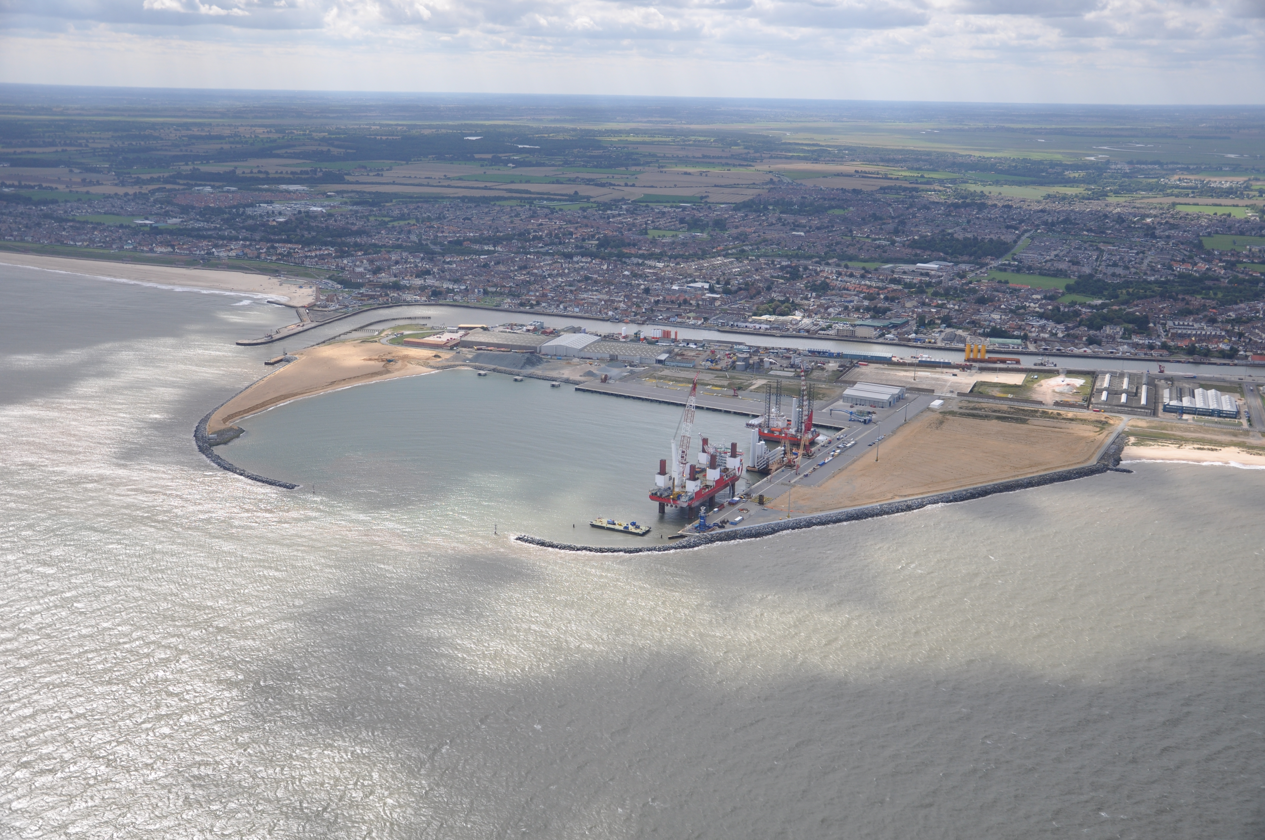
Great Yarmouth Outer Harbour
Great Yarmouth Outer Harbour is a port constructed on the east coast of England at Great Yarmouth. Construction work on the Outer Harbour began in June...

Great Yarmouth and Gorleston Lifeboat Station
Great Yarmouth and Gorleston lifeboat station (not to be confused with Yarmouth on the Isle of Wight) is a RNLI base in Norfolk, England. There were originally...

Britannia Monument
The Nelson's Monument is a commemorative column or tower built in memorial to Admiral Horatio Nelson, situated on the Denes, Great Yarmouth in the county...
Nearby Amenities
Located within 500m of 52.581319,1.7395786Have you been to South Beach?
Leave your review of South Beach below (or comments, questions and feedback).