Stoupe Beck Sands

Beach in Yorkshire Scarborough

England

Stoupe Beck Sands

Path at Robin Hood's Bay 
A cliffside path leads down from Upper Bay to Lower Bay.
Path at Robin Hood's Bay Credit: Gerald England

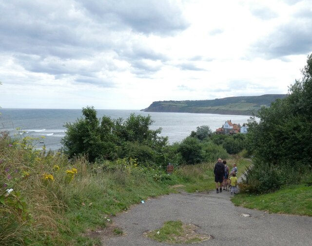
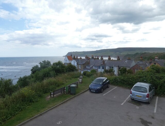
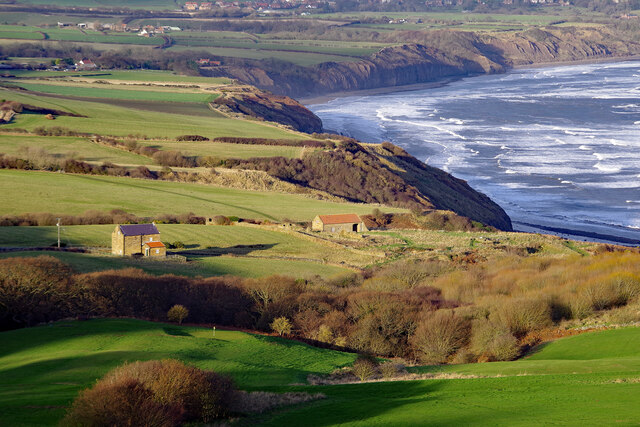
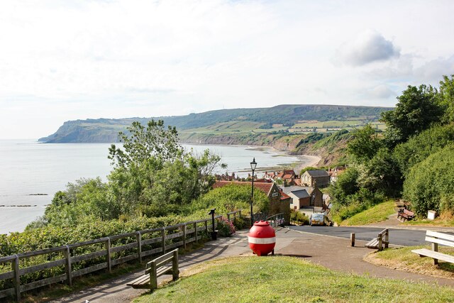
Stoupe Beck Sands is a picturesque beach located in the county of Yorkshire, England. Situated on the eastern coast, this sandy stretch is nestled between the towns of Robin Hood's Bay and Ravenscar. With its stunning natural beauty and tranquil atmosphere, Stoupe Beck Sands is a popular destination for visitors seeking a peaceful coastal retreat.

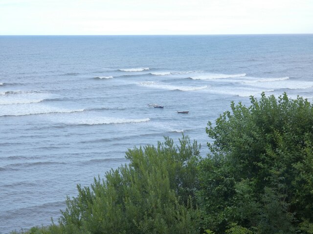
The beach itself boasts a long expanse of golden sand that extends over half a mile. At low tide, the vast shoreline is exposed, providing ample space for beachcombing, picnicking, and enjoying leisurely walks along the water's edge. The sand is soft and inviting, making it an ideal spot for sunbathing and building sandcastles.

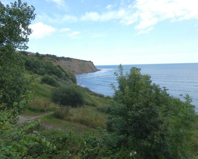
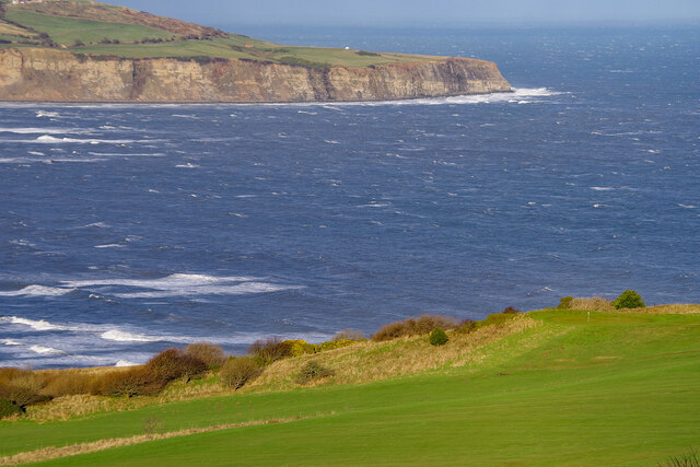
One of the standout features of Stoupe Beck Sands is the towering cliffs that surround the beach. These dramatic limestone cliffs add to the area's allure and create a stunning backdrop against the sparkling blue waters of the North Sea. The cliffs also serve as a haven for wildlife, with various seabirds often seen swooping and nesting along their rugged faces.

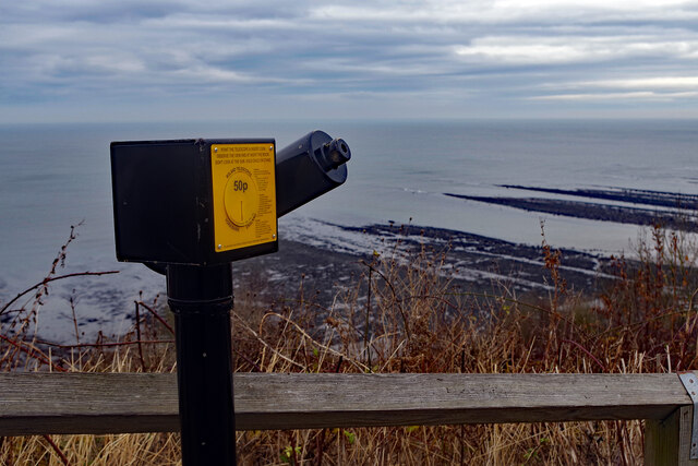
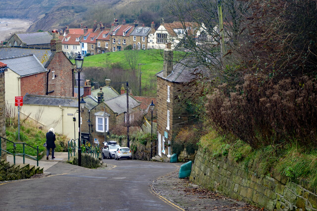
Access to Stoupe Beck Sands is via a steep path leading down from the nearby coastal villages. While the descent may be challenging for some, the reward of reaching the beach is well worth the effort. Visitors can also explore the surrounding area, which offers breathtaking cliff-top walks and panoramic views of the coastline.

Stoupe Beck Sands is a hidden gem along Yorkshire's coastline, offering a serene and unspoiled beach experience. Whether you're seeking relaxation, natural beauty, or a chance to immerse yourself in the region's rich wildlife, this beach is a must-visit destination.

If you have any feedback on the listing, please let us know in the comments section below.

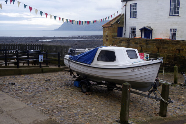
Stoupe Beck Sands Images

Images are sourced within 2km of 54.417071/-0.52188396 or Grid Reference NZ9603. Thanks to Geograph Open Source API. All images are credited.

Path at Robin Hood's Bay 
A cliffside path leads down from Upper Bay to Lower Bay.
Path at Robin Hood's Bay
A cliffside path leads down from Upper Bay to Lower Bay.
Toilets at Robin Hood's Bay 
The toilets have been much improved since 2008 <a href="https://www.geograph.org.uk/photo/818318">NZ9505 : Robin Hood's Bay - public toilets</a>. However it does now cost 40p to "spend a penny". The doors carry a warning that they may lock if you try to hold them open for the next person. There is a defibrillator of the wall outside. Behind the block is a children's play area.
Toilets at Robin Hood's Bay
The toilets have been much improved since 2008 NZ9505 : Robin Hood's Bay - public toilets. However it does now cost 40p to "spend a penny". The doors carry a warning that they may lock if you try to hold them open for the next person. There is a defibrillator of the wall outside. Behind the block is a children's play area.
Robin Hood's Bay View from the terrace of the Fish Box.
Robin Hood's Bay
View from the terrace of the Fish Box.
Robin Hood's Bay Boats offshore.
Robin Hood's Bay
Boats offshore.
Robin Hood's Bay From the terrace at the Fish Box.
Robin Hood's Bay
From the terrace at the Fish Box.
Telescope at Robin Hood's Bay 50p buys a look through the telescope strategically located at the top of the hill down to the harbour.
Telescope at Robin Hood's Bay
50p buys a look through the telescope strategically located at the top of the hill down to the harbour.
New Road, Robin Hood's Bay The road down to the sea is both steep and narrow; visitors must park at the top and walk down. This is the view from near the top.
New Road, Robin Hood's Bay
The road down to the sea is both steep and narrow; visitors must park at the top and walk down. This is the view from near the top.
New Road, Robin Hood's Bay Two days before Christmas and Robin's Hood Bay is relatively deserted with few of the businesses open. Those that are here, however, can move around relatively easily.
New Road, Robin Hood's Bay
Two days before Christmas and Robin's Hood Bay is relatively deserted with few of the businesses open. Those that are here, however, can move around relatively easily.
'All Gold' at Robin Hood's Bay A boat is drawn up at the bottom of the village where the tide is right out.
'All Gold' at Robin Hood's Bay
A boat is drawn up at the bottom of the village where the tide is right out.
Muir Lea Stores, Robin Hood's Bay According to the shop's website, Muir Lea Stores offers locals, day trippers and people staying in the village 'a large range of goods from food to wine, newspapers to milk, and beach toys to gifts'. Perhaps the range of buckets and spades is a little optimistic for a cold dull day in December. The Covid-19 notice specifies only three customers inside at any one time and asks anyone with a cough or fever not to enter.
Muir Lea Stores, Robin Hood's Bay
According to the shop's website, Muir Lea Stores offers locals, day trippers and people staying in the village 'a large range of goods from food to wine, newspapers to milk, and beach toys to gifts'. Perhaps the range of buckets and spades is a little optimistic for a cold dull day in December. The Covid-19 notice specifies only three customers inside at any one time and asks anyone with a cough or fever not to enter.
Robin Hood's Bay Bucking the trend for the month, Christmas Day 2021 dawned bright and clear on the Yorkshire coast. Even so, a brisk breeze ensured plenty of waves. Robin Hood's Bay village can be seen straight ahead. Ness Point is at the end of the headland.
Robin Hood's Bay
Bucking the trend for the month, Christmas Day 2021 dawned bright and clear on the Yorkshire coast. Even so, a brisk breeze ensured plenty of waves. Robin Hood's Bay village can be seen straight ahead. Ness Point is at the end of the headland.
Low Peak Looking down from High Peak. There was once an alum works here; alum was extracted from quarried shales and used for textile dyes. The process was slow and complex and synthetic alum became available in the second half of the 19th century, leading to the end of the industry in this area.
Low Peak
Looking down from High Peak. There was once an alum works here; alum was extracted from quarried shales and used for textile dyes. The process was slow and complex and synthetic alum became available in the second half of the 19th century, leading to the end of the industry in this area.
Robin Hood's Bay A telephoto lens has been used here to show the sweep of the bay and the village at its north end.
Robin Hood's Bay
A telephoto lens has been used here to show the sweep of the bay and the village at its north end.
Robin Hood's Bay Looking across the choppy sea from Peakside Farm to Ness Point. In the foreground is part of the golf course belonging to Raven Hall Hotel.
Robin Hood's Bay
Looking across the choppy sea from Peakside Farm to Ness Point. In the foreground is part of the golf course belonging to Raven Hall Hotel.
Stoupe Brow Looking up at Stoupe Brow.
Stoupe Brow
Looking up at Stoupe Brow.
Browside Farm view The view from the old railway line at Browside Farm.
Browside Farm view
The view from the old railway line at Browside Farm.
At Robin Hood's Bay Looking south towards the bay from the Cleveland Way/England Coast Path.

Wikipedia <span class="nowrap"><a title="https://en.wikipedia.org/wiki/Robin_Hood%27s_Bay" rel="nofollow ugc noopener" href="https://en.wikipedia.org/wiki/Robin_Hood%27s_Bay">Link</a><img style="margin-left:2px;" alt="External link" title="External link - shift click to open in new window" src="https://s1.geograph.org.uk/img/external.png" width="10" height="10"/></span>
At Robin Hood's Bay
Looking south towards the bay from the Cleveland Way/England Coast Path. Wikipedia LinkExternal link
The Millennium Statue at Robin Hoods Bay A stone sculpture of a fallen tree trunk, on which a globe is mounted. Atop the globe is a 'structure' with the year MM and some reliefs as an owl, a boat, portrait of Robin Hood and E.T.

Source <span class="nowrap"><a title="https://statues.vanderkrogt.net/object.php?webpage=ST&record=gbyh207" rel="nofollow ugc noopener" href="https://statues.vanderkrogt.net/object.php?webpage=ST&record=gbyh207">Link</a><img style="margin-left:2px;" alt="External link" title="External link - shift click to open in new window" src="https://s1.geograph.org.uk/img/external.png" width="10" height="10"/></span>
The Millennium Statue at Robin Hoods Bay
A stone sculpture of a fallen tree trunk, on which a globe is mounted. Atop the globe is a 'structure' with the year MM and some reliefs as an owl, a boat, portrait of Robin Hood and E.T. Source LinkExternal link
Show me another place!

Stoupe Beck Sands is located at Grid Ref: NZ9603 (Lat: 54.417071, Lng: -0.52188396)

Division: North Riding

Administrative County: North Yorkshire

District: Scarborough

Police Authority: North Yorkshire

What 3 Words

///blend.working.mystified. Near Whitby, North Yorkshire

Related Wikis

Ramsdale Beck

Ramsdale Beck is a small river that feeds directly into the North Sea between Robin Hood's Bay and Ravenscar on the North Yorkshire coast in England. The...

Fylingdales

Fylingdales is a civil parish in North Yorkshire, England situated south of Whitby, within the North York Moors National Park. It contains the villages...

Robin Hood's Bay Marine Laboratory

The Robin Hood's Bay Marine Laboratory was a marine scientific research and education unit in North Yorkshire, England, from 1912 to 1982. Purchased in...

Fyling Hall railway station

Fyling Hall railway station was a railway station on the Scarborough & Whitby Railway. It opened on 16 July 1885, and was named after Fyling Hall, near...

The Old Chapel, Robin Hood's Bay

The former Wesleyan Chapel on Chapel Street, Robin Hood's Bay, North Yorkshire, England, was built in 1779. John Wesley is recorded as preaching there...

Robin Hood's Bay

Robin Hood's Bay is a village in North Yorkshire, England. It is 6 miles (10 km) south of Whitby and 15 miles (24 km) north of Scarborough on the Yorkshire...

Robin Hood's Bay railway station

Robin Hood's Bay railway station was a railway station on the Scarborough & Whitby Railway situated 15 miles (24 km) from Scarborough and 6 miles (9.7...

Fylingthorpe

Fylingthorpe is a village in the civil parish of Fylingdales in North Yorkshire, England. == Geography == Fylingthorpe is located about 1.1 mi (1.8 km...

Nearby Amenities

Located within 500m of 54.417071,-0.52188396
Source: PGS
Lat/Long: 54.4138222/-0.5173293
Source: PGS
Lat/Long: 54.4142365/-0.5180677
Source: PGS
Lat/Long: 54.4145742/-0.5188912
Source: PGS
Lat/Long: 54.4148529/-0.5196174
Source: PGS
Lat/Long: 54.4151424/-0.5205746
Source: PGS
Lat/Long: 54.4154498/-0.5214432
Source: PGS
Lat/Long: 54.4157006/-0.5220392
Source: PGS
Lat/Long: 54.4159491/-0.5224348
Source: PGS
Lat/Long: 54.4163246/-0.5230207
Source: PGS
Lat/Long: 54.4166512/-0.5234249
Source: PGS
Lat/Long: 54.4169728/-0.523853
Source: PGS
Lat/Long: 54.4172991/-0.5242861
Source: PGS
Lat/Long: 54.4175584/-0.5246179
Source: PGS
Lat/Long: 54.4179817/-0.5250854
Source: PGS
Lat/Long: 54.4182314/-0.5254653
Source: PGS
Lat/Long: 54.4190373/-0.5258299
Source: PGS
Lat/Long: 54.4196149/-0.5262298
Source: PGS
Lat/Long: 54.4200885/-0.5265222
Source: PGS
Lat/Long: 54.4204914/-0.5267801
Building: ruins
Bunker Type: pillbox
Was Military: bunker
Lat/Long: 54.4145358/-0.520541
Information: guidepost
Tourism: information
Lat/Long: 54.4169444/-0.525296
Information: guidepost
Tourism: information
Lat/Long: 54.4148572/-0.5232264
Information: route_marker
Tourism: information
Lat/Long: 54.4146231/-0.521656
Information: guidepost
Tourism: information
Lat/Long: 54.4181337/-0.5258863
The data included in this document is from www.openstreetmap.org. The data is made available under ODbL.

Have you been to Stoupe Beck Sands?

Leave your review of Stoupe Beck Sands below (or comments, questions and feedback).