Whitby Sands

Beach in Yorkshire Scarborough

England

Whitby Sands

Whitby Abbey from the pond
Whitby Abbey from the pond Credit: Nigel Thompson

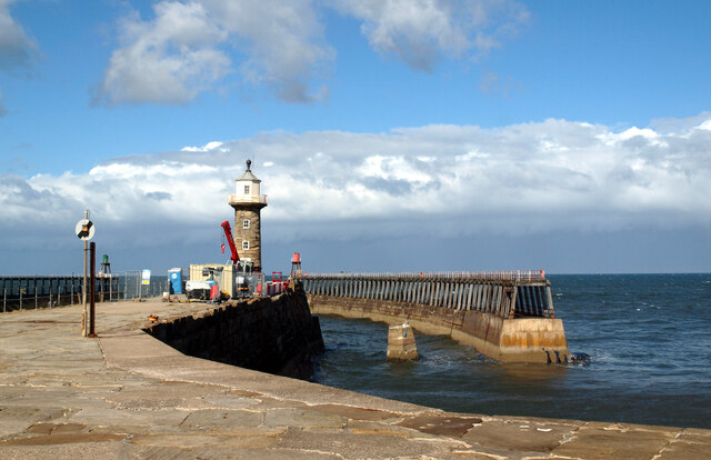
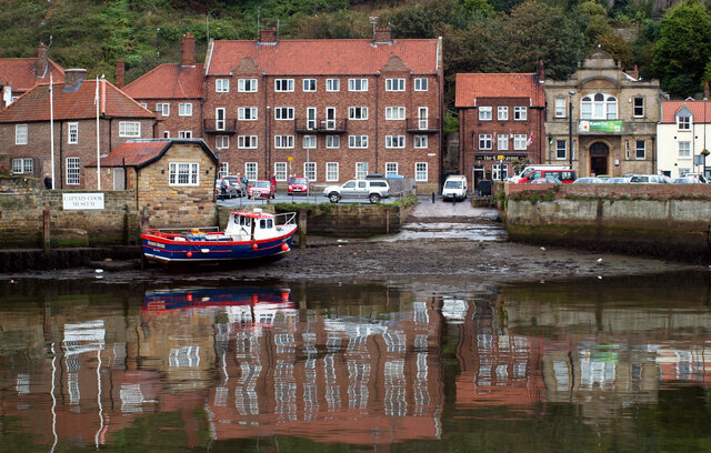
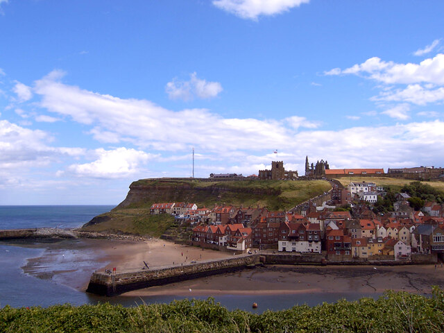
Whitby Sands, located in the charming town of Whitby in Yorkshire, England, is a picturesque beach renowned for its natural beauty and historical significance. Stretching for approximately two miles, this sandy beach is situated at the mouth of the River Esk, where it meets the North Sea.

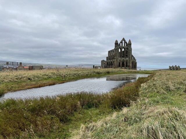
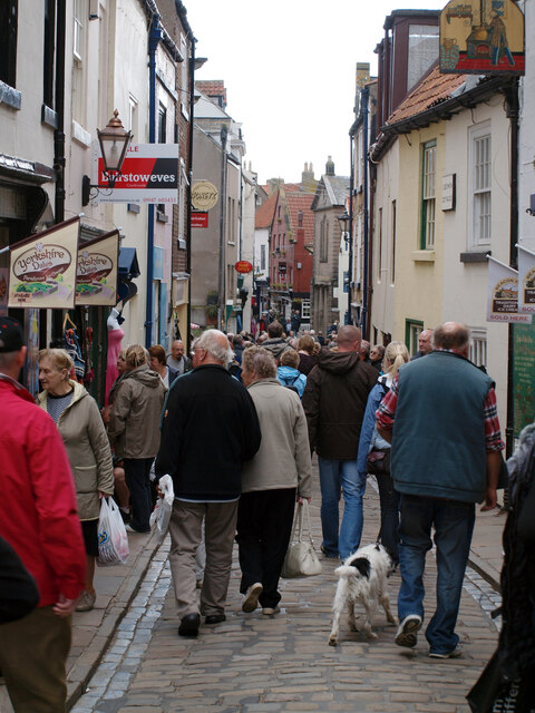
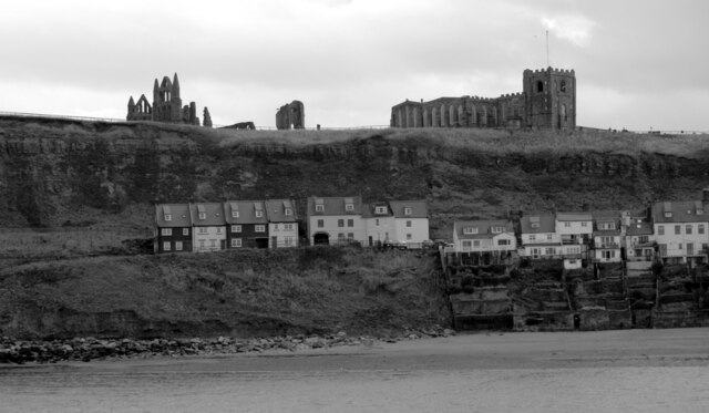
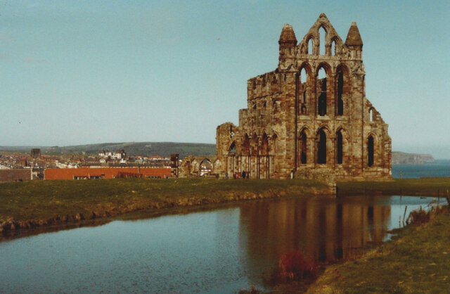
With its stunning views of the surrounding cliffs and the iconic Whitby Abbey perched high above, Whitby Sands attracts visitors from near and far. The beach is easily accessible, with ample parking available nearby, and is within walking distance of the town center.

Whitby Sands offers a variety of amenities to cater to all beachgoers. It is a family-friendly beach, providing safe swimming conditions and a designated area for water sports enthusiasts. Lifeguards are on duty during peak seasons to ensure the safety of visitors. The beach also offers beach huts for rent, where visitors can relax and enjoy the stunning views.

For those who enjoy beachcombing, Whitby Sands is a treasure trove of interesting finds. Fossil enthusiasts often flock to the beach, as it is known for its rich fossil deposits, particularly ammonites. The beach also boasts a wide array of wildlife, such as seabirds and seals, making it a haven for nature lovers.

Whitby Sands is not only a natural wonder but also holds historical significance. It is famously associated with the novel "Dracula" by Bram Stoker, as the author found inspiration for his gothic tale during his stay in Whitby. The town's connections to Captain Cook, the renowned explorer, can also be explored through the various attractions nearby.

In summary, Whitby Sands is a captivating beach destination in Yorkshire, offering not only natural beauty but also a wealth of recreational activities and historical interest.

If you have any feedback on the listing, please let us know in the comments section below.

Whitby Sands Images

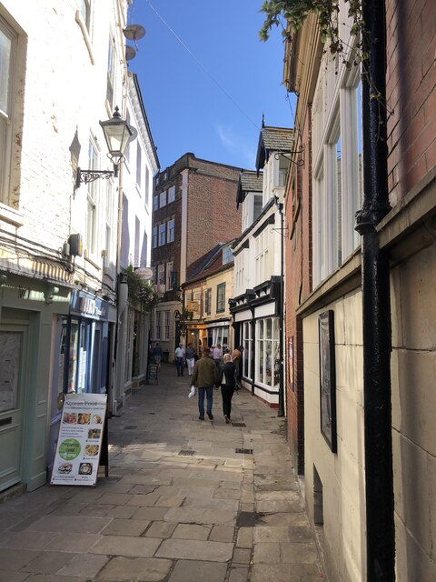
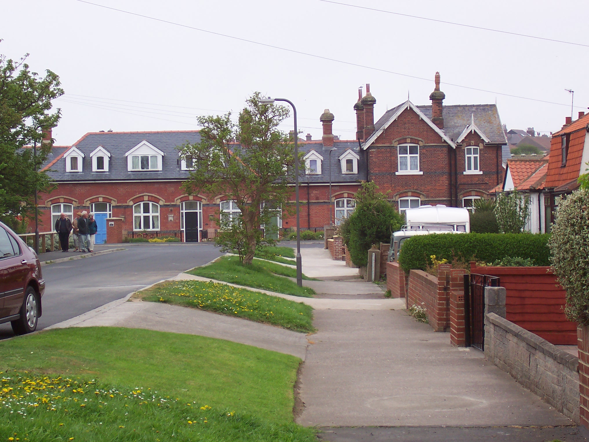
Images are sourced within 2km of 54.493834/-0.63074725 or Grid Reference NZ8811. Thanks to Geograph Open Source API. All images are credited.

Whitby Abbey from the pond
Whitby Abbey Whitby Abbey was a 7th century monastery that later became a Benedictine abbey. The abbey and its possessions were confiscated by the crown during the Dissolution of the Monasteries under Henry VIII. The abbey church was situated overlooking the North Sea on the East Cliff above Whitby in North Yorkshire, England. The substantial ruins of the church are designated as a Grade I Listed building (List entry Number: 1316347 <span class="nowrap"><a title="https://historicengland.org.uk/listing/the-list/list-entry/1316347" rel="nofollow ugc noopener" href="https://historicengland.org.uk/listing/the-list/list-entry/1316347">Link</a><img style="margin-left:2px;" alt="External link" title="External link - shift click to open in new window" src="https://s1.geograph.org.uk/img/external.png" width="10" height="10"/></span>  Historic England) and are in the care of English Heritage <span class="nowrap"><a title="http://www.english-heritage.org.uk/visit/places/whitby-abbey/" rel="nofollow ugc noopener" href="http://www.english-heritage.org.uk/visit/places/whitby-abbey/">Link</a><img style="margin-left:2px;" alt="External link" title="External link - shift click to open in new window" src="https://s1.geograph.org.uk/img/external.png" width="10" height="10"/></span>  .
Whitby Abbey
Whitby Abbey was a 7th century monastery that later became a Benedictine abbey. The abbey and its possessions were confiscated by the crown during the Dissolution of the Monasteries under Henry VIII. The abbey church was situated overlooking the North Sea on the East Cliff above Whitby in North Yorkshire, England. The substantial ruins of the church are designated as a Grade I Listed building (List entry Number: 1316347 LinkExternal link Historic England) and are in the care of English Heritage LinkExternal link .
The east pier, Whitby harbour
Church Street, Whitby
Old Town, Whitby, seen from the west pier of the harbour The ruins of Whitby Abbey, St. Mary's Church and houses on Henrietta Street can be seen.
Old Town, Whitby, seen from the west pier of the harbour
The ruins of Whitby Abbey, St. Mary's Church and houses on Henrietta Street can be seen.
A slipway on the River Esk seen from New Quay Road, Whitby River Esk rises on Westerdale Moor (North Yorkshire Moors) and flows east 28 miles to Whitby. A good Salmon river.
A slipway on the River Esk seen from New Quay Road, Whitby
River Esk rises on Westerdale Moor (North Yorkshire Moors) and flows east 28 miles to Whitby. A good Salmon river.
The old town seen from West Cliff, Whitby
Fortune's Kippers, Henrietta Street, Whitby Fortune's smokehouse on Henrietta Street in Whitby was founded in 1872 by William Fortune. It is still owned and operated by the Fortune family. The kippers are smoked here and then sold from a small shop on the same premises.
Fortune's Kippers, Henrietta Street, Whitby
Fortune's smokehouse on Henrietta Street in Whitby was founded in 1872 by William Fortune. It is still owned and operated by the Fortune family. The kippers are smoked here and then sold from a small shop on the same premises.
The smoke-house, Fortune's Kippers, Henrietta Street, Whitby Fortune's smokehouse on Henrietta Street in Whitby was founded in 1872 by William Fortune. It is still owned and operated by the Fortune family. The kippers are smoked here and then sold from a small shop on the same premises.
The smoke-house, Fortune's Kippers, Henrietta Street, Whitby
Fortune's smokehouse on Henrietta Street in Whitby was founded in 1872 by William Fortune. It is still owned and operated by the Fortune family. The kippers are smoked here and then sold from a small shop on the same premises.
The harbour sands, Whitby
Whitby Coastguard Station Seen from the Cleveland Way as it enters Whitby from the east.
Whitby Coastguard Station
Seen from the Cleveland Way as it enters Whitby from the east.
Old Town and the harbour, Whitby
Whitby Abbey A view looking over the wall in Abbey Lane, on a day of brilliant sunshine in April.
Whitby Abbey
A view looking over the wall in Abbey Lane, on a day of brilliant sunshine in April.
Whitby Abbey Whitby Abbey was a 7th century monastery that later became a Benedictine abbey. The abbey and its possessions were confiscated by the crown during the Dissolution of the Monasteries under Henry VIII. The abbey church was situated overlooking the North Sea on the East Cliff above Whitby in North Yorkshire, England. The substantial ruins of the church are designated as a Grade I Listed building (List entry Number: 1316347 <span class="nowrap"><a title="https://historicengland.org.uk/listing/the-list/list-entry/1316347" rel="nofollow ugc noopener" href="https://historicengland.org.uk/listing/the-list/list-entry/1316347">Link</a><img style="margin-left:2px;" alt="External link" title="External link - shift click to open in new window" src="https://s1.geograph.org.uk/img/external.png" width="10" height="10"/></span>  Historic England) and are in the care of English Heritage <span class="nowrap"><a title="http://www.english-heritage.org.uk/visit/places/whitby-abbey/" rel="nofollow ugc noopener" href="http://www.english-heritage.org.uk/visit/places/whitby-abbey/">Link</a><img style="margin-left:2px;" alt="External link" title="External link - shift click to open in new window" src="https://s1.geograph.org.uk/img/external.png" width="10" height="10"/></span>  .
Whitby Abbey
Whitby Abbey was a 7th century monastery that later became a Benedictine abbey. The abbey and its possessions were confiscated by the crown during the Dissolution of the Monasteries under Henry VIII. The abbey church was situated overlooking the North Sea on the East Cliff above Whitby in North Yorkshire, England. The substantial ruins of the church are designated as a Grade I Listed building (List entry Number: 1316347 LinkExternal link Historic England) and are in the care of English Heritage LinkExternal link .
Grape Lane, Whitby A narrow street in the old town
Grape Lane, Whitby
A narrow street in the old town
The Endeavour Pub On Church Street.
The Endeavour Pub
On Church Street.
Whitby Merchant Seamens Hospital Houses Twenty almshouses, for retired seafarers and the Armed Forces, their widows or dependants aged 55 years and over who are residents of Whitby and the neighbouring area.
Whitby Merchant Seamens Hospital Houses
Twenty almshouses, for retired seafarers and the Armed Forces, their widows or dependants aged 55 years and over who are residents of Whitby and the neighbouring area.
Looking down from Church Lane Part of the way up the 199 steps to Whitby Abbey. West Pier in view over the top of the houses.
Looking down from Church Lane
Part of the way up the 199 steps to Whitby Abbey. West Pier in view over the top of the houses.
Show me another place!

Whitby Sands is located at Grid Ref: NZ8811 (Lat: 54.493834, Lng: -0.63074725)

Division: North Riding

Administrative County: North Yorkshire

District: Scarborough

Police Authority: North Yorkshire

What 3 Words

///submerged.brush.junction. Near Whitby, North Yorkshire

Nearby Locations

West Cliff Whitby Sands

Related Wikis

Whitby Town F.C.

Whitby Town Football Club is an English football club based in Whitby, North Yorkshire. The club participates in the Northern Premier League, the seventh...

Whitby West Cliff railway station

Whitby West Cliff railway station was a railway station on the Whitby Redcar and Middlesbrough Union Railway. It was opened on 3 December 1883, to serve...

Whitby Museum

Whitby Museum is an independent museum in Whitby, North Yorkshire, England, run by Whitby Literary and Philosophical Society, a learned society and registered...

Whitby

Whitby is a seaside town, port and civil parish in North Yorkshire, England. It is on the Yorkshire Coast at the mouth of the River Esk. It has a maritime...

Nearby Amenities

Located within 500m of 54.493834,-0.63074725
Source: PGS
Lat/Long: 54.491639/-0.6245735
Source: PGS
Lat/Long: 54.4917627/-0.6254867
Source: PGS
Lat/Long: 54.4920624/-0.6272187
Source: PGS
Lat/Long: 54.4922043/-0.6277268
Source: PGS
Lat/Long: 54.4926267/-0.6287521
Source: PGS
Lat/Long: 54.4929188/-0.6294581
Source: PGS
Lat/Long: 54.4932145/-0.6304128
Source: PGS
Lat/Long: 54.4935018/-0.6312853
Source: PGS
Lat/Long: 54.4937693/-0.6322114
Source: PGS
Lat/Long: 54.4940035/-0.6330685
Source: PGS
Lat/Long: 54.4942273/-0.6340276
Source: PGS
Lat/Long: 54.4944355/-0.6349032
Source: PGS
Lat/Long: 54.4946926/-0.6358981
Source: PGS
Lat/Long: 54.4949114/-0.6367738
Crossing
Crossing: zebra
Lat/Long: 54.4907193/-0.631267
Pharmacy
Day Lewis Pharmacy
Addr City: Whitby
Addr Postcode: YO21 3JP
Addr Street: The Parade
Brand: Day Lewis Pharmacy
Brand Wikidata: Q62563772
Dispensing: yes
Healthcare: pharmacy
Lat/Long: 54.4908741/-0.631648
Bus Stop
Bus: yes
Ele: 52
Note: shelter is rather old-fashioned
Public Transport: platform
Shelter: yes
Lat/Long: 54.4908525/-0.6318687
Post Box
Ele: 53.718994
Operator: Royal Mail
Operator Wikidata: Q638098
Post Box Type: pillar
Ref: YO21 21
Royal Cypher: GR
Royal Cypher Wikidata: Q33102273
Lat/Long: 54.4908024/-0.6315133
Post Office
Costcutter
Addr City: Whitby
Addr Country: GB
Addr Housenumber: 2-3
Addr Postcode: YO21 3JP
Addr Street: The Parade
Brand: Costcutter
Brand Wikidata: Q5175072
Brand Wikipedia: en:Costcutter
Contact Website: https://store-locator.costcutter.co.uk/costcutter-f463ff4f857d
Opening Hours: Mo-Su 07:00-22:00
Ref Pol Id: 131218
Shop: convenience
Lat/Long: 54.4909432/-0.6318068
Mini Roundabout
Direction: clockwise
Source: Bing
Lat/Long: 54.4913498/-0.6356756
Crossing
Crossing: zebra
Lat/Long: 54.490653/-0.6310738
Pub
White House
Addr City: Whitby
Addr Postcode: YO21 3JJ
Addr Street: Upgang Lane
Lat/Long: 54.4925859/-0.6363381
Fast Food
Rainbow
Addr City: Whitby
Addr Postcode: YO21 3JP
Addr Street: The Parade
Cuisine: chinese
Lat/Long: 54.4910012/-0.6319091
Crossing
Crossing: zebra
Lat/Long: 54.4905471/-0.6313066
Fast Food
Parade Fisheries
Addr City: Whitby
Addr Postcode: YO21 3JP
Addr Street: The Parade
Cuisine: fish_and_chips
Lat/Long: 54.4908672/-0.6314773
Veterinary
Clevedale Veterinary Practice
Addr City: Whitby
Addr Postcode: YO21 3JP
Addr Street: The Parade
Lat/Long: 54.490928/-0.6311662
Fast Food
Gino's
Addr City: Whitby
Addr Postcode: YO21 3JP
Addr Street: The Parade
Cuisine: pizza
Lat/Long: 54.4908828/-0.6312306
Telephone
Booth: KX100
Covered: booth
Lat/Long: 54.4912029/-0.632805
Bench
Source: survey
Lat/Long: 54.4909982/-0.6264752
Bench
Source: survey
Lat/Long: 54.4908815/-0.6254855
Bench
Source: survey
Lat/Long: 54.4909187/-0.6262097
Bench
Source: survey
Lat/Long: 54.4908395/-0.6249759
Bench
Source: survey;gps
Lat/Long: 54.4927573/-0.632591
Bench
Source: survey;gps
Lat/Long: 54.4926412/-0.6322718
Bench
Backrest: yes
Source: survey;gps
Lat/Long: 54.4925423/-0.6318453
Bench
Source: survey;gps
Lat/Long: 54.4928881/-0.6328136
Bench
Source: survey;gps
Lat/Long: 54.493107/-0.6331368
Bench
Source: survey;gps
Lat/Long: 54.4935927/-0.635245
Bench
Source: survey;gps
Lat/Long: 54.4936554/-0.6354542
Bench
Source: survey;gps
Lat/Long: 54.4936881/-0.6355575
Bench
Source: survey;gps
Lat/Long: 54.4937188/-0.6356554
Bench
Lat/Long: 54.4937554/-0.6357586
Bench
Source: survey;gps
Lat/Long: 54.493787/-0.6358492
Bench
Source: survey;gps
Lat/Long: 54.4938174/-0.6359491
Bench
Source: survey;gps
Lat/Long: 54.4943451/-0.6376302
Spider's Web Outdoor Swimming Pool
Board Type: history
Information: board
Tourism: information
Lat/Long: 54.4937566/-0.6358592
Defibrillator
Access: yes
Defibrillator Location: outside Day Lewis Pharmacy, Upgang Lane, Whitby
Emergency: defibrillator
Indoor: no
Lat/Long: 54.490881/-0.6316932
The data included in this document is from www.openstreetmap.org. The data is made available under ODbL.

Have you been to Whitby Sands?

Leave your review of Whitby Sands below (or comments, questions and feedback).