Battery Beach

Beach in Shetland

Scotland

Battery Beach

The Bight of Ham Small bay on the west coast of the Isle of Bressay.
The Bight of Ham Credit: Oliver Dixon

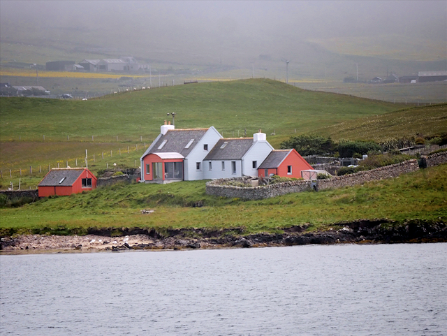
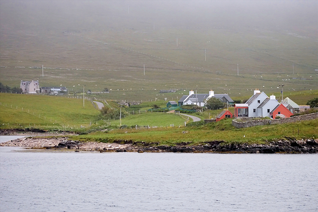
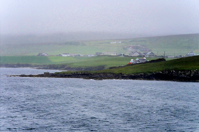
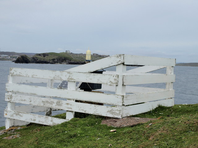
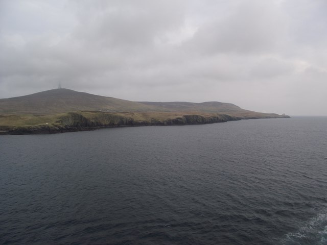
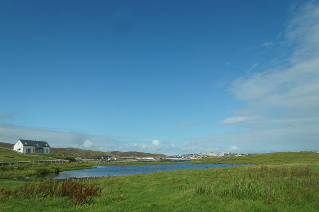
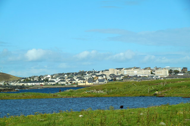
Battery Beach, located in Shetland, Scotland, is a picturesque and captivating stretch of coastline renowned for its natural beauty and historical significance. Situated on the northern side of Lerwick, the capital of Shetland, Battery Beach offers visitors a unique combination of stunning views, tranquil surroundings, and a glimpse into the area's rich military history.

The beach derives its name from the presence of an old battery, a former coastal defense installation, which dates back to the 19th century. This historical relic adds a touch of intrigue to the beach, as visitors can explore the remnants of the fortifications and imagine the past conflicts that took place on these shores.

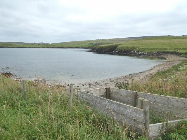
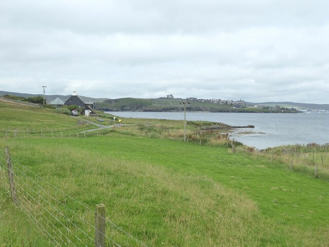
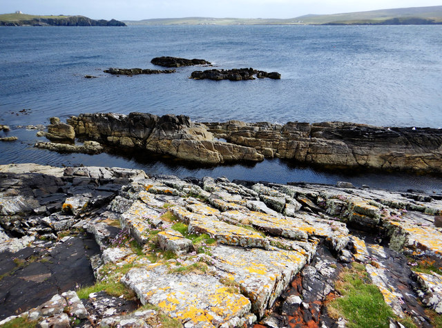
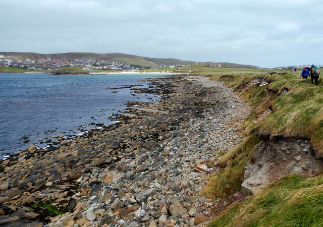
Characterized by its pristine sandy shoreline and crystal-clear turquoise waters, Battery Beach is a haven for nature lovers and outdoor enthusiasts alike. The beach provides an idyllic setting for leisurely walks, picnics, or simply basking in the sun while taking in the panoramic views of the nearby islands and cliffs. Its secluded location makes it a hidden gem, offering a sense of serenity and escape from the hustle and bustle of everyday life.

Battery Beach is also a popular spot for wildlife enthusiasts, as it provides opportunities for birdwatching and marine life sightings. Seals can often be spotted basking on the rocks, while seabirds soar above the waves, creating a symphony of natural sounds.

Visitors to Battery Beach can access the area via a short walk from Lerwick, enjoying the scenic coastal path that meanders through heather-covered hills and picturesque landscapes. Facilities such as parking and toilets are available nearby, ensuring a comfortable and convenient experience for all who visit this enchanting beach.

In conclusion, Battery Beach in Shetland offers a delightful blend of natural beauty and historical intrigue. With its stunning vistas, peaceful atmosphere, and fascinating military heritage, it is a must-visit destination for those seeking a truly unique and memorable beach experience in Scotland.

If you have any feedback on the listing, please let us know in the comments section below.

Battery Beach Images

Images are sourced within 2km of 60.149562/-1.1449146 or Grid Reference HU4740. Thanks to Geograph Open Source API. All images are credited.

The Bight of Ham Small bay on the west coast of the Isle of Bressay.
The Bight of Ham
Small bay on the west coast of the Isle of Bressay.
House at the Taing of Ham
Ham Peninsula on the west coast of the Isle of Bressay. Across the water are houses on the Ness of Sound <a href="https://www.geograph.org.uk/gridref/HU4639">HU4639</a> on Shetland Mainland.
Ham
Peninsula on the west coast of the Isle of Bressay. Across the water are houses on the Ness of Sound HU4639 on Shetland Mainland.
MV Costa Fortuna at anchor in Bressay Sound The size of the MV Costa Fortuna (464 cabins, nine swimming pools and five restaurants) meant that it was obliged to anchor out in the Sound rather than at the quayside in Lerwick. A flotilla of barges were kept busy ferrying passengers to and from the Victoria Pier. The Costa Fortuna is a sister ship to the ill-starred Costa Concordia which sank off the Italian coast in 2012.
MV Costa Fortuna at anchor in Bressay Sound
The size of the MV Costa Fortuna (464 cabins, nine swimming pools and five restaurants) meant that it was obliged to anchor out in the Sound rather than at the quayside in Lerwick. A flotilla of barges were kept busy ferrying passengers to and from the Victoria Pier. The Costa Fortuna is a sister ship to the ill-starred Costa Concordia which sank off the Italian coast in 2012.
Pullar's Loch, Sound, from the air
Ness of Sound, Lerwick, from the air
Small boat off Ness of Sound Taken from the Knab in Lerwick.
Small boat off Ness of Sound
Taken from the Knab in Lerwick.
Coastal Farm, Bressay
Bressay, House at Ham
MV Knab, Lerwick Pilot Boat The Lerwick pilot boat, MV Knab, in Bressay Sound.
MV Knab, Lerwick Pilot Boat
The Lerwick pilot boat, MV Knab, in Bressay Sound.
Ham Coastal settlement on Bressay.
Ham
Coastal settlement on Bressay.
Cro of Ham
Cro of Ham
Light Beacon White construction, Cro of Ham on Bressay, containing a light beacon,
that anyone who has ever taken the Lerwick-Aberdeen Ferry, must have 
seen when entering/leaving Lerwick Harbour.
Across Bressay Sound you see South Ness Cemetery.
Light Beacon
White construction, Cro of Ham on Bressay, containing a light beacon, that anyone who has ever taken the Lerwick-Aberdeen Ferry, must have seen when entering/leaving Lerwick Harbour. Across Bressay Sound you see South Ness Cemetery.
Cro of Ham
Cro of Ham
Skerries on east side of Ness of Sound The gently dipping Middle Old Red Sandstone of east Mainland produces skerries with a steep side facing the shore of Ness of Sound, and a slope off into the waters of Brei Wick. This makes them easy for seals to haul out on the seaward side, and slide quickly away from the shore if disturbed, though the ones we saw had chosen a boulder beach a little way north where they seemed better camouflaged. Perhaps the less visible ones remained while ones here had already departed before we got to them ! There certainly seeme to be seal heads popping up all along the shore of Brei Wick, watching the people passing by.

In the distance in this view is Bressay Sound, overlooked by Lerwick on the left (with the prominent coastguard building on the hilltop) and Bressay on the right.
Skerries on east side of Ness of Sound
The gently dipping Middle Old Red Sandstone of east Mainland produces skerries with a steep side facing the shore of Ness of Sound, and a slope off into the waters of Brei Wick. This makes them easy for seals to haul out on the seaward side, and slide quickly away from the shore if disturbed, though the ones we saw had chosen a boulder beach a little way north where they seemed better camouflaged. Perhaps the less visible ones remained while ones here had already departed before we got to them ! There certainly seeme to be seal heads popping up all along the shore of Brei Wick, watching the people passing by. In the distance in this view is Bressay Sound, overlooked by Lerwick on the left (with the prominent coastguard building on the hilltop) and Bressay on the right.
Voe of Sound This is the low western side of Ness of Sound, with no cliffs and a short drop to the bouldery beach overlooking Voe of Sound. Although the Voe is not very wide, and doesn't have much in the way of waves even in the fresh gusty wind, it is clear that it can get a lot rougher. Much of the shoreline vegetation was blackened by dehydration caused by the salt spray which blows over - anything brave enough to stick up above the surrounding grasses seemed badly affected, particularly the nettles.

To the left (west) of Sands of Sound, the green lump is Holm of Sound, behind which are the houses of Sound and Upper Sound (now westerly suburbs of Lerwick).
Voe of Sound
This is the low western side of Ness of Sound, with no cliffs and a short drop to the bouldery beach overlooking Voe of Sound. Although the Voe is not very wide, and doesn't have much in the way of waves even in the fresh gusty wind, it is clear that it can get a lot rougher. Much of the shoreline vegetation was blackened by dehydration caused by the salt spray which blows over - anything brave enough to stick up above the surrounding grasses seemed badly affected, particularly the nettles. To the left (west) of Sands of Sound, the green lump is Holm of Sound, behind which are the houses of Sound and Upper Sound (now westerly suburbs of Lerwick).
Pullar's Loch, Ness of Sound, Lerwick
Pullar's Loch, Ness of Sound, Lerwick Lerwick, and the Gilbert Bain Hospital, in the background.
Pullar's Loch, Ness of Sound, Lerwick
Lerwick, and the Gilbert Bain Hospital, in the background.
Show me another place!

Battery Beach is located at Grid Ref: HU4740 (Lat: 60.149562, Lng: -1.1449146)

Unitary Authority: Shetland Islands

Police Authority: Highlands and Islands

What 3 Words

///press.bashed.salaried. Near Lerwick, Shetland Islands

Related Wikis

Shetland Library

Shetland Library is the public library service of Shetland, with its main branch based in Lerwick. Membership is open to both residents of and visitors...

Lerwick and Bressay Parish Church

Lerwick and Bressay Parish Church is the largest Church of Scotland congregation in Shetland, serving the islands' capital Lerwick and the surrounding...

Lerwick Town Hall

Lerwick Town Hall is a municipal building located on Hillhead in Lerwick, Shetland, Scotland. It is used as an events venue and registrar's office. The...

Montfield Hospital

The Montfield Hospital is a health facility in the burgh of Lerwick, Shetland, Scotland. It is managed by NHS Shetland. == History == The facility, which...
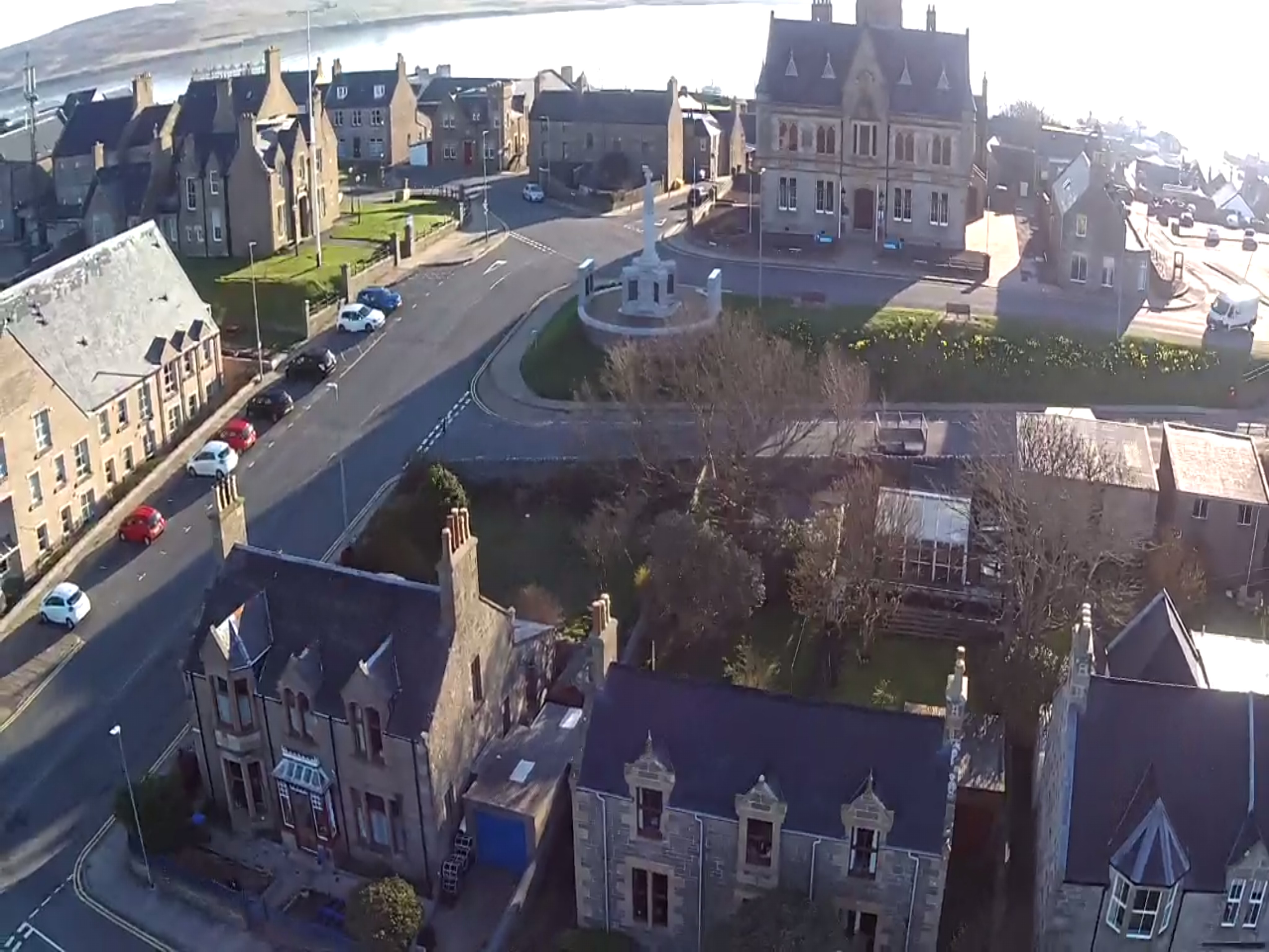
Lerwick

Lerwick ( or ; Old Norse: Leirvik; Norn: Larvik) is the main town and port of the Shetland archipelago, Scotland. Shetland's only burgh, Lerwick had a...

County Buildings, Lerwick

County Buildings is a municipal structure in King Erik Street, Lerwick, Shetland, Scotland. The structure, which is used as a judicial complex, is a Category...

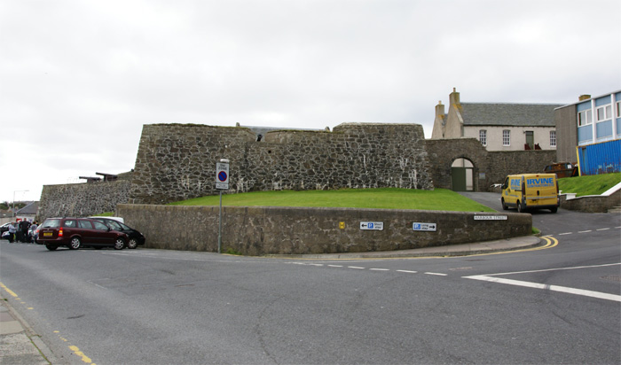
Fort Charlotte, Shetland

Fort Charlotte in the centre of Lerwick, Shetland, is an artillery fort, roughly five sided, with bastions on each of three landward corners, and half...

Gilbert Bain Hospital

The Gilbert Bain Hospital is a rural general hospital in the burgh of Lerwick, Shetland, Scotland. It is managed by NHS Shetland. == History == The hospital...

Nearby Amenities

Located within 500m of 60.149562,-1.1449146
Mini Roundabout
Lat/Long: 60.1517011/-1.141623
Mini Roundabout
Market Cross
Alt Name: Maks Island
Direction: clockwise
Historic: memorial
Mapillary: 4514508645245092
Memorial: mercat_cross
Lat/Long: 60.15313/-1.1427207
Crossing
Crossing: zebra
Lat/Long: 60.1530799/-1.1407383
Tourist Centre
Addr City: Shetland
Addr Postcode: ZE1 0LU
Addr Street: Commercial Street
Addr Suburb: Lerwick
Information: office
Mapillary: 532201167792160
Opening Hours: Mo-Sa 09:00-17:00;Su 10:00-16:00
Tourism: information
Lat/Long: 60.1530318/-1.1427488
Waste Basket
Check Date: 2023-05-04
Lat/Long: 60.1499536/-1.1445813
Bench
Lat/Long: 60.150317/-1.1476008
Bench
Lat/Long: 60.1499599/-1.1456606
Post Office
Lerwick Post Office
Addr City: Shetland
Addr Housenumber: 46
Addr Postcode: ZE1 0EH
Addr Street: Commercial Street
Addr Suburb: Lerwick
Opening Hours: Mo,We-Fr 09:00-17:00; Tu 09:30-17:00; Sa 09:00-12:30
Operator: Post Office
Ref Pol Id: 4
Source: pol_branch_list_2019-03
Lat/Long: 60.1531563/-1.1413558
Place Of Worship
Adam Clark Methodist Church Minster
Religion: christian
Lat/Long: 60.1525542/-1.146158
Place Of Worship
The Church of Jesus Christ of Latter-day Saints
Denomination: latter-day_saints
Religion: christian
Lat/Long: 60.15241/-1.1467266
Tourism: hotel
Lat/Long: 60.1503284/-1.1529793
Cafe
Islesburgh Cafe
Lat/Long: 60.1529112/-1.1490179
Crossing
Crossing: traffic_signals
Lat/Long: 60.1529534/-1.1407019
Brucefield Stores
Brand: localsbest
Shop: convenience
Lat/Long: 60.1509863/-1.145026
Post Box
Brand: Royal Mail
Brand Wikidata: Q638098
Collection Times: Mo-Fr 17:15; Sa 15:15
Operator: Royal Mail
Operator Wikidata: Q638098
Post Box Mounting: brick_pillar
Post Box Type: wall
Ref: ZE1 12
Royal Cypher: scottish_crown
Lat/Long: 60.1508209/-1.1446643
Queens Hotel
Addr City: Shetland
Addr Housenumber: 24
Addr Postcode: ZE1 0AB
Addr Street: Commercial Street
Addr Suburb: Lerwick
Email: info@kgqhotels.co.uk
Fhrs Id: 408999
Operator: kgqhotels
Phone: +44 1595 692826
Tourism: hotel
Website: http://www.kgqhotels.co.uk/queens-hotel.html
Lat/Long: 60.1530982/-1.1401628
Barrier: swing_gate
Lat/Long: 60.1533415/-1.1403176
Love From Shetland
Addr City: Shetland
Addr Housenumber: 101
Addr Postcode: ZE1 0BD
Addr Street: Commercial Street
Addr Suburb: Lerwick
Note: Handmade Goats Milk Soaps
Shop: cosmetics
Lat/Long: 60.1530283/-1.142542
Alder Lodge
Addr Housenumber: 6
Addr Street: Clairmont Place
Tourism: guest_house
Website: http://www.alderlodgeguesthouse.com/
Lat/Long: 60.1518544/-1.1449671
Eddlewood
Addr City: Shetland
Addr Housenumber: 8
Addr Postcode: ZE1 0BR
Addr Street: Clairmont Place
Fhrs Id: 680100
Internet Access: yes
Internet Access Fee: no
Smoking: no
Source Addr Postcode: FHRS Open Data
Tourism: guest_house
Website: http://www.eddlewood.com/
Wheelchair: no
Lat/Long: 60.151902/-1.1452376
Kveldsro House Hotel
Addr City: Shetland
Addr Housenumber: 20
Addr Postcode: ZE1 0AQ
Addr Street: Greenfield Place
Fhrs Id: 408603
Source Addr: FHRS Open Data
Tourism: hotel
Lat/Long: 60.1519418/-1.1385058
Bank
RBS
Brand: RBS
Brand Wikidata: Q160126
Brand Wikipedia: en:Royal Bank of Scotland
Official Name: Royal Bank of Scotland
Lat/Long: 60.1530177/-1.1417643
Atm
RBS
Brand: RBS
Brand Wikidata: Q160126
Official Name: Royal Bank of Scotland
Operator: RBS
Operator Wikidata: Q160126
Lat/Long: 60.1530166/-1.1416235
Telephone
Booth: K6
Covered: booth
Listed Status: Category B
Lat/Long: 60.1531365/-1.1415147
Post Box
Brand: Royal Mail
Brand Wikidata: Q638098
Collection Times: Mo-Fr 17:30; Sa 16:00
Operator: Royal Mail
Operator Wikidata: Q638098
Post Box Type: wall
Ref: ZE1 121
Lat/Long: 60.1531366/-1.141476
Grand Hotel
Addr City: Shetland
Addr Housenumber: 149
Addr Postcode: ZE1 0EX
Addr Street: Commercial Street
Addr Suburb: Lerwick
Fhrs Id: 1348768
Phone: +44 1595 692826
Tourism: hotel
Website: https://www.grandhotelshetland.co.uk/
Lat/Long: 60.1539465/-1.1439192
Bench
Backrest: no
Lat/Long: 60.1534287/-1.1416717
Bench
Backrest: no
Lat/Long: 60.1533559/-1.1409576
Bench
Backrest: no
Lat/Long: 60.153381/-1.1412128
Bench
Backrest: no
Lat/Long: 60.1534088/-1.1415001
Bench
Backrest: no
Lat/Long: 60.1533954/-1.1413365
Bench
Backrest: no
Lat/Long: 60.1533735/-1.1411155
Bench
Backrest: no
Lat/Long: 60.1534462/-1.1418246
Bench
Lat/Long: 60.1533273/-1.1406174
Bench
Backrest: no
Lat/Long: 60.1534595/-1.1420097
Toilets
Esplanade Public Toilets
Access: yes
Ele: 7 ft
Fee: no
Opening Hours: 07:30-22:00
Operator: shetland Islands Council
Shower: yes
Wheelchair: yes
Lat/Long: 60.153663/-1.1429073
Toilets
Description: Public toilet Lerwick
Drinking Water: yes
Fee: no
Lat/Long: 60.1476/-1.1388308
Lerwick
Name En: Lerwick
Name Gd: Liùrabhaig
Name Is: Leirvík
Name Non: Leirvík
Name Ru: Леруик
Name Sco: Lerwick
Name Uk: Лервік
Place: town
Population: 6680
Source: user note
Wikidata: Q213485
Wikipedia: en:Lerwick
Lat/Long: 60.1531357/-1.1427296
Post Box
Brand: Royal Mail
Brand Wikidata: Q638098
Operator: Royal Mail
Operator Wikidata: Q638098
Post Box Type: wall
Ref: ZE1 10
Royal Cypher: GR
Royal Cypher Wikidata: Q33102273
Lat/Long: 60.152766/-1.1456193
Post Box
Brand: Royal Mail
Brand Wikidata: Q638098
Operator: Royal Mail
Operator Wikidata: Q638098
Post Box Type: wall
Ref: ZE1 52
Royal Cypher: GR
Royal Cypher Wikidata: Q33102273
Lat/Long: 60.1518598/-1.1498685
Smiths of Lerwick
Addr City: Shetland
Addr Housenumber: 97
Addr Postcode: ZE1 0BD
Addr Street: Commercial Street
Addr Suburb: Lerwick
Shop: clothes
Lat/Long: 60.1530516/-1.1421883
Outdoor Trek
Addr City: Shetland
Addr Housenumber: 99
Addr Postcode: ZE1 0BD
Addr Street: Commercial Street
Addr Suburb: Lerwick
Shop: clothes
Lat/Long: 60.1530459/-1.1423485
Fast Food
Lat/Long: 60.153142/-1.1410959
Cafe
Lat/Long: 60.1531287/-1.1409591
Shop: clothes
Lat/Long: 60.1531661/-1.1420266
Jamieson’s Knitwear
Shop: clothes
Lat/Long: 60.1530543/-1.1420421
The Shetland Times Bookshop
Addr City: Shetland
Addr Postcode: ZE1 0AJ
Addr Street: Commercial Street
Addr Suburb: Lerwick
Email: bookshop@shetlandtimes.co.uk
Phone: +44 1595 695 531
Shop: books
Lat/Long: 60.1530112/-1.1413615
Shop: clothes
Lat/Long: 60.1531821/-1.1424048
Shop: greengrocer
Lat/Long: 60.1533957/-1.1426462
Bank
TSB
Brand: TSB
Brand Wikidata: Q7671560
Brand Wikipedia: en:TSB Bank (United Kingdom)
Lat/Long: 60.1534958/-1.1426677
The Wine Shop
Addr Street: Commercial Street
Shop: alcohol
Lat/Long: 60.1531848/-1.1431639
Bank
Bank of Scotland
Addr Country: GB
Brand: Bank of Scotland
Brand Wikidata: Q627381
Brand Wikipedia: en:Bank of Scotland
Contact Website: https://branches.bankofscotland.co.uk/lerwick/117-commercial-street
Lat/Long: 60.1532835/-1.1433972
Shetland Soap Company
Shop: gift
Lat/Long: 60.1531434/-1.1430298
Shop: gift
Lat/Long: 60.1530272/-1.1405487
RNLI Shop
Brand: RNLI Shop
Brand Wikidata: Q2166873
Brand Wikipedia: en:Royal National Lifeboat Institution
Shop: charity
Lat/Long: 60.1531661/-1.1406131
Bar
Lat/Long: 60.153708/-1.1435206
Refan
Shop: jewelry
Lat/Long: 60.1537588/-1.1437164
Shop: gift
Lat/Long: 60.1535906/-1.1436199
Shop: convenience
Lat/Long: 60.1535559/-1.1433946
Shop: confectionery
Lat/Long: 60.1536626/-1.1436708
Fast Food
Lat/Long: 60.1536333/-1.1434482
Shoes
Shop: clothes
Lat/Long: 60.153869/-1.1438837
Bar
Lat/Long: 60.153951/-1.1436521
Shop: gift
Lat/Long: 60.1528178/-1.1460569
School
Lat/Long: 60.1522799/-1.1487015
Man Made: tower
Lat/Long: 60.1485739/-1.1406334
Barrier: bollard
Lat/Long: 60.152144/-1.1410111
Da Lightsome Buoy
Artist Name: Jo Chapman
Artwork Type: sculpture
Start Date: 2016-10-08
Tourism: artwork
Lat/Long: 60.1533262/-1.1408251
Bar
Lat/Long: 60.1531395/-1.1403062
Anderson & Co
Addr City: Shetland
Addr Housenumber: 60-62
Addr Postcode: ZE1 0BD
Addr Street: Commercial Street
Addr Suburb: Lerwick
Shop: fabric
Lat/Long: 60.1531497/-1.1423635
Made Here Chocalate
Addr City: Shetland
Addr Housenumber: 103
Addr Postcode: ZE1 0BD
Addr Street: Commercial Street
Addr Suburb: Lerwick
Shop: confectionery
Lat/Long: 60.1530136/-1.1426948
Restaurant
Da Steak Hoose
Addr City: Shetland
Addr Housenumber: 5
Addr Postcode: ZE1 0BJ
Addr Street: Mounthooly Street
Addr Suburb: Lerwick
Contact Facebook: https://www.facebook.com/lerwicksteakhouse/
Contact Phone: +44 1595 696566
Cuisine: steak_house
Fhrs Id: 1425623
Opening Hours: Tu-Sa 17:00-21:00
Lat/Long: 60.15285/-1.1429201
Pub
The Lounge
Addr City: Shetland
Addr Housenumber: 4
Addr Postcode: ZE1 0BJ
Addr Street: Mounthooly Street
Addr Suburb: Lerwick
Fhrs Id: 391157
Opening Hours: Mo-Su 11:00-01:00
Wheelchair: no
Lat/Long: 60.1529682/-1.1430033
Bus Stop
Bus: yes
Naptan AtcoCode: 603013
Naptan NaptanCode: 45823723
Public Transport: platform
Shelter: yes
Lat/Long: 60.151713/-1.1519783
Bus Stop
Scalloway Road (Goudies)
Bus: yes
Public Transport: platform
Shelter: yes
Lat/Long: 60.1518091/-1.1487397
Bus Stop
Annsbrae
Bus: yes
Public Transport: platform
Shelter: yes
Lat/Long: 60.1515305/-1.1430541
Bus Stop
Harrison Square
Bus: yes
Naptan AtcoCode: 6030710147
Naptan NaptanCode: 45823594
Public Transport: platform
Shelter: no
Lat/Long: 60.1537185/-1.1428373
Bench
Backrest: yes
Lat/Long: 60.1499645/-1.144751
Barrier: cycle_barrier
Lat/Long: 60.1494333/-1.1417843
Parking
Lat/Long: 60.1510721/-1.1405489
Parking
Lat/Long: 60.1508241/-1.1401593
The Knab
Place: locality
Lat/Long: 60.14796/-1.1408107
Bench
Backrest: yes
Lat/Long: 60.1487431/-1.1432321
Parking
Lat/Long: 60.1529408/-1.1448285
Generator Method: photovoltaic
Generator Output Electricity: yes
Generator Source: solar
Generator Type: solar_photovoltaic_panel
Location: roof
Power: generator
Lat/Long: 60.1489706/-1.1390416
Bight of the Sletts
Natural: bay
Lat/Long: 60.1491795/-1.149466
Traffic Calming: cushion
Lat/Long: 60.1524129/-1.1410321
Crossing
Crossing: unmarked
Crossing Markings: no
Kerb: lowered
Supervised: no
Tactile Paving: yes
Lat/Long: 60.1519925/-1.1414142
Traffic Signals
Lat/Long: 60.1539149/-1.142832
Crossing
Crossing: traffic_signals
Crossing Island: no
Crossing Ref: pelican
Supervised: no
Lat/Long: 60.1539365/-1.1428437
College
UHI Shetland - Islesburgh Learning Centre
Fixme: location in building uncertain
Operator: University of the Highlands and Islands
Lat/Long: 60.1527266/-1.148932
Noexit: yes
Lat/Long: 60.1539989/-1.1452663
Noexit: yes
Lat/Long: 60.1539678/-1.1455677
Noexit: yes
Lat/Long: 60.1539117/-1.1459333
Give Way
Direction: forward
Lat/Long: 60.153433/-1.1476612
Give Way
Direction: backward
Lat/Long: 60.1534577/-1.1474966
Give Way
Direction: forward
Lat/Long: 60.1526239/-1.1471747
Give Way
Direction: forward
Lat/Long: 60.1525424/-1.1471362
HyImpulse UK
Addr City: Shetland
Addr Housename: St Olaf's Hall
Addr Postcode: ZE1 0FD
Addr Street: Church Road
Aerospace Product: rocket
Company: aerospace
Description: subsidiary of HyImpulse Technologies GmbH
Office: company
Website: https://hyimpulse.de
Lat/Long: 60.151838/-1.1418614
Bus Stop
Scalloway Road (Goudies)
Bus: yes
Naptan AtcoCode: 603014
Naptan NaptanCode: 45823724
Public Transport: platform
Lat/Long: 60.1518882/-1.1490664
Bus Stop
King Harald Street
Bus: yes
Naptan AtcoCode: 6030710004
Naptan NaptanCode: 45823423
Public Transport: platform
Lat/Long: 60.1535502/-1.1490369
Bus Stop
King Harald Street
Bench: no
Bin: no
Bus: yes
Lit: yes
Naptan AtcoCode: 6030781
Naptan NaptanCode: 45825832
Public Transport: platform
Shelter: yes
Tactile Paving: no
Lat/Long: 60.1536156/-1.1487928
Give Way
Direction: backward
Lat/Long: 60.1537929/-1.1425198
Begg
Addr Street: Commercial Street
Shop: shoes
Lat/Long: 60.1539912/-1.1438834
Ram
Addr Street: Commercial Street
Craft: handicraft
Lat/Long: 60.1537811/-1.1435639
The data included in this document is from www.openstreetmap.org. The data is made available under ODbL.

Have you been to Battery Beach?

Leave your review of Battery Beach below (or comments, questions and feedback).